 Block
Elizabeth, Illinois
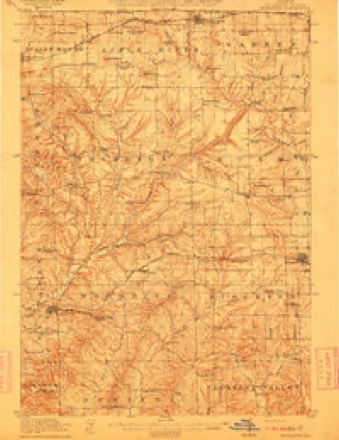
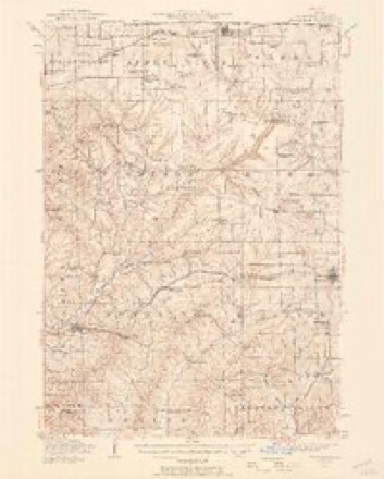
14 topographic sheets cover this place, the earliest surveyed in 1911 and the latest in 1984. It stands in Elizabeth Township. It lies in ZIP code area 61028. The Survey maps it on the Elizabeth quadrangle.
On record in Elizabeth
Buildings and businesses the archive holds for this place. Each opens its own page, with the source record it came from.
On the National Register 3 records
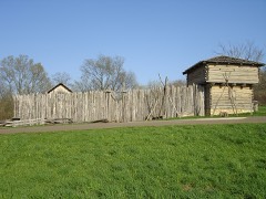 Apple River Fort Sitelisted 1997
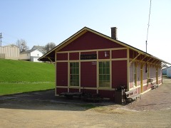 Chicago Great Western Railroad Depotlisted 1996
- Bishop's Busy Big Store-Lyric Opera Houselisted 2022
Topographic sheets covering this place
8 surveys from 14 printed sheetsMatched by testing this settlement's coordinate against the published boundary of every sheet in the United States Geological Survey's historical collection. Each opens the scanned sheet at the Survey.
- 1911 USGS Elizabeth quadrangle1:62500, 2 printings
- 1936 USGS Elizabeth quadrangle1:62500, 2 printings
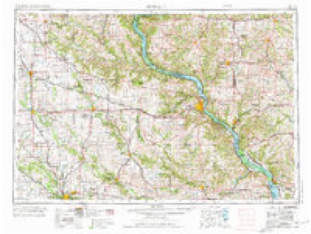
- 1959 USGS Dubuque quadrangle1:250000
- 1961 USGS Dubuque quadrangle1:250000
- 1962 USGS Dubuque quadrangle1:250000, 2 printings
- 1968 USGS Elizabeth quadrangle1:24000
- 1976 USGS Dubuque quadrangle1:250000
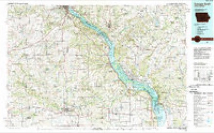
- 1984 USGS Dubuque South quadrangle1:100000, 4 printings
In the county-history sources
13,991 words on this townshipThe History of Jo Daviess County, Illinois, Containing a History of the County, Its Cities, Towns, Etc., a Biographical Directory of Its Citizens, War Record of Its Volunteers in the Late Rebellion ... History of the Northwest, History of Illinois ... Constitution of the United States, published 1878 names this settlement in its chapter on Elizabeth Township. These are the passages that mention it, exactly as the scans read.
The Village of Elizabeth is situated near the township line, between the Townships of Elizabeth and Woodbine. The historical fort of the Black Hawk War was situated near the same line ; and, in fact, the history.of the two townships maintain, throughout, such intimate connection that it is thought advisable to unite them in our historical sketch.
Passage source: The History of Jo Daviess County, Illinois, Containing a History of the County, Its Cities, Towns, Etc., a Biographical Directory of Its Citizens, War Record of Its Volunteers in the Late Rebellion ... History of the Northwest, History of Illinois ... Constitution of the United States, published 1878.
The valley probably had no white visitor until the coming of A. P. Van Matre, in 1825. The. legend is current that Mr. Van Matre was asked by an Indian girl whom he met, what he was seeking for. Upon replying that he was prospecting for mineral, he received the proposal, that if he would marry her, she would show him a good lead of mineral. He, doubtless, considered the bargain a very good one, and accepted it, when he was made acquainted with the diggings in the hollow, near Elizabeth, which have received his name. Here, on the bank of the river, he built the first smelting furnace in that part of the county, and also built a house on the opposite side of the river, where he continued to live and mine. The diggings were not exhausted for more than a dozen years.
Passage source: The History of Jo Daviess County, Illinois, Containing a History of the County, Its Cities, Towns, Etc., a Biographical Directory of Its Citizens, War Record of Its Volunteers in the Late Rebellion ... History of the Northwest, History of Illinois ... Constitution of the United States, published 1878.
The next earliest accounts of a civilized visitor to the rich valley of Apple River point to Henry Van Volkenburg, who is reputed to have passed through the territory now called Elizabeth, as early as 1827, on a trapping and prospecting excursion. Mr. Van Volkenburg afterwards returned to Ohio, then came
Passage source: The History of Jo Daviess County, Illinois, Containing a History of the County, Its Cities, Towns, Etc., a Biographical Directory of Its Citizens, War Record of Its Volunteers in the Late Rebellion ... History of the Northwest, History of Illinois ... Constitution of the United States, published 1878.
Machine-read from a century-old scan, so expect the errors a machine makes: misspelled names, dropped words, stray characters.
Read the whole chapter on Elizabeth Township - it names this place 73 more 73 times.
Fires near this place
10 since 2008Regional context, not property-specific evidence. The federal wildfire occurrence database lists 10 fires within 5 miles of Elizabeth between 2008 and 2010, burning about 32 acres in total. None started naturally. 1 was recorded as arson. Distance is straight-line from the map coordinates, so a fire counted here may appear on a neighbouring settlement's page as well.
| Reported cause | Fires |
|---|---|
| Missing data/not specified/undetermined | 6 |
| Debris and open burning | 2 |
| Equipment and vehicle use | 1 |
| Arson/incendiarism | 1 |
The most recent of them, most recent first, with the day each was reported and the service that recorded it.
| Date | Cause | Size | Reported by | Name on the report |
|---|---|---|---|---|
| 27 September 2010 | Arson/incendiarism | under an acre | Illinois Division of Forestry Resources | WURSTER |
| 12 September 2008 | Missing data/not specified/undetermined | under an acre | Illinois Division of Forestry Resources | ELECTRIC |
| 16 July 2010 | Debris and open burning | under an acre | Illinois Division of Forestry Resources | TREE |
| 5 April 2010 | Missing data/not specified/undetermined | 12 acres | Illinois Division of Forestry Resources | HASS |
| 23 April 2010 | Missing data/not specified/undetermined | under an acre | Illinois Division of Forestry Resources | HANOVER2 |
| 2 April 2008 | Missing data/not specified/undetermined | 1.0 acres | Illinois Division of Forestry Resources | WHEELERIGHT |
| 25 March 2008 | Missing data/not specified/undetermined | 3.0 acres | Illinois Division of Forestry Resources | BALDERINI |
| 18 March 2010 | Debris and open burning | 15 acres | Illinois Division of Forestry Resources | WOODBINE |
Settlements close enough to share some of these fires:
Mines and quarries near this place
9 within 5 milesRegional context, not property-specific evidence. The federal mineral resources record lists 9 workings within 5 miles of Elizabeth: 5 past producers, 3 unknowns, 1 producer. 1 still produces. What was taken out: Lead, Zinc, Stone, Crushed/Broken, Zinc, Lead. Distance is straight-line from the map coordinates, so a quarry counted here may appear on a neighbouring settlement's page as well.
| Where | Site | Commodity | Status | Recorded |
|---|---|---|---|---|
| Haggerty Mine | Zinc, Lead | Unknown | Galena, Sphalerite | |
| Kansas Mine | Lead, Zinc | Unknown | Galena, Sphalerite | |
| Brown Quarry | Stone, Crushed/Broken | Producer | ||
| Brudi Quarry | Stone, Crushed/Broken | Past Producer | ||
| Illinois Mine | Lead, Zinc | Unknown | Galena, Sphalerite | |
| Skene Mine | Lead, Zinc | Past Producer | 1901, 1907 | |
| Wishon Mine | Lead, Zinc | Past Producer | 1865, 1910 | |
| Haggerty Mine | Lead | Past Producer | ||
| Illinois Mine | Lead | Past Producer |
Storms near this place
21 since 1994Regional context, not property-specific evidence. The National Weather Service names Elizabeth in 21 storm reports between 1994 and 2026: 13 thunderstorm wind, 6 hail, 2 heavy rain. The reports record 2 injuries. Each account below is quoted exactly as the forecast office filed it, from the NOAA Storm Events Database, and each date opens the federal record of that event.
| When | Event | Place named | Harm | What the report says |
|---|---|---|---|---|
| February 1999 | Thunderstorm Wind | Elizabeth | 2 hurt | no account filed |
| April 1994 | Hail | Elizabeth | $5,000 | Thunderstorm winds damaged a porch in East Dubuque and knocked down trees at Menominee. Large hail damaged cars and siding at Elizabeth. |
| July 2018 | Thunderstorm Wind | Elizabeth | $3,000 | Local law enforcement reported windows were blown out and a deck was severely damaged on a house. |
| July 2006 | Thunderstorm Wind | Elizabeth | $3,000 | trees and corn down |
| May 2024 | Thunderstorm Wind | Elizabeth | - | Spotter estimated wind gust. |
| July 2024 | Thunderstorm Wind | Elizabeth | - | A public report of large tree branches down and garden corn flattened. |
| July 2024 | Thunderstorm Wind | Elizabeth | - | A public report estimating 60 MPH winds at the leading edge of the line of storms with low visibility. |
| July 2023 | Thunderstorm Wind | Elizabeth | - | Tree limbs down near Highway 20 and Elizabeth Scales Mound Road, relayed by law enforcement. |
| June 2019 | Thunderstorm Wind | Elizabeth | - | A trained spotter reported an 8 inch diameter tree limb down. |
| September 2019 | Thunderstorm Wind | Elizabeth | - | A large tree was blown down along Highway 20. |
| August 2018 | Thunderstorm Wind | Elizabeth | - | A State Official reported trees were blown down on the southeast side of Elizabeth. |
| March 2017 | Thunderstorm Wind | Elizabeth | - | Some dead trees were observed blown down. |
| June 2017 | Thunderstorm Wind | Elizabeth | - | Tree branches were blown down. |
| July 2011 | Heavy Rain | Elizabeth | - | As of 517 am CDT July 28, the 12 hour rainfall total near Elizabeth, IL was 9.35 inches. The rainfall total since July 21 was 15.97 inches. |
| July 2011 | Heavy Rain | Elizabeth | - | As of 630 am CDT July 28, the 24 hour rainfall total in Elizabeth, IL was 9.52 inches. |
| September 2010 | Hail | Elizabeth | - | Quarter-sized hail fell in Elizabeth, IL between 310 pm CDT and 315 pm CDT September 21. |
| March 2007 | Thunderstorm Wind | Elizabeth | - | Sheriffs department reported many trees down, some blocking roads in the Elizabeth area. |
| April 2026 | Hail | Elizabeth | - | no account filed |
| April 2026 | Hail | Elizabeth | - | no account filed |
| July 2009 | Hail | Elizabeth | - | no account filed |
| June 1998 | Hail | Elizabeth | - | no account filed |
Nearest settlements
The eight closest, with where each one stands in the county. Distances are straight-line, computed from the Geographic Names Information System coordinates.
| Map | Place | Distance | Sheets |
|---|---|---|---|
| Weston (historical) | 2.2 miles | 18 | |
| North Hanover | 3.5 miles | 18 | |
| Pleasant Hill (historical) | 3.7 miles | 14 | |
| Woodbine | 4.4 miles | 14 | |
| Derinda Center | 5.0 miles | 14 | |
| Hanover | 5.2 miles | 18 | |
| Rodden | 5.3 miles | 18 | |
| Schapville | 5.5 miles | 15 |
Provenance
This settlement is recorded in the Geographic Names Information System as feature 407869. The sheet list is computed by point-in-boundary test against the United States Geological Survey's historical topographic inventory. Both are works of the United States government and carry no copyright under 17 U.S.C. 105.
Wildfire. Short, Karen C. 2022. Spatial wildfire occurrence data for the United States, 1992-2020 [FPA_FOD_20221014]. 6th Edition. Fort Collins, CO: Forest Service Research Data Archive. https://doi.org/10.2737/RDS-2013-0009.6 Collected with United States Government funding and usable without additional permissions or fees.
Mines and quarries. USGS Mineral Resources Data System (MRDS) https://mrdata.usgs.gov/mrds/ A work of the United States government, no copyright under 17 U.S.C. 105.
Storms. NOAA National Centers for Environmental Information, Storm Events Database https://www.ncei.noaa.gov/stormevents/ A work of the United States government, no copyright under 17 U.S.C. 105. Narratives are quoted verbatim from the National Weather Service report and are not edited or summarised.