 Block
Hudson, Illinois
15 topographic sheets cover this place, the earliest surveyed in 1926 and the latest in 1998. It stands in Hudson Township. It lies in ZIP code area 61748. The Survey maps it on the Normal East quadrangle. 1,753 people lived here at the 2020 count. It stands 766 feet above sea level.
On record in Hudson
Buildings and businesses the archive holds for this place. Each opens its own page, with the source record it came from.
On the National Register 2 records
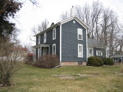 Hubbard Houselisted 1979
- Gildersleeve Houselisted 1977
Population over time
2 figuresHudson fell from 1,838 to 1,753 between 2010 and 2020. These are the recorded population figures Wikidata holds for this place, reached through the Geographic Names Information System number this page is keyed on rather than by name, so they belong to this place and not to another of the same name. Most are census counts, but not all are: an early figure may be a founding or settlement estimate, and an estimate published within five years of a census is left out. The change column is computed, and is left blank where more than 20 years separate a figure from the one before it, because a gap that long is not a change between two counts.
| Year | People | Change |
|---|---|---|
| 2010 | 1,838 | |
| 2020 | 1,753 | -85 (-5%) |
Topographic sheets covering this place
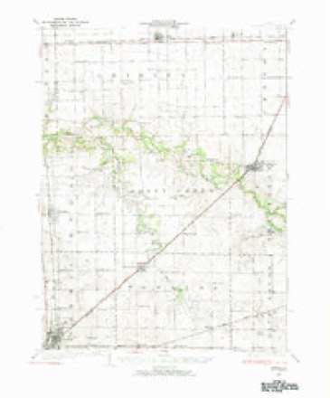
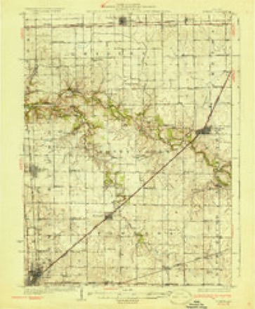
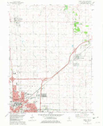
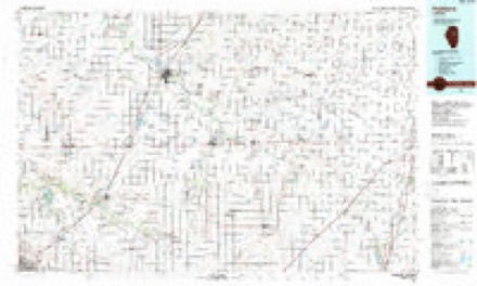
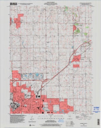
9 surveys from 15 printed sheetsMatched by testing this settlement's coordinate against the published boundary of every sheet in the United States Geological Survey's historical collection. Each opens the scanned sheet at the Survey.
- 1926 USGS Normal quadrangle1:62500, 2 printings
- 1930 USGS Normal quadrangle1:62500, 2 printings
- 1958 USGS Peoria quadrangle1:250000, 4 printings
- 1961 USGS Peoria quadrangle1:250000
- 1963 USGS Peoria quadrangle1:250000
- 1981 USGS Normal East quadrangle1:24000
- 1985 USGS Fairbury quadrangle1:100000, 2 printings
- 1990 USGS Peoria quadrangle1:250000
- 1998 USGS Normal East quadrangle1:24000




In the county-history sources
26,056 words on this townshipThe Good Old Times in McLean County, Illinois : Containing Two Hundred and Sixty-one Sketches of Old Settlers, a Complete Historical Sketch of the Black Hawk War and Descriptions of All Matters of Interest Relating to McLean County, published 1874 names this settlement in its chapter on Hudson Township. These are the passages that mention it, exactly as the scans read.
He went in 1801 to where Newark, Ohio, now is, and built several log cabins for a company which settled there. He married and moved eight miles north of that place and cleared out a small farm and ran a shop in which he made furniture, chairs, etc. Jesse Havens enlisted in the war of 1812 and was at the desperate defence made by Major Croghan and his band of one hundred and sixty men, of Fort Stephenson on the Lower Sandusky. In the fall of 1829 Jesse Havens came to Illinois. He came first to Big Grove, near where Urbana now is, and from there went in search of a house and found one on the North Fork of the Sangamon, south of where Leroy now is. When he moved his family there, which was in December, 1829, the sleet troubled him very much, and he was obliged to walk many miles to obtain corn for food. He left the Sangamon and came to Buckles' Grove and from there he came to where Hudson now is, in January, 1830. There he bought some claims, made improvements and went to farming, as did all the settlers in that section.
Passage source: The Good Old Times in McLean County, Illinois : Containing Two Hundred and Sixty-one Sketches of Old Settlers, a Complete Historical Sketch of the Black Hawk War and Descriptions of All Matters of Interest Relating to McLean County, published 1874.
The winter of the deep snow was a hard one for the Smith family. When the first heavy snowfall came, John Smith was at White Oak timber, and during that night stayed at More's mill with several others. lie was watching the mill as it ground his corn, but it broke during the night, and he could grind no more. The mill was built of logs, and was not chinked, and the snow drifted on the inside about eight feet high. It required the whole of the next day for Mr. Smith to go to Havens' Grove, and the whole of the following day to reach home at Smith's Grove. A few days afterwards, when the snow became settled and packed, it was impossible to go anywhere.
Passage source: The Good Old Times in McLean County, Illinois : Containing Two Hundred and Sixty-one Sketches of Old Settlers, a Complete Historical Sketch of the Black Hawk War and Descriptions of All Matters of Interest Relating to McLean County, published 1874.
John Smith married, March 30, 1831, Anna Havens. In the spring of 1832 he settled at Havens' Grove, about three-quarters of a mile north of his present residence. In 1849 he settled about half a mile from Hudson, in the edge of Havens' Grove, and has lived there ever since.
Passage source: The Good Old Times in McLean County, Illinois : Containing Two Hundred and Sixty-one Sketches of Old Settlers, a Complete Historical Sketch of the Black Hawk War and Descriptions of All Matters of Interest Relating to McLean County, published 1874.
Machine-read from a century-old scan, so expect the errors a machine makes: misspelled names, dropped words, stray characters.
Read the whole chapter on Hudson Township - it names this place 24 more 24 times.
Fires near this place
10 since 2013Regional context, not property-specific evidence. The federal wildfire occurrence database lists 10 fires within 5 miles of Hudson between 2013 and 2014, burning about 21 acres in total. None started naturally. 3 were recorded as arson. Distance is straight-line from the map coordinates, so a fire counted here may appear on a neighbouring settlement's page as well.
| Reported cause | Fires |
|---|---|
| Debris and open burning | 3 |
| Arson/incendiarism | 3 |
| Missing data/not specified/undetermined | 2 |
| Recreation and ceremony | 1 |
| Equipment and vehicle use | 1 |
The most recent of them, most recent first, with the day each was reported and the service that recorded it.
| Date | Cause | Size | Reported by | Name on the report |
|---|---|---|---|---|
| 15 September 2013 | Missing data/not specified/undetermined | under an acre | Illinois Division of Forestry Resources | 2013-1467 |
| 6 June 2014 | Arson/incendiarism | under an acre | Illinois Division of Forestry Resources | 2014-092 |
| 28 June 2014 | Arson/incendiarism | under an acre | Illinois Division of Forestry Resources | 2014-105 |
| 1 June 2014 | Arson/incendiarism | 1.0 acres | Illinois Division of Forestry Resources | 2014-88 |
| 31 May 2014 | Recreation and ceremony | 3.0 acres | Illinois Division of Forestry Resources | 2014-87 |
| 12 May 2013 | Missing data/not specified/undetermined | 1.5 acres | Illinois Division of Forestry Resources | 2014-73 |
| 7 April 2014 | Debris and open burning | 6.0 acres | Illinois Division of Forestry Resources | 2014-62 |
| 6 April 2014 | Debris and open burning | 6.0 acres | Illinois Division of Forestry Resources | 2014-060 |
Settlements close enough to share some of these fires:
Mines and quarries near this place
1 within 5 milesRegional context, not property-specific evidence. The federal mineral resources record lists 1 working within 5 miles of Hudson: 1 past producer. None of them still produces. What was taken out: Sand and Gravel, Construction. Distance is straight-line from the map coordinates, so a quarry counted here may appear on a neighbouring settlement's page as well.
| Where | Site | Commodity | Status | Recorded |
|---|---|---|---|---|
| Evergreen Lake Pit | Sand and Gravel, Construction | Past Producer |
Storms near this place
22 since 1996Regional context, not property-specific evidence. The National Weather Service names Hudson in 22 storm reports between 1996 and 2025: 13 thunderstorm wind, 7 hail, 1 tornado, 1 funnel cloud. The reports record 2 injuries. Each account below is quoted exactly as the forecast office filed it, from the NOAA Storm Events Database, and each date opens the federal record of that event.
| When | Event | Place named | Harm | What the report says |
|---|---|---|---|---|
| June 2008 | Thunderstorm Wind | Hudson | 1 hurt, $40,000 | Numerous tree limbs were blown down. One tree limb fell on a person causing a minor head injury. |
| March 2025 | Thunderstorm Wind | Hudson | 1 hurt | A semi-truck was overturned by thunderstorm wind gusts along I-39. The driver was transported to the hospital. |
| July 2020 | Thunderstorm Wind | Hudson | $350,000 | Numerous trees and tree branches were blown down in Hudson. Some of the falling trees damaged cars, houses, and power lines. |
| July 2020 | Thunderstorm Wind | Hudson | $40,000 | Numerous trees and tree limbs were blown down from Hudson to Lake Bloomington. Large corn fields were flattened as well. |
| May 2025 | Thunderstorm Wind | Hudson | - | Mesonet station FW2710 near Towanda measured a 60 mph wind gust. |
| April 2025 | Thunderstorm Wind | Hudson | - | Measured wind gust from mesonet station northwest of Towanda. |
| April 2019 | Hail | Hudson | - | Half dollar-sized hail was reported at the White Oak Campground in Comlara Park. |
| August 2011 | Funnel Cloud | Hudson | - | A funnel cloud was sighted by numerous people between Hudson and Lexington, including the Lake Bloomington recreational areas. There was no evidence of debris near the ground, and no reports of damage. |
| April 2006 | Tornado (F0) | Hudson | - | The tornado did minor roof damage to an outbuilding. It then crossed into Woodford County. |
| April 2006 | Thunderstorm Wind | Hudson | - | Home lost much of its roof in Hudson. |
| May 2006 | Thunderstorm Wind | Hudson | - | A farm near Hudson sustained significant damage to many outbuildings. In addition, numerous trees and power lines were blown down between Hudson and Gridley. |
| July 2003 | Thunderstorm Wind | Hudson | - | Thunderstorm winds blew down numerous trees, tree limbs and power lines. In Lexington, the roof of a maintenance building was blown off. Several of the fallen trees in Lexington and Bloomington caused minor damage to a couple of homes. No injuries were reported. |
| May 2003 | Thunderstorm Wind | Hudson | - | Several trees were blown down between Hudson and Colfax. |
| May 1998 | Thunderstorm Wind | Hudson | - | Thunderstorm winds blew down a tree which damaged a chimney on a house in Hudson. No injuries were reported and no dollar amount damage was available. |
| June 2024 | Hail | Hudson | - | no account filed |
| May 2023 | Thunderstorm Wind | Hudson | - | no account filed |
| April 2015 | Hail | Hudson | - | no account filed |
| January 2008 | Hail | Hudson | - | no account filed |
| August 2007 | Hail | Hudson | - | no account filed |
| August 2007 | Hail | Hudson | - | no account filed |
| April 2006 | Hail | Hudson | - | no account filed |
| July 1996 | Thunderstorm Wind | Hudson | - | no account filed |
Nearest settlements
The eight closest, with where each one stands in the county. Distances are straight-line, computed from the Geographic Names Information System coordinates.
| Map | Place | Distance | Sheets |
|---|---|---|---|
| Kerrick | 3.6 miles | 15 | |
| Towanda | 5.5 miles | 15 | |
| Cardinal Court | 6.1 miles | 15 | |
| Greenbriar | 6.3 miles | 15 | |
| Yuton | 6.3 miles | 15 | |
| Normal | 6.3 miles | 15 | |
| North Pointe | 6.9 miles | 15 | |
| Eagle Ridge | 7.1 miles | 15 |
Elsewhere
Matched on this settlement's Geographic Names Information System number rather than its name, so it cannot be a different place of the same name in another state.
| Wikipedia article on Hudson | An encyclopaedic summary. Its text is share-alike, so it is linked here rather than copied. |
| Wikidata item Q2672022 | The structured record the population and elevation above come from. Public domain (CC0). |
Provenance
This settlement is recorded in the Geographic Names Information System as feature 410647. The sheet list is computed by point-in-boundary test against the United States Geological Survey's historical topographic inventory. Both are works of the United States government and carry no copyright under 17 U.S.C. 105.
Wildfire. Short, Karen C. 2022. Spatial wildfire occurrence data for the United States, 1992-2020 [FPA_FOD_20221014]. 6th Edition. Fort Collins, CO: Forest Service Research Data Archive. https://doi.org/10.2737/RDS-2013-0009.6 Collected with United States Government funding and usable without additional permissions or fees.
Mines and quarries. USGS Mineral Resources Data System (MRDS) https://mrdata.usgs.gov/mrds/ A work of the United States government, no copyright under 17 U.S.C. 105.
Storms. NOAA National Centers for Environmental Information, Storm Events Database https://www.ncei.noaa.gov/stormevents/ A work of the United States government, no copyright under 17 U.S.C. 105. Narratives are quoted verbatim from the National Weather Service report and are not edited or summarised.