 Block
Carlock, Illinois
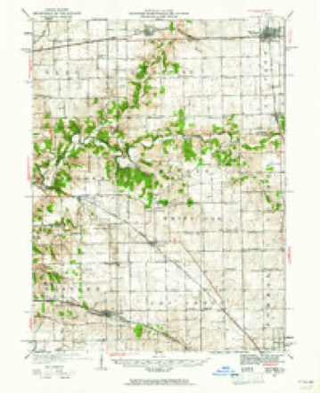
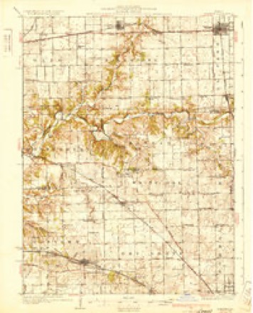
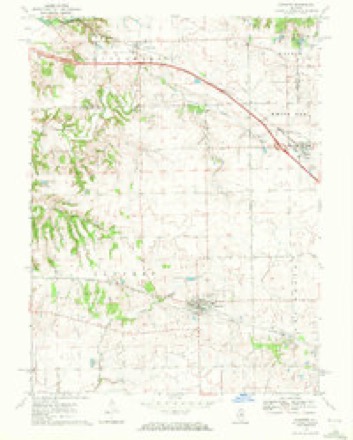
13 topographic sheets cover this place, the earliest surveyed in 1927 and the latest in 1990. It stands in White Oak Township. It lies in ZIP code area 61725. The Survey maps it on the Danvers quadrangle. 548 people lived here at the 2020 count. It stands 770 feet above sea level.
Population over time
2 figuresCarlock fell from 552 to 548 between 2010 and 2020. These are the recorded population figures Wikidata holds for this place, reached through the Geographic Names Information System number this page is keyed on rather than by name, so they belong to this place and not to another of the same name. Most are census counts, but not all are: an early figure may be a founding or settlement estimate, and an estimate published within five years of a census is left out. The change column is computed, and is left blank where more than 20 years separate a figure from the one before it, because a gap that long is not a change between two counts.
| Year | People | Change |
|---|---|---|
| 2010 | 552 | |
| 2020 | 548 | -4 (-1%) |
Topographic sheets covering this place
9 surveys from 13 printed sheetsMatched by testing this settlement's coordinate against the published boundary of every sheet in the United States Geological Survey's historical collection. Each opens the scanned sheet at the Survey.
- 1927 USGS Danvers quadrangle1:62500
- 1930 USGS Danvers quadrangle1:62500, 2 printings
- 1958 USGS Peoria quadrangle1:250000, 4 printings
- 1961 USGS Peoria quadrangle1:250000
- 1963 USGS Peoria quadrangle1:250000
- 1970 USGS Danvers quadrangle1:24000
- 1985 USGS Peoria quadrangle1:100000
- 1989 USGS Peoria quadrangle1:100000
- 1990 USGS Peoria quadrangle1:250000






In the county-history sources
21,654 words on this townshipThe Good Old Times in McLean County, Illinois : Containing Two Hundred and Sixty-one Sketches of Old Settlers, a Complete Historical Sketch of the Black Hawk War and Descriptions of All Matters of Interest Relating to McLean County, published 1874 names this settlement in its chapter on White Oak Township. These are the passages that mention it, exactly as the scans read.
Mr. Benson has made the usual trips to Chicago. He hauled wheat -and drove hogs there, and sold them for prices which would not now be considered worth the trouble of the journey. At Peoria, pork brought $1.25 to $1.50, provided the larger part of the pay was taken in goods. Vinton Carlock succeeded in getting $1.00 per hundred in cash.
Passage source: The Good Old Times in McLean County, Illinois : Containing Two Hundred and Sixty-one Sketches of Old Settlers, a Complete Historical Sketch of the Black Hawk War and Descriptions of All Matters of Interest Relating to McLean County, published 1874.
Abraham W. Carlock was born April 7, 1800, in Hampshire County, West Virginia, near the west branch of the Potomac River. His paternal grandfather emigrated to this country from Germany, and settled in Virginia shortly before the outbreak of the Revolutionary war. During the war he was a soldier in the Continental army. Shortly after Abraham's birth his father moved to Overton County, Tennessee, about fifteen miles from Livingston, the county seat, on the Obey River. Here he began farming on a small scale, and hunting on a large scale. Young Abraham was then quite a rambler. His son, W. B. Carlock, says of him: "He busied himself in rambling over the mountains, hills and valleys, gathering chestnuts, chincapins, blackberries and whortleberries, and chasing squirrels and ground hogs (woodchucks)." If he did all of that in one day, it certainly must have kept him quite busy. But it seems that the big game was left for Abraham's father, for the same good authority says; "There were a great many bear in the country at that time, but that sort of game was left for the old gentleman to attend to, and it is safe to say that bear meat was no rarity in the old man's family." Abraham Carlock was a good, industrious boy, and did not neglect his "chores." He "tended" the farm well, and raised corn, tobacco and sweet potatoes. He raised pork, too, for the Southern market, though his pigs had a bad habit of running wild and becoming, as his son says, "as wild as the wildest deer." At the age of twenty-four Abraham was married to Mary Goodpasture, and in his subsequent prosperity he might exclaim :
Passage source: The Good Old Times in McLean County, Illinois : Containing Two Hundred and Sixty-one Sketches of Old Settlers, a Complete Historical Sketch of the Black Hawk War and Descriptions of All Matters of Interest Relating to McLean County, published 1874.
In the spring of 1827 Abraham Carlock, with his wife and two children moved to Morgan County, Illinois. They walked nearly the whole distance. After remaining there three or four years he moved to Dry Grove, McLean County, and in 1836 he moved to "White Oak Grove. At White Oak Grove his boys caught many prairie chickens close to his house, even within thirty yards of his door. Sometimes they would catch twenty or thirty in a trap. They were dried and hung on strings to be preserved. Shortly after the Black Hawk war he traveled over the northern part of the State, and especially over the Fox River country, to find land to purchase. While on his travels he met the old Indian chief, Shabbona, who lived on Fox River at the grove which bears his name. This chief had been a warm friend to the whites through good and evil report, and saved many lives during the Indian troubles in early days, by warning settlers of approaching danger.
Passage source: The Good Old Times in McLean County, Illinois : Containing Two Hundred and Sixty-one Sketches of Old Settlers, a Complete Historical Sketch of the Black Hawk War and Descriptions of All Matters of Interest Relating to McLean County, published 1874.
Machine-read from a century-old scan, so expect the errors a machine makes: misspelled names, dropped words, stray characters.
Read the whole chapter on White Oak Township - it names this place 5 more 5 times.
Fires near this place
3 since 2014Regional context, not property-specific evidence. The federal wildfire occurrence database lists 3 fires within 5 miles of Carlock in 2014, burning about 12 acres in total. None started naturally. None was recorded as arson. Distance is straight-line from the map coordinates, so a fire counted here may appear on a neighbouring settlement's page as well.
| Reported cause | Fires |
|---|---|
| Debris and open burning | 2 |
| Smoking | 1 |
The most recent of them, most recent first, with the day each was reported and the service that recorded it.
| Date | Cause | Size | Reported by | Name on the report |
|---|---|---|---|---|
| 6 April 2014 | Debris and open burning | 6.0 acres | Illinois Division of Forestry Resources | 2014-060 |
| 21 March 2014 | Debris and open burning | 5.0 acres | Illinois Division of Forestry Resources | 2014-45 |
| 24 February 2014 | Smoking | under an acre | Illinois Division of Forestry Resources | 2014-033 |
Settlements close enough to share some of these fires:
Storms near this place
14 since 1995Regional context, not property-specific evidence. The National Weather Service names Carlock in 14 storm reports between 1995 and 2026: 7 hail, 5 thunderstorm wind, 2 tornado. No death or injury is recorded in these reports. Each account below is quoted exactly as the forecast office filed it, from the NOAA Storm Events Database, and each date opens the federal record of that event.
| When | Event | Place named | Harm | What the report says |
|---|---|---|---|---|
| May 1995 | Tornado (F0) | Carlock | $150,000 | A tornado briefly touched down 1 SW of Carlock damaging two homes and three outbuildings. No injuries were reported and damage was estimated around $150,000. |
| March 2026 | Thunderstorm Wind | Carlock | - | A semi truck was blown over. |
| June 2023 | Thunderstorm Wind | Carlock | - | A large tree was blown down in Carlock. |
| March 2005 | Thunderstorm Wind | Carlock | - | Power lines down east of Carlock. |
| June 1999 | Thunderstorm Wind | Carlock | - | As a line of severe thunderstorms moved southeast across McLean County, several reports of damage were reported. In Carlock, a 70 mph wind gust was reported. On the west side of Bloomington, a large tree fell onto a house causing moderate damage to the roof and siding. In Heyworth, numerous large tree limbs were blown down. |
| June 1999 | Tornado (F0) | Carlock | - | A tornado briefly touched down on the Hudson/Carlock blacktop 5 miles east of Carlock. No damage or injuries were reported. |
| August 1997 | Thunderstorm Wind | Carlock | - | Thunderstorm winds blew down numerous large tree limbs and power lines, as well as, some small business signs. No injuries were reported and no damage estimate was available. |
| June 2015 | Hail | Carlock | - | no account filed |
| June 2008 | Hail | Carlock | - | no account filed |
| April 2006 | Hail | Carlock | - | no account filed |
| April 2006 | Hail | Carlock | - | no account filed |
| April 2006 | Hail | Carlock | - | no account filed |
| July 2003 | Hail | Carlock | - | no account filed |
| December 1996 | Hail | Carlock | - | no account filed |
Nearest settlements
The eight closest, with where each one stands in the county. Distances are straight-line, computed from the Geographic Names Information System coordinates.
| Map | Place | Distance | Sheets |
|---|---|---|---|
| Danvers | 4.4 miles | 13 | |
| Yuton | 5.1 miles | 15 | |
| Woodruff | 6.1 miles | 13 | |
| Twin Grove | 6.7 miles | 13 | |
| Hudson | 7.8 miles | 15 | |
| Kerrick | 7.9 miles | 15 | |
| Cardinal Court | 8.3 miles | 15 | |
| Bloomington Heights | 8.7 miles | 13 |
Elsewhere
Matched on this settlement's Geographic Names Information System number rather than its name, so it cannot be a different place of the same name in another state.
| Wikipedia article on Carlock | An encyclopaedic summary. Its text is share-alike, so it is linked here rather than copied. |
| Wikidata item Q2079343 | The structured record the population and elevation above come from. Public domain (CC0). |
Provenance
This settlement is recorded in the Geographic Names Information System as feature 405596. The sheet list is computed by point-in-boundary test against the United States Geological Survey's historical topographic inventory. Both are works of the United States government and carry no copyright under 17 U.S.C. 105.
Wildfire. Short, Karen C. 2022. Spatial wildfire occurrence data for the United States, 1992-2020 [FPA_FOD_20221014]. 6th Edition. Fort Collins, CO: Forest Service Research Data Archive. https://doi.org/10.2737/RDS-2013-0009.6 Collected with United States Government funding and usable without additional permissions or fees.
Storms. NOAA National Centers for Environmental Information, Storm Events Database https://www.ncei.noaa.gov/stormevents/ A work of the United States government, no copyright under 17 U.S.C. 105. Narratives are quoted verbatim from the National Weather Service report and are not edited or summarised.