 Block
Kankakee, Illinois
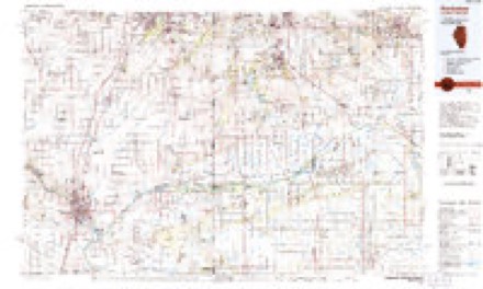
14 topographic sheets cover this place, the earliest surveyed in 1922 and the latest in 1991. It stands in Kankakee Township. It lies in ZIP code area 60901. It stands on Gar Creek. The Survey maps it on the Kankakee quadrangle. 24,052 people lived here at the 2020 count. It stands 656 feet above sea level.
Research this city
On record in Kankakee
Buildings and businesses the archive holds for this place. Each opens its own page, with the source record it came from.
On the National Register 10 records
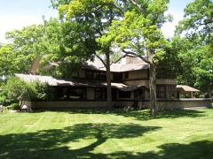 B. Harley Bradley House and Stablelisted 2009
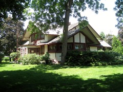 Warren Hickox Houselisted 1978
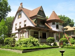 Hunter-Hattenburg Houselisted 2008
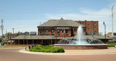 Illinois Central Railroad Depotlisted 2000
 Kankakee County Courthouselisted 2007
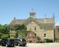 Lemuel Milk Carriage Houselisted 1979
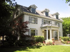 Riverview Historic Districtlisted 1986
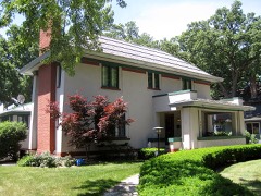 Charles E. Swannell Houselisted 1982
- Kankakee State Hospital Historic Districtlisted 1995
- Pope Brace Company Buildinglisted 2021
Population over time
2 figuresKankakee fell from 27,537 to 24,052 between 2010 and 2020. These are the recorded population figures Wikidata holds for this place, reached through the Geographic Names Information System number this page is keyed on rather than by name, so they belong to this place and not to another of the same name. Most are census counts, but not all are: an early figure may be a founding or settlement estimate, and an estimate published within five years of a census is left out. The change column is computed, and is left blank where more than 20 years separate a figure from the one before it, because a gap that long is not a change between two counts.
| Year | People | Change |
|---|---|---|
| 2010 | 27,537 | |
| 2020 | 24,052 | -3,485 (-13%) |
Topographic sheets covering this place
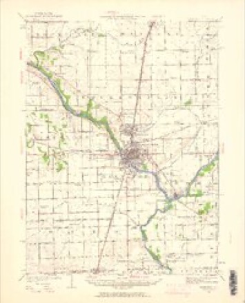
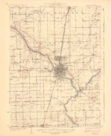
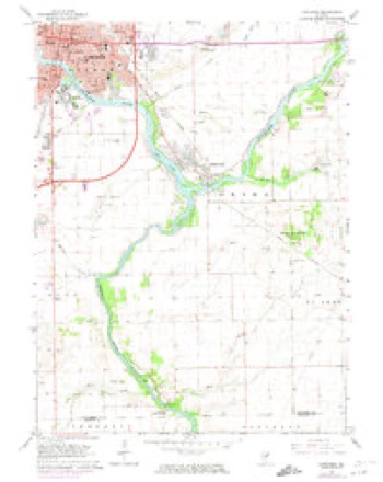
7 surveys from 14 printed sheetsMatched by testing this settlement's coordinate against the published boundary of every sheet in the United States Geological Survey's historical collection. Each opens the scanned sheet at the Survey.
- 1922 USGS Kankakee quadrangle1:62500, 2 printings
- 1924 USGS Kankakee quadrangle1:62500, 2 printings
- 1953 USGS Chicago quadrangle1:250000, 5 printings
- 1957 USGS Chicago quadrangle1:250000
- 1964 USGS Kankakee quadrangle1:24000, 2 printings
- 1984 USGS Kankakee quadrangle1:100000
- 1991 USGS Kankakee quadrangle1:100000

Fires near this place
50 since 2008Regional context, not property-specific evidence. The federal wildfire occurrence database lists 50 fires within 5 miles of Kankakee between 2008 and 2020, burning about 43 acres in total. None started naturally. None was recorded as arson. Distance is straight-line from the map coordinates, so a fire counted here may appear on a neighbouring settlement's page as well.
| Reported cause | Fires |
|---|---|
| Missing data/not specified/undetermined | 39 |
| Debris and open burning | 9 |
| Equipment and vehicle use | 1 |
| Fireworks | 1 |
The most recent of them, most recent first, with the day each was reported and the service that recorded it.
| Date | Cause | Size | Reported by | Name on the report |
|---|---|---|---|---|
| 30 September 2018 | Missing data/not specified/undetermined | under an acre | Illinois Division of Forestry Resources | 18-4632 |
| 29 September 2010 | Equipment and vehicle use | 5.0 acres | Illinois Division of Forestry Resources | COGNIS |
| 18 September 2012 | Debris and open burning | 2.0 acres | Illinois Division of Forestry Resources | MITCHELL |
| 16 September 2018 | Missing data/not specified/undetermined | under an acre | Illinois Division of Forestry Resources | 18-4382 |
| 1 September 2020 | Missing data/not specified/undetermined | under an acre | Illinois Division of Forestry Resources | 20-0004144 |
| 6 August 2019 | Missing data/not specified/undetermined | under an acre | Illinois Division of Forestry Resources | 2019-1883 |
| 3 August 2020 | Missing data/not specified/undetermined | under an acre | Illinois Division of Forestry Resources | 20-0003283 |
| 28 August 2018 | Missing data/not specified/undetermined | under an acre | Illinois Division of Forestry Resources | 18-4059 |
Settlements close enough to share some of these fires:
Mines and quarries near this place
8 within 5 milesRegional context, not property-specific evidence. The federal mineral resources record lists 8 workings within 5 miles of Kankakee: 7 past producers, 1 producer. 1 still produces. What was taken out: Sand and Gravel, Construction, Clay, Stone, Crushed/Broken, Stone. Distance is straight-line from the map coordinates, so a quarry counted here may appear on a neighbouring settlement's page as well.
| Where | Site | Commodity | Status | Recorded |
|---|---|---|---|---|
| Kankakee Highway Pit No. 1 | Stone | Past Producer | ||
| Kankakee Pit | Clay | Past Producer | ||
| Lehigh East Quarry | Stone, Crushed/Broken | Past Producer | ||
| Azzarelli Pit No.2 | Sand and Gravel, Construction | Past Producer | ||
| Grasso and Son Pit | Sand and Gravel, Construction | Past Producer | ||
| Havener Sand Pit | Sand and Gravel, Construction | Producer | ||
| Ohrt Rd. Sand Pit | Sand and Gravel, Construction | Past Producer | ||
| Route 113 Gravel Pit Azzarell: | Sand and Gravel, Construction | Past Producer |
Storms near this place
60 of 85 shownRegional context, not property-specific evidence. The National Weather Service names Kankakee in 85 storm reports between 1994 and 2026: 44 thunderstorm wind, 31 hail, 4 lightning, 3 flood. The reports record 1 injury. Each account below is quoted exactly as the forecast office filed it, from the NOAA Storm Events Database, and each date opens the federal record of that event.
| When | Event | Place named | Harm | What the report says |
|---|---|---|---|---|
| October 2013 | Lightning | Kankakee | 1 hurt | A golfer standing near a tree was struck by lightning. His injuries were not life threatening and he was treated and released. |
| July 2009 | Lightning | Kankakee | $500,000 | Lightning struck a new auto body repair building on Grinnell Road and started a fire. The building along with 3 vehicles was completely destroyed. |
| May 2011 | Thunderstorm Wind | West Kankakee | $250,000 | Trees were blown down on Cobb Street. A 12 to 16 inch diameter tree was uprooted and fell onto a car. The driver was not injured. Three large trees were blown down on Main Street near the hospital, along with many large tree limbs. Tree limbs and power lines were blown down across much of the city of Kankakee. A large tree was uprooted and fell onto a house on Nelson Avenue causing severe damage to the first and second floors of the house. Several large tree limbs were blown onto a house on South Seventh Avenue. |
| May 2006 | Flash Flood | Kankakee | $125,000 | Several roads were flooded. Seven cars stalled in high water, two cars were floating under a viaduct. A woman was rescued from one of the cars. The right shoulder of 1500N at 3100W washed away. Kankakee measured 3.95 inches of rain. |
| August 2008 | Thunderstorm Wind | West Kankakee | $100,000 | Extensive wind damage occurred across southern parts of the City of Kankakee. The damage began along West Jeffery Street and extended east of the Cobb Park area. Many roads were impassable across these locations due to downed trees. Several very large trees were uprooted and power lines were blown down. One very large tree landed on the roof of a home across the western portion of the main area of damage. About two dozen of the city's oldest trees in Cobb Park were damaged. A car was crushed and destroyed by a falling tree on South Wildwood Avenue. A tree limb was thrown through the windshield of a second car and a third car was damaged on South Greenwood Avenue. Wind gusts were estimated between 80 and 100 mph. |
| May 2003 | Thunderstorm Wind | Kankakee | $35,000 | no account filed |
| November 2013 | Thunderstorm Wind | Kankakee | $25,000 | A tree fell onto a house on Eagle Street. |
| May 2006 | Thunderstorm Wind | Kankakee | $10,000 | Several barns and trees were blown down in a one half mile wide path in Limestone Township. |
| May 2011 | Thunderstorm Wind | West Kankakee | $5,000 | On the west side of Kankakee, several 4 to 6 inch diameter tree branches were reported down. A ten inch diameter tree was down in Small Memorial Park. A large branch fell onto a van on West Hawkins Street. |
| June 2008 | Lightning | West Kankakee | $5,000 | A house was struck by lightning on Wiley Ridge Road and suffered minor damage. |
| June 2006 | Thunderstorm Wind | Kankakee | $5,000 | A barn roof was blown off. |
| August 2008 | Thunderstorm Wind | Kankakee | $2,000 | Several trees and power lines were blown down. |
| June 2015 | Thunderstorm Wind | Kankakee | $1,000 | Trees and a fence were blown down on Old Farm South Court. |
| June 2012 | Thunderstorm Wind | Kankakee | $1,000 | A one foot diameter branch was blown down on River Street. Two power poles were blown down just east of the entrance to Kankakee Community College on River Road. |
| July 2008 | Thunderstorm Wind | Kankakee | $500 | A large tree was blown over and uprooted near the corner of North Taylor Avenue and East Oak Street. The only damage reported was to a concrete sidewalk ripped up by the roots of the tree. |
| March 2026 | Hail | West Kankakee | - | A hailstone measuring 6.6 inches in diameter (168.05 mm to be precise) was found along Calista St on the west side of Kankakee. Faculty from Northern Illinois University partnered with the Insurance Institute for Business and Home Safety to verify the dimensions of the stone. It weighed in at 557.2 grams, or 19.65 ounces. As of this writing, the hailstone is being considered for the official Illinois state record. |
| April 2026 | Thunderstorm Wind | Kankakee | - | Extensive tree damage was noted around Kankakee, including downed branches up to one foot in diameter. |
| January 2024 | Flood | Kankakee | - | Low lying yards were flooded along the Kankakee River as an ice jam broke up. |
| August 2022 | Thunderstorm Wind | Kankakee | - | Power lines were blown down at Interstate 57 and the Court Street exit. |
| August 2022 | Thunderstorm Wind | Kankakee | - | Multiple large trees were blown down onto roadways. |
| August 2022 | Thunderstorm Wind | West Kankakee | - | Twenty five large trees were blown down across Small Memorial Park. |
| August 2022 | Thunderstorm Wind | West Kankakee | - | A light pole was bent and several tree limbs 3 to 6 inches in diameter were blown down. Winds were estimated to 65 mph. |
| August 2022 | Thunderstorm Wind | Kankakee | - | Trees and tree limbs were blown down. |
| September 2021 | Thunderstorm Wind | West Kankakee | - | A tree limb 6 to 12 inches in diameter was blown down. |
| May 2020 | Flood | Kankakee | - | Flood waters eroded a stream through a field, which were flowing heavily. |
| August 2020 | Thunderstorm Wind | West Kankakee | - | Numerous trees were blown down and uprooted in Kankakee. Tree limbs and power lines were also blown down. Many trees fell onto roofs and garages causing damage. The hardest hit areas were on the west side of Kankakee and the Riverview neighborhood where streets were blocked by the fallen trees. |
| February 2019 | Flood | Kankakee | - | A localized area along the Kankakee River experienced flooding due to ongoing river ice northwest of Aroma Park. Several homes were completely surrounded by water. |
| March 2017 | Thunderstorm Wind | Kankakee | - | Large tree branches were blown down throughout town. |
| July 2016 | Thunderstorm Wind | Kankakee | - | Across central and southern Kankakee County, over 200 trees and powerlines down. |
| June 2013 | Hail | Kankakee | - | Numerous reports of hail up to the size of golfballs were received between Kankakee and Bourbonnais. |
| June 2013 | Thunderstorm Wind | Kankakee | - | Numerous large trees and branches were blown down. |
| May 2013 | Thunderstorm Wind | Kankakee | - | Numerous 3 to 6 inch diameter tree limbs were blown down in downtown Kankakee. |
| July 2012 | Hail | Kankakee | - | Multiple reports of nickel to quarter size hail were received from portions of Kankakee, Bourbonnais, and Bradley. |
| May 2011 | Hail | West Kankakee | - | Up to walnut size hail was reported across portions of Bradley and Kankakee as a line of thunderstorms moved through. Specific reports include penny size hail at the intersection of Grinnell Road and Interstate 57, and nickel size hail at the intersection of West Station Street and South Curtis Avenue. Walnut size hail was reported at North Street and Illinois Route 50. |
| June 2010 | Thunderstorm Wind | Kankakee | - | A twenty inch diameter tree was snapped off blocking the road near Elm and Emory Roads. |
| June 2010 | Thunderstorm Wind | Kankakee | - | Tree limbs were blown down with estimated wind gusts to 60 mph. |
| June 2010 | Thunderstorm Wind | Kankakee | - | A tree was blown down on a car near Route 17 and Hobbie Avenue. |
| August 2009 | Thunderstorm Wind | Kankakee | - | A 20 foot tall tree was blown down. |
| January 2008 | Flash Flood | Kankakee | - | The intersection of Hobbie Avenue and Route 50 was flooded with 2 to 3 feet of water. |
| April 2006 | Thunderstorm Wind | Kankakee | - | Wind damage was reported in the River Bend Subdivision on Route 113, northwest of Kankakee. |
| May 2006 | Hail | Kankakee | - | Penny size hail reported at Oak Springs Golf Course. |
| July 2006 | Thunderstorm Wind | Kankakee | - | Tree limbs were blown down on Highland and Route 17, east of Kankakee. |
| October 2006 | Thunderstorm Wind | Kankakee | - | Trees down city wide, some blocking roads. |
| October 2006 | Thunderstorm Wind | Kankakee | - | Six inch diameter trees blown down in the road on North 9th and Stone Streets. |
| October 2006 | Thunderstorm Wind | Kankakee | - | Two large trees were blown down, one blocking Route 17. |
| March 2005 | Hail | Kankakee | - | Penny sized hail was reported to be covering the ground. |
| May 2005 | Hail | Kankakee | - | Baseball size hail was reported near mile marker 302 on Interstate 57 in Chebanse at the Kankakee-Iroquois County line. |
| April 2004 | Tornado (F1) | Kankakee | - | The tornado formed just southwest of the intersection of County Roads 5000S and 3000W. Eyewitnesses stated there were multiple funnels aloft occasionally lowering at this point. The developing vortex continued northeast to cross 3000S just west of 1000W. A brick one story house was directly hit. The roof was torn off and scattered northeast in a field across the street. Numerous large trees were snapped or uprooted around the home. An empty corrugated grain bin was pushed into a tree. The tornado continued northeast to the Cognis chemical plant where the brick wall of a building fell outward. About 200 feet of chain link fence was torn up. Several cinder block buildings were damaged or destroyed in this complex just northeast of where the fence was taken out. The vortex moved across railroad tracks to tear up part of the corrugated metal roofs at the River Valley Metro building (city bus storage) and other nearby businesses. The final damage was at a farm at the corner of Rts 45/52 and River Road. A barn was destroyed as well as several large sheds. The vortex apparently lifted after that as it moved just west of Kankakee Community College to the Kankakee River. Areas of debris could be seen in the trees north of River Road but no tree damage was noted. |
| May 2000 | Thunderstorm Wind | Kankakee | - | Trees were uprooted and large limbs were broken in Kankakee. Falling trees and limbs damaged cars and homes. As many as 30 trees were uprooted. In Momence a large tree was blown down at a school. |
| March 2026 | Hail | Kankakee | - | no account filed |
| March 2026 | Hail | Kankakee | - | no account filed |
| March 2025 | Hail | West Kankakee | - | no account filed |
| March 2023 | Hail | West Kankakee | - | no account filed |
| May 2020 | Hail | Kankakee | - | no account filed |
| June 2019 | Thunderstorm Wind | Kankakee | - | no account filed |
| May 2018 | Hail | Kankakee | - | no account filed |
| March 2006 | Hail | Kankakee | - | no account filed |
| May 2006 | Hail | Kankakee | - | no account filed |
| March 2003 | Hail | Kankakee | - | no account filed |
| March 2003 | Hail | Kankakee | - | no account filed |
Nearest settlements
The eight closest, with where each one stands in the county. Distances are straight-line, computed from the Geographic Names Information System coordinates.
| Map | Place | Distance | Sheets |
|---|---|---|---|
| West Kankakee | 1.4 miles | 15 | |
| Bradley | 1.5 miles | 15 | |
| Bourbonnais | 2.6 miles | 15 | |
| Greenwich | 3.5 miles | 15 | |
| Aroma Park | 3.8 miles | 14 | |
| Hillside Manor | 4.6 miles | 15 | |
| Indian Oaks | 5.0 miles | 15 | |
| Otto | 5.3 miles | 15 |
Elsewhere
Matched on this settlement's Geographic Names Information System number rather than its name, so it cannot be a different place of the same name in another state.
| Wikipedia article on Kankakee | An encyclopaedic summary. Its text is share-alike, so it is linked here rather than copied. |
| Wikidata item Q578351 | The structured record the population and elevation above come from. Public domain (CC0). |
Provenance
This settlement is recorded in the Geographic Names Information System as feature 411300. The sheet list is computed by point-in-boundary test against the United States Geological Survey's historical topographic inventory. Both are works of the United States government and carry no copyright under 17 U.S.C. 105.
Wildfire. Short, Karen C. 2022. Spatial wildfire occurrence data for the United States, 1992-2020 [FPA_FOD_20221014]. 6th Edition. Fort Collins, CO: Forest Service Research Data Archive. https://doi.org/10.2737/RDS-2013-0009.6 Collected with United States Government funding and usable without additional permissions or fees.
Mines and quarries. USGS Mineral Resources Data System (MRDS) https://mrdata.usgs.gov/mrds/ A work of the United States government, no copyright under 17 U.S.C. 105.
Storms. NOAA National Centers for Environmental Information, Storm Events Database https://www.ncei.noaa.gov/stormevents/ A work of the United States government, no copyright under 17 U.S.C. 105. Narratives are quoted verbatim from the National Weather Service report and are not edited or summarised.