 Block
From the record
14 National Register listings published here.
Sources: the National Register database, National Park Service
62 topographic sheets cover 61 settlements here, and 14 properties are on the National Register of Historic Places.
14 National Register listings published here.
Sources: the National Register database, National Park Service
Every property in this county listed on the National Register of Historic Places, with the year it was listed and the federal nomination document.
| Photograph | Property | Type | Listed | Reference |
|---|---|---|---|---|
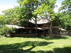 | B. Harley Bradley House and Stable | building | 2009 | 09000374 |
 | Edward Chipman Public Library | building | 2017 | 100000629 |
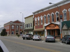 | Downtown Momence Historic District | district | 2006 | 06000449 |
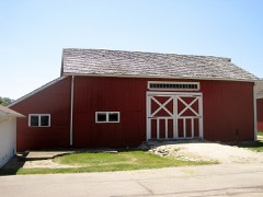 | Durham-Perry Farmstead | district | 2006 | 06000445 |
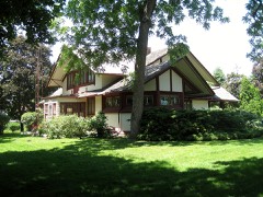 | Warren Hickox House | building | 1978 | 78001158 |
 | Hunter-Hattenburg House | building | 2008 | 07001475 |
 | Illinois Central Railroad Depot | building | 2000 | 00000409 |
 | Kankakee County Courthouse | building | 2007 | 07000115 |
| Kankakee State Hospital Historic District | district | 1995 | 95000987 | |
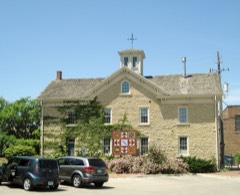 | Lemuel Milk Carriage House | building | 1979 | 79000849 |
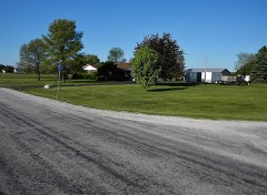 | Point School | building | 1992 | 92001539 |
| Pope Brace Company Building | building | 2021 | 100006866 | |
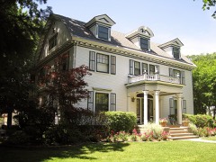 | Riverview Historic District | district | 1986 | 86001488 |
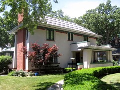 | Charles E. Swannell House | building | 1982 | 82002551 |
Every wildfire the federal occurrence database records inside this county: 96 of them, burning about 179 acres. 1 started naturally and 2 were recorded as arson. Each settlement page carries the fires within five miles of it.
| Reported cause | Fires |
|---|---|
| Missing data/not specified/undetermined | 60 |
| Debris and open burning | 28 |
| Arson/incendiarism | 2 |
| Smoking | 2 |
| Equipment and vehicle use | 2 |
| Fireworks | 1 |
| Natural | 1 |
The five largest, by the area the report gives. One of them was set deliberately.
| Date | Cause | Size | Reported by | Name on the report |
|---|---|---|---|---|
| 31 October 2020 | Equipment and vehicle use | 40 acres | Illinois Division of Forestry Resources | 2020-2345 |
| 26 December 2018 | Missing data/not specified/undetermined | 15 acres | Illinois Division of Forestry Resources | 2018-2936 |
| 23 March 2019 | Arson/incendiarism | 10 acres | Illinois Division of Forestry Resources | 2019-00000089 |
| 24 March 2009 | Missing data/not specified/undetermined | 8.0 acres | Illinois Division of Forestry Resources | HIGHTOWER |
| 3 October 2018 | Debris and open burning | 5.0 acres | Illinois Division of Forestry Resources | 130-400 |
| 10 March 2012 | Debris and open burning | 5.0 acres | Illinois Division of Forestry Resources | TRUDEU |
| 29 September 2010 | Equipment and vehicle use | 5.0 acres | Illinois Division of Forestry Resources | COGNIS |
| 11 March 2012 | Debris and open burning | 4.0 acres | Illinois Division of Forestry Resources | OHRT |
Every settlement page carries the fires within five miles of it - see the settlement index below.
The NOAA Storm Events Database holds 562 reports for this county, causing 4 deaths, 92 injuries and about $40,889,250 in recorded property damage. Each settlement page carries the reports that name it.
| Kind of event | Reports |
|---|---|
| Thunderstorm Wind | 282 |
| Hail | 138 |
| Tornado | 69 |
| Flood | 29 |
| Flash Flood | 24 |
| Heavy Rain | 11 |
| Lightning | 7 |
| Funnel Cloud | 2 |
The most serious of them, by death, then injury, then recorded damage. The accounts are quoted exactly as the forecast office filed them.
| When | Event | Place named | Harm | What the report says |
|---|---|---|---|---|
| April 1963 | Tornado (F4) | not stated | 1 killed, 50 hurt, $2,500,000 | no account filed |
| April 1954 | Tornado (F3) | not stated | 1 killed, 13 hurt, $250,000 | no account filed |
| March 2026 | Tornado (EF3) | (Ikk) Greater Kankakee Airport | 1 killed, 9 hurt | A destructive EF-3 tornado with peak winds of 160 mph impacted portions of central and eastern Kankakee County before moving into northwest Indiana. The most notable damage caused by this tornado in Kankakee County occurred in the Aroma Park area. This tornado began just north of W 3000S Road southwest of Kankakee, IL, about one mile east of State Route 115. The tornado intensified while traveling east-northeastward into the far southern section of the city of Kankakee in the vicinity of Route 45, where concentrated higher end EF-1 tree damage and structural damage was observed. The tornado intensified further while moving across E 2500S Road, destroying a two-story home and several metal farm buildings, consistent with EF-3 caliber wind speeds. Concentrated extreme tree damage was noted, with numerous large hardwood trees snapped, stubbed, or uprooted despite lacking leaves, likely due to extensive debris lofting in the area.|After crossing I-57 and the Kankakee River, the tornado rapidly increased in size, producing a swath of significant damage in and near northern portions of Aroma Park. In this area, multiple homes were heavily damaged to an estimated EF-2 intensity. The tornado's peak width occurred here and was estimated to be approximately 1550 yards. Ground survey and aerial imagery suggests that the tornado further intensified as it tracked east-southeast before crossing the Kankakee River again. Within a narrow 150-200 yard wide section along S. Sandbar Road to the northeast of Aroma Park, three homes were completely destroyed, consistent with EF-3 caliber winds, and multiple others were heavily damaged and rendered uninhabitable. A heavy pickup truck parked in front of the garage of one of the destroyed homes was moved over 100 feet into a ditch next to the driveway, possibly being spun around the remnants of a small tree before reaching the ditch. In addition, on the other side of Sandbar Road, a crossover type SUV appeared to have been rolled onto the adjacent property and deposited onto a pile of debris just north of a heavily damaged residence. Along the swath of the most intense structural damage, concentrated extreme tree damage was noted, with numerous large hardwood trees snapped, stubbed, or uprooted despite lacking leaves, likely owing to extensive flying debris. Along Sandbar Road and through the Kankakee Elks Golf Course, the tornado's width was estimated at near 1500 yards. The tornado then continued generally east to east-northeast towards the Indiana state line, downing numerous additional trees, causing occasional structural damage, and flipping irrigation pivots as it moved just north of the communities of Wichert and Hopkins Park. The tornado continued on its destructive path into Newton County, Indiana where it caused additional EF-3 damage before eventually lifting west of De Motte in Jasper County. It was on the ground for over 35 miles and, at its peak, spanned a half mile in diameter. The storm destroyed numerous homes and resulted in around a dozen injuries and three fatalities: one in Aroma Park and the other two in Newton County, Indiana. |
| June 1986 | Thunderstorm Wind | not stated | 1 killed | no account filed |
| April 1982 | Tornado (F3) | not stated | 15 hurt, $25,000,000 | no account filed |
| August 2007 | Thunderstorm Wind | Bourbonnais | 3 hurt, $500,000 | Several houses received minor wind damage with five homes suffering significant damage. Numerous trees, tree limbs and power lines were blown down. Three people suffered minor injuries from flying debris. One man was injured when part of a roof landed on his vehicle. |
| June 2010 | Tornado (EF3) | Aroma Park | 1 hurt, $600,000 | The tornado began 3 miles northwest of St. Anne in Kankakee county. The tornado developed just west of 6000E Road and tracked to the east, where it produced damage to a home and a garage along the road. At this location, a single family home collapsed upon itself, leaving it inhabitable. The garage sustained damage to its roof and exterior walls. The tornado was rated EF2 with winds estimated at around 113 mph.||The tornado continued to move to the east northeast, where it increased in intensity as it encountered yet another family home at the intersection of Route 1 and 4000S Road. This home and the garage/barn next to it sustained considerable damage, leaving the home inhabitable. The damage to the home consisted of all the walls collapsing, with all remaining debris from the house tossed to the northeast. The garage walls collapsed with the contents tossed to the east. Two four-wheelers and a four-door automobile inside the garage were lifted and flipped over as the tornado passed. Further north along Route 1, there was minor structural damage to a couple of homes and several trees uprooted. Damage at this location was rated EF3 with winds estimated at around 142 mph and a path width of 175 yards.||As this tornado continued to the northeast, it lost its intensity as it came across another residence at the intersection of 4000S Road and 8500E Road. Here, a house sustained partial damage to its roof with several surrounding trees having limbs sheared at the top. The tornado weakened at this point, and damage was rated EF1 with winds estimated at around 97 mph and a path width of 50 yards.||The tornado moved to the northeast through a wooded area, causing damage to many trees along its way. The more significant damage occurred near the intersection of 13000E Road and Gamble Road in the Hopkins Park area, where several healthy large hardwood tree tops were sheared or broken. Some homes were damaged by falling trees. The tornado continued to weaken and damage was rated EF1, with winds estimated at around 88 mph, and a path width of 50 yards. It was along 13000E Road where the tornado appeared to lift, with no other damage evident beyond this point. |
| October 2013 | Lightning | Kankakee | 1 hurt | A golfer standing near a tree was struck by lightning. His injuries were not life threatening and he was treated and released. |
| March 1991 | Tornado (F1) | not stated | $2,500,000 | no account filed |
| May 2008 | Hail | Manteno | $2,000,000 | Hail to the size of tennis balls was reported covering the ground near Main Street and Route 50. School roofs were damaged including heating and cooling units. Two school greenhouses were also damaged. Windows were also broken on some houses and businesses. |
| February 2018 | Flood | Kankakee River Pk Ar | $1,100,000 | Numerous roads in Kankakee County were flooded and several roads were closed. Storm total rainfall amounts included 5.73 inches in St. Anne and 3.39 inches in Kankakee. Approximately 110 homes throughout the county were affected by flood waters. |
| June 2014 | Tornado (EF2) | Puder | $500,000 | This strong tornado touched down slightly north of the intersection between E. 10500N Rd and N. 14000E Rd. The tornado torqued a house on its foundation beyond repair and damaged a small church. There were also numerous barns and outbuildings destroyed and severe damage to several large trees. The tornado dissipated near N. 17500E Rd. Maximum winds were estimated to 115 mph. |
| June 2010 | Tornado (EF1) | Irwin | $500,000 | A brief tornado developed about 5 miles southwest of Kankakee, or 3 miles south of Limestone, in southern Kankakee County. This brief tornado caused damage to a farm just north of the intersection of 5000W Road and 3000S Road. Several trees were uprooted or snapped. A machine shed on the property was destroyed, along with farm equipment and vehicles. A quonset building was damaged, and a fence was blown over. The tornado was rated EF1 with winds estimated at around 100 mph. |
| July 2009 | Lightning | Kankakee | $500,000 | Lightning struck a new auto body repair building on Grinnell Road and started a fire. The building along with 3 vehicles was completely destroyed. |
| January 2008 | Flood | Kankakee River Pk Ar | $500,000 | After flash flooding during the morning hours of January 8th, flooding continued until January 11th. Significant flooding occurred in Aroma Park. As the rain ran off into streams and creeks, rivers overflowed their banks causing additional flooding. Numerous roads were closed and flooded. Storm total rainfall amounts included 2.78 inches in Kankakee, 2.75 inches in St. Anne and 2.61 inches in Bourbonnais. |
| May 2011 | Thunderstorm Wind | West Kankakee | $250,000 | Trees were blown down on Cobb Street. A 12 to 16 inch diameter tree was uprooted and fell onto a car. The driver was not injured. Three large trees were blown down on Main Street near the hospital, along with many large tree limbs. Tree limbs and power lines were blown down across much of the city of Kankakee. A large tree was uprooted and fell onto a house on Nelson Avenue causing severe damage to the first and second floors of the house. Several large tree limbs were blown onto a house on South Seventh Avenue. |
| May 2011 | Tornado (EF1) | Leesville | $250,000 | Tree damage was observed at multiple locations along the path of this tornado including snapped hardwood trees. Additional damage included snapped utility poles, roof and shingle damage to homes, overturned campers, and an attached garage removed from a home that was under construction. Two people reported watching this tornado as it just missed their property. Two buildings, built from concrete blocks, were destroyed near 11580E and 7000S. At 4702S and 14000E, storage sheds were destroyed and a metal grain bin was blown over. Shingles were also blown off the roof of a house. |
| July 2001 | Thunderstorm Wind | St Anne | $250,000 | no account filed |
| June 1990 | Tornado (F2) | not stated | $250,000 | no account filed |
| March 1976 | Tornado (F3) | not stated | $250,000 | no account filed |
| May 1955 | Tornado (F1) | not stated | $250,000 | no account filed |
| January 1950 | Tornado (F2) | not stated | $250,000 | no account filed |
| June 2013 | Thunderstorm Wind | Manteno | $180,000 | Along Route 45 between county roads 9000 and 10000, nine power poles were snapped at the base. A church under construction was completely destroyed. |
| June 2014 | Tornado (EF1) | Whitaker | $166,000 | A tornado started near the intersection of 11000N Rd and N 8000E Rd. A large shed was destroyed with all of its posts and several anchors to the posts pulled from the ground. There was also minor buckling of a house's foundation, numerous trees snapped and uprooted, a snapped wooden power pole, and damage to corn crops. The tornado dissipated near Illinois Highway 1. Maximum winds were estimated to 110 mph. |
| June 2014 | Tornado (EF1) | Whitaker | $166,000 | This tornado began near a farmstead on N. 8000E Rd and would end near the intersection of 9000N Rd and N. 11000E Rd. A barn was destroyed, a 4,000 lb. trailer moved 50 feet, and numerous hardwood trees were snapped and uprooted. Maximum winds were estimated to 105 mph. |
| June 2014 | Tornado (EF1) | Whitaker | $158,000 | This tornado began near 10000N Rd and ended near a farmstead along N. 8000E Rd. A large machine shed was heavily damaged, and trees were snapped and uprooted. Maximum winds were estimated to 95 mph. |
| June 2014 | Tornado (EF0) | Manteno | $133,000 | A tornado touched down near N. 5000E Rd and ended near N 8000E Rd. It snapped a wooden power pole and damaged corn along its path. Maximum winds were estimated to 85 mph. |
| June 2014 | Tornado (EF1) | Puder | $128,000 | This tornado began near Kankakee County Highway 13 in Illinois and crossed into Indiana just south of E. 10500N Rd. A house under construction (but sealed) had an exterior wall of the garage blown out, part of a second story exterior wall blown in, and a portion of roof removed. A barn also had substantial roof damage along with numerous large trees snapped, uprooted, and partially stripped of their branches. The tornado dissipated south of Lowell, Indiana near Colfax St. Maximum winds were estimated to 110 mph. |
| May 2006 | Flash Flood | Kankakee | $125,000 | Several roads were flooded. Seven cars stalled in high water, two cars were floating under a viaduct. A woman was rescued from one of the cars. The right shoulder of 1500N at 3100W washed away. Kankakee measured 3.95 inches of rain. |
| June 2014 | Thunderstorm Wind | Bourbonnais | $100,000 | Some siding was peeled off of homes. |
| June 2012 | Flash Flood | Altorf | $100,000 | Very heavy rain fell across portions of Kankakee County. In Momence, several inches of standing water in roadways caused road closures, including County Road 3500N. In Bourbonnais, two to three feet of standing water forced road closures, including the intersection of Bethel Drive and Independence Drive. Law enforcement in Kankakee reported numerous road closures across portions of Kankakee and Bradley as well as rural portions of the county due to water rushing over roadways. Near Bradley, a mesonet site measured 4.90 inches of rain while a trained spotter measured a storm total of 7.33 inches, which was the highest rainfall report for the event. Near Bourbonnais, an observer measured 4.74 inches of rain. |
| June 2011 | Tornado (EF0) | Lehigh | $100,000 | The survey team reported a housing residence along Route 17 that had a shed completely destroyed, with the walls collapsed and the roof blown approximately 25 feet away. There was extensive hardwood tree damage for most of the damage path. Most of the trees damaged were either uprooted or snapped off at the base. These were large, mostly healthy trees. There were several trees where the break was a third to half of the way up the tree trunk. One of the housing structures along 7000W had a glass window blown out. An additional building had damage in the siding from a branch piercing the outer wall. Along 2000N, there were several occurrences of damage to man-made objects at several homesteads. The door on a large tin barn was blown into the structure and several panels of the siding collapsed. On the same property, a wooden corn shed was completely destroyed, and a house sustained shingle damage. A metal siding fence also blew down on the property line, as well as a chain link fence. Another property on 2000N incurred heavy structural damage due to fallen trees. Along the damage path, there were convergent wind patterns in several corn and wheat fields. In addition, the fallen trees laid in a convergent pattern. Many branches were speared into the ground in a convergent pattern, as well. The nature of this damage was consistent with an EF1 tornado with winds of 100 to 110 mph. |
| July 2008 | Thunderstorm Wind | Bourbonnais | $100,000 | A parked car on North Blaine Avenue was destroyed by a large tree that was blown down onto it. Another car on Goodwin Street sustained significant damage after a large tree limb fell on it. An SUV on South Grand Avenue suffered major damage after a large tree limb fell onto the roof. Some trees were uprooted. Numerous trees, tree limbs and power lines were blown down throughout Bradley. |
| August 2008 | Thunderstorm Wind | West Kankakee | $100,000 | Extensive wind damage occurred across southern parts of the City of Kankakee. The damage began along West Jeffery Street and extended east of the Cobb Park area. Many roads were impassable across these locations due to downed trees. Several very large trees were uprooted and power lines were blown down. One very large tree landed on the roof of a home across the western portion of the main area of damage. About two dozen of the city's oldest trees in Cobb Park were damaged. A car was crushed and destroyed by a falling tree on South Wildwood Avenue. A tree limb was thrown through the windshield of a second car and a third car was damaged on South Greenwood Avenue. Wind gusts were estimated between 80 and 100 mph. |
| July 1995 | Thunderstorm Wind | Manteno | $100,000 | About 20 empty tractor-semitrailers were knocked over, upended or blown on top of each other. A tractor-semitrailer was overturned on the Interstate 57 entrance ramp at Manteno. Several trees and limbs were blown down in town, mainly on the west side. Porches and gutters were damaged on a few homes. Crops were also flattened by winds. |
| June 2010 | Tornado (EF1) | Wichert | $75,000 | Spotters witnessed a brief secondary tornado to the north of the primary St. Anne tornado. This tornado touched down in a farm field near a creek, about 1/4 mile north of County Road 3500 S, and one quarter mile west of Illinois Route 1. It destroyed a machine shed and flipped over a large grain trailer. The tornado also blew down large tree limbs. |
| May 2006 | Tornado (F1) | Aroma Park | $75,000 | The tornado began near Sugar Island at 6000 South and about 3000 East and appears to have ended near 5500 South and 4500 East. The tornado path was embedded in a half mile wide swath of tree limb damage. In the narrow tornado path, more concentrated damage occurred. A large healthy tree was uprooted and other trees had large limbs blown down. Barn roofs were ripped off. A large machine shed was completely destroyed. Wood supports were pulled from the ground, two by fours were snapped and a large steel beam was thrown into a nearby barn. Pieces of metal roof and siding were blown a mile downstream. A camper was rolled over. |
| May 2018 | Thunderstorm Wind | Bourbonnais | $50,000 | Twenty utility poles were blown down. Several roofs were pulled back. A corn crib and metal silos were blown down with debris oriented roughly toward the east. |
| June 2015 | Thunderstorm Wind | Bradley | $50,000 | Numerous trees and large limbs were blown down across portions of Bradley. At least one large tree fell onto a house causing damage. |
| June 2014 | Thunderstorm Wind | Grant Park | $50,000 | Multiple large trees were blown down along area county roads, including one that fell onto a house at 620W County Line Road, and another that was uprooted and fell onto a car. Some of the trees were up to 16 inches in diameter. |
| June 2010 | Lightning | Grant Park | $50,000 | Lightning struck a house, which started a fire. |
| May 2009 | Thunderstorm Wind | Yeager | $50,000 | Dozens of trees were uprooted along 4000N, northwest of Momence. The fallen trees damaged vehicles and flattened a large pole barn. Just down the road, a roof of an outbuilding was partially removed. At the same location the roof of a house was torn off. Pieces of twisted metal from the roofs of barns and sheds were found in trees and wrapped around nearby utility poles. |
| June 2011 | Lightning | Bourbonnais | $40,000 | A large tree was struck by lightning in an alley near Kennedy Drive and North Street. The tree then fell on to three cars, destroying two of them. Power lines were also brought down by the falling tree. |
| March 2009 | Tornado (EF1) | St George | $40,000 | An EF1 tornado touched down near the intersection of county roads 5000N and 7500E. On the southwest corner of this intersection, a detached garage and steel shed were destroyed. A two foot diameter tree was snapped at the base and several other trees had large branches broken off. Debris from this location was lifted and carried approximately 100 yards into the field across the road. The tornado also damaged property on the northeast corner of the intersection. A corn crib and a shed which served as a blacksmith forge were both destroyed. Debris from these buildings was scattered to the northeast in a narrow path approximately 800 yards long. Corn stalks in a field to the northeast appeared to have been flattened and twisted by this tornado. |
| August 2001 | Thunderstorm Wind | Bourbonnais | $40,000 | no account filed |
| June 2013 | Tornado (EF0) | Deselm | $35,000 | A tornado briefly touched down at a farmstead just south of the intersection of County Line Road and North 1500 West Road. The tornado collapsed a barn, killing a horse. Debris was tossed 75 yards southeast across the road into an adjacent field. Maximum estimated winds were 85 mph. |
| May 2003 | Thunderstorm Wind | Kankakee | $35,000 | no account filed |
| July 2010 | Thunderstorm Wind | Manteno | $30,000 | Several trees six to eight inches in diameter were blown down near Interstate 57 around exit 322. A 12 inch diameter tree was snapped off at its base. Numerous trees were blown down on Leahy Circle and on Park Street. A 10 inch diameter tree was blown down on a house on Leahy Circle. A tree fell on a car on Park Street. |
| March 2009 | Tornado (EF1) | Whitaker | $30,000 | A tornado touched down at a farm about one half mile east of the intersection of county roads 8000N and 9000E. Two barns at this location lost part of their roof. Another garage and another steel building were completely destroyed. Debris from this location was lifted and deposited in a field and treeline approximately 400 yards to the northeast. |
| May 2006 | Thunderstorm Wind | St Anne | $30,000 | About 200 trees were blown down in St. Anne. Numerous tree limbs and power lines were also blown down. Several trees fell onto houses. Bleachers at a high school were thrown across a field. |
| November 2013 | Thunderstorm Wind | Dickeys | $25,000 | The roof of a barn was torn off on the south side of 7000S between 8000W and 9000W/ Debris was thrown about half a mile to the northeast. A power pole was snapped at the base near the barn. |
| November 2013 | Thunderstorm Wind | Kankakee | $25,000 | A tree fell onto a house on Eagle Street. |
| May 2009 | Flash Flood | Altorf | $25,000 | Several roads in Bourbonnais and Bradley were flooded. Viaducts were also flooded and closed. Three stalled cars were reported in a flooded viaduct east of Broadway. Eighteen inches of water was reported in the intersection of Mooney Drive and Armour Road. Storm total rainfall in Bourbonnais was measured at 3.47 inches. |
| March 2009 | Thunderstorm Wind | Grant Park | $25,000 | High winds damaged a brand new, 10,000 foot greenhouse and flattened and damaged 30,000 perennials. The high winds also blew plastic roofs off some 30 separate plant buildings and took the roof off of a pole barn. A grain auger was flipped over and damaged. A large barn on N 11000 E Road was blown over and destroyed. A large tree was blown down. |
| September 1969 | Tornado (F2) | not stated | $25,000 | no account filed |
| June 1957 | Tornado (F1) | not stated | $25,000 | no account filed |
| June 2014 | Tornado (EF1) | St George | $20,000 | This tornado started near the intersection of E. 6000N Rd and N. County Highway 51. Roof damage was done to a barn along with numerous trees snapped and uprooted. The tornado ended along County Highway 13. Maximum winds were estimated to be 90 mph. |
| November 2013 | Thunderstorm Wind | Bonfield | $20,000 | A home was damaged when strong winds tore off a large section of a roof. A power pole was also blown down. |
| September 2014 | Thunderstorm Wind | Grant Park | $15,000 | Numerous large trees were blown down, including some that damaged a home. |
| November 2013 | Thunderstorm Wind | Buckingham | $15,000 | Route 115 was closed between 17000W and 16000W roads due to several power snapped power poles. Two power lines were blown down on 5000S Road between 16000W and 15000W roads. Several south facing windows were blown in on a house. A roof was blown off a shed. |
The Survey's mineral resources record lists 22 workings inside this county. 6 still produce and 16 are closed or unrecorded. Each settlement page carries the workings within five miles of it.
| Commodity | Workings |
|---|---|
| Sand and Gravel, Construction | 12 |
| Stone, Crushed/Broken | 5 |
| Clay | 3 |
| Sulfur | 1 |
| Stone | 1 |
The least common of them first, because a county's hundredth gravel pit says nothing its first ten did not.
| Where | Site | Commodity | Status | Recorded |
|---|---|---|---|---|
| Hershey Sulfur Plant | Sulfur | Producer | ||
| Kankakee Highway Pit No. 1 | Stone | Past Producer | ||
| Eastern Illinois Pit & Mill | Clay | Producer | ||
| Kankakee Pit | Clay | Past Producer | ||
| N.Ill.Coal Co.Clay Shale Pit 2 | Clay | Past Producer | ||
| Lehigh East Quarry | Stone, Crushed/Broken | Past Producer | ||
| Lehigh Main Quarry | Stone, Crushed/Broken | Producer | ||
| Lehigh Stone | Stone, Crushed/Broken | Past Producer | ||
| Manteno Quarry & Mill | Stone, Crushed/Broken | Producer | ||
| Momence Quarry & Mill | Stone, Crushed/Broken | Producer | ||
| Azzarelli Pit 3 | Sand and Gravel, Construction | Past Producer | ||
| Azzarelli Pit No. 1 | Sand and Gravel, Construction | Past Producer | ||
| Azzarelli Pit No.2 | Sand and Gravel, Construction | Past Producer | ||
| Bice Pit | Sand and Gravel, Construction | Past Producer | ||
| Blend Sand Pit | Sand and Gravel, Construction | Past Producer | ||
| Grasso and Son Pit | Sand and Gravel, Construction | Past Producer | ||
| Grosso Pit Number 1 | Sand and Gravel, Construction | Past Producer | ||
| Grosso Pit Number 2 | Sand and Gravel, Construction | Past Producer | ||
| Havener Sand Pit | Sand and Gravel, Construction | Producer | ||
| Ohrt Rd. Sand Pit | Sand and Gravel, Construction | Past Producer | ||
| Route 113 Gravel Pit Azzarell: | Sand and Gravel, Construction | Past Producer | ||
| Tanner Pit | Sand and Gravel, Construction | Past Producer |
Named settlements recorded in the Geographic Names Information System, each with the topographic sheets covering it. Villages, hamlets and abandoned places alike. Each is shown with the nearest named watercourse or landform and the survey quadrangle it falls on.
Momence township · 60954 · Near Vails Island · Illiana Heights quadrangle
15 sheets, 1922 to 1991
Bourbonnais township · 60914 · Near Langham Island · Bourbonnais quadrangle
15 sheets, 1922 to 1991
St. Anne township · 60964 · Saint Anne quadrangle
13 sheets, 1922 to 1991
No longer a settlement
Momence township · 60954 · On Bull Creek · Illiana Heights quadrangle
15 sheets, 1922 to 1991
Salina township · 60935 · On North Bonfield Branch · Bonfield quadrangle
11 sheets, 1923 to 1991
Momence township · 60954 · On Bull Creek · Illiana Heights quadrangle
15 sheets, 1922 to 1991
Momence township · 60954 · On Bull Creek · Illiana Heights quadrangle
15 sheets, 1922 to 1991
Yellowhead township · 60940 · Beecher West quadrangle
12 sheets, 1949 to 1991
No longer a settlement
Momence township · 60954 · Near Vails Island · Illiana Heights quadrangle
15 sheets, 1922 to 1991
Pilot township · 60941 · Herscher quadrangle
12 sheets, 1923 to 1991
No longer a settlement
Momence township · 60954 · Near Vails Island · Illiana Heights quadrangle
15 sheets, 1922 to 1991
Ganeer township · 60964 · Near Eagle Island · Momence quadrangle
14 sheets, 1922 to 1991
Momence township · 60954 · On Bull Creek · Illiana Heights quadrangle
15 sheets, 1922 to 1991
Sumner township · 60940 · On East Branch Tower Creek · Momence quadrangle
14 sheets, 1922 to 1991
The vanished settlements of Kankakee County: the places named above that are no longer on the map.