 Block
Lebanon, Illinois
18 topographic sheets cover this place, the earliest surveyed in 1907 and the latest in 1991. It stands in Lebanon Township. It lies in ZIP code area 62254. It stands on East Branch Little Silver Creek. The Survey maps it on the Lebanon quadrangle. 4,691 people lived here at the 2020 count. It stands 463 feet above sea level.
On record in Lebanon
Buildings and businesses the archive holds for this place. Each opens its own page, with the source record it came from.
On the National Register 2 records
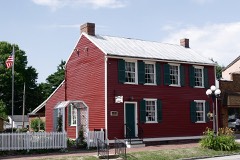 Mermaid House Hotellisted 1975
- Lebanon Historic Districtlisted 1978
Population over time
2 figuresLebanon grew from 4,418 to 4,691 between 2010 and 2020. These are the recorded population figures Wikidata holds for this place, reached through the Geographic Names Information System number this page is keyed on rather than by name, so they belong to this place and not to another of the same name. Most are census counts, but not all are: an early figure may be a founding or settlement estimate, and an estimate published within five years of a census is left out. The change column is computed, and is left blank where more than 20 years separate a figure from the one before it, because a gap that long is not a change between two counts.
| Year | People | Change |
|---|---|---|
| 2010 | 4,418 | |
| 2020 | 4,691 | +273 (+6%) |
Topographic sheets covering this place
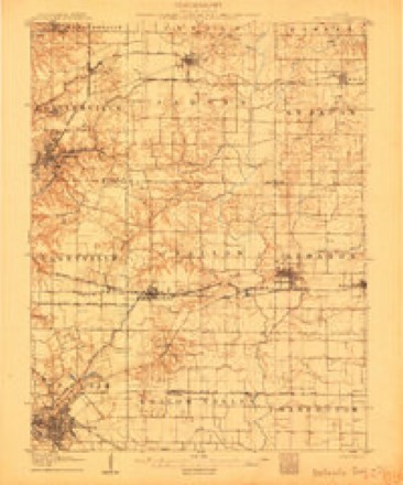
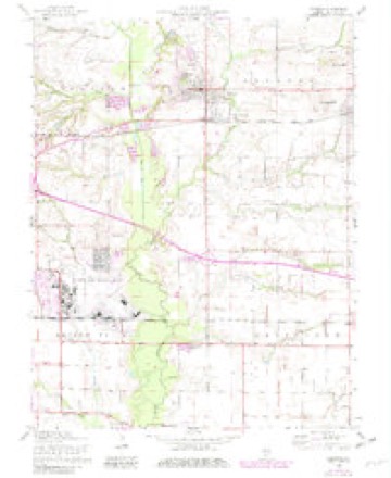
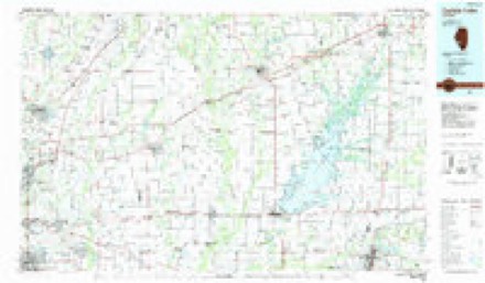
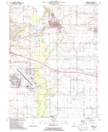
8 surveys from 18 printed sheetsMatched by testing this settlement's coordinate against the published boundary of every sheet in the United States Geological Survey's historical collection. Each opens the scanned sheet at the Survey.
- 1907 USGS Belleville quadrangle1:62500, 3 printings
- 1935 USGS Lebanon quadrangle1:24000, 2 printings
- 1949 USGS Lebanon quadrangle1:24000, 2 printings
- 1954 USGS Lebanon quadrangle1:24000, 4 printings
- 1958 USGS Belleville quadrangle1:250000, 3 printings
- 1962 USGS Belleville quadrangle1:250000
- 1985 USGS Carlyle Lake quadrangle1:100000, 2 printings
- 1991 USGS Lebanon quadrangle1:24000


In the county-history sources
36,345 words on this townshipHistory of St. Clair County, Illinois. With Illustrations ... and Biographical Sketches of Some of Its Prominent Men and Pioneers, published 1881 names this settlement in its chapter on Lebanon Township. These are the passages that mention it, exactly as the scans read.
This beautiful and thriving little city is located on the Ohio and Mississippi railroad, twenty-two miles east of St. Louis, and about eleven miles north-east from Belleville, the county-seat. It is eligibly situated, on a gracefully sloping hill, and commands a fine view of the surrounding country. The city is nicely laid out, and contains many elegant residences. The streets are broad, with good side-walks, and well shaded. The south-east quarter of section nineteen, upon which the original town was laid out, was entered by Henry White, September 24, 1814. Thri first house was erected by Gillis Maddeaux. It was constructed of logs, and was situated in the south-eastern part of the town, but has long since disappeared. The next was erected by Joseph Akin, and stood just south-east of the present public square, on the lot now owned by Mrs. Flint. Joseph Hathaway built a two-story log cabin on west Main street where Neuman's saloon now stands. Thomas Ray, the proprietor of the west end of the town, built the next, a little west on the same block. Another log house was built just opposite these, on the sam 3 street by Nathan Horner. Adam Vinyard also built a house in the east part of town. The first store was established as early as 1818, by Gov. Kinney, and kept by his nephew, Abraham Kinney. Thomas Ray, Nathan Horner, Mulligan & Sublett, Samuel and Andrew Christy and James Riggin opened stores soon afterwards. These and perhaps a few more log buildings were erected on the present site of Lebanon prior to 1820- In that year Gov. Kinney erected the hotel « Veranda," which is still standing and forms a part of the Bishop House. It is brick, and in those days it was considered a very handsome building. This, then, became a stage stand, being located on the line of the Vincennes and St. Louis stage route. A post-office was established and mails were received by stage twice a day. About this time Gov. Kinney built an oxmill for grinding flour. In 1821 Col. E. B. Clempson erected the first frame house. This now forms a part of H. H. Horner's resi- 43 '
Passage source: History of St. Clair County, Illinois. With Illustrations ... and Biographical Sketches of Some of Its Prominent Men and Pioneers, published 1881.
The town was laid out by Gov. William Kinney and Thomas Ray. It was surveyed and platted by Aaron Reed, Jr., and filed in the office of county Recorder July 27, 1825. Since then there have been twenty-one additions made to the original plat. In 1828 there were not more than thirty cabins and houses in the place. There were two stores, one kept by Nathan Horner and the other by James Riggin, a grocery, or saloon, kept by Josiah Crocker, and a log school-house with oiled paper for windows, where school and religious meetings were held. The Lebanon Seminary (McKendree College) was also partially completed and the school established. In the fall of 1832 a large store-house was erected and a complete stock of general goods was opened by Horner and Hypes. Benjamin Hypes, of this firm, was born in Virginia in 1810, and came here from Ohio, and was an early and prominent business man from 1828 to 1863, and is still living here much esteemed by the community. Joseph Hypes, his brother, was also born in Virginia, in 1798. He came here as early as 1821, and engaged in the milling business, and subsequently in the manufacture of carriages and wagons. He is yet living, hale and hearty, at his residence in this city. James Riggin, a Tennesseean, was an early and enterprising merchant, and died here in 1858. His excellent wife survived him until a few years ago. Esquire Thomas Williams built a tannery establishment here in 1829, and operated it successfully and profitably for many years-. He died about 1865, and left a handsome estate. Lyman Adams, an old sea captain, built a hotel here in 1830, known as the "Mermaid House." He was also an early merchant, and an active business-man He died here in the decade of 1850. The hotel " Veranda," mentioned above, was first occupied by Jeremiah Johnson, a noted hotel-keeper. He was for many years proprietor of the old Missouri Hotel in St. Louis, and opened the " Veranda " in 1820, which he occupied until his death, about 1836. Theodore W. Gray, a native of Maryland, located in Lebanon in 1824 and engaged in the tailoring business, at which he acquired a competency, and is now enjoying a retired life, much respected by the citizens. These are a few of the very earliest and most successful business-men of the place.
Passage source: History of St. Clair County, Illinois. With Illustrations ... and Biographical Sketches of Some of Its Prominent Men and Pioneers, published 1881.
From the Illinois Oazeteer, published by Rev. John M. Peck in 1837, we copy the following: "Lebanon has a steam-mill for manufacturing grain, and an ox-mill for flouring, on an inclined plane ; a post-office, two public houses, seven stores, one grocery ; three physicians ; mechanics' shops of various kinds, and about sixty families. The Methodist college is located in the immediate vicinity." From this the town has grown, and now contains a population of about two thousand, with fine residences, handsome business blocks, good schools, churches, and various manufacturing institutions.
Passage source: History of St. Clair County, Illinois. With Illustrations ... and Biographical Sketches of Some of Its Prominent Men and Pioneers, published 1881.
Machine-read from a century-old scan, so expect the errors a machine makes: misspelled names, dropped words, stray characters.
Read the whole chapter on Lebanon Township - it names this place 34 more 34 times.
Mines and quarries near this place
1 within 5 milesRegional context, not property-specific evidence. The federal mineral resources record lists 1 working within 5 miles of Lebanon: 1 occurrence. None of them still produces. What was taken out: Stone, Crushed/Broken. Distance is straight-line from the map coordinates, so a quarry counted here may appear on a neighbouring settlement's page as well.
| Where | Site | Commodity | Status | Recorded |
|---|---|---|---|---|
| Limestone Prospect | Stone, Crushed/Broken | Occurrence |
Storms near this place
26 since 1996Regional context, not property-specific evidence. The National Weather Service names Lebanon in 26 storm reports between 1996 and 2025: 17 thunderstorm wind, 7 hail, 1 tornado, 1 flash flood. The reports record 3 injuries. Each account below is quoted exactly as the forecast office filed it, from the NOAA Storm Events Database, and each date opens the federal record of that event.
| When | Event | Place named | Harm | What the report says |
|---|---|---|---|---|
| March 2025 | Thunderstorm Wind | Lebanon | 2 hurt, $35,000 | The St. Clair County emergency manager reported an overturned mobile home with residents trapped inside. |
| June 2002 | Thunderstorm Wind | Lebanon | 1 hurt | no account filed |
| May 2022 | Thunderstorm Wind | Lebanon | $50,000 | Thunderstorm winds blew off part of the roof of a house into a tree approximately 100 yards away. |
| March 2025 | Thunderstorm Wind | Lebanon | $35,000 | Thunderstorm winds destroyed a mobile home. |
| July 2025 | Flash Flood | Lebanon | $10,000 | A video submitted recorded extensive standing water and flooding along Madison Street including the parking lot of Ace Hardware Store. Water was reportedly several inches deep in the backyard of a home nearby, and flood water seeped into their basement. A total of 5.04 inches of rain fell in Lebanon within a 2.5 hour span. Nearby Summerfield also received 5 inches of rain, but flash flooding was not reported here. |
| July 2025 | Thunderstorm Wind | Lebanon | - | Thunderstorm winds downed a large tree across Route 4 in Lebanon. |
| June 2019 | Thunderstorm Wind | Lebanon | - | Thunderstorm winds blew down a tree onto power lines. |
| May 2018 | Thunderstorm Wind | Lebanon | - | Thunderstorm winds blew down numerous tree limbs around town. |
| September 2017 | Thunderstorm Wind | Lebanon | - | Thunderstorm winds blew down several power lines around town. |
| April 2012 | Hail | Lebanon | - | There were numerous reports of large hail across Lebanon. The largest hail stones were baseball size. Numerous car windows and several windows on homes sustained damage. |
| December 2010 | Tornado (EF0) | Lebanon | - | A tornado touched down just west of Emerald Mound Grange Road, south of Midgley Neiss Road. It traveled to the northeast crossing Emerald Mound Grange Road, then lifted a short time later. The tornado damaged a few outbuildings and trees on a farmstead on the west side of the road. |
| August 2008 | Thunderstorm Wind | Lebanon | - | Thunderstorm winds blew down numerous tree limbs in town. |
| April 2006 | Thunderstorm Wind | Lebanon | - | Some large trees and tree limbs were down in Lebanon, especially on the campus of McKendree College. Highway 4 just south of town was blocked by downed trees. |
| July 2006 | Thunderstorm Wind | Lebanon | - | Downburst winds caused tree and crop damage in a 5 mile swath from northwest of Lebanon to north of Summerfield. Several hundred acres of corn were affected. |
| August 2005 | Thunderstorm Wind | Lebanon | - | Storm spotters reported large tree limbs and power lines down. |
| July 2004 | Thunderstorm Wind | Lebanon | - | Storm spotters reported large tree limbs and power lines down. |
| April 2003 | Hail | Lebanon | - | Storm spotters reported 1 inch hail just south of Lebanon. |
| June 2003 | Thunderstorm Wind | Lebanon | - | Thunderstorm winds downed trees and power lines in Lebanon. Part of the roof of a gasoline/convenience store was blown off which resulted in water damage inside the store. Twelve power poles were damaged along Highway 4 just south of town. |
| August 2000 | Thunderstorm Wind | Lebanon | - | Thunderstorm wind gusts estimated at 70 mph flattened a corn field near Lebanon. |
| April 2017 | Hail | Lebanon | - | no account filed |
| July 2008 | Hail | Lebanon | - | no account filed |
| July 2006 | Hail | Lebanon | - | no account filed |
| May 2004 | Thunderstorm Wind | Lebanon | - | no account filed |
| May 2004 | Hail | Lebanon | - | no account filed |
| May 1998 | Thunderstorm Wind | Lebanon | - | no account filed |
| May 1996 | Hail | Lebanon | - | no account filed |
Nearest settlements
The eight closest, with where each one stands in the county. Distances are straight-line, computed from the Geographic Names Information System coordinates.
| Map | Place | Distance | Sheets |
|---|---|---|---|
| Summerfield | 3.0 miles | 18 | |
| O'Fallon | 5.6 miles | 17 | |
| Shiloh | 5.6 miles | 17 | |
| Petersburg | 6.1 miles | 17 | |
| Shiloh Station | 6.8 miles | 17 | |
| Glenview | 7.0 miles | 17 | |
| Carbon | 7.0 miles | 17 | |
| Mascoutah | 7.9 miles | 14 |
Elsewhere
Matched on this settlement's Geographic Names Information System number rather than its name, so it cannot be a different place of the same name in another state.
| Wikipedia article on Lebanon | An encyclopaedic summary. Its text is share-alike, so it is linked here rather than copied. |
| Wikidata item Q578899 | The structured record the population and elevation above come from. Public domain (CC0). |
Provenance
This settlement is recorded in the Geographic Names Information System as feature 426404. The sheet list is computed by point-in-boundary test against the United States Geological Survey's historical topographic inventory. Both are works of the United States government and carry no copyright under 17 U.S.C. 105.
Mines and quarries. USGS Mineral Resources Data System (MRDS) https://mrdata.usgs.gov/mrds/ A work of the United States government, no copyright under 17 U.S.C. 105.
Storms. NOAA National Centers for Environmental Information, Storm Events Database https://www.ncei.noaa.gov/stormevents/ A work of the United States government, no copyright under 17 U.S.C. 105. Narratives are quoted verbatim from the National Weather Service report and are not edited or summarised.