 Block
Summerfield, Illinois
18 topographic sheets cover this place, the earliest surveyed in 1907 and the latest in 1991. It stands in Lebanon Township. It lies in ZIP code area 62289. It lies near Berger Hill. The Survey maps it on the Lebanon quadrangle. 347 people lived here at the 2020 count. It stands 479 feet above sea level.
Population over time
2 figuresSummerfield fell from 451 to 347 between 2010 and 2020. These are the recorded population figures Wikidata holds for this place, reached through the Geographic Names Information System number this page is keyed on rather than by name, so they belong to this place and not to another of the same name. Most are census counts, but not all are: an early figure may be a founding or settlement estimate, and an estimate published within five years of a census is left out. The change column is computed, and is left blank where more than 20 years separate a figure from the one before it, because a gap that long is not a change between two counts.
| Year | People | Change |
|---|---|---|
| 2010 | 451 | |
| 2020 | 347 | -104 (-23%) |
Topographic sheets covering this place
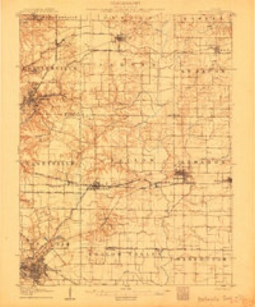
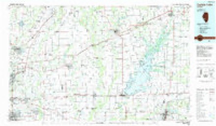
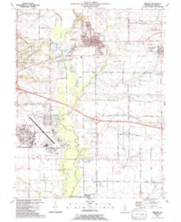
8 surveys from 18 printed sheetsMatched by testing this settlement's coordinate against the published boundary of every sheet in the United States Geological Survey's historical collection. Each opens the scanned sheet at the Survey.
- 1907 USGS Belleville quadrangle1:62500, 3 printings
- 1935 USGS Lebanon quadrangle1:24000, 2 printings
- 1949 USGS Lebanon quadrangle1:24000, 2 printings
- 1954 USGS Lebanon quadrangle1:24000, 4 printings
- 1958 USGS Belleville quadrangle1:250000, 3 printings
- 1962 USGS Belleville quadrangle1:250000
- 1985 USGS Carlyle Lake quadrangle1:100000, 2 printings
- 1991 USGS Lebanon quadrangle1:24000


In the county-history sources
36,345 words on this townshipHistory of St. Clair County, Illinois. With Illustrations ... and Biographical Sketches of Some of Its Prominent Men and Pioneers, published 1881 names this settlement in its chapter on Lebanon Township. These are the passages that mention it, exactly as the scans read.
I HIS precinct lies in the extreme north-east corner of the county, the greater part being in T. 2 N., R, 6 W., with a strip one and a half miles wide and four long, from the north of T. 1 N., R. 6 W. It is bounded on the north by Madison county, east by Clinton county, south by Mascoutah, and west by Lebanon precints. The surface is a pleasantly undulating prairie, containing numerous high and beautiful building sites. The soil is rich and productive, and many fine, highly-improved farms may be seen within its borders. Several small streams, tributaries of Silver Creek, flow westwardly through the precinct, and furnish drainage to the lands and a supply of water for other purposes. There are several small patches of timber scattered over the territory, which supply the demand for fencing, etc. The Ohio and Mississippi railroad runs from east to west through the precinct, entering it on section 24 and leaving on section 28. The first settlements in this precinct were made prior to 1810, one mile south of the present site of Summerfield, in what is known as the Union Grove settlement. The earliest settler was Nathan Chambers, who located on section 33, near a small branch of Silver Creek, as early as 1806. Chambers was a man of some talent, and well adapted for the hardships incident to a frontier life. In 1811- 12 he built a fort on his place, which was known as " Chambers' Fort," where the neighboring families gathered for protection against Indian depredations. Mr. Chambers held several minor county offices in early times. We will mention the names of some of the earliest settlers in this vicinity : - Robert and James Moore, John Broom, William Padfield, Robert Farar, Samuel and Alfred Ryle, Henry Button, John Dew, a Methodist minister ; Thornton Peeples, also a Methodist minister ; Dr. Anthony W. Casad, Edmond Randle, Malcom Johnson, Peter Wright, Wm. Lunceford and Samuel H. Thompson - a noted Methodist minister. William Padfield was a native of Kentucky, and settled here in 1815. He had quite a large family, mott of whom married and left descendants. The sons were - Thomas, William R. (who lived in a fine residence in the suburbs of Summerfield) ; Henry, James R., a farmer, residing on section 34; Joseph, Hiram, and several daughters. Wm R. and James R. are the only sons now living. Mr. Padfield was a zealous member of the M. E. Church, and for a number of years had a camp-meeting ground on his farm. Joshua Barnes was an early settler, and also an early Methodist preacher and school teacher. Among the earliest settlers north of Union Grove may be mentioned W. W. Roman, Wm. Frazier, Michael Keith, J. McKeg, John Lord, Mr. Anderson, Joseph Schrougham, John Marney, Capt. Morris, Preston Utley, James Paydon, and others. The following are the land entries in this precinct in 1814, as taken from the county records : Daniel Simons, S. W. i sec. 33, 160 acres, Sept. 26; George Nichols, N. E. i sec. 34, 160 acres, Sept. 15; Pleasant Nichols, N. W. i sec. 34, 160 acres, Sept. 15 ; Nathan Chambers, S. W. i sec. 34, 160 acres, Sept. 15; Francis Swan, S. E. i sec. 34, 160 acres, Sept. 16. The above are in T. 2 N. R. 6 W. Francis Swan, N. E. i sec. 3, 153 im acres, Sept. 16 ; Nathan Chambers, N. W. i sec. 3, 154 acres, Sept. 15 ; Robert Frazier, N. E. i sec. 9, 160 acres, Sept. 10; John Brown, N. W. i sec. 10, 160 acres, Nov. 24; John Nichols, N. E. i sec. 4, 154 /oo acres, Sept. 26; Henry Hutton, 8. W. i sec. 4, 160 acres, Sept. 10, are in T. 1 N. R. 6 W. John Wordsworth, who resides on section 16, is a native of Clinton county, Illinois, and settled in St. Clair in 1830. G H. Appel, a farmer on section 35, was born in Germany, and came to this county in 1834. John H. Calbreath, who resides on section 11, is a son of William Calbreath, who settled in this county about 1804^5. He was born here in 1825. Judge James Whittaker, an honorable citizen who resides in the northern part of this precinct, was an early associate judge, and has held other minor offices.
Passage source: History of St. Clair County, Illinois. With Illustrations ... and Biographical Sketches of Some of Its Prominent Men and Pioneers, published 1881.
Frederick Hecker arrived in the United States in autumn, 1848, a voluntary exile. Hecker was born in Eichtersheim, Baden, September 28th, 1811, had received a splendid education, became a most distinguished jurisprudent and ardent politician. Hecker was the acknowledged leader of republicanism in south Germany, organized as such, an insurrection against the existing monarchy, in the spring of 1848, was defeated at Kandern, and fled into Switzerland. After a brief stay, he emigrated t ) America. Another revolutionary attempt, promising a better success, re-called Hecker to Europe, where he arrived in July, 1849, just in tinie to learn that his most cherished dreams of freedom and popular sovereignty would have to remain dreams for ages yet. Hecker returned the same year and settled in this township, near Summerfield. His home was known as the most hospitable one far or near, and of the thousands that came in the course of years to pay their respects to the revolutionist and philosopher, not one departed but was most favorably impressed with the amiability of host and hostess. Hecker died on the 24th of March, 1881, and was buried on the 28th. His funeral was the largest ever witnessed in St. Clair county. A dozen states sent delegations, and the friends that participated in the solemnizing of the day, are to be numbered by thousands.
Passage source: History of St. Clair County, Illinois. With Illustrations ... and Biographical Sketches of Some of Its Prominent Men and Pioneers, published 1881.
A coal-shaft was sunk at this point several years ago, but was never successfully worked. Coal was discovered at a depth of three hundred and eighty feet ; the vein, however, was but three and a half feet in thickness, which was too small to be profitably worked, Summerfield, situated as it is in the heart of a rich and populous farming district, makes it a good point for shipping and general mercantile business. The precinct and village together have a population of 1 ,676, both well supplied with churches and schools, which are liberally maintained. Summerfield has two secret societies ; the Summerfield Lodge, No. 342, A. F. & A. M., was chartered in 1860, and has a membership of twenty-four. The Summerfield Lodge, No. 163, A. O. W. M., was chartered March 12, 1880, and has twenty-eight members. Both societies are in good working order.
Passage source: History of St. Clair County, Illinois. With Illustrations ... and Biographical Sketches of Some of Its Prominent Men and Pioneers, published 1881.
Machine-read from a century-old scan, so expect the errors a machine makes: misspelled names, dropped words, stray characters.
Read the whole chapter on Lebanon Township - it names this place 11 more 11 times.
Storms near this place
15 since 1997Regional context, not property-specific evidence. The National Weather Service names Summerfield in 15 storm reports between 1997 and 2025: 6 thunderstorm wind, 4 tornado, 4 flash flood, 1 hail. No death or injury is recorded in these reports. Each account below is quoted exactly as the forecast office filed it, from the NOAA Storm Events Database, and each date opens the federal record of that event.
| When | Event | Place named | Harm | What the report says |
|---|---|---|---|---|
| July 2025 | Flash Flood | Summerfield | $25,000 | Heavy rain caused flash flood conditions on Route 13 south of Freeburg where 4 to 5 feet of water flooded the road. One car also stalled in water on US-50 west of Trenton where both directions were flooded. |
| July 2025 | Flash Flood | Summerfield | $25,000 | A home in Ramsey saw significant basement flooding, including walls being knocked down by flood waters. |
| May 2022 | Tornado (EF0) | Summerfield | $10,000 | A weak tornado touched down over a residence just east of Summerfield Street/St. Jacob Road, 1 mile north of Summerfield, IL. Trees suffered damage on the property before the tornado continued north-northeast through a small, open field. The tornado impacted a row of trees on the north edge of the field, entered another field and lifted approximately one minute after initially developing. Overall, the tornado was rated EF0 with a path length of 0.23 miles and a max path width of 50 yards. No deaths or injuries were reported. |
| June 1997 | Thunderstorm Wind | Summerfield | $4,000 | Thunderstorm wind gusts blew down truck barn at a local trucking company. One tractor cab in the barn suffered abut $2,000.00 in damage. A couple of grain silos and power poles in the area were also damaged. |
| May 2024 | Tornado (EF0) | Summerfield | $500 | A tornado touched down 3 miles northwest of New Baden on Summerfield South Road, about a third of a mile north of I-64. In this location there was minor shingle damage to an outbuilding roof and a large tree limb was snapped off. The tornado tracked to the southeast and crossed into Clinton County, about a third of a mile south of the Illinois Route 161. The tornado was rated EF0 in Clinton County with a path length of 2.94 miles and a max path width of 285 yards. |
| May 2016 | Thunderstorm Wind | Summerfield | - | Thunderstorm winds blew down a large tree in Summerfield. |
| October 2014 | Tornado (EF1) | Summerfield | - | A tornado touched down one tenth of a mile northwest of the intersection of Illinois Route 161 and Ruth School House Road. It moved almost due north striking a farm, destroying a couple of outbuildings before lifting and dissipating. |
| June 2013 | Flash Flood | Summerfield | - | Up to three inches of rain fell in a short amount of time causing flash flooding. Several roads were flooded including Missouri Avenue in East St. Louis. Also, the east bound lanes of Interstates 70/55/64 were flooded so the interstate had to be closed for a time. In Lebanon, U.S. Highway 50 near intersection with Illinois Route 4 was closed due to high water. |
| May 2009 | Flash Flood | Summerfield | - | Up to three inches of rain fell in a short amount of time causing flash flooding. Several roads were flooded including U.S. Highway 50 between Summerfield and Trenton and Illinois State Route 13 between Lenzburg and Marissa. |
| July 2006 | Tornado (F0) | Summerfield | - | A tornado first formed in St. Clair County north of Summerfield and moved east southeast into Clinton County near Trenton. In St. Clair County damage was limited to downed and severed trees. |
| July 2006 | Thunderstorm Wind | Summerfield | - | Several large trees were blown down. A couple of the trees fell onto two homes causing minor to moderate damage. |
| June 2006 | Hail | Summerfield | - | no account filed |
| August 2005 | Thunderstorm Wind | Summerfield | - | no account filed |
| May 2004 | Thunderstorm Wind | Summerfield | - | no account filed |
| July 2004 | Thunderstorm Wind | Summerfield | - | no account filed |
Nearest settlements
The eight closest, with where each one stands in the county. Distances are straight-line, computed from the Geographic Names Information System coordinates.
| Map | Place | Distance | Sheets |
|---|---|---|---|
| Lebanon | 3.0 miles | 18 | |
| Mascoutah | 7.7 miles | 14 | |
| Shiloh | 8.1 miles | 17 | |
| O'Fallon | 8.5 miles | 17 | |
| Shiloh Station | 8.9 miles | 17 | |
| Petersburg | 9.0 miles | 17 | |
| Rentchler | 9.7 miles | 14 | |
| Glenview | 9.9 miles | 17 |
Elsewhere
Matched on this settlement's Geographic Names Information System number rather than its name, so it cannot be a different place of the same name in another state.
| Wikipedia article on Summerfield | An encyclopaedic summary. Its text is share-alike, so it is linked here rather than copied. |
| Wikidata item Q2668879 | The structured record the population and elevation above come from. Public domain (CC0). |
Provenance
This settlement is recorded in the Geographic Names Information System as feature 426547. The sheet list is computed by point-in-boundary test against the United States Geological Survey's historical topographic inventory. Both are works of the United States government and carry no copyright under 17 U.S.C. 105.
Storms. NOAA National Centers for Environmental Information, Storm Events Database https://www.ncei.noaa.gov/stormevents/ A work of the United States government, no copyright under 17 U.S.C. 105. Narratives are quoted verbatim from the National Weather Service report and are not edited or summarised.