 Block
Lincoln, Illinois
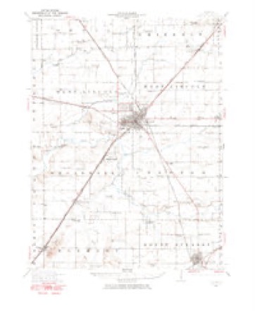
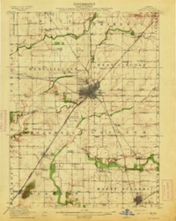
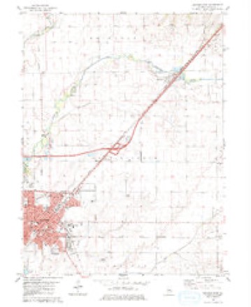
14 topographic sheets cover this place, the earliest surveyed in 1911 and the latest in 1990. It stands in East Lincoln Township. It lies in ZIP code area 62656. The Survey maps it on the Lincoln East quadrangle. 13,288 people lived here at the 2020 count. It stands 591 feet above sea level.
Research this city
On record in Lincoln
Buildings and businesses the archive holds for this place. Each opens its own page, with the source record it came from.
On the National Register 6 records
 Allen Chapel African Methodist Episcopal Churchlisted 2004
 Stephan A. Foley Houselisted 1984
 Hoblit Houselisted 2007
 Lincoln Courthouse Square Historic Districtlisted 1985
 Lincoln Public Librarylisted 1980
 University Halllisted 1973
Population over time
2 figuresLincoln fell from 14,504 to 13,288 between 2010 and 2020. These are the recorded population figures Wikidata holds for this place, reached through the Geographic Names Information System number this page is keyed on rather than by name, so they belong to this place and not to another of the same name. Most are census counts, but not all are: an early figure may be a founding or settlement estimate, and an estimate published within five years of a census is left out. The change column is computed, and is left blank where more than 20 years separate a figure from the one before it, because a gap that long is not a change between two counts.
| Year | People | Change |
|---|---|---|
| 2010 | 14,504 | |
| 2020 | 13,288 | -1,216 (-8%) |
Topographic sheets covering this place
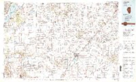
9 surveys from 14 printed sheetsMatched by testing this settlement's coordinate against the published boundary of every sheet in the United States Geological Survey's historical collection. Each opens the scanned sheet at the Survey.
- 1911 USGS Lincoln quadrangle1:62500
- 1913 USGS Lincoln quadrangle1:62500, 3 printings
- 1958 USGS Peoria quadrangle1:250000, 4 printings
- 1961 USGS Peoria quadrangle1:250000
- 1963 USGS Peoria quadrangle1:250000
- 1980 USGS Lincoln East quadrangle1:24000
- 1985 USGS Lincoln quadrangle1:100000
- 1989 USGS Lincoln quadrangle1:100000
- 1990 USGS Peoria quadrangle1:250000




Fires near this place
36 since 2008Regional context, not property-specific evidence. The federal wildfire occurrence database lists 36 fires within 5 miles of Lincoln between 2008 and 2020, burning about 119 acres in total. None started naturally. None was recorded as arson. Distance is straight-line from the map coordinates, so a fire counted here may appear on a neighbouring settlement's page as well.
| Reported cause | Fires |
|---|---|
| Missing data/not specified/undetermined | 20 |
| Smoking | 8 |
| Debris and open burning | 5 |
| Equipment and vehicle use | 2 |
| Power generation/transmission/distribution | 1 |
The most recent of them, most recent first, with the day each was reported and the service that recorded it.
| Date | Cause | Size | Reported by | Name on the report |
|---|---|---|---|---|
| 23 September 2018 | Power generation/transmission/distribution | under an acre | Illinois Division of Forestry Resources | 180573 |
| 19 September 2018 | Missing data/not specified/undetermined | 1.0 acres | Illinois Division of Forestry Resources | 180562 |
| 22 August 2018 | Smoking | under an acre | Illinois Division of Forestry Resources | 180506 |
| 18 August 2008 | Debris and open burning | 1.0 acres | Illinois Division of Forestry Resources | SMITH |
| 11 July 2019 | Smoking | under an acre | Illinois Division of Forestry Resources | 190468 |
| 1 July 2018 | Equipment and vehicle use | under an acre | Illinois Division of Forestry Resources | 180462 |
| 3 June 2018 | Smoking | under an acre | Illinois Division of Forestry Resources | 180355 |
| 21 June 2008 | Missing data/not specified/undetermined | 1.0 acres | Illinois Division of Forestry Resources | NO NAME |
Settlements close enough to share some of these fires:
Mines and quarries near this place
3 within 5 milesRegional context, not property-specific evidence. The federal mineral resources record lists 3 workings within 5 miles of Lincoln: 1 occurrence, 1 past producer, 1 producer. 1 still produces. What was taken out: Stone, Crushed/Broken, Stone, Sand and Gravel, Construction. Distance is straight-line from the map coordinates, so a quarry counted here may appear on a neighbouring settlement's page as well.
| Where | Site | Commodity | Status | Recorded |
|---|---|---|---|---|
| Limestone Prospect | Stone, Crushed/Broken | Occurrence | ||
| Lincoln Sand & Gravel | Sand and Gravel, Construction | Producer | ||
| Logan County Pit | Stone | Past Producer |
Storms near this place
60 of 135 shownRegional context, not property-specific evidence. The National Weather Service names Lincoln in 135 storm reports between 1994 and 2026: 78 thunderstorm wind, 29 hail, 17 tornado, 6 flash flood. The reports record 10 injuries. Each account below is quoted exactly as the forecast office filed it, from the NOAA Storm Events Database, and each date opens the federal record of that event.
| When | Event | Place named | Harm | What the report says |
|---|---|---|---|---|
| May 2004 | Tornado (F0) | Lincoln | 3 hurt, $250,000 | A tornado briefly touched down in a mobile home park destroying 3 mobile homes and causing minor damage to 28 others. Three people sustained minor injuries. |
| April 2006 | Thunderstorm Wind | Lincoln | 2 hurt | Several trees were blown down and the roof was damaged at the State Prison. In addition, 15 power poles and numerous trees were blown down along Old Route 66 and the Union Pacific Railroad tracks for about a mile just west of Lincoln. Finally, a semi truck was overturned on Interstate 55, near mile marker 123, causing two injuries. |
| April 2006 | Tornado (F0) | Lincoln | 2 hurt | A tornado developed in an open field and crossed Interstate 55 near mile marker 126. It overturned two semi trucks, causing two injuries. No other damage was reported. |
| June 1999 | Tornado (F0) | Lincoln | 2 hurt | The tornado initially touched down near the intersection of I-155 and I-55, about 3.5 miles northwest of Lincoln. It blew over several semis causing injuries to two drivers. The drivers were treated and released. The tornado continued to the east southeast damaging trees, grain bins, and farm equipment near IL Route 121 and county road 1750N. It crossed IL Route 121 and entered Kickapoo Creek county park, where it did extensive damage to dozens of trees. Several tree limbs and sheared tree tops were thrown 50 to 100 yards away. The tornado lifted and dissipated near the east edge of the park. |
| June 1999 | Thunderstorm Wind | Lincoln | 1 hurt | Just to the south of the tornado that moved through the northern sections of Lincoln, a swath of damaging downburst winds cut a path through portions of Lincoln. Numerous trees, tree limbs, and power lines were blown down. Several residences sustained damage as a result of downed trees and large tree limbs. Lincoln College also sustained tree damage, as well as, minor damage to fencing and dugouts at the baseball field. Near the junction of IL Routes 10 and 121 a billboard was blown down and a grocery store suffered minor damage to the roof and exterior wall. On the west side of Lincoln near the entrance to I-55 (exit 126), a truck driver was injured while trying to exit his truck and run for cover in a local restaurant. The downburst winds knocked him to the ground. He suffered a broken arm and numerous bruises. |
| May 1995 | Hail | Lincoln | $12,000,000 | WFO ILX reported 2.25-inch hail on the east side of Lincoln. Hail of various sizes fell for 40 minutes ending at 1730 CST. The hail damaged thousands of cars and homes (mainly roof damage) in Lincoln, causing $12 million in damage. |
| April 2006 | Tornado (F0) | Lincoln | $2,500,000 | A tornado touched down on the northeast side of Lincoln. It tracked through a small subdivision, just northeast of the Logan County Airport. The tornado damaged roofs, siding and outbuildings, and blew down numerous trees and power lines. In addition, before lifting, the tornado damaged several barns in a rural area to the east of Lincoln. |
| May 2003 | Tornado (F2) | Lincoln | $2,500,000 | A tornado touched down 4 miles north of the Lincoln Weather Service Office, just southwest of Lawndale (Logan County). It traveled to the southeast blowing down numerous trees, tree limbs, power lines and power poles. It destroyed a mobile home, shoved a two-story house 15 feet off its foundation, destroyed several sheds and barns. Six to seven other homes sustained minor to major damage due to the tornado. It crossed from Logan County into DeWitt County just north of Illinois Route 10 near Beason. No injuries were reported. |
| April 1998 | Flash Flood | Lincoln | $1,000,000 | no account filed |
| July 2017 | Thunderstorm Wind | Lincoln | $300,000 | Numerous trees, power poles and power lines were blown down across Lincoln...creating power outages that lasted for over 12 hours in some cases. |
| April 2003 | Thunderstorm Wind | Lincoln | $300,000 | A microburst began on the northwest side of Lincoln near the intersection of Illinois Route 10 and I-55 and quickly moved east across the northern portions of town. Numerous large trees were blown over, some onto homes causing damage. Also, a construction trailer was destroyed, a 150 foot communications tower was blown down, a hotel sustained roof and siding damage, several garages were destroyed, 8 power poles were broken off along Lincoln Parkway, and minor roofing and shingle damage occurred. One business lost a portion of its roof and numerous business signs were damaged. Nine mobile homes were destroyed and six others sustained damage. No injuries were reported. The National Weather Service office recorded a 62 mph wind gust on the east side of town. |
| June 2013 | Lightning | Lincoln | $250,000 | A lightning strike initiated a roof fire at the Oasis Senior Center on the corner of Pulaski and Kickapoo Streets in downtown Lincoln. |
| July 2017 | Thunderstorm Wind | Lincoln | $100,000 | Numerous trees and power lines were blown down across Lincoln. |
| July 2013 | Lightning | Lincoln | $50,000 | A lightning strike started a house fire on the 800 block of North Sherman Street in Lincoln. |
| June 2009 | Thunderstorm Wind | Lincoln | $50,000 | A power pole was snapped near Zion Lutheran School in Lincoln. A traffic signal was blown down at the intersection of Woodlawn and Madigan. Numerous large trees and limbs were also brought down in the high wind. |
| July 2008 | Thunderstorm Wind | Lincoln | $50,000 | Numerous trees and tree limbs were blown down across Lincoln. The Logan County Fairgrounds sustained tree and tent damage from the wind. |
| April 2003 | Tornado (F1) | Lincoln | $50,000 | A tornado touched down 6 miles west of Lincoln. It damaged a garage and the roof of a home it was attached to. Also, several trees were blown down and a grain bin was blown into a barn. It was on the ground for a mile before lifting and dissipating. No injuries were reported. |
| July 1994 | Thunderstorm Wind | Lincoln | $50,000 | Thunderstorm winds blew down numerous trees, some of which damaged two homes in the Forest Hills Subdivision totaling between $20,000 and $30,000. Also, numerous tree limbs and power lines were blown down. |
| July 2016 | Thunderstorm Wind | Lincoln | $45,000 | Numerous trees were blown down on the west side of Lincoln. |
| April 2020 | Thunderstorm Wind | Lincoln | $40,000 | Power poles were blown down along Primm Road on the south side of Lincoln. Power lines were knocked down at Railsplitter State Park. |
| October 2017 | Thunderstorm Wind | Lincoln | $40,000 | Six power poles were blown down on Old Route 121 northwest of Lincoln. |
| August 2009 | Thunderstorm Wind | Lincoln | $35,000 | Numerous trees and power lines were blown down. One tree was blown down onto an apartment complex in Lincoln. In addition, a storage shed was toppled and minor roof damage was reported. |
| April 2020 | Thunderstorm Wind | Lincoln | $30,000 | Three tractor trailers were blown over on I-55 between Lincoln and Elkhart. |
| March 2017 | Thunderstorm Wind | Lincoln | $30,000 | A storm siren was blown over on Pulaski Street on the southeast side of Lincoln. |
| March 2009 | Thunderstorm Wind | Lincoln | $30,000 | A barn was destroyed at the intersection of Route 121 and County Road 1700. |
| June 2016 | Thunderstorm Wind | Lincoln | $25,000 | Numerous tree limbs were blown on to power lines. Construction signage was displaced by the wind. |
| May 2008 | Thunderstorm Wind | Lincoln | $25,000 | Numerous large tree limbs and power lines were blown down. |
| July 2011 | Thunderstorm Wind | Lincoln | $20,000 | An empty grain bin was shifted off its foundation by strong winds about 3 miles northwest of Lincoln along old Illinois Route 121. Several corn fields were also flattened in the area. |
| June 2009 | Thunderstorm Wind | Lincoln | $20,000 | Power lines were blown down in Lincoln. |
| June 2014 | Thunderstorm Wind | Lincoln | $15,000 | A semi was blown over at I-55 mile marker 126 in Lincoln. |
| July 2014 | Thunderstorm Wind | Lincoln | $15,000 | A 4-foot diameter tree was blown down at the Lincoln Safety Complex causing minor damage to cars parked beneath it. A 3-foot diameter tree fell onto Broadway. Several other trees, tree branches, and power lines were blown down in the center of Lincoln between Union, 9th, Tremont, and Broadway streets. |
| December 2008 | Thunderstorm Wind | Lincoln | $15,000 | Power poles and lines were blown down for at least one quarter of a mile along State Route 10 outside the National Weather Service office. |
| August 2022 | Lightning | Lincoln | $10,000 | Lightning struck a guard tower at Logan Correctional Center causing a fire. |
| December 2008 | Thunderstorm Wind | Lincoln | $10,000 | A semi truck was blown over near exit 126 on I-55 west of Lincoln. |
| August 2009 | Thunderstorm Wind | Lincoln | $6,000 | A 2-foot diameter tree was blown onto a house in Lincoln. The tree was partially dead. |
| June 2011 | Thunderstorm Wind | Lincoln | $4,000 | Two trees were blown down onto power lines in Lincoln. |
| June 2013 | Thunderstorm Wind | Lincoln | $3,000 | Several large tree limbs were blown down onto North Kickapoo Street in Lincoln. |
| August 2010 | Thunderstorm Wind | Lincoln | $3,000 | Powerlines were blown down near Lincoln College. |
| May 2015 | Thunderstorm Wind | Lincoln | $2,000 | A large tree limb was blown onto a power line. |
| June 2015 | Thunderstorm Wind | Lincoln | $2,000 | A large tree was blown down on the Old Postville Courthouse property bordering 5th Street. |
| June 2013 | Thunderstorm Wind | Lincoln | $2,000 | A tree was blown down onto Union Street in Lincoln. |
| June 2010 | Thunderstorm Wind | Lincoln | $2,000 | A large tree branch was broken off at the National Weather Service office east of Lincoln. |
| July 2008 | Thunderstorm Wind | Lincoln | $1,500 | A tree was blown down on 1350th Avenue. |
| July 2013 | Thunderstorm Wind | Lincoln | $1,000 | A large tree branch was blown down at 5th and State Street in Lincoln. |
| April 2012 | Thunderstorm Wind | Lincoln | $1,000 | A tree was knocked down in Lincoln. |
| April 2012 | Thunderstorm Wind | Lincoln | $1,000 | A tree was blown down across Route 121 and 2000th Avenue. |
| March 2026 | Thunderstorm Wind | Lincoln | - | A large tree was blown down. |
| April 2025 | Thunderstorm Wind | Lincoln | - | The roof was partially torn off the Eaton Manufacturing Plant. |
| April 2025 | Thunderstorm Wind | Lincoln | - | A few large tree branches and two powerlines were downed in Lincoln. |
| July 2025 | Thunderstorm Wind | Lincoln | - | A trained spotter estimated a 60 mph wind gust. |
| July 2025 | Thunderstorm Wind | Lincoln | - | Several 6-inch diameter tree branches were blown down across Kickapoo Creek Park. |
| August 2024 | Thunderstorm Wind | Lincoln | - | A large tree was split at the base and an 8-inch diameter branch was blown down across Elm Street. |
| June 2023 | Tornado (EF1) | Lincoln | - | A tornado touched down in the southern part of Kickapoo Creek Park on the northwest side of Lincoln at 12:26 PM CDT. It damaged several trees in the park before tracking northeastward across the Eaton Corporation property and open fields before downing large electrical poles near I-55 exit 133. The interstate was closed in both directions for several hours while the poles were being repaired. The tornado dissipated about 2 miles south-southwest of Lawndale at 12:30 PM CDT. |
| August 2023 | Thunderstorm Wind | Lincoln | - | Four power poles were blown down along Woodland Road. |
| August 2023 | Flood | Lincoln | - | Water over the roadway along Woodlawn Road and adjacent side streets such as College Street and Union Street. |
| June 2023 | Thunderstorm Wind | Lincoln | - | The wind gust was estimated by a CoCoRaHS observer. |
| June 2023 | Thunderstorm Wind | Lincoln | - | A large tree was blown onto a residence, causing significant damage. |
| June 2023 | Thunderstorm Wind | Lincoln | - | A two-foot diameter tree was blown down and shingles were ripped off an apartment complex. |
| June 2023 | Thunderstorm Wind | Lincoln | - | Many power lines were blown down in Lincoln. |
| August 2022 | Thunderstorm Wind | Lincoln | - | Power lines were blown down in Lincoln. |
Nearest settlements
The eight closest, with where each one stands in the county. Distances are straight-line, computed from the Geographic Names Information System coordinates.
| Map | Place | Distance | Sheets |
|---|---|---|---|
| Bell | 3.2 miles | 15 | |
| Chestervale | 4.5 miles | 14 | |
| Fogarty | 4.8 miles | 14 | |
| Evans | 5.1 miles | 14 | |
| Skelton | 5.9 miles | 14 | |
| Lawndale | 6.5 miles | 14 | |
| Burton View | 6.5 miles | 15 | |
| Broadwell | 6.9 miles | 14 |
Elsewhere
Matched on this settlement's Geographic Names Information System number rather than its name, so it cannot be a different place of the same name in another state.
| Wikipedia article on Lincoln | An encyclopaedic summary. Its text is share-alike, so it is linked here rather than copied. |
| Wikidata item Q568563 | The structured record the population and elevation above come from. Public domain (CC0). |
Provenance
This settlement is recorded in the Geographic Names Information System as feature 412109. The sheet list is computed by point-in-boundary test against the United States Geological Survey's historical topographic inventory. Both are works of the United States government and carry no copyright under 17 U.S.C. 105.
Wildfire. Short, Karen C. 2022. Spatial wildfire occurrence data for the United States, 1992-2020 [FPA_FOD_20221014]. 6th Edition. Fort Collins, CO: Forest Service Research Data Archive. https://doi.org/10.2737/RDS-2013-0009.6 Collected with United States Government funding and usable without additional permissions or fees.
Mines and quarries. USGS Mineral Resources Data System (MRDS) https://mrdata.usgs.gov/mrds/ A work of the United States government, no copyright under 17 U.S.C. 105.
Storms. NOAA National Centers for Environmental Information, Storm Events Database https://www.ncei.noaa.gov/stormevents/ A work of the United States government, no copyright under 17 U.S.C. 105. Narratives are quoted verbatim from the National Weather Service report and are not edited or summarised.