 Block
Malta, Illinois
10 topographic sheets cover this place, the earliest surveyed in 1934 and the latest in 1985. It stands in Malta Township. It lies in ZIP code area 60150. The Survey maps it on the DeKalb quadrangle. 1,143 people lived here at the 2020 count. It stands 909 feet above sea level.
Population over time
2 figuresMalta fell from 1,164 to 1,143 between 2010 and 2020. These are the recorded population figures Wikidata holds for this place, reached through the Geographic Names Information System number this page is keyed on rather than by name, so they belong to this place and not to another of the same name. Most are census counts, but not all are: an early figure may be a founding or settlement estimate, and an estimate published within five years of a census is left out. The change column is computed, and is left blank where more than 20 years separate a figure from the one before it, because a gap that long is not a change between two counts.
| Year | People | Change |
|---|---|---|
| 2010 | 1,164 | |
| 2020 | 1,143 | -21 (-2%) |
Topographic sheets covering this place
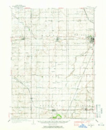
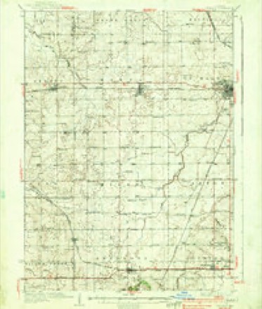
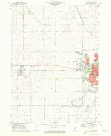
6 surveys from 10 printed sheetsMatched by testing this settlement's coordinate against the published boundary of every sheet in the United States Geological Survey's historical collection. Each opens the scanned sheet at the Survey.
- 1934 USGS De Kalb quadrangle1:62500
- 1937 USGS De Kalb quadrangle1:62500, 2 printings
- 1958 USGS Aurora quadrangle1:250000, 3 printings
- 1961 USGS Aurora quadrangle1:250000
- 1971 USGS De Kalb quadrangle1:24000, 2 printings
- 1985 USGS Aurora quadrangle1:100000



In the county-history sources
6,067 words on this townshipPortrait and Biographical Album of DeKalb County, Illinois : Containing Full-page Portraits and Biographical Sketches of Prominent and Representative Citizens of the County : Together with Portraits and Biographies of All the Governors of Illinois, and of the Presidents of the United States : Also Containing a History of the County, from Its Earliest Settlement to the Present Time, published 1885 names this settlement in its chapter on Malta Township. These are the passages that mention it, exactly as the scans read.
ALTA Township is bounded on the north by South Grove, on the east by De Kalb, on the south by Milan and on the west by Ogle County. The Chicago & Northwestern Railroad enters the township on section 24, and running almost due west enters Ogle County from section 19. There is no natural timber in the township, and it was not therefore settled until a late day, the first settlement being made in i8sr by Ezekiel Whitehead. But little of the land had been taken up at the time, but was soon afterwards entered by various persons more for speculative purposes than with a design of making for
Previous to 1856 the township had been a part of De Kalb. At this time there was a sufficient population to entitle it to a separate government, and the Board of Supervisors accordingly organized it under the name of Milton. When organized it embraced the north half of the present township of Milan. Subsequently its name was changed to Etna, and soon after to Malta, the name of the village that had sprung up on the line of the railroad.
The schools in the township are in good condition. From, the County Superintendent's report for the year ending June 30, 1884, the following facts are gleaned: There were in the township eight school districts, each having a good frame school-house, the total value of which was estimated at $10,700. One of the districts had a graded school, the remainder being ungraded. There were 496 persons under 21, of whom 364 were over six. Of this number 303 were enrolled in the public schools. During the year 15 teachers had been employed, receiving an average of $34.43 per month, - the highest being $66.67 and the lowest $25. The tax. levy for school purposes was $33.88.
Machine-read from a century-old scan, so expect the errors a machine makes: misspelled names, dropped words, stray characters.
Read the whole chapter on Malta Township - it names this place 10 more 10 times.
Mines and quarries near this place
1 within 5 milesRegional context, not property-specific evidence. The federal mineral resources record lists 1 working within 5 miles of Malta: 1 past producer. None of them still produces. What was taken out: Limestone, General. Distance is straight-line from the map coordinates, so a quarry counted here may appear on a neighbouring settlement's page as well.
| Where | Site | Commodity | Status | Recorded |
|---|---|---|---|---|
| Elmhurst-Mccarthy Joint | Limestone, General | Past Producer |
Storms near this place
17 since 1993Regional context, not property-specific evidence. The National Weather Service names Malta in 17 storm reports between 1993 and 2025: 11 thunderstorm wind, 4 hail, 1 tornado, 1 flash flood. No death or injury is recorded in these reports. Each account below is quoted exactly as the forecast office filed it, from the NOAA Storm Events Database, and each date opens the federal record of that event.
| When | Event | Place named | Harm | What the report says |
|---|---|---|---|---|
| May 2014 | Thunderstorm Wind | Malta | $500,000 | An approximately seven mile swath of damage occurred on the south side of Dekalb which was consistent with 60 mph to occasionally 100 mph winds. Damage began near the intersection of Malta Road and Nelson Road and concluded near Lynch Road just south of Gurler Road. A warehouse on Harvestore Drive had a portion of the roof torn off along with a broken window. Some mobile homes in the parking lot were rolled or overturned. |
| April 2010 | Thunderstorm Wind | Malta | $25,000 | A barn was destroyed. |
| June 2008 | Thunderstorm Wind | Malta | $10,000 | A semi truck was blown over near mile marker 86 on Interstate 88. |
| May 2014 | Thunderstorm Wind | Malta | $1,000 | A power pole snapped and a pole barn received roof damage near Nelson Road and Malta Road. |
| August 2025 | Flash Flood | Malta | - | A report of flooding was received from northeast of Creston via mPing. |
| July 2024 | Thunderstorm Wind | Malta | - | Scattered tree limbs were blown down near Rich Road. |
| June 2021 | Thunderstorm Wind | Malta | - | Utility poles were leaning over and power lines were blown down in Malta. |
| November 2020 | Thunderstorm Wind | Malta | - | A utility pole was damaged and hanging over a roadway. |
| January 2018 | Hail | Malta | - | Hail was mostly pea size with some larger penny size hail stones. |
| July 2012 | Thunderstorm Wind | Malta | - | Wind gusts were estimated to 60 mph near Interstate 88 and University Road. |
| May 2007 | Thunderstorm Wind | Malta | - | Wind gusts estimated to 60 mph. |
| May 1998 | Thunderstorm Wind | Malta | - | Strong thunderstorm winds downed trees, ripped barn roof off, and blew over a fuel storage tank. Nickel size hail also reported. |
| August 1993 | Thunderstorm Wind | Malta | - | County sheriff reported trees down in Malta due to thunderstorm winds. |
| May 2014 | Hail | Malta | - | no account filed |
| May 2004 | Hail | Malta | - | no account filed |
| June 1996 | Tornado (F0) | Malta | - | no account filed |
| April 1996 | Hail | Malta | - | no account filed |
Nearest settlements
The eight closest, with where each one stands in the county. Distances are straight-line, computed from the Geographic Names Information System coordinates.
| Map | Place | Distance | Sheets |
|---|---|---|---|
| DeKalb | 5.9 miles | 10 | |
| Clare | 6.2 miles | 13 | |
| Elva | 6.4 miles | 10 | |
| Wilkinson | 6.7 miles | 13 | |
| Afton Center | 7.2 miles | 10 | |
| Five Points | 8.1 miles | 13 | |
| Esmond | 8.2 miles | 14 | |
| McGirr | 8.3 miles | 10 |
Elsewhere
Matched on this settlement's Geographic Names Information System number rather than its name, so it cannot be a different place of the same name in another state.
| Wikipedia article on Malta | An encyclopaedic summary. Its text is share-alike, so it is linked here rather than copied. |
| Wikidata item Q2672411 | The structured record the population and elevation above come from. Public domain (CC0). |
Provenance
This settlement is recorded in the Geographic Names Information System as feature 421923. The sheet list is computed by point-in-boundary test against the United States Geological Survey's historical topographic inventory. Both are works of the United States government and carry no copyright under 17 U.S.C. 105.
Mines and quarries. USGS Mineral Resources Data System (MRDS) https://mrdata.usgs.gov/mrds/ A work of the United States government, no copyright under 17 U.S.C. 105.
Storms. NOAA National Centers for Environmental Information, Storm Events Database https://www.ncei.noaa.gov/stormevents/ A work of the United States government, no copyright under 17 U.S.C. 105. Narratives are quoted verbatim from the National Weather Service report and are not edited or summarised.