 Block
DeKalb, Illinois
10 topographic sheets cover this place, the earliest surveyed in 1934 and the latest in 1985. It stands in DeKalb Township. It lies in ZIP code area 60115. The Survey maps it on the DeKalb quadrangle. 40,290 people lived here at the 2020 count. It stands 879 feet above sea level.
On record in DeKalb
Buildings and businesses the archive holds for this place. Each opens its own page, with the source record it came from.
On the National Register 1 record
- President John Williston Cook Mansionlisted 2025
Population over time
3 figuresDeKalb grew from 39,018 to 40,290 between 2000 and 2020. These are the recorded population figures Wikidata holds for this place, reached through the Geographic Names Information System number this page is keyed on rather than by name, so they belong to this place and not to another of the same name. Most are census counts, but not all are: an early figure may be a founding or settlement estimate, and an estimate published within five years of a census is left out. The change column is computed, and is left blank where more than 20 years separate a figure from the one before it, because a gap that long is not a change between two counts.
| Year | People | Change |
|---|---|---|
| 2000 | 39,018 | |
| 2010 | 43,862 | +4,844 (+12%) |
| 2020 | 40,290 | -3,572 (-8%) |
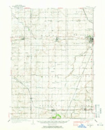
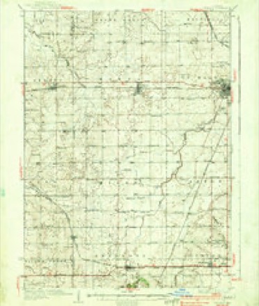
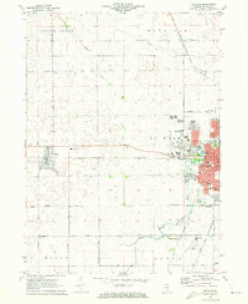
Topographic sheets covering this place
6 surveys from 10 printed sheetsMatched by testing this settlement's coordinate against the published boundary of every sheet in the United States Geological Survey's historical collection. Each opens the scanned sheet at the Survey.
- 1934 USGS De Kalb quadrangle1:62500
- 1937 USGS De Kalb quadrangle1:62500, 2 printings
- 1958 USGS Aurora quadrangle1:250000, 3 printings
- 1961 USGS Aurora quadrangle1:250000
- 1971 USGS De Kalb quadrangle1:24000, 2 printings
- 1985 USGS Aurora quadrangle1:100000



In the county-history sources
5,161 words on this townshipPast and Present of DeKalb County, Illinois, published 1907 names this settlement in its chapter on DeKalb Township. These are the passages that mention it, exactly as the scans read.
By way of explanation we will state thai the timber land of DeKalb township naturally divided itself into three parts. 'Flic South Grove, or Huntley's Grove, was separated from the Central Grove, later called Union Grove, by a gap extending east and west over the present site of the Norma] bridge. Another gap was found on the land owned by Phineas Stevens and extending westward, and for a long time these settlements were known by the names Huntley's Grove, Union Grove and Coltonville. The latter became the more populous settlement and had a village that was aspiring to be the county seat and in fact the first court, held in the county after its organization was held at that place.
Passage source: Past and Present of DeKalb County, Illinois, published 1907.
In the summer of 1836, the first election held in the county was at the home of Captain Eli Barnes, on land now owned by Henry Groves. Voters came from all parts of the county- It was an election for justice of the peace and we must remember at this time that the available settlements of what is now DeKalb county were known as the Kishwaukee district and were a part of La Salle count}''. Stephen Mowry and Captain Collier were elected justices and received their commission from the governor, countersigned by a county officer from La Salle county. Mr. Samuel Miller of Squaw Grove, relates that ten dollars was sent down to him by one of the candidates to pay him for bringing up ten voters and that these voti re carried his election. Mr. Boies says, in his history, that this was probably the first $10 spent to cany an election in this county, but not the last by thousands.
Passage source: Past and Present of DeKalb County, Illinois, published 1907.
Hard times followed the period of wild-cat money and the people grew very poor and in 1843, when the land that has just been described came into market, Mr. Huntley offered large portions of it for $1.25 an acre. Some of this land is where the city of DeKalb now stands. For twenty years he kept an excellent tavern, built of logs, and in busy seasons of travel it was continually crowded by teamsters who came from as far west as the Mississippi river and were on their way to Chieago with grain. A good picture of this hotel will be found in another portion of the work. As it did not pay at all times to haul the grain to Chicago, thousands of bushels of wheat were fed to cattle without threshing. The people of this locality did not thrive materially until the railroad was built in 1853.
Passage source: Past and Present of DeKalb County, Illinois, published 1907.
Machine-read from a century-old scan, so expect the errors a machine makes: misspelled names, dropped words, stray characters.
Read the whole chapter on DeKalb Township - it names this place 25 more 25 times.
Mines and quarries near this place
2 within 5 milesRegional context, not property-specific evidence. The federal mineral resources record lists 2 workings within 5 miles of DeKalb: 2 producers. All of them still produce. What was taken out: Vermiculite, Perlite. Distance is straight-line from the map coordinates, so a quarry counted here may appear on a neighbouring settlement's page as well.
| Where | Site | Commodity | Status | Recorded |
|---|---|---|---|---|
| Mica Pellets Inc. Plant | Perlite, Vermiculite | Producer | ||
| Mica Pellets Inc. Vermiculite Plant | Vermiculite | Producer |
Storms near this place
26 since 1996Regional context, not property-specific evidence. The National Weather Service names DeKalb in 26 storm reports between 1996 and 2026: 15 thunderstorm wind, 8 hail, 2 flash flood, 1 flood. No death or injury is recorded in these reports. Each account below is quoted exactly as the forecast office filed it, from the NOAA Storm Events Database, and each date opens the federal record of that event.
| When | Event | Place named | Harm | What the report says |
|---|---|---|---|---|
| May 2025 | Thunderstorm Wind | Dekalb | - | Several photos relayed on social media showed tree damage in and around DeKalb. A one foot diameter tree was snapped midway up the trunk. Live web cameras at the time the storm moved through showed considerable blowing dust as well as several gustnadoes. |
| August 2025 | Flash Flood | Dekalb | - | A report of flooding was received from the northwest side of DeKalb via mPing. |
| August 2025 | Thunderstorm Wind | Dekalb | - | A softwood tree was uprooted and an 8 to 12 inch diameter limb was snapped in the vicinity of Greenbrier Rd in DeKalb. |
| July 2024 | Thunderstorm Wind | Dekalb | - | A reasonably healthy 12 inch diameter tree was blown down just south of 1st Street and Bethany Road. |
| June 2024 | Thunderstorm Wind | Dekalb | - | An approximately 8 inch diameter tree was uprooted in DeKalb. |
| June 2024 | Thunderstorm Wind | Dekalb | - | Numerous tree branches were down on the 1700 block of N 1st St. A tall tree had also snapped and another tree had fallen onto a house in the area. |
| July 2024 | Thunderstorm Wind | Dekalb | - | Numerous trees and tree limbs were blown down between 1st Street and the railroad tracks, just north of Taylor Street. |
| March 2023 | Thunderstorm Wind | Dekalb | - | A handheld anemometer measured a 74 mph gust. Tree damage and minor roof damage were also reported. |
| July 2022 | Thunderstorm Wind | Dekalb | - | A couple of tree limbs about 3 to 6 inches in diameter were blown down near the Northern Illinois University coop station. |
| August 2022 | Thunderstorm Wind | Dekalb | - | A large tree limb was blown down on the campus of Northern Illinois University. |
| August 2022 | Flash Flood | Dekalb | - | Multiple reports of street flooding were received from Sycamore and DeKalb. |
| August 2022 | Flood | Dekalb | - | Video shared on social media showed water over a roadway in downtown DeKalb. Several roads were covered by flood waters of varying depths. The DeKalb Airport measured 1.42 inches of rain in one hour. A spotter 3 miles northeast of DeKalb measured a storm total of 3.30 inches of rain. |
| August 2021 | Thunderstorm Wind | Dekalb | - | A photo shared on social media showed a tree snapped near its base near Northern Illinois University. |
| August 2021 | Thunderstorm Wind | Dekalb | - | A photo shared on social media showed multiple tree limbs up to 8 inches in diameter blown down near Hillcrest Drive and Blackhawk Road. |
| November 2020 | Thunderstorm Wind | Dekalb | - | Multiple utility poles and power lines were blown down in the 1400 block of 4th Street. |
| June 2017 | Thunderstorm Wind | Dekalb | - | A wind gust to 64 mph was measured at the De Kalb Airport (KDKB). Tree limbs were blown down in De Kalb. |
| August 2015 | Hail | Dekalb | - | There were multiple reports of quarter to golf ball size hail in and around De Kalb. Golf ball size hail fell at 1st Street and Taylor. Half dollar size hail fell near Annie Glidden Road. |
| April 2026 | Hail | Dekalb | - | no account filed |
| April 2026 | Hail | Dekalb | - | no account filed |
| April 2026 | Hail | Dekalb | - | no account filed |
| April 2026 | Hail | Dekalb | - | no account filed |
| April 2023 | Thunderstorm Wind | Dekalb | - | no account filed |
| April 2019 | Hail | Dekalb | - | no account filed |
| June 2014 | Hail | Dekalb | - | no account filed |
| June 1996 | Thunderstorm Wind | Dekalb | - | no account filed |
| April 1996 | Hail | Dekalb | - | no account filed |
Nearest settlements
The eight closest, with where each one stands in the county. Distances are straight-line, computed from the Geographic Names Information System coordinates.
| Map | Place | Distance | Sheets |
|---|---|---|---|
| Cortland | 3.3 miles | 9 | |
| Elva | 4.7 miles | 10 | |
| Five Points | 5.1 miles | 13 | |
| Sycamore | 5.3 miles | 9 | |
| Wilkinson | 5.6 miles | 13 | |
| Afton Center | 5.7 miles | 10 | |
| Malta | 5.9 miles | 10 | |
| Clare | 7.3 miles | 13 |
Elsewhere
Matched on this settlement's Geographic Names Information System number rather than its name, so it cannot be a different place of the same name in another state.
| Wikipedia article on DeKalb | An encyclopaedic summary. Its text is share-alike, so it is linked here rather than copied. |
| Wikidata item Q580478 | The structured record the population and elevation above come from. Public domain (CC0). |
Provenance
This settlement is recorded in the Geographic Names Information System as feature 421762. The sheet list is computed by point-in-boundary test against the United States Geological Survey's historical topographic inventory. Both are works of the United States government and carry no copyright under 17 U.S.C. 105.
Mines and quarries. USGS Mineral Resources Data System (MRDS) https://mrdata.usgs.gov/mrds/ A work of the United States government, no copyright under 17 U.S.C. 105.
Storms. NOAA National Centers for Environmental Information, Storm Events Database https://www.ncei.noaa.gov/stormevents/ A work of the United States government, no copyright under 17 U.S.C. 105. Narratives are quoted verbatim from the National Weather Service report and are not edited or summarised.