 Block
Maquon, Illinois
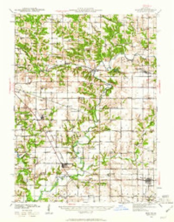
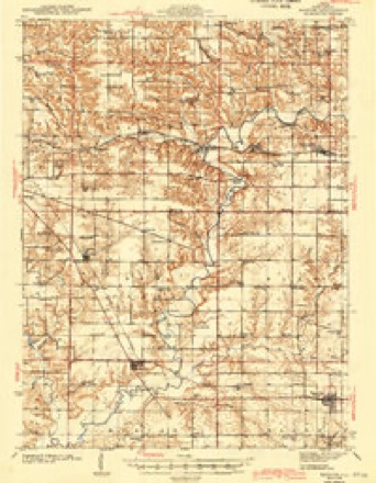
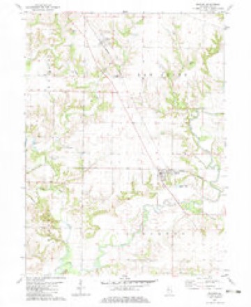
16 topographic sheets cover this place, the earliest surveyed in 1941 and the latest in 1990. It stands in Maquon Township. It lies in ZIP code area 61458. It stands on Hickory Creek. The Survey maps it on the Maquon quadrangle. 218 people lived here at the 2020 count. It stands 633 feet above sea level.
Population over time
2 figuresMaquon fell from 284 to 218 between 2010 and 2020. These are the recorded population figures Wikidata holds for this place, reached through the Geographic Names Information System number this page is keyed on rather than by name, so they belong to this place and not to another of the same name. Most are census counts, but not all are: an early figure may be a founding or settlement estimate, and an estimate published within five years of a census is left out. The change column is computed, and is left blank where more than 20 years separate a figure from the one before it, because a gap that long is not a change between two counts.
| Year | People | Change |
|---|---|---|
| 2010 | 284 | |
| 2020 | 218 | -66 (-23%) |
Topographic sheets covering this place
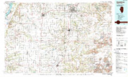
9 surveys from 16 printed sheetsMatched by testing this settlement's coordinate against the published boundary of every sheet in the United States Geological Survey's historical collection. Each opens the scanned sheet at the Survey.
- 1941 USGS Maquon quadrangle1:62500, 2 printings
- 1943 USGS Maquon quadrangle1:62500, 2 printings
- 1958 USGS Burlington quadrangle1:250000, 4 printings
- 1961 USGS Burlington quadrangle1:250000
- 1963 USGS Burlington quadrangle1:250000
- 1982 USGS Maquon quadrangle1:24000
- 1985 USGS Galesburg quadrangle1:100000, 2 printings
- 1989 USGS Galesburg quadrangle1:100000
- 1990 USGS Burlington quadrangle1:250000, 2 printings




In the county-history sources
5,621 words on this townshipHistory of Knox County, Illinois, published 1878 names this settlement in its chapter on Maquon Township. These are the passages that mention it, exactly as the scans read.
When the red men roamed unmolested over this beautiful county their principal village was in this township, on Spoon river. As they were driven westward by the advance of civilization, a Mr. Palmer, a bee-hunter, came to the township and stopped at their vacated village. He arrived in 1828, but made no improvementin the way of fencing, or preparing a permanent home; and as it was not his intention to remain, he could not be termed a settler. He stayed here bu a short time, when he removed farther west. Interesting remains of this Indian village and of their burying ground are found. It will be noticed that their trails, as marked on the map in this work, lead from near the town of Maquon.
Passage source: History of Knox County, Illinois, published 1878.
James Millan settled on section 25 in 1830. Among other early settlers were Wm. Darnell, Wm. Farmer and Mark and Thomas Thurman. The first Justice of the Peace was Mark Thurman. The first death was that of a little daughter of Mark Thurman, named Rebecca, who was also the first child born in the township. The first marriage was that of Elisha Thurman to Miss Anna Hall. Although they went to Fulton county to have the ceremony performed, yet they resided in this township at the time. The first school-house was erected on section 34 in 1834. The first school was taught by Benjamin Brooks. In the northern part of the township, on section 4, is situated the town of Maquon. Spoon river passes diagonally across the township in a southwestern direction. The township contains a good proportion of prairie and timber lands.
Passage source: History of Knox County, Illinois, published 1878.
The prairie and timber land of this township is finely proportioned. Spoon river enters at section 1, flowing south makes its exit at section 35. The 0., B. & Q. railroad makes its entrance at section T, running southeast, converges with the river. The town of Gilson is in the township. This was the second township settled in the county, PJenderson being the first. In 1829 Parnach Owen, then a young man living with his widowed mother in Ohio, had a strong desire to go westward. He was strongly urged to remain in the bounds of civilization, but without avail. His mother, seeing his determination to emigrate to a new country, concluded to accompany him. Accordingly she with her two daughters prepared for this western journey. Knox county was their destination, and in September of that year they arrived in this township, where, on section 18, they erected their log cabin. When we reflect that the first white persons inhabiting this vast region of country were a widow lady and her children, it would seem that she possessed bravery unequaled, patience untiring, and a devotion and love for her son that would permit no separation but that of death. Could we give a detailed account of the life of this noble woman, of the trials and hardships and sufferings endured, it would be read with great interest. Mrs. Owen and family moved into Knoxville soon after that city was laid off, her son doing the surveying. Parnach Owen took an important part in organizing the county. He was a land dealer and speculator, and we are told that be has owned more land in Knox county than any other man. He died in Iowa, Mrs. Owen in Knoxville, and the two daughters are still living. One is the wife of Dr. Eice, of-Lewistown; the other the widow of the late John G. Sanburn and residing in Knoxville.
Passage source: History of Knox County, Illinois, published 1878.
Machine-read from a century-old scan, so expect the errors a machine makes: misspelled names, dropped words, stray characters.
Read the whole chapter on Maquon Township - it names this place 10 more 10 times.
Fires near this place
1 since 2013Regional context, not property-specific evidence. The federal wildfire occurrence database lists 1 fire within 5 miles of Maquon in 2013, burning about 25 acres in total. None started naturally. None was recorded as arson. Distance is straight-line from the map coordinates, so a fire counted here may appear on a neighbouring settlement's page as well.
| Reported cause | Fires |
|---|---|
| Missing data/not specified/undetermined | 1 |
The most recent of them, most recent first, with the day each was reported and the service that recorded it.
| Date | Cause | Size | Reported by | Name on the report |
|---|---|---|---|---|
| 5 April 2013 | Missing data/not specified/undetermined | 25 acres | Illinois Division of Forestry Resources | 40513 |
Settlements close enough to share some of these fires:
Storms near this place
15 since 1993Regional context, not property-specific evidence. The National Weather Service names Maquon in 15 storm reports between 1993 and 2025: 12 thunderstorm wind, 2 hail, 1 tornado. No death or injury is recorded in these reports. Each account below is quoted exactly as the forecast office filed it, from the NOAA Storm Events Database, and each date opens the federal record of that event.
| When | Event | Place named | Harm | What the report says |
|---|---|---|---|---|
| May 2011 | Thunderstorm Wind | Maquon | $10,000 | Trees were blown down onto Illinois Route 97 south of Maquon. |
| March 2017 | Thunderstorm Wind | Maquon | $7,000 | A power pole was blown down near the intersection of 1200E and 650N. |
| August 1993 | Thunderstorm Wind | Maquon | $50 | Large tree limbs were blown down. |
| April 2025 | Thunderstorm Wind | Maquon | - | Home playground equipment was destroyed. |
| August 2023 | Thunderstorm Wind | Maquon | - | An uprooted tree fell onto the Maquon District Public Library. |
| June 2023 | Thunderstorm Wind | Maquon | - | A large tree was snapped in Maquon. |
| June 2019 | Thunderstorm Wind | Maquon | - | A tree was blown down in Maquon. |
| June 2018 | Thunderstorm Wind | Maquon | - | A tree was blown down in Maquon. |
| May 2017 | Tornado (EF0) | Maquon | - | A landspout tornado briefly touched down in an open field at 8:05PM CDT. No damage occurred. |
| June 2007 | Thunderstorm Wind | Maquon | - | Numerous tree limbs were blown down. |
| June 2007 | Thunderstorm Wind | Maquon | - | Numerous tree limbs were blown down. |
| August 2004 | Thunderstorm Wind | Maquon | - | Several trees had the tops broken off of them, as well as several large tree limbs blown down. |
| June 1999 | Thunderstorm Wind | Maquon | - | Six 25 foot tall trees were snapped off at their bases one mile north of Maquon. |
| June 1999 | Hail | Maquon | - | no account filed |
| June 1996 | Hail | Maquon | - | no account filed |
Nearest settlements
The eight closest, with where each one stands in the county. Distances are straight-line, computed from the Geographic Names Information System coordinates.
| Map | Place | Distance | Sheets |
|---|---|---|---|
| Douglas | 4.4 miles | 16 | |
| Gilson | 4.7 miles | 16 | |
| Uniontown | 5.0 miles | 16 | |
| Bridgeport (historical) | 5.4 miles | 17 | |
| Rapatee | 5.8 miles | 17 | |
| Burnside (historical) | 6.1 miles | 18 | |
| Elba Center | 7.2 miles | 16 | |
| DeLong | 7.5 miles | 18 |
Elsewhere
Matched on this settlement's Geographic Names Information System number rather than its name, so it cannot be a different place of the same name in another state.
| Wikipedia article on Maquon | An encyclopaedic summary. Its text is share-alike, so it is linked here rather than copied. |
| Wikidata item Q2357945 | The structured record the population and elevation above come from. Public domain (CC0). |
Provenance
This settlement is recorded in the Geographic Names Information System as feature 412979. The sheet list is computed by point-in-boundary test against the United States Geological Survey's historical topographic inventory. Both are works of the United States government and carry no copyright under 17 U.S.C. 105.
Wildfire. Short, Karen C. 2022. Spatial wildfire occurrence data for the United States, 1992-2020 [FPA_FOD_20221014]. 6th Edition. Fort Collins, CO: Forest Service Research Data Archive. https://doi.org/10.2737/RDS-2013-0009.6 Collected with United States Government funding and usable without additional permissions or fees.
Storms. NOAA National Centers for Environmental Information, Storm Events Database https://www.ncei.noaa.gov/stormevents/ A work of the United States government, no copyright under 17 U.S.C. 105. Narratives are quoted verbatim from the National Weather Service report and are not edited or summarised.