 Block
Uniontown, Illinois
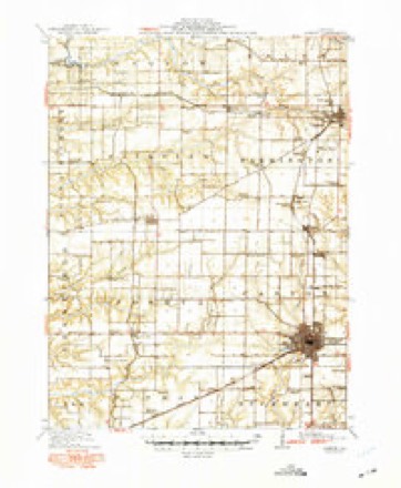
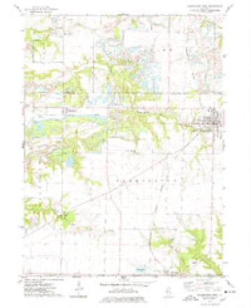
16 topographic sheets cover this place, the earliest surveyed in 1912 and the latest in 1990. It stands in Salem Township. It lies in ZIP code area 61531. The Survey maps it on the Farmington West quadrangle. It stands 682 feet above sea level.
Topographic sheets covering this place
8 surveys from 16 printed sheetsMatched by testing this settlement's coordinate against the published boundary of every sheet in the United States Geological Survey's historical collection. Each opens the scanned sheet at the Survey.
- 1912 USGS Canton quadrangle1:62500, 4 printings
- 1958 USGS Burlington quadrangle1:250000, 4 printings
- 1961 USGS Burlington quadrangle1:250000
- 1963 USGS Burlington quadrangle1:250000
- 1974 USGS Farmington West quadrangle1:24000
- 1985 USGS Galesburg quadrangle1:100000, 2 printings
- 1989 USGS Galesburg quadrangle1:100000
- 1990 USGS Burlington quadrangle1:250000, 2 printings




In the county-history sources
3,803 words on this townshipHistory of Knox County, Illinois, published 1878; Portrait and Biographical Album of Knox County, Illinois, published 1886 names this settlement in its chapter on Salem Township. These are the passages that mention it, exactly as the scans read.
Among the first settlers of this excellent township were Solomon Sherwood, Henry Dalton, Alexander Taylor, Felix Thurman, Avery Dalton, Benona Hawkins, John Darnell, Sala Blakeslee, William Kent, John Thurman, and John Haskins. Taylor arrived first, and settled on section 5. The first birth was Laura, daughter of John Haskins, in 1835. The first marriage was that of Avery Dalton, to Delilah Dalton. The first death was Anderson Corbine, in the summer of 1835. The first sermon was preached by Rev. Henry Summers, on section 13, on the 4th of November, 1836. Emeline Shinn was the first to die in the township, on the 9th of August, 1839. The first postoffice was established at a place in the southwest corner of the township, called Middle Grove. The first school was taught by Abid Drew, on section 13, in 1838. The first Justice of the Peace was William Davis. There are three towns in this township, and more miles of railroad than in any other township in the county except Galesburg. The first frame building in Salem township was erected by Sala Blakeslee, in 1837. It was a barn, 30 by 40 feet in size; and burned down the same year. Mr. Blakeslee also brought the first timothy seed into the township, in 1834. On his farm are ten chestnut trees, growing from seeds planted by him, in 1810. Thev will now measure two feet in diameter. He also has a rail fence, which is lemarkable for its perfect state of preservation. In 32 rods, which was built in 1844, there are not more than five rails but what are sound and good yet. It has never been re-set. He claims that the rails do not rot, for the reason that they were cut in August, and the fence laid while the moon was in its last quarter. He has logs in a corn-crib that were cut in 1829, and gate posts that were cut in 1832.
Passage source: History of Knox County, Illinois, published 1878.
Salem was settled up by a good class of people, and after a beginning was made its population increased quite rapidly. Its lands lie fair and are rich and very productive, and easily drained by the little water-courses that meander through. A great portion of the township is beautiful rolling prairies, the southeastern and southwestern portions being somewliat broken. These sections at one lime were liberally timbered. It is regarded as one of the best townships in the county; it ranks second in raising cattle and horses, and first in hogs. It has more miles of railroad than any other township, e.xcept Galesburg, and is third in population.
Passage source: Portrait and Biographical Album of Knox County, Illinois, published 1886.
In addition to this, Yates City has a good banking institution, known as the Farmers' Bank, which is ably presided over by L. F. Wenman. Several large business houses,, lumber-yards and elevator, and many other buaness establishments are located here. There is here a co-operative store, which was organized in the spring of 1875. Its capital stock now is $20,000, and the business is carried on in a two-story brick building, which was erected by this corap)any at a cost of $3,000. They are now out of debt and have a fund large enough to meet purchasing demaruis, and hereafter it is proposed to pay dividends.
Passage source: Portrait and Biographical Album of Knox County, Illinois, published 1886.
Machine-read from a century-old scan, so expect the errors a machine makes: misspelled names, dropped words, stray characters.
Read the whole chapter on Salem Township - it names this place 1 more 1 time.
Fires near this place
1 since 2013Regional context, not property-specific evidence. The federal wildfire occurrence database lists 1 fire within 5 miles of Uniontown in 2013, burning about 25 acres in total. None started naturally. None was recorded as arson. Distance is straight-line from the map coordinates, so a fire counted here may appear on a neighbouring settlement's page as well.
| Reported cause | Fires |
|---|---|
| Missing data/not specified/undetermined | 1 |
The most recent of them, most recent first, with the day each was reported and the service that recorded it.
| Date | Cause | Size | Reported by | Name on the report |
|---|---|---|---|---|
| 5 April 2013 | Missing data/not specified/undetermined | 25 acres | Illinois Division of Forestry Resources | 40513 |
Settlements close enough to share some of these fires:
Storms near this place
2 since 1997Regional context, not property-specific evidence. The National Weather Service names Uniontown in 2 storm reports between 1997 and 2008: 1 tornado, 1 hail. No death or injury is recorded in these reports. Each account below is quoted exactly as the forecast office filed it, from the NOAA Storm Events Database, and each date opens the federal record of that event.
| When | Event | Place named | Harm | What the report says |
|---|---|---|---|---|
| May 2008 | Hail | Uniontown | - | no account filed |
| April 1997 | Tornado (F0) | Uniontown | - | no account filed |
Nearest settlements
The eight closest, with where each one stands in the county. Distances are straight-line, computed from the Geographic Names Information System coordinates.
| Map | Place | Distance | Sheets |
|---|---|---|---|
| Douglas | 2.8 miles | 16 | |
| Rapatee | 3.9 miles | 17 | |
| Yates City | 4.9 miles | 16 | |
| Maquon | 5.0 miles | 16 | |
| Elba Center | 7.3 miles | 16 | |
| Bridgeport (historical) | 7.3 miles | 17 | |
| Burnside (historical) | 9.4 miles | 18 | |
| Gilson | 9.6 miles | 16 |
Elsewhere
Matched on this settlement's Geographic Names Information System number rather than its name, so it cannot be a different place of the same name in another state.
| Wikipedia article on Uniontown | An encyclopaedic summary. Its text is share-alike, so it is linked here rather than copied. |
| Wikidata item Q24061770 | The structured record the population and elevation above come from. Public domain (CC0). |
Provenance
This settlement is recorded in the Geographic Names Information System as feature 423267. The sheet list is computed by point-in-boundary test against the United States Geological Survey's historical topographic inventory. Both are works of the United States government and carry no copyright under 17 U.S.C. 105.
Wildfire. Short, Karen C. 2022. Spatial wildfire occurrence data for the United States, 1992-2020 [FPA_FOD_20221014]. 6th Edition. Fort Collins, CO: Forest Service Research Data Archive. https://doi.org/10.2737/RDS-2013-0009.6 Collected with United States Government funding and usable without additional permissions or fees.
Storms. NOAA National Centers for Environmental Information, Storm Events Database https://www.ncei.noaa.gov/stormevents/ A work of the United States government, no copyright under 17 U.S.C. 105. Narratives are quoted verbatim from the National Weather Service report and are not edited or summarised.