 Block
Marietta, Illinois
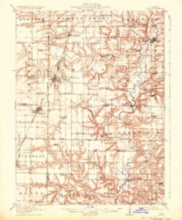
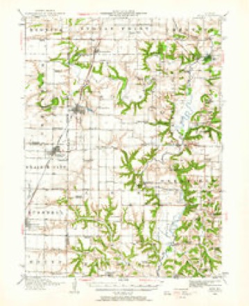
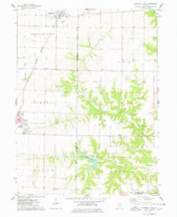
16 topographic sheets cover this place, the earliest surveyed in 1915 and the latest in 1990. It stands in Harris Township. It lies in ZIP code area 61459. It stands on South Fork Shaw Creek. The Survey maps it on the Bushnell East quadrangle. 101 people lived here at the 2020 count. It stands 651 feet above sea level.
Population over time
2 figuresMarietta fell from 112 to 101 between 2010 and 2020. These are the recorded population figures Wikidata holds for this place, reached through the Geographic Names Information System number this page is keyed on rather than by name, so they belong to this place and not to another of the same name. Most are census counts, but not all are: an early figure may be a founding or settlement estimate, and an estimate published within five years of a census is left out. The change column is computed, and is left blank where more than 20 years separate a figure from the one before it, because a gap that long is not a change between two counts.
| Year | People | Change |
|---|---|---|
| 2010 | 112 | |
| 2020 | 101 | -11 (-10%) |
Topographic sheets covering this place
9 surveys from 16 printed sheetsMatched by testing this settlement's coordinate against the published boundary of every sheet in the United States Geological Survey's historical collection. Each opens the scanned sheet at the Survey.
- 1915 USGS Avon quadrangle1:62500, 3 printings
- 1944 USGS Avon quadrangle1:62500
- 1958 USGS Burlington quadrangle1:250000, 4 printings
- 1961 USGS Burlington quadrangle1:250000
- 1963 USGS Burlington quadrangle1:250000
- 1974 USGS Bushnell East quadrangle1:24000
- 1985 USGS Galesburg quadrangle1:100000, 2 printings
- 1989 USGS Galesburg quadrangle1:100000
- 1990 USGS Burlington quadrangle1:250000, 2 printings




In the county-history sources
6,101 words on this townshipHistory of Fulton County, Illinois;, published 1879 names this settlement in its chapter on Harris Township. These are the passages that mention it, exactly as the scans read.
Point Pleasant United Brethren Oiurch, section 20, Harris township, was organized about the year 1855 by J. J. Wyatt. The exact date is not certainly known, but the first conference of this society was held in the Salem circuit, in Marietta, Dec. 26, 1857. This class numbered about 60 communicants at one time, but through the instrumentalities of death and removals, it has been re- duced, until it now numbers about 30, Services are held every alternate Sunday by Rev. David Martin, Pastor. Tliev worslii])ed fur many years in school-houses, until October, 1873, when the present Church structure was erected.
Passage source: History of Fulton County, Illinois;, published 1879.
George Caley, son of Chambers Caley, was born in Yorkshire, Eng., Feb. 20, 1833; crossed the ocean with his parents in 1839 and located in Knox Co., O. ; came to this county in 1855, and is engaged in ftirming and stock-raising; was married Oct. 7, 1858, to Nancy, daughter of Stephen Bliss, who was one of the early settlers of Bernadotte tp., and now deceased. This union was blessed with 5 children, of whom 4 are living. Mrs. C. died Sept. 27, 1866, and Mr. C. married a second time. This wedding occurred Nov. 27, 1872, when he was married to Helen 15evans, daughter of Milton Bevans, deceased, who was one of the pioneers of Harris. He settled in Marietta and lived there till his death, which occurred Nov. 8, 1875. Mr. C.'s eldest daughter, who is a subscriber for this book, is now teaching in district No. 9, Harris tp., where she had previously taught 2 terms. In her profession she has been quite successful.
Passage source: History of Fulton County, Illinois;, published 1879.
Henri/ Coon.s, harness-maker, was born in Indiana, May 25, 1832. His father, David Coons, came with his family to Bernadotte tp., this county, in 1852, and after establishing a comfortable home for his family, he died in Sept., 1876, a member of the United Brethren Church. ' Henry enlisted in Co. I, lU3d Keg. 111. Vol. Inf., Aiig. 24, 1862, and lost his left leg in the war, after two years' service. In 1869, he established himself in Marietta as a harness-maker; Jan. 7, 1872, he married Lucy Dodge, daughter of Geo. W. Dodge, who died when she was a child. Emma, born Dec. 26, 1875, is the only child of Mr. Coons. ^Irs. Coons' mother, aged 78, lives with them. Mr. C. is a Democrat.
Passage source: History of Fulton County, Illinois;, published 1879.
Machine-read from a century-old scan, so expect the errors a machine makes: misspelled names, dropped words, stray characters.
Read the whole chapter on Harris Township - it names this place 18 more 18 times.
Storms near this place
23 since 2000Regional context, not property-specific evidence. The National Weather Service names Marietta in 23 storm reports between 2000 and 2024: 9 thunderstorm wind, 8 hail, 3 flash flood, 2 tornado. No death or injury is recorded in these reports. Each account below is quoted exactly as the forecast office filed it, from the NOAA Storm Events Database, and each date opens the federal record of that event.
| When | Event | Place named | Harm | What the report says |
|---|---|---|---|---|
| June 2010 | Thunderstorm Wind | Marietta | $25,000 | Several tree limbs were blown down. Shingles were stripped off a few homes. |
| June 2009 | Thunderstorm Wind | Marietta | $12,000 | A few trees were blown down in Marietta. |
| June 2010 | Thunderstorm Wind | Marietta | $4,000 | Several two to three-inch diameter tree limbs were blown down. A sign was damaged near a church. |
| July 2024 | Flash Flood | Marietta | - | A road washed out near Marietta due to flash flooding. |
| July 2024 | Thunderstorm Wind | Marietta | - | Emergency management estimated wind gusts up to 60 mph. |
| August 2023 | Tornado (EFU) | Marietta | - | A brief landspout tornado was observed near County Road 34 and Belville Road in rural Fulton County. No damage was observed, so an intensity rating could not be assigned. |
| August 2023 | Tornado (EF0) | Marietta | - | The emergency manager observed a brief landspout tornado two miles south of Marietta. |
| April 2017 | Flood | Marietta | - | Rain amounts of 2.00 to 3.50 inches in about a two hour period during the evening hours, on already saturated ground, resulted in flash flooding across parts of eastern and central Fulton County. Numerous streets in Canton were impassable, as were numerous rural roads in the county. Illinois Route 9 west of Canton was closed due to high water. Additional rain of 0.50 to 1.00 inch during the early morning hours kept many roads flooded. Flood waters subsided by mid-morning on the 30th. |
| April 2017 | Flash Flood | Marietta | - | Rain amounts of 2.00 to 3.50 inches in about a two hour period during the evening hours, on already saturated ground, resulted in flash flooding across parts of eastern and central Fulton County. Numerous streets in Canton were impassable, as were numerous rural roads in the county. Illinois Route 9 west of Canton was closed due to high water. |
| May 2009 | Flash Flood | Marietta | - | Heavy rain of 1.50 to 3.00 inches within two hours produced significant flash flooding of most roads in southern Fulton County. |
| April 2006 | Thunderstorm Wind | Marietta | - | Power lines blown down. |
| September 2006 | Thunderstorm Wind | Marietta | - | Numerous trees were blown down. |
| June 2005 | Thunderstorm Wind | Marietta | - | Tree blown down. |
| August 2001 | Thunderstorm Wind | Marietta | - | Several power lines and large tree limbs were blown down. |
| September 2000 | Thunderstorm Wind | Marietta | - | Half of a tree was blown down onto a car in Marietta. Also, a 3 foot diameter maple tree was snapped off and landed onto a car in Canton. No injuries resulted from this damage and no damage estimates were available. |
| May 2023 | Hail | Marietta | - | no account filed |
| June 2014 | Hail | Marietta | - | no account filed |
| June 2014 | Hail | Marietta | - | no account filed |
| May 2008 | Hail | Marietta | - | no account filed |
| May 2006 | Hail | Marietta | - | no account filed |
| March 2005 | Hail | Marietta | - | no account filed |
| June 2001 | Hail | Marietta | - | no account filed |
| August 2000 | Hail | Marietta | - | no account filed |
Nearest settlements
The eight closest, with where each one stands in the county. Distances are straight-line, computed from the Geographic Names Information System coordinates.
| Map | Place | Distance | Sheets |
|---|---|---|---|
| Seville | 2.8 miles | 18 | |
| Checkrow | 3.7 miles | 16 | |
| Poverty Ridge | 3.8 miles | 18 | |
| Smithfield | 5.7 miles | 18 | |
| Buckeye | 5.8 miles | 17 | |
| Manley | 6.0 miles | 16 | |
| Babylon | 6.6 miles | 17 | |
| Blyton | 7.5 miles | 17 |
Elsewhere
Matched on this settlement's Geographic Names Information System number rather than its name, so it cannot be a different place of the same name in another state.
| Wikipedia article on Marietta | An encyclopaedic summary. Its text is share-alike, so it is linked here rather than copied. |
| Wikidata item Q2194119 | The structured record the population and elevation above come from. Public domain (CC0). |
Provenance
This settlement is recorded in the Geographic Names Information System as feature 413000. The sheet list is computed by point-in-boundary test against the United States Geological Survey's historical topographic inventory. Both are works of the United States government and carry no copyright under 17 U.S.C. 105.
Storms. NOAA National Centers for Environmental Information, Storm Events Database https://www.ncei.noaa.gov/stormevents/ A work of the United States government, no copyright under 17 U.S.C. 105. Narratives are quoted verbatim from the National Weather Service report and are not edited or summarised.