 Block
Smithfield, Illinois
18 topographic sheets cover this place, the earliest surveyed in 1918 and the latest in 1990. It stands in Cass Township. It lies in ZIP code area 61477. The Survey maps it on the Smithfield quadrangle. 191 people lived here at the 2020 count. It stands 647 feet above sea level.
On record in Smithfield
Buildings and businesses the archive holds for this place. Each opens its own page, with the source record it came from.
On the National Register 3 records
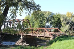 Bernadotte Bridgelisted 1980
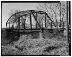 Buckeye Bridgelisted 1980
 Tartar's Ferry Bridgelisted 1980
Population over time
2 figuresSmithfield fell from 230 to 191 between 2010 and 2020. These are the recorded population figures Wikidata holds for this place, reached through the Geographic Names Information System number this page is keyed on rather than by name, so they belong to this place and not to another of the same name. Most are census counts, but not all are: an early figure may be a founding or settlement estimate, and an estimate published within five years of a census is left out. The change column is computed, and is left blank where more than 20 years separate a figure from the one before it, because a gap that long is not a change between two counts.
| Year | People | Change |
|---|---|---|
| 2010 | 230 | |
| 2020 | 191 | -39 (-17%) |
Topographic sheets covering this place
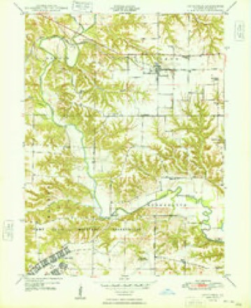
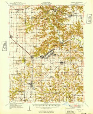
10 surveys from 18 printed sheetsMatched by testing this settlement's coordinate against the published boundary of every sheet in the United States Geological Survey's historical collection. Each opens the scanned sheet at the Survey.
- 1918 USGS Vermont quadrangle1:62500, 2 printings
- 1921 USGS Vermont quadrangle1:62500, 2 printings
- 1948 USGS Smithfield quadrangle1:24000, 2 printings
- 1949 USGS Vermont quadrangle1:62500, 2 printings
- 1958 USGS Burlington quadrangle1:250000, 4 printings
- 1961 USGS Burlington quadrangle1:250000
- 1963 USGS Burlington quadrangle1:250000
- 1985 USGS Macomb quadrangle1:100000
- 1989 USGS Macomb quadrangle1:100000
- 1990 USGS Burlington quadrangle1:250000, 2 printings




In the county-history sources
9,894 words on this townshipHistory of Fulton County, Illinois;, published 1879 names this settlement in its chapter on Cass Township. These are the passages that mention it, exactly as the scans read.
Antioch Christian Church. - This people is more commonly known as New-Light Christians. lu 18(31 two classes of this denomination were organized, one at the Hanchett school-house, and the other at the Medley school-house in Harris township. In 1866 these congregations united and erected a house of worship in Smithfield. There are at present 45 communicants connected with the Church.
Passage source: History of Fulton County, Illinois;, published 1879.
John C. A)if}iony, M. 7)., Smithfield ; was born in Mercer Co., Pa., Feb. 1, 1852. He is the son of" Benjamin A. and Fanny A. Antliony; came to this county in 1854; was educated mostly in common schools and Abingdon College. The doctor attended both Rush and Missouri Medical Colleges, graduating at the latter March 4, 1875; commenced jM-acticing April 4, 1875, in Marbletown, this countv. He remained there three years and was successful, but suffered many trials that young physicians are heir to. From there he removed to Table Grove, thence to Smithfield. While at Marbletown the Doctor was united in matrimony with Charlotte J. Markley. One child was born to them, but died in infanciy. By close attention to his work and hard study he has gained a lasting reputation.
Passage source: History of Fulton County, Illinois;, published 1879.
Joseph E. BdKc/hman, son of Samuel and Eliza (Camron) Baughman, of Cass township, was born, raised and educated in Cass township near Smithfield. His father came to this county in 1831, being one of the early settlers ; was a cooi)er in younger days, but is a nurseryman and farmer at ])resent. lie was fond of the chase, and frequently shot deer from his porch. The subject of this sketch, Mr. J. E. liaughraan, is an enterprising young farmer, but 21 years old ; was early taught to cook, bake, wash and iron, etc., his mother being an invalid since he was 7 years old. He worked l)y the month since 13 years of age until recently. P. O., Smithfield.
Passage source: History of Fulton County, Illinois;, published 1879.
Machine-read from a century-old scan, so expect the errors a machine makes: misspelled names, dropped words, stray characters.
Read the whole chapter on Cass Township - it names this place 29 more 29 times.
Fires near this place
1 since 2020Regional context, not property-specific evidence. The federal wildfire occurrence database lists 1 fire within 5 miles of Smithfield in 2020, burning about 20 acres in total. None started naturally. None was recorded as arson. Distance is straight-line from the map coordinates, so a fire counted here may appear on a neighbouring settlement's page as well.
| Reported cause | Fires |
|---|---|
| Railroad operations and maintenance | 1 |
The most recent of them, most recent first, with the day each was reported and the service that recorded it.
| Date | Cause | Size | Reported by | Name on the report |
|---|---|---|---|---|
| 4 April 2020 | Railroad operations and maintenance | 20 acres | Illinois Division of Forestry Resources | 20-009 |
Settlements close enough to share some of these fires:
Storms near this place
20 since 1995Regional context, not property-specific evidence. The National Weather Service names Smithfield in 20 storm reports between 1995 and 2026: 9 thunderstorm wind, 8 hail, 2 tornado, 1 flash flood. No death or injury is recorded in these reports. Each account below is quoted exactly as the forecast office filed it, from the NOAA Storm Events Database, and each date opens the federal record of that event.
| When | Event | Place named | Harm | What the report says |
|---|---|---|---|---|
| August 2018 | Tornado (EF0) | Smithfield | $30,000 | A tornado touched down in a field about 1.5 miles ESE of Smithfield at 4:38pm CDT. The tornado travelled slowly southeastward, impacting one farmstead along its path. A pole barn and small shed were destroyed, with flying debris from the barn causing minor roof and siding damage to the house. The tornado continued along its path doing minor crop damage along the way before dissipating 3 miles SSW of Cuba at 4:48pm CDT. |
| July 2009 | Thunderstorm Wind | Smithfield | $10,000 | Numerous trees were blown down. |
| July 2009 | Thunderstorm Wind | Smithfield | $4,000 | Two power poles were snapped near Smithfield. |
| June 2016 | Thunderstorm Wind | Smithfield | $2,000 | A tree was blown onto IL-95 near Smithfield. |
| March 2026 | Thunderstorm Wind | Smithfield | - | A power pole was snapped and a tree was blown over. |
| May 2024 | Thunderstorm Wind | Smithfield | - | Power poles were blown down. |
| July 2024 | Flash Flood | Smithfield | - | Roadway damage occurred along Route 95 due to flash flooding. |
| June 2010 | Thunderstorm Wind | Smithfield | - | Two telephone poles leaned over due to high winds. |
| July 2006 | Thunderstorm Wind | Smithfield | - | Numerous trees and power lines were blown down from Marietta, to Smithfield, to Lewistown. |
| June 2002 | Tornado (F0) | Smithfield | - | A tornado touched down 1.2 miles northwest of Smithfield at the west end of Stevens Road in a field. The tornado then briefly lifted before touching down once again in a field near Old Miller Lane. An unoccupied 15 foot travel trailer was picked up and destroyed. The tornado then lifted and dissipated. No injuries were reported. |
| August 2023 | Hail | Smithfield | - | no account filed |
| June 2020 | Hail | Smithfield | - | no account filed |
| September 2019 | Hail | Smithfield | - | no account filed |
| April 2016 | Hail | Smithfield | - | no account filed |
| June 2014 | Hail | Smithfield | - | no account filed |
| June 2007 | Thunderstorm Wind | Smithfield | - | no account filed |
| September 2006 | Hail | Smithfield | - | no account filed |
| July 2004 | Hail | Smithfield | - | no account filed |
| May 2003 | Thunderstorm Wind | Smithfield | - | no account filed |
| May 1995 | Hail | Smithfield | - | no account filed |
Nearest settlements
The eight closest, with where each one stands in the county. Distances are straight-line, computed from the Geographic Names Information System coordinates.
| Map | Place | Distance | Sheets |
|---|---|---|---|
| Poverty Ridge | 2.7 miles | 18 | |
| Seville | 2.9 miles | 18 | |
| Buckeye | 4.0 miles | 17 | |
| Bernadotte (historical) | 5.2 miles | 18 | |
| Cuba | 5.5 miles | 19 | |
| Marietta | 5.7 miles | 16 | |
| Blyton | 6.3 miles | 17 | |
| Depler Springs | 6.3 miles | 19 |
Elsewhere
Matched on this settlement's Geographic Names Information System number rather than its name, so it cannot be a different place of the same name in another state.
| Wikipedia article on Smithfield | An encyclopaedic summary. Its text is share-alike, so it is linked here rather than copied. |
| Wikidata item Q2332386 | The structured record the population and elevation above come from. Public domain (CC0). |
Provenance
This settlement is recorded in the Geographic Names Information System as feature 418653. The sheet list is computed by point-in-boundary test against the United States Geological Survey's historical topographic inventory. Both are works of the United States government and carry no copyright under 17 U.S.C. 105.
Wildfire. Short, Karen C. 2022. Spatial wildfire occurrence data for the United States, 1992-2020 [FPA_FOD_20221014]. 6th Edition. Fort Collins, CO: Forest Service Research Data Archive. https://doi.org/10.2737/RDS-2013-0009.6 Collected with United States Government funding and usable without additional permissions or fees.
Storms. NOAA National Centers for Environmental Information, Storm Events Database https://www.ncei.noaa.gov/stormevents/ A work of the United States government, no copyright under 17 U.S.C. 105. Narratives are quoted verbatim from the National Weather Service report and are not edited or summarised.