 Block
Maunie, Illinois
11 topographic sheets cover this place, the earliest surveyed in 1940 and the latest in 1982. It stands in Emma Township. It lies in ZIP code area 62821. It stands on Lower Sandy Slough. The Survey maps it on the Maunie quadrangle. 91 people lived here at the 2020 count. It stands 371 feet above sea level.
Population over time
2 figuresMaunie fell from 139 to 91 between 2010 and 2020. These are the recorded population figures Wikidata holds for this place, reached through the Geographic Names Information System number this page is keyed on rather than by name, so they belong to this place and not to another of the same name. Most are census counts, but not all are: an early figure may be a founding or settlement estimate, and an estimate published within five years of a census is left out. The change column is computed, and is left blank where more than 20 years separate a figure from the one before it, because a gap that long is not a change between two counts.
| Year | People | Change |
|---|---|---|
| 2010 | 139 | |
| 2020 | 91 | -48 (-35%) |
Topographic sheets covering this place
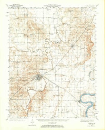
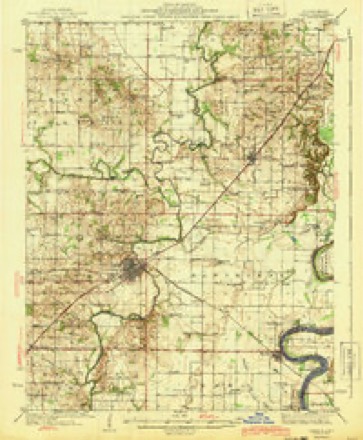
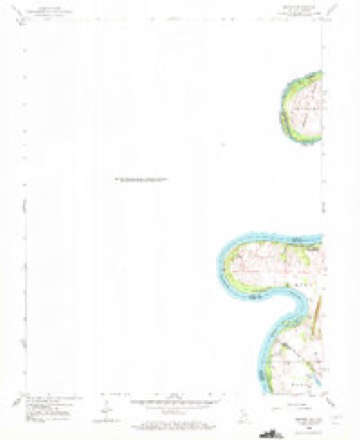
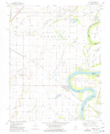
7 surveys from 11 printed sheetsMatched by testing this settlement's coordinate against the published boundary of every sheet in the United States Geological Survey's historical collection. Each opens the scanned sheet at the Survey.
- 1940 USGS Carmi quadrangle1:62500
- 1943 USGS Carmi quadrangle1:62500, 2 printings
- 1958 USGS Belleville quadrangle1:250000, 3 printings
- 1959 USGS Maunie quadrangle1:24000, 2 printings
- 1962 USGS Belleville quadrangle1:250000
- 1974 USGS Maunie quadrangle1:24000
- 1982 USGS Mount Vernon quadrangle1:100000


Storms near this place
60 of 75 shownRegional context, not property-specific evidence. The National Weather Service names Maunie in 75 storm reports between 2003 and 2024: 71 flood, 2 thunderstorm wind, 1 funnel cloud, 1 hail. The reports record 10 injuries. Each account below is quoted exactly as the forecast office filed it, from the NOAA Storm Events Database, and each date opens the federal record of that event.
| When | Event | Place named | Harm | What the report says |
|---|---|---|---|---|
| June 2019 | Flood | Maunie | 10 hurt, $30,000 | no account filed |
| May 2011 | Flood | Maunie | $800,000 | Major flooding continued on the Wabash River from April. At the New Harmony (Indiana) river gage, the river crested at 23.67 feet on May 4. This level was the fourth highest crest on record, exceeding the 2005 flood by about six inches. This was the highest level since 1943. Sandbagging began to prevent Wabash River floodwaters from entering the Grayville water plant. Several homes in Grayville were threatened by rising water, and water entered a number of basements. The approach to the bridge to Maunie was washed out. The 172 residents of Maunie were asked to evacuate, but 42 of them did not. An airboat was brought in by Illinois police to shuttle supplies into the isolated community and evacuate medical patients. The airboats were used to assist residents in the communities of Dogtown and Concord that were isolated by floodwaters. In New Haven, a combination of Little Wabash River floodwater and Wabash River backwater flooded more than a dozen homes. |
| December 2015 | Thunderstorm Wind | Maunie | $150,000 | A National Weather Service damage survey revealed a strong downburst struck the community of Maunie. In Maunie, the cement and brick facade of a building partially collapsed. A tree was uprooted in front of the post office. About a half mile north of Maunie, one large irrigation unit was turned over and bent. Several large trees were uprooted, and large limbs were snapped. On County Road 1225, a machine shed roof was blown off. Peak winds were estimated near 100 mph. |
| April 2011 | Thunderstorm Wind | Maunie | $20,000 | Ten power poles were down, along with trees and power lines. |
| April 2011 | Flood | Maunie | $10,000 | Sandbagging began to prevent Wabash River floodwaters from entering the Grayville water plant. Several homes in Grayville were threatened by rising water. |
| April 2018 | Flood | Maunie | $5,000 | no account filed |
| January 2012 | Flood | Maunie | $1,000 | Minor flooding of low-lying fields and woodlands occurred along the Wabash River. Oil field production was restricted. A few local river roads were flooded. |
| February 2012 | Flood | Maunie | $1,000 | Minor flooding of low-lying fields and woodlands occurred along the Wabash River. Oil field production was restricted. A few local river roads were flooded. |
| February 2022 | Flood | Maunie | - | The Wabash River rose above flood stage and remained there into March. The crest did not occur until March. |
| April 2022 | Flood | Maunie | - | Minor flooding ended on the Wabash River very early in the month. Some low-lying cropland was underwater. |
| March 2020 | Flood | Maunie | - | Minor flooding occurred on the Wabash River. Low-lying woods and fields near the river were flooded. The flooding continued into April. |
| January 2020 | Flood | Maunie | - | Moderate flooding occurred on the Wabash River. The river crested at 20.17 feet on the 21st at the New Harmony, IN river gage. Moderate flooding begins at 20.0 feet. There was considerable flooding of low-lying fields. Some county roads were impassable. |
| March 2019 | Flood | Maunie | - | Minor flooding redeveloped along the Wabash River. Low-lying woods and fields and some rural county roads were under water. Crop damage was minimal since planting season was not underway. |
| March 2019 | Flood | Maunie | - | Moderate flooding on the Wabash River in February ended during the first few days of March. At the New Harmony, IN river gage, the river crested at 20.41 feet on Feb. 16th. Considerable flooding of low ground occurred on the Illinois side of the river. Most of the low ground was dormant agricultural fields. Some county roads were flooded. |
| April 2019 | Flood | Maunie | - | Minor flooding occurred on the Wabash River. Low-lying woods and fields were inundated, along with a couple of county roads. |
| May 2019 | Flood | Maunie | - | Minor flooding of the Wabash River that began in late April ended in mid May. Low-lying woods and fields near the river were inundated, along with a few county roads. |
| February 2018 | Flood | Maunie | - | Moderate flooding developed along the Wabash River. The river was three miles wide at Interstate 64. Considerable flooding of bottomland agricultural land occurred. A few rural county roads were impacted. The river continued rising into March. |
| March 2018 | Flood | Maunie | - | The Wabash River rose above flood stage on the 29th and continued rising through the end of the month. The flooding during late March was minor. |
| February 2017 | Flood | Maunie | - | Minor flooding on the Wabash River ended shortly after midnight. The flooding began in January. Some low-lying fields were underwater. |
| April 2016 | Flood | Maunie | - | Minor flooding occurred along the Wabash River. Low-lying fields and woodlands near the river were inundated. |
| March 2015 | Flood | Maunie | - | Minor flooding occurred on the Wabash River. At the New Harmony, IN river gage, the river crested at 18.34 feet on the 20th. Flood stage is 15 feet. There was minor flooding of lowland woods and fields in the bottomlands. |
| April 2015 | Flood | Maunie | - | Minor flooding occurred along the Wabash River. Low-lying woods and fields were inundated. |
| December 2015 | Flood | Maunie | - | The Wabash River rose above flood stage late in the month, but the crest did not occur until early January. There was flooding of low-lying fields and woodlands. Some county roads and river access roads were underwater. |
| January 2014 | Flood | Maunie | - | Minor flooding lingered along the Wabash River through the first few days of 2014. Low-lying woods and fields were underwater. |
| April 2014 | Flood | Maunie | - | Minor flooding occurred along the Wabash River. Low-lying fields near the river were inundated. A few county roads were flooded. |
| February 2014 | Flood | Maunie | - | Minor flooding occurred along the Wabash River. Some low-lying woods and fields near the river were underwater. The flooding continued into March. |
| March 2014 | Flood | Maunie | - | Minor flooding occurred along the Wabash River. Some low-lying woods and fields near the river were underwater. The flooding continued from late February. |
| May 2013 | Flood | Maunie | - | The flooded Wabash River continued to recede after cresting in late April. Some low-lying fields and woodlands remained under water. |
| December 2013 | Flood | Maunie | - | Minor flooding occurred along the Wabash River. Low-lying woods and fields were underwater. |
| June 2013 | Flood | Maunie | - | Minor flooding occurred along the Wabash River. Some cropland was flooded, along with a few county roads. The flooding continued into early July. |
| July 2013 | Flood | Maunie | - | Minor flooding continued along the Wabash River from late June. Some cropland was flooded, along with a few county roads. |
| April 2013 | Flood | Maunie | - | Moderate flooding occurred along the Wabash River. Extensive flooding of low-lying fields and woodlands occurred. The river continued above flood stage into early May. |
| January 2012 | Flood | Maunie | - | Minor flooding continued from December into the first day of January along the Wabash River. The river crested in December and continued falling into early January. Several local river roads were flooded. Low-lying fields near the river were flooded. |
| December 2011 | Flood | Maunie | - | Minor flooding occurred along the Wabash River. Several local river roads were flooded. Low-lying fields near the river were flooded. |
| June 2011 | Flood | Maunie | - | Minor flooding along the Wabash River flooded some low-lying fields. |
| July 2011 | Flood | Maunie | - | Minor flooding that began on the Wabash River in late June ended very early in July. There was some inundation of low-lying fields near the river. |
| June 2011 | Flood | Maunie | - | Minor flooding continued along the Wabash River from late May. Some low-lying fields along the river were flooded. |
| July 2010 | Flood | Maunie | - | Minor flooding of the Wabash River continued from late June into early July. Low-lying fields were flooded, including some cropland. Crop damage estimates were posted in the June report. |
| February 2009 | Flood | Maunie | - | Minor flooding of the Wabash River occurred. At the New Harmony, IN gage, the river crested at 17.56 feet on the 21st. Flood stage there is 15 feet. Low-lying bottomlands along the river were flooded. |
| April 2009 | Flood | Maunie | - | Minor flooding of low-lying fields and bottomland occurred along the Wabash River. At the New Harmony, Indiana gage, where flood stage is 15 feet, the river crested at 17.32 feet on the 16th. |
| May 2009 | Flood | Maunie | - | Minor flooding of the Wabash River occurred for most of the month. At the New Harmony, Indiana gage, where flood stage is 15 feet, the river crested at 18.65 feet on the 24th. Low ground was flooded along the river, including agricultural fields. |
| April 2008 | Flood | Maunie | - | Flooding of the Wabash River that began in early March continued through much of April. The April crest occurred on the 4th, when the crest on the New Harmony (Indiana) gage was 19.81 feet. This resulted in minor flooding of low-lying fields and bottomlands. Flood stage at New Harmony is 15 feet. |
| March 2008 | Flood | Maunie | - | Moderate flooding of the Wabash River occurred. At the New Harmony, IN gage, the river crested at 20.87 feet on March 28. Flood stage there is 15 feet, and moderate flooding begins at 20 feet. Considerable flooding of low ground occurred on the Illinois side of the river. Most of the low ground was dormant agricultural land. |
| February 2008 | Flood | Maunie | - | Lowlands were flooded along the Wabash River. The flooding was generally minor along the White County shore. |
| June 2008 | Flood | Maunie | - | Moderate flooding of the Wabash River occurred. At New Harmony, IN, the river crested at 22.45 feet on the 15th. Flood stage there is 15 feet. The river was three miles wide at I-64. Extensive flooding of low-lying fields occurred. |
| May 2008 | Flood | Maunie | - | Minor flooding of the Wabash River occurred. At the New Harmony, IN gage, the river crested at 16.93 feet on the 20th. Flood stage there is 15 feet. Minor flooding of low bottomlands occurred, shutting down some oil wells. |
| March 2007 | Flood | Maunie | - | Minor flooding of fields and woodlands occurred along the shore of the Lower Wabash River. At New Harmony, Indiana, where flood stage is 15 feet, the river crested at 16.05 feet on the 11th. |
| March 2007 | Flood | Maunie | - | Minor flooding of lowland fields and woodlands occurred near the Wabash River. At New Harmony, Indiana, the river rose above flood stage on the last day of the month. |
| April 2007 | Flood | Maunie | - | Minor flooding of the Wabash River occurred. At New Harmony, Indiana, the river crested at 16.35 feet on the 4th. This crest was over a foot above the 15-foot flood stage. The river overflowed onto low fields and woodlands. |
| January 2007 | Flood | Maunie | - | Moderate flooding occurred along the White County side of the river. At the gage at New Harmony, Indiana, the river crested at 20.01 feet on the 23rd. Flood stage at New Harmony is 15 feet. Extensive lowland flooding occurred in areas not protected by levees. Some oil wells in the lowlands were flooded. |
| April 2006 | Flood | Maunie | - | Minor flooding of the Wabash River occurred. At the New Harmony, Indiana gage, where flood stage is 15 feet, the river crested at 15.39 feet on April 24. Minor flooding of low-lying bottomlands occurred. |
| April 2006 | Flood | Maunie | - | Minor flooding of the Wabash River occurred. At the New Harmony, Indiana gage, where flood stage is 15 feet, the river crested at 15.32 feet on April 12. Minor flooding of low-lying bottomlands occurred. |
| December 2006 | Flood | Maunie | - | Minor flooding of the Wabash River occurred. At New Harmony, Indiana, where flood stage is 15 feet, the river crested at 16.11 feet on the 12th. This resulted in minor flooding of low-lying fields and woods on the Illinois side. |
| December 2006 | Flood | Maunie | - | At New Harmony, Indiana, where flood stage is 15 feet, the river rose to 16.4 feet by the end of the month and was still rising. This resulted in minor flooding of low-lying fields and woods on the Illinois side. |
| July 2003 | Funnel Cloud | Maunie | - | A very narrow rope-like funnel cloud was photographed by a motorist looking north from the Dogtown area, which is near the Wabash River to the south of Maunie. |
| March 2024 | Hail | Maunie | - | no account filed |
| April 2024 | Flood | Maunie | - | no account filed |
| April 2023 | Flood | Maunie | - | no account filed |
| March 2023 | Flood | Maunie | - | no account filed |
| January 2022 | Flood | Maunie | - | no account filed |
Nearest settlements
The eight closest, with where each one stands in the county. Distances are straight-line, computed from the Geographic Names Information System coordinates.
| Map | Place | Distance | Sheets |
|---|---|---|---|
| Brownsport (historical) | 1.4 miles | 11 | |
| Rising Sun | 2.6 miles | 11 | |
| Epworth | 4.0 miles | 11 | |
| Elm Grove (historical) | 5.0 miles | 21 | |
| Garnerville | 5.5 miles | 11 | |
| Emma | 5.8 miles | 21 | |
| Carmi | 7.1 miles | 9 | |
| Phillipstown | 7.4 miles | 9 |
Elsewhere
Matched on this settlement's Geographic Names Information System number rather than its name, so it cannot be a different place of the same name in another state.
| Wikipedia article on Maunie | An encyclopaedic summary. Its text is share-alike, so it is linked here rather than copied. |
| Wikidata item Q2428751 | The structured record the population and elevation above come from. Public domain (CC0). |
Provenance
This settlement is recorded in the Geographic Names Information System as feature 413136. The sheet list is computed by point-in-boundary test against the United States Geological Survey's historical topographic inventory. Both are works of the United States government and carry no copyright under 17 U.S.C. 105.
Storms. NOAA National Centers for Environmental Information, Storm Events Database https://www.ncei.noaa.gov/stormevents/ A work of the United States government, no copyright under 17 U.S.C. 105. Narratives are quoted verbatim from the National Weather Service report and are not edited or summarised.