 Block
Mendota, Illinois
11 topographic sheets cover this place, the earliest surveyed in 1952 and the latest in 1993. It stands in Mendota Township. It lies in ZIP code area 61342. It stands on Mendota Creek. The Survey maps it on the Mendota East quadrangle. 7,061 people lived here at the 2020 count. It stands 741 feet above sea level.
Population over time
3 figuresMendota fell from 7,272 to 7,061 between 2000 and 2020. These are the recorded population figures Wikidata holds for this place, reached through the Geographic Names Information System number this page is keyed on rather than by name, so they belong to this place and not to another of the same name. Most are census counts, but not all are: an early figure may be a founding or settlement estimate, and an estimate published within five years of a census is left out. The change column is computed, and is left blank where more than 20 years separate a figure from the one before it, because a gap that long is not a change between two counts.
| Year | People | Change |
|---|---|---|
| 2000 | 7,272 | |
| 2010 | 7,372 | +100 (+1%) |
| 2020 | 7,061 | -311 (-4%) |
Topographic sheets covering this place
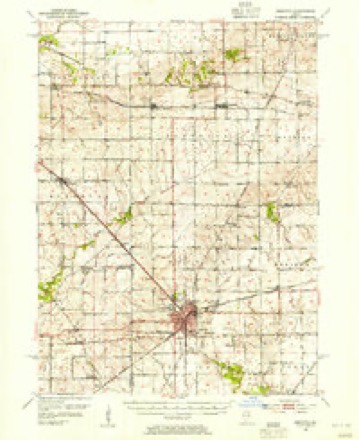
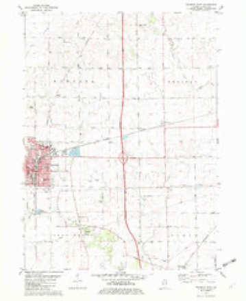
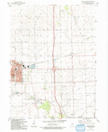
6 surveys from 11 printed sheetsMatched by testing this settlement's coordinate against the published boundary of every sheet in the United States Geological Survey's historical collection. Each opens the scanned sheet at the Survey.
- 1952 USGS Mendota quadrangle1:62500, 3 printings
- 1958 USGS Aurora quadrangle1:250000, 3 printings
- 1961 USGS Aurora quadrangle1:250000
- 1982 USGS Mendota East quadrangle1:24000
- 1985 USGS Dixon quadrangle1:100000, 2 printings
- 1993 USGS Mendota East quadrangle1:24000



In the county-history sources
376 words on this townshipHistory of LaSalle County, Illinois : Its Topography, Geology, Botany, Natural History, History of the Mound Builders, Indian Tribes, French Explorations, and a Sketch of the Pioneer Settlers of Each Town to 1840, with an Appendix, Giving the Present Status of the County, Its Population, Resources, Manufactures and Institutions, published 1877 names this settlement in its chapter on Mendota Township. These are the passages that mention it, exactly as the scans read.
T. 36, R. 1, constitutes the town of Mendota, It lies in the reme northwest corner of the connty ; has no natural growth of timber, and was entirely ignored by the early settlers, The settlements around the head of Troy Grove timber had extended just over the line into T. 80, in 1840. O'Brian came in 1840, Taylor, in 1841; Ward, in 1842; Meath, in 1 Charles Foster settled on S. W. 4 S. 34, in 1848. Bela and William Bowen, from New York in 1849.
The increase of population and building up of the town wns very mpid, so that in 1855, less than two years from the completion of the railroad, Town Trustees were chosen and a municipal government Organized. The village limits were the lines of S. 33. There have been several additions since. March 4, 1867, a city government was organized, and city Officers chosen on the 9th of April following. The growth of Mendota has been constant and rapid, and it is destined to be a city of no mean proportions, The enterprise and intelligence of the people is shown by their admirable schools and institutions of
Machine-read from a century-old scan, so expect the errors a machine makes: misspelled names, dropped words, stray characters.
Read the whole chapter on Mendota Township - it names this place 1 more 1 time.
Storms near this place
60 since 1995Regional context, not property-specific evidence. The National Weather Service names Mendota in 60 storm reports between 1995 and 2025: 34 thunderstorm wind, 13 hail, 4 funnel cloud, 4 flash flood. No death or injury is recorded in these reports. Each account below is quoted exactly as the forecast office filed it, from the NOAA Storm Events Database, and each date opens the federal record of that event.
| When | Event | Place named | Harm | What the report says |
|---|---|---|---|---|
| June 2015 | Tornado (EF1) | Mendota | $100,000 | A tornado crossed through the center of Mendota resulting in significant tree damage. Some trees were blown down onto structures and at least one fell onto a vehicle. The tornado touched down near the intersection of Knoll Crest Drive and S Park Avenue where numerous hardwood trees were snapped. One to three inch branches were broken as the tornado crossed 13th Avenue. A large trunk was split on Washington Street. Trees were uprooted on 5th Street near 5th Avenue. Hardwood trees were snapped on N 1st Avenue, including one that fell onto a pickup truck. Maximum winds were estimated to be 105 mph. (Tornado 4 of 10). |
| June 2015 | Thunderstorm Wind | Mendota | $50,000 | Severe winds blew down around half a dozen trees on the southwest side of Mendota. One tree fell onto a home causing damage. A few utility poles were also blown down. Some homes had shingle damage. |
| June 2014 | Thunderstorm Wind | Mendota | $50,000 | Two semi-trucks were flipped over on I-39 and numerous tree branches were blown down in Mendota. |
| June 2015 | Thunderstorm Wind | Mendota | $10,000 | An outbuilding was damaged along Illinois Highway 251. A few trees and large branches were blown down in Restland Cemetary. |
| June 2013 | Thunderstorm Wind | Mendota | $5,000 | Numerous large trees and branches were blown down across town. A free standing light pole was blown down at the high school. |
| June 2007 | Thunderstorm Wind | Mendota | $5,000 | One large tree blown down, several large tree limbs blown down. Siding ripped off of a house. A picnic table was picked up and tossed 100 yards. |
| June 2007 | Thunderstorm Wind | Mendota | $5,000 | Trees up to two feet in diameter were blown down. A barn wall was blown in and windows were blown out of mobile homes. Powerlines also blown down. |
| July 2010 | Thunderstorm Wind | Mendota | $2,000 | A few large trees were blown down, one along Stroble Avenue and a couple by the skate park at Lake Mendota. Numerous tree limbs and power lines were also blown down. |
| August 2006 | Thunderstorm Wind | Mendota | $2,000 | Two and a half foot diameter tree blown down. Power lines also blown down. |
| June 2001 | Lightning | Mendota | $2,000 | A bolt of lightning struck the Mendota city water tower. The lightning hit the aviation lights then came down through the electrical panel into the tower and blew out switches and phone lines. Two chemical feed bumps were burned. |
| July 2011 | Thunderstorm Wind | Mendota | $1,000 | Numerous trees and power lines were blown down. A limb fell on a vehicle. Corn was flattened near town. |
| June 2010 | Thunderstorm Wind | Mendota | $1,000 | Large tree limbs were snapped by wind. A large tree limb fell on power lines and damaged a power pole. Nearly 400 customers lost power. |
| January 2025 | Flood | Mendota | - | An NWS employee reported multiple areas with flooded ditches, fields, and yards around Mendota. |
| July 2023 | Thunderstorm Wind | Mendota | - | Local broadcast media relayed to us reports and photos of extensive tree and power line damage in and around Mendota. |
| April 2023 | Hail | Mendota | - | Quarter size hail was reported east of Mendota. |
| April 2023 | Hail | Mendota | - | A photo was shared of golf ball size hail near Route 251 and 46th Road. |
| April 2023 | Hail | Mendota | - | A photo showed quarter size hail near Stroble Avenue and 14th Street. |
| April 2023 | Hail | Mendota | - | A photo shared on social media showed golf ball size hail. |
| April 2023 | Hail | Mendota | - | Quarter size hail was reported on the south side of Mendota. |
| May 2023 | Hail | Mendota | - | A report of one inch diameter hail in Mendota was relayed by an off duty meteorologist. Time was estimated using radar. |
| March 2023 | Thunderstorm Wind | Mendota | - | Several trees and power lines were reported down in Mendota. Wind magnitude and time were estimated based on radar. |
| March 2023 | Thunderstorm Wind | Mendota | - | Five mobile homes were reported to have their roofs peeled off. Additionally, heavy duty 6-inch girders were tossed across the street into a parking lot. Wind magnitude and time were estimated based on radar. |
| August 2023 | Funnel Cloud | Mendota | - | A photo of a funnel cloud in Mendota was shared on social media. |
| August 2021 | Thunderstorm Wind | Mendota | - | Numerous trees were blown down. |
| July 2020 | Thunderstorm Wind | Mendota | - | Wind gusts were estimated between 60 mph and 70 mph. Numerous small tree limbs were blown down, a few were 6 inches in diameter. |
| July 2020 | Thunderstorm Wind | Mendota | - | Numerous tree limbs were blown down on the south side of Mendota. |
| August 2020 | Thunderstorm Wind | Mendota | - | A large tree was blown down and a tree limb was impaled into the side of a manufactured home. Windows were also blown out of this home. |
| August 2020 | Thunderstorm Wind | Mendota | - | Wind gusts were estimated to 80 mph. Several large trees were blown down. Wind gusts to severe limits were frequent for 30 minutes after they started. |
| November 2020 | Thunderstorm Wind | Mendota | - | Wind gusts were estimated to 70 mph. |
| June 2019 | Thunderstorm Wind | Mendota | - | A large portion of a tree was blown down onto power lines and snapped a utility pole. |
| September 2018 | Thunderstorm Wind | Mendota | - | A large tree was blown down. |
| May 2017 | Thunderstorm Wind | Mendota | - | A few large trees were blown down in Mendota. |
| July 2016 | Thunderstorm Wind | Mendota | - | Scattered tree limbs up to 4 inches in diameter down throughout town. Relayed via twitter. Time estimated by radar. |
| July 2016 | Thunderstorm Wind | Mendota | - | Large tree down in the 1000 block of Illinois Avenue. |
| September 2015 | Flash Flood | Mendota | - | A portion of Rt. 251 was closed due to flooding following the heavy rainfall. Two miles southeast of Mendota 2.10 inches of rain fell in the past 90 minutes. |
| September 2015 | Heavy Rain | Mendota | - | CoCoRaHs observer reported 2.10 inches in the past 90 minutes. |
| May 2011 | Flash Flood | Mendota | - | Several creeks in the town of Mendota were near bankfull. Several intersections were closed due to flooding on the roadways. |
| June 2009 | Thunderstorm Wind | Mendota | - | Wind gusts were estimated to 60 mph with 3 inch diameter tree limbs blown down. |
| August 2009 | Flood | Mendota | - | Yard and street flooding was reported north of Mendota with a storm total rainfall of 2.49 inches. |
| May 2008 | Thunderstorm Wind | Mendota | - | Numerous large tree limbs were blown down along with a few small trees that were uprooted. |
| June 2008 | Thunderstorm Wind | Mendota | - | Wind gusts to 60 mph were estimated in Mendota. |
| June 2008 | Thunderstorm Wind | Mendota | - | Wind gusts were estimated to 60 mph on East Fourth Street. |
| June 2008 | Thunderstorm Wind | Mendota | - | Trees 18 inches in diameter were blown down. |
| September 2008 | Flash Flood | Mendota | - | Several streets were flooded in Mendota with three feet of water reported on 1st Street. The Fourth Avenue viaduct south of Doenier Field was flooded. Water was seen coming up through sewers. Creeks also overflowed their banks. |
| August 2006 | Thunderstorm Wind | Mendota | - | A tree was blown down on Route 251. |
| May 2004 | Flash Flood | Mendota | - | Street flooding was reported and creeks overflowed their banks. A total of 1.5 inches of rain fell in 1 hour and 45 minutes. |
| July 2004 | Hail | Mendota | - | Several reports of large hail, up to 1.75 inches were observed in Mendota by trained spotters. |
| July 2000 | Funnel Cloud | Mendota | - | There was a newspaper account and photograph of a cold air funnel west of Mendota. Time of the event was not given. There was no damage reported. |
| August 1995 | Thunderstorm Wind | Mendota | - | Severe thunderstorms developed across Lee, La Salle and Grundy Counties in the mid to late afternoon. Funnel clouds were sighted near Wedron and a tornado was reported north of Marseilles but there was no report of damage from the tornado. The storm also dropped large hail at Wedron and Seneca. Trees and limbs were blown down in and around Seneca and in Marseilles. Another storm produced large hail in western La Salle County in the La Salle-Peru area. Another storm developed at the Lee-La Salle County line. Corn was flattened north of Mendota. The storm built southward and later damaged an air conditioner and the roof of a JC Penney store at a mall in Peru. |
| April 2020 | Hail | Mendota | - | no account filed |
| February 2017 | Hail | Mendota | - | no account filed |
| June 2015 | Hail | Mendota | - | no account filed |
| July 2008 | Hail | Mendota | - | no account filed |
| March 2006 | Hail | Mendota | - | no account filed |
| September 2006 | Hail | Mendota | - | no account filed |
| June 2002 | Thunderstorm Wind | Mendota | - | no account filed |
| August 2002 | Funnel Cloud | Mendota | - | no account filed |
| August 1997 | Thunderstorm Wind | Mendota | - | no account filed |
| May 1997 | Thunderstorm Wind | Mendota | - | no account filed |
| July 1996 | Funnel Cloud | Mendota | - | no account filed |
Nearest settlements
The eight closest, with where each one stands in the county. Distances are straight-line, computed from the Geographic Names Information System coordinates.
| Map | Place | Distance | Sheets |
|---|---|---|---|
| Peterstown | 3.7 miles | 19 | |
| Culton (historical) | 4.4 miles | 20 | |
| Meriden | 4.8 miles | 11 | |
| Troy Grove | 5.8 miles | 20 | |
| Triumph | 6.0 miles | 20 | |
| Fitchmoor | 6.4 miles | 19 | |
| Dimmick | 7.4 miles | 20 | |
| Waltham | 9.7 miles | 20 |
Elsewhere
Matched on this settlement's Geographic Names Information System number rather than its name, so it cannot be a different place of the same name in another state.
| Wikipedia article on Mendota | An encyclopaedic summary. Its text is share-alike, so it is linked here rather than copied. |
| Wikidata item Q575606 | The structured record the population and elevation above come from. Public domain (CC0). |
Provenance
This settlement is recorded in the Geographic Names Information System as feature 413397. The sheet list is computed by point-in-boundary test against the United States Geological Survey's historical topographic inventory. Both are works of the United States government and carry no copyright under 17 U.S.C. 105.
Storms. NOAA National Centers for Environmental Information, Storm Events Database https://www.ncei.noaa.gov/stormevents/ A work of the United States government, no copyright under 17 U.S.C. 105. Narratives are quoted verbatim from the National Weather Service report and are not edited or summarised.