 Block
Neunert, Illinois
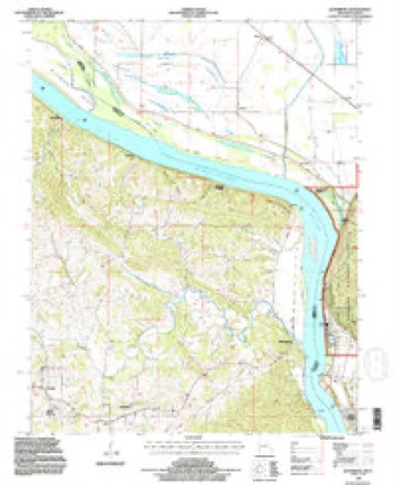
28 topographic sheets cover this place, the earliest surveyed in 1918 and the latest in 1994. It stands in Fountain Bluff Township. It lies in ZIP code area 62950. It lies near Hat Island. The Survey maps it on the Altenburg quadrangle. It stands 361 feet above sea level.
Topographic sheets covering this place
15 surveys from 28 printed sheetsMatched by testing this settlement's coordinate against the published boundary of every sheet in the United States Geological Survey's historical collection. Each opens the scanned sheet at the Survey.
- 1918 USGS Altenburg quadrangle1:62500
- 1925 USGS Altenburg quadrangle1:62500, 3 printings
- 1947 USGS Altenburg quadrangle1:24000, 4 printings
- 1947 USGS Altenburg quadrangle1:62500
- 1948 USGS Altenburg quadrangle1:24000, 2 printings
- 1949 USGS Altenburg quadrangle1:62500, 3 printings
- 1949 USGS Paducah quadrangle1:250000, 2 printings
- 1950 USGS Paducah quadrangle1:250000
- 1954 USGS Paducah quadrangle1:250000, 2 printings
- 1961 USGS Paducah quadrangle1:250000, 2 printings
- 1964 USGS Paducah quadrangle1:250000, 2 printings
- 1984 USGS Carbondale quadrangle1:100000
- 1986 USGS Carbondale quadrangle1:100000
- 1987 USGS Paducah quadrangle1:250000
- 1994 USGS Altenburg quadrangle1:24000, 2 printings






Fires near this place
8 since 1995Regional context, not property-specific evidence. The federal wildfire occurrence database lists 8 fires within 5 miles of Neunert between 1995 and 2019, burning about 6 acres in total. None started naturally. 2 were recorded as arson. Distance is straight-line from the map coordinates, so a fire counted here may appear on a neighbouring settlement's page as well.
| Reported cause | Fires |
|---|---|
| Debris and open burning | 4 |
| Arson/incendiarism | 2 |
| Power generation/transmission/distribution | 1 |
| Equipment and vehicle use | 1 |
The most recent of them, most recent first, with the day each was reported and the service that recorded it.
| Date | Cause | Size | Reported by | Name on the report |
|---|---|---|---|---|
| 13 June 2012 | Debris and open burning | 2.0 acres | Shawnee National Forest | BLUFFS |
| 30 April 2018 | Equipment and vehicle use | under an acre | Shawnee National Forest | SKEETER PARK |
| 27 March 2019 | Debris and open burning | under an acre | Shawnee National Forest | WHITE |
| 26 March 1995 | Arson/incendiarism | 2.0 acres | Shawnee National Forest | FOUNTAIN BLUFF |
| 23 March 2014 | Debris and open burning | under an acre | Shawnee National Forest | BLUFFS |
| 23 March 2011 | Debris and open burning | under an acre | Shawnee National Forest | OTTER SLOUGH |
| 17 March 2011 | Power generation/transmission/distribution | under an acre | Shawnee National Forest | HAPPY HOLLOW |
| 23 October 2010 | Arson/incendiarism | under an acre | Shawnee National Forest | SKEETER |
Settlements close enough to share some of these fires:
Mines and quarries near this place
8 within 5 milesRegional context, not property-specific evidence. The federal mineral resources record lists 8 workings within 5 miles of Neunert: 5 past producers, 2 occurrences, 1 prospect. None of them still produces. What was taken out: Stone, Crushed/Broken, Lead, Clay, Sand and Gravel, Construction. Distance is straight-line from the map coordinates, so a quarry counted here may appear on a neighbouring settlement's page as well.
| Where | Site | Commodity | Status | Recorded |
|---|---|---|---|---|
| Lawder Dredge | Sand and Gravel, Construction | Past Producer | ||
| Minor Lead Occurence No. 1 | Lead | Occurrence | ||
| Unknown | Clay | Past Producer | ||
| Fountain Bluff Sandstone Exposure | Stone, Crushed/Broken | Prospect | ||
| Limestone Prospect | Stone, Crushed/Broken | Occurrence | ||
| Unknown | Stone, Crushed/Broken | Past Producer | ||
| Unknown | Stone, Crushed/Broken | Past Producer | ||
| Unknown | Stone, Crushed/Broken | Past Producer |
Storms near this place
1 since 2009Regional context, not property-specific evidence. The National Weather Service names Neunert in 1 storm report in 2009: 1 thunderstorm wind. The reports record 1 death and 6 injuries. Each account below is quoted exactly as the forecast office filed it, from the NOAA Storm Events Database, and each date opens the federal record of that event.
| When | Event | Place named | Harm | What the report says |
|---|---|---|---|---|
| May 2009 | Thunderstorm Wind | Neunert | 1 killed, 6 hurt, $100,000,000 | Widespread wind damage occurred across Jackson County. Widespread damage to trees, power lines, and structures occurred as the comma head of a bow echo moved east across the county. In the city of Carbondale alone, officials reported 34 properties were deemed total losses from the storm. All but nine of those properties were mobile homes. Damage in the city alone (excluding Southern Illinois University) was estimated near 3 million dollars. Officials estimated about 3,000 trees were down or damaged in Carbondale alone, including the campus of Southern Illinois University. Officials in Murphysboro reported 17 dwellings in that city were total losses. One mobile home was blown over onto a car. Murphysboro officials also reported a police cruiser, a truck, and a mobile command center were destroyed. The city's public works garage was shifted off its foundation, and the city police station was damaged. The peak gust recorded by the automated system at the Carbondale airport was 81 mph before the system failed. An observer at the airport visually observed a separate anemometer located on the rooftop reach 106 mph. The automated system measured a sustained wind of 68 mph before failing. Numerous permanent structures and vehicles were damaged countywide. Small outbuildings were destroyed. The roof of a school collapsed. Carbondale was virtually impassable due to debris. One fatality occurred on Old Route 13 in Murphysboro when a large tree limb fell on a home, knocking an elderly man down a flight of stairs and causing a severe head injury. Emergency responders were delayed by blocked roads. A state disaster declaration was granted for Jackson County. A curfew and state of emergency was declared. Cleanup was expected to take most or all of the summer. Hundreds of trees were blown down in parks, which were closed indefinitely. The preliminary damage estimate for Southern Illinois University was 5 million dollars. Many buildings on campus sustained roof damage. The storm blew out nearly 100 windows in residence halls. Countywide, efforts to restore power were complicated by swampy fields, mud, and downed trees. Eighty-seven percent of the county was without power at the peak of the outages. Widespread power and telephone outages complicated recovery efforts. Most roads were blocked by debris and downed trees. Gas stations were closed in many areas, adding to problems obtaining fuel for generators. Red Cross shelters were opened in Carbondale and Murphysboro. Major grocery stores were closed for at least 12 to 24 hours, and much of their frozen food was lost. Most communication by cell phone and land line was impossible. |
Nearest settlements
The eight closest, with where each one stands in the county. Distances are straight-line, computed from the Geographic Names Information System coordinates.
Elsewhere
Matched on this settlement's Geographic Names Information System number rather than its name, so it cannot be a different place of the same name in another state.
| Wikipedia article on Neunert | An encyclopaedic summary. Its text is share-alike, so it is linked here rather than copied. |
| Wikidata item Q48847160 | The structured record the population and elevation above come from. Public domain (CC0). |
Provenance
This settlement is recorded in the Geographic Names Information System as feature 414372. The sheet list is computed by point-in-boundary test against the United States Geological Survey's historical topographic inventory. Both are works of the United States government and carry no copyright under 17 U.S.C. 105.
Wildfire. Short, Karen C. 2022. Spatial wildfire occurrence data for the United States, 1992-2020 [FPA_FOD_20221014]. 6th Edition. Fort Collins, CO: Forest Service Research Data Archive. https://doi.org/10.2737/RDS-2013-0009.6 Collected with United States Government funding and usable without additional permissions or fees.
Mines and quarries. USGS Mineral Resources Data System (MRDS) https://mrdata.usgs.gov/mrds/ A work of the United States government, no copyright under 17 U.S.C. 105.
Storms. NOAA National Centers for Environmental Information, Storm Events Database https://www.ncei.noaa.gov/stormevents/ A work of the United States government, no copyright under 17 U.S.C. 105. Narratives are quoted verbatim from the National Weather Service report and are not edited or summarised.