 Block
Nevins, Illinois
15 topographic sheets cover this place, the earliest surveyed in 1947 and the latest in 1986. It stands in Elbridge Township. It lies in ZIP code area 61944. The Survey maps it on the Paris South quadrangle.
On record in Nevins
Buildings and businesses the archive holds for this place. Each opens its own page, with the source record it came from.
On the National Register within a mile 1 record
The National Register names another town for these. They stand within one mile of this settlement's coordinate.
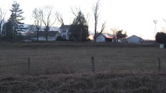 Asher Morton Farmsteadlisted 1996 · 0.5 miles away
Topographic sheets covering this place
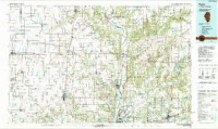
8 surveys from 15 printed sheetsMatched by testing this settlement's coordinate against the published boundary of every sheet in the United States Geological Survey's historical collection. Each opens the scanned sheet at the Survey.
- 1947 USGS Paris quadrangle1:62500
- 1949 USGS Paris quadrangle1:62500, 2 printings
- 1953 USGS Indianapolis quadrangle1:250000, 4 printings
- 1956 USGS Indianapolis quadrangle1:250000
- 1957 USGS Indianapolis quadrangle1:250000, 2 printings
- 1962 USGS Indianapolis quadrangle1:250000
- 1966 USGS Paris South quadrangle1:24000, 2 printings
- 1986 USGS Paris quadrangle1:100000, 2 printings




In the county-history sources
17,476 words on this townshipThe History of Edgar County, Illinois, Containing a History of the County--its Cities, Towns, &c. : Directory of Its Tax-payers; War Records of Its Volunteers in the Late Rebellion Portraits of Early Settlers and Prominent Men; General and Local Statistics; Map of Edgar County; History of Illinois, Illustrated; History of the Northwest, Illustrated; Constitution of the United States, Miscellaneous Matters, &c., &c. Illustrated, published 1879 names this settlement in its chapter on Elbridge Township. These are the passages that mention it, exactly as the scans read.
The completion ofr the Illinois Midland Railroad through the township in February, 1874, was the touchstone that deprived Elbridge of its growth. It has more of a history than any village in the township, but cannot hope to succeed against its more fortunate rivals.
The charter for the Parish Terre Haute Railroad was obtained March 1, 1872. The line was the extension of the Midland Railroad, and had been built from Paris to Decatur a year or so before. Its completion through Elbridge Township was the signal for the starting of some new towns. One of these, the largest, is Nevins. It was surveyed by George W. Foreman, County Sur¬ veyor, for James W. and B. F. Parrish and Ashier Morton, early in 1874, on land belong-ino; to them. Mr. Morton and his brother John erected a store soon after, in which they opened a general stock of goods. A post office was secured and named in conjunction with the town in honor of Mr. Robert N. Nevins, of Paris. The store is now owned by John W. Staples, who does a good business. A warehouse was built by John W. Morton, about two years ago, from which considerable grain is shipped. Soon after the town was laid out, a blacksmith-shop was erected by Robert Osborne, who is yet in business. For awhile, a shoe-shop was kept here; but the business proving unremunerative, owing to its nearness to the county seat, it was closed. These business enterprise comprise the trade of the village. It is yet in its infancy, and cannot be expected to furnish a long history.
School has been regularly maintained in this locality many years ; first in the old log schoolhouse, then in a hewed-log one, and lastly in the presen frame building originally built for a church. The number of scholars in attendance is now about fifty. The town is not incorporated, and the school is under the district control.
Machine-read from a century-old scan, so expect the errors a machine makes: misspelled names, dropped words, stray characters.
Read the whole chapter on Elbridge Township - it names this place 26 more 26 times.
Fires near this place
1 since 2007Regional context, not property-specific evidence. The federal wildfire occurrence database lists 1 fire within 5 miles of Nevins in 2007, burning about 5 acres in total. None started naturally. None was recorded as arson. Distance is straight-line from the map coordinates, so a fire counted here may appear on a neighbouring settlement's page as well.
| Reported cause | Fires |
|---|---|
| Equipment and vehicle use | 1 |
The most recent of them, most recent first, with the day each was reported and the service that recorded it.
| Date | Cause | Size | Reported by | Name on the report |
|---|---|---|---|---|
| 16 November 2007 | Equipment and vehicle use | 5.0 acres | Illinois Division of Forestry Resources | not named |
Settlements close enough to share some of these fires:
Storms near this place
5 since 2010Regional context, not property-specific evidence. The National Weather Service names Nevins in 5 storm reports between 2010 and 2024: 3 hail, 1 flash flood, 1 thunderstorm wind. No death or injury is recorded in these reports. Each account below is quoted exactly as the forecast office filed it, from the NOAA Storm Events Database, and each date opens the federal record of that event.
| When | Event | Place named | Harm | What the report says |
|---|---|---|---|---|
| June 2024 | Thunderstorm Wind | Nevins | - | Seven large trees were blown down, including some that fell onto powerlines causing a power outage. A garage building was shifted and a steel roof cap was ripped off a home. Crops were flattened in nearby fields. |
| July 2020 | Flash Flood | Nevins | - | Water was flowing across 400 North just east of Nevins. |
| June 2024 | Hail | Nevins | - | no account filed |
| April 2010 | Hail | Nevins | - | no account filed |
| April 2010 | Hail | Nevins | - | no account filed |
Nearest settlements
The eight closest, with where each one stands in the county. Distances are straight-line, computed from the Geographic Names Information System coordinates.
Provenance
This settlement is recorded in the Geographic Names Information System as feature 414377. The sheet list is computed by point-in-boundary test against the United States Geological Survey's historical topographic inventory. Both are works of the United States government and carry no copyright under 17 U.S.C. 105.
Wildfire. Short, Karen C. 2022. Spatial wildfire occurrence data for the United States, 1992-2020 [FPA_FOD_20221014]. 6th Edition. Fort Collins, CO: Forest Service Research Data Archive. https://doi.org/10.2737/RDS-2013-0009.6 Collected with United States Government funding and usable without additional permissions or fees.
Storms. NOAA National Centers for Environmental Information, Storm Events Database https://www.ncei.noaa.gov/stormevents/ A work of the United States government, no copyright under 17 U.S.C. 105. Narratives are quoted verbatim from the National Weather Service report and are not edited or summarised.