 Block
Newman, Illinois
14 topographic sheets cover this place, the earliest surveyed in 1953 and the latest in 1998. It stands in Newman Township. It lies in ZIP code area 61942. It stands on Newman Number 2 Drain. The Survey maps it on the Newman quadrangle. 778 people lived here at the 2020 count. It stands 654 feet above sea level.
On record in Newman
Buildings and businesses the archive holds for this place. Each opens its own page, with the source record it came from.
On the National Register 1 record
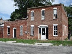 Streibich Blacksmith Shoplisted 1991
Population over time
2 figuresNewman fell from 865 to 778 between 2010 and 2020. These are the recorded population figures Wikidata holds for this place, reached through the Geographic Names Information System number this page is keyed on rather than by name, so they belong to this place and not to another of the same name. Most are census counts, but not all are: an early figure may be a founding or settlement estimate, and an estimate published within five years of a census is left out. The change column is computed, and is left blank where more than 20 years separate a figure from the one before it, because a gap that long is not a change between two counts.
| Year | People | Change |
|---|---|---|
| 2010 | 865 | |
| 2020 | 778 | -87 (-10%) |
Topographic sheets covering this place
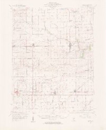
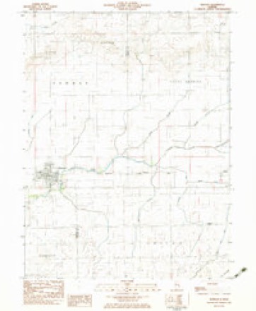
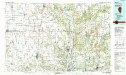
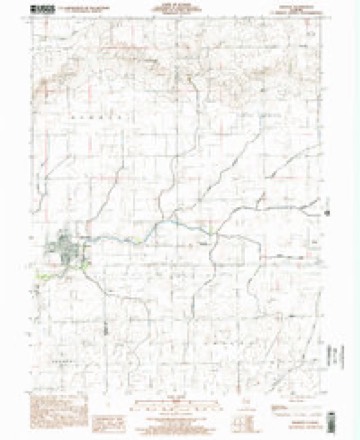
8 surveys from 14 printed sheetsMatched by testing this settlement's coordinate against the published boundary of every sheet in the United States Geological Survey's historical collection. Each opens the scanned sheet at the Survey.
- 1953 USGS Indianapolis quadrangle1:250000, 4 printings
- 1956 USGS Indianapolis quadrangle1:250000
- 1956 USGS Newman quadrangle1:62500, 2 printings
- 1957 USGS Indianapolis quadrangle1:250000, 2 printings
- 1962 USGS Indianapolis quadrangle1:250000
- 1982 USGS Newman quadrangle1:24000
- 1986 USGS Paris quadrangle1:100000, 2 printings
- 1998 USGS Newman quadrangle1:24000




In the county-history sources
2,558 words on this townshipHistory of Douglas County, Illinois, published 1876 names this settlement in its chapter on Newman Township. These are the passages that mention it, exactly as the scans read.
Newman Tov\rnship has an area of about 48 square miles and is nearly all prairie, though there is considerable timber in the south part along Brushy Fork. It has 30,756 acres. The north part of this township rises into a considerable elevation known as the Ridge, a view from which is more extensive than can be obtained from any other part of the county.
Passage source: History of Douglas County, Illinois, published 1876.
The city of Newman is situated on section 31, 16, 14, on the line of the I., D. & S. Railway, and the original town was laid off by the same company which instituted Tuscola and at abovit the same time. It was named for 1>. Newman, one of the proprietors, who was a sonin-law of Peter Cartright, the celebrated itinerant preacher. The town was laid out in December, 1S57, in Coles countv, and in the advertisements ot the place the proprietors preaicted that a new county would be formed, and that the railroad would be built. The new county was formed in 1S59 an(^ the ^"Iroad came along in 1S72.
Passage source: History of Douglas County, Illinois, published 1876.
A proposed railroad, the line of which has been surveyed and approximately located, is a nearly straight line from Homer, in Champaign county, to Newman, with prospective extensions both ways, and a preliminary survey was made on the line ot the Mattoon & Danville road which also crosses the township.
Passage source: History of Douglas County, Illinois, published 1876.
Machine-read from a century-old scan, so expect the errors a machine makes: misspelled names, dropped words, stray characters.
Read the whole chapter on Newman Township - it names this place 4 more 4 times.
Storms near this place
29 since 1996Regional context, not property-specific evidence. The National Weather Service names Newman in 29 storm reports between 1996 and 2025: 16 thunderstorm wind, 10 hail, 2 flash flood, 1 tornado. No death or injury is recorded in these reports. Each account below is quoted exactly as the forecast office filed it, from the NOAA Storm Events Database, and each date opens the federal record of that event.
| When | Event | Place named | Harm | What the report says |
|---|---|---|---|---|
| April 2011 | Thunderstorm Wind | Newman | $125,000 | Two houses sustained roof damage in Newman. A large shed and a small block warehouse were severely damaged. In addition, a small shed was tipped over and blown across a lot into an antique trailer. |
| November 2013 | Thunderstorm Wind | Newman | $80,000 | Numerous power poles and trees were blown down and a pole barn had its roof blown off. |
| May 2011 | Thunderstorm Wind | Newman | $75,000 | Seven power poles were knocked down. |
| June 2021 | Thunderstorm Wind | Newman | $65,000 | A tree was blown onto a roof in the 600 block of West Green Street in Newman. Power poles were snapped and powerlines were blown down at Gabe Street and North Howard Street. |
| June 2015 | Thunderstorm Wind | Newman | $50,000 | Numerous tree branches and power lines were blown down in Newman. |
| May 2009 | Thunderstorm Wind | Newman | $20,000 | Several 6 to 10-inch diamter trees were blown down. |
| June 2013 | Thunderstorm Wind | Newman | $9,000 | A two-foot diameter tree limb and power lines were blown down on Lytle Street in Newman. |
| August 2014 | Thunderstorm Wind | Newman | $3,000 | A tree was blown onto a power line. |
| May 2024 | Thunderstorm Wind | Newman | - | Trees were blown down on Main Street in Newman. |
| March 2023 | Thunderstorm Wind | Newman | - | A farm outbuilding was blown over. |
| June 2023 | Thunderstorm Wind | Newman | - | Several tree limbs were blown down resulting in structural damage, including broken windows and a destroyed chain link fence. |
| August 2019 | Thunderstorm Wind | Newman | - | Several large tree limbs were blown down. |
| March 2017 | Thunderstorm Wind | Newman | - | A few small tree branches were blown down. |
| May 2014 | Flash Flood | Newman | - | Persistent rain from numerous thunderstorms tracking over the same areas produced 2.50 to 3.00 inches in less than two hours during the early evening hours in a small portion of northeast Douglas County. Numerous rural roads were impassable and closed as a result. |
| June 2008 | Flash Flood | Newman | - | Numerous streets were flooded in and around Newman. |
| June 2000 | Thunderstorm Wind | Newman | - | Several power lines were blown down in town. |
| June 2000 | Thunderstorm Wind | Newman | - | Several power lines were blown down. |
| April 1998 | Tornado (F0) | Newman | - | A tornado briefly touched down in a field 2 miles south of Newman. No injuries or damage were reported. |
| June 1997 | Thunderstorm Wind | Newman | - | Thunderstorm winds blew down a large tree in Newman. No injuries were reported and no damage estimate was available. |
| March 2025 | Hail | Newman | - | no account filed |
| May 2024 | Hail | Newman | - | no account filed |
| May 2022 | Hail | Newman | - | no account filed |
| March 2022 | Hail | Newman | - | no account filed |
| April 2017 | Hail | Newman | - | no account filed |
| May 2014 | Hail | Newman | - | no account filed |
| February 2008 | Hail | Newman | - | no account filed |
| June 2008 | Hail | Newman | - | no account filed |
| June 2000 | Hail | Newman | - | no account filed |
| April 1996 | Hail | Newman | - | no account filed |
Nearest settlements
The eight closest, with where each one stands in the county. Distances are straight-line, computed from the Geographic Names Information System coordinates.
| Map | Place | Distance | Sheets |
|---|---|---|---|
| Murdock | 4.9 miles | 11 | |
| Fairland | 8.2 miles | 11 | |
| Hugo | 9.2 miles | 11 | |
| Camargo | 9.4 miles | 11 | |
| Villa Grove | 10.3 miles | 11 | |
| Patterson Springs | 11.0 miles | 11 | |
| Hindsboro | 11.1 miles | 16 | |
| West Ridge | 12.4 miles | 11 |
Elsewhere
Matched on this settlement's Geographic Names Information System number rather than its name, so it cannot be a different place of the same name in another state.
| Wikipedia article on Newman | An encyclopaedic summary. Its text is share-alike, so it is linked here rather than copied. |
| Wikidata item Q575583 | The structured record the population and elevation above come from. Public domain (CC0). |
Provenance
This settlement is recorded in the Geographic Names Information System as feature 414490. The sheet list is computed by point-in-boundary test against the United States Geological Survey's historical topographic inventory. Both are works of the United States government and carry no copyright under 17 U.S.C. 105.
Storms. NOAA National Centers for Environmental Information, Storm Events Database https://www.ncei.noaa.gov/stormevents/ A work of the United States government, no copyright under 17 U.S.C. 105. Narratives are quoted verbatim from the National Weather Service report and are not edited or summarised.