 Block
Odin, Illinois
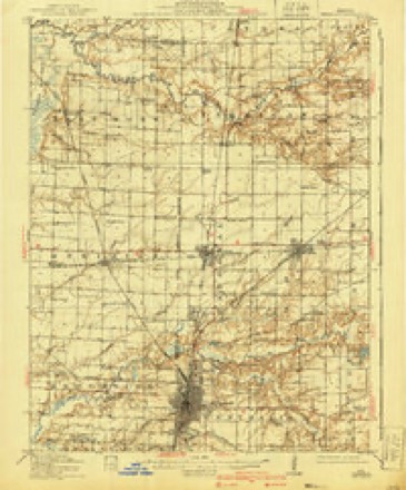
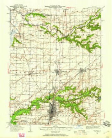
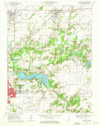
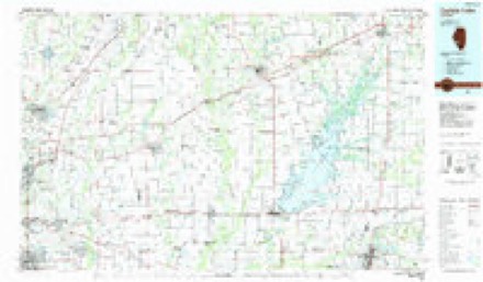
13 topographic sheets cover this place, the earliest surveyed in 1914 and the latest in 1985. It stands in Odin Township. It lies in ZIP code area 62870. The Survey maps it on the Centralia East quadrangle. 935 people lived here at the 2020 count. It stands 528 feet above sea level.
Population over time
2 figuresOdin fell from 1,076 to 935 between 2010 and 2020. These are the recorded population figures Wikidata holds for this place, reached through the Geographic Names Information System number this page is keyed on rather than by name, so they belong to this place and not to another of the same name. Most are census counts, but not all are: an early figure may be a founding or settlement estimate, and an estimate published within five years of a census is left out. The change column is computed, and is left blank where more than 20 years separate a figure from the one before it, because a gap that long is not a change between two counts.
| Year | People | Change |
|---|---|---|
| 2010 | 1,076 | |
| 2020 | 935 | -141 (-13%) |
Topographic sheets covering this place
6 surveys from 13 printed sheetsMatched by testing this settlement's coordinate against the published boundary of every sheet in the United States Geological Survey's historical collection. Each opens the scanned sheet at the Survey.
- 1914 USGS Centralia quadrangle1:62500, 3 printings
- 1935 USGS Centralia quadrangle1:62500
- 1958 USGS Belleville quadrangle1:250000, 3 printings
- 1962 USGS Belleville quadrangle1:250000
- 1970 USGS Centralia East quadrangle1:24000, 3 printings
- 1985 USGS Carlyle Lake quadrangle1:100000, 2 printings


In the county-history sources
2,243 words on this townshipBrinkerhoff's History of Marion County, Illinois, published 1909 names this settlement in its chapter on Odin Township. These are the passages that mention it, exactly as the scans read.
The thriving little city of Odin is situated in the east side of township 2 north, range i east, and about two miles from the north line of the township. It is at the crossing of the Illinois Central branch and the Baltimore & Ohio Southwestern railroads and is the product of these roads, hence was not built until the roads were. The first building was put up by one John Hill, as a saloon, and with Hill as a saloonkeeper absorbed much of the hard earnings of the railway laborers. It stood south of the railroads and near the tracks. The Illinois Central built their depot in 1856 and in 1860,
Passage source: Brinkerhoff's History of Marion County, Illinois, published 1909.
April 5th, laid out the town, it being on a railroad section. The house of the section boss, David Dudy, of the Ohio & Mississippi Company, was the first dwelling erected. The first store building was erected by P. Z. Stone, who opened a general store about 1857 or 1858. James Garretson was the first postmaster and hotel-keeper. He built the first hotel in 1859 and called it after himself, the Garretson House. It was afterward called the Hartley House. It still stands, but at present is not used as a hotel. Before 1860 one De Schan, Branson and Lester, and George Craig had opened stores and were doing a country trade and supplying the railroad men and passengers from one road waiting for a train on the other. During the years of the war between the states, 1862 to 1864, the town grew very rapidly, many refugees from the South making it a stopping place and many a permanent home. A woolen mill called the Odin Woolen Factory was built in 1867. It was of brick and two stories high and manufactured jeans and flannel. It was destroyed by fire in 1879, and was never rebuilt. There was a sawmill in connection, which did not burn at that time and was operated for some years by W. E. Smith, but it finally was destroyed by fire. In 1863 a large hay press barn was built by A. M. Woodward & Co., and it was afterward enlarged until it was one of the largest press barns in the country, but it, too, was destroyed by fire in the nineties. It may be well to state for the information of the younger generation that until about 1870 hay was pressed into bales only in barns built for that purpose with presses built in them, and these presses were massive pieces of machinery with a heavy weight arranged like a pile driver, which was drawn to the top of the barn and fell into the press and beat the loose hay solidly together until two hundred or three hundred pounds were beat into a bale, when an immense screw operated from below compressed the bale, which was then "baled" or bound with hickory hoop-poles being passed around them and nailed together. The hay had to be hauled to these barns loose and was much labor and expense. The invention of the modern portable hay press killed the hay barn press, but has been a blessing to the farmer. In 1863 Captain Pierce built a twoburr grist mill. It changed hands frequently and the firm of Morrison & Smart ran it from 1873 to 1880, and then sold to James Warren, the owner when the mill went out of business. Odin has a commodious twostory brick school building and has a corps of six teachers and takes pride in maintaining a first class school. The Methodist Episcopals and Protestant Methodists each have a church in Odin, as also have the Christians and Presbyterians, although the latter is not used of late, only occasionally, as no minister is in charge. Odin Masonic lodge No. 503 was instituted in 1866, under dispensation from the grand master. E. B. Wilcox was the first worshipful master; E. Sidwell, senior warden, and O. F. Ball, junior warden. It was organized with only eleven members. It is now in a flourishing condition. The Modern Woodmen also have a strong lodge in Odin, with about one hundred members. In 1886 a stock company was formed under the name Odin Coal Company, to sink a shaft and mine coal, which was successful in striking a fine vein of coal at a depth of seven hundred and fifteen feet, with a vein of about seven feet in thickness. After undergoing the usual ups and downs of such stock companies, Messrs. Morrison and Secor, with perhaps a few others, obtained a controlling interest, since which time it has been so successfully handled as to prove a valuable and profitable property. Some few years ago electric mining and haulage and electric lighting was installed. The dynamo of the mine also furnishes electricity for lighting the city. During the life of the mine it has been singularly free from fatalities, but few accidents of serious character having occurred. The railroad crossing of the Illinois Central branch and the Baltimore & Ohio Southwestern is controlled by an interlocking device controlled from a tower built so as to give the operator a view of both tracks.
Passage source: Brinkerhoff's History of Marion County, Illinois, published 1909.
The city of Sandoval, like Centralia and Odin, was laid out by the Illinois Central Railroad Company on their own section of land. It is at the crossing of the Baltimore & Ohio Southwestern and Illinois Central Railroad main line, and is about one mile from the west line of the township and two from the north line, and, like Odin, gave its name to the west half of township 2 north, range i east, when the township was divided. The survey and laying out of the city was on May n, 1855. Two other additions were laid out the same year. Welcome Martin, as early as 1853, put up a frame store house on the Ohio & Mississippi right of way just west of the right of way of the Illinois Central Railroad, and sold goods to the railroad laborers and the general public. The first boarding house or hotel was kept by J. B. Crawford, the original building afterward making part of the Sandoval
Passage source: Brinkerhoff's History of Marion County, Illinois, published 1909.
Machine-read from a century-old scan, so expect the errors a machine makes: misspelled names, dropped words, stray characters.
Read the whole chapter on Odin Township - it names this place 2 more 2 times.
Storms near this place
21 since 1995Regional context, not property-specific evidence. The National Weather Service names Odin in 21 storm reports between 1995 and 2025: 8 thunderstorm wind, 8 hail, 2 tornado, 2 flash flood. The reports record 7 injuries. Each account below is quoted exactly as the forecast office filed it, from the NOAA Storm Events Database, and each date opens the federal record of that event.
| When | Event | Place named | Harm | What the report says |
|---|---|---|---|---|
| April 1996 | Tornado (F2) | Odin | 7 hurt, $7,000,000 | no account filed |
| May 1996 | Tornado (F0) | Odin | $10,000 | no account filed |
| May 1995 | Thunderstorm Wind | Odin | $3,500 | Numerous trees were snapped off and roofs damaged south of Odin while a mobile home south of Salem was completely destroyed. Several stores in Centralia also had broken windows and trees were blown down damaging parked cars. |
| June 1995 | Thunderstorm Wind | Odin | $200 | Large trees and tree limbs were blown down. Winds gusts in Centralia were estimated at 60 mph. |
| April 2025 | Flood | Odin | - | Heavy rain caused ponding in the park across from Salem Community High School with 2 to 3 feet of flowing water across the parking lot. Nearby, a member of the public reported minor flooding due to Crooked Creek overflowing. |
| April 2025 | Thunderstorm Wind | Odin | - | Thunderstorm winds damaged a barn roof. A few pieces of sheet metal were strewn into a nearby field. |
| June 2019 | Flash Flood | Odin | - | Up to two inches of rain fell in a short amount of time causing flash flooding. Numerous secondary roads were flooded. |
| June 2018 | Thunderstorm Wind | Odin | - | Thunderstorm winds blew down numerous large tree limbs in Odin and about 2 miles south of Tonti. |
| June 2013 | Flash Flood | Odin | - | Up to 4 inches of rain fell in a short amount of time causing flash flooding. Several roads were flooded including the intersection of Illinois Route 37 and Cartter Road. Also, there was water over Route 161 extension just west of intersection with Buchanan Road. |
| June 2013 | Thunderstorm Wind | Odin | - | Thunderstorm winds blew over a large tree. It landed on an unoccupied car causing major damage. |
| June 2013 | Hail | Odin | - | no account filed |
| March 2012 | Hail | Odin | - | no account filed |
| May 2007 | Hail | Odin | - | no account filed |
| April 2007 | Hail | Odin | - | no account filed |
| August 2004 | Thunderstorm Wind | Odin | - | no account filed |
| May 2000 | Thunderstorm Wind | Odin | - | no account filed |
| June 1998 | Thunderstorm Wind | Odin | - | no account filed |
| May 1996 | Hail | Odin | - | no account filed |
| May 1996 | Hail | Odin | - | no account filed |
| May 1996 | Hail | Odin | - | no account filed |
| April 1996 | Hail | Odin | - | no account filed |
Nearest settlements
The eight closest, with where each one stands in the county. Distances are straight-line, computed from the Geographic Names Information System coordinates.
| Map | Place | Distance | Sheets |
|---|---|---|---|
| Selmaville | 3.1 miles | 11 | |
| Sandoval | 3.3 miles | 13 | |
| Junction City | 4.7 miles | 12 | |
| Fairman | 5.0 miles | 11 | |
| Tonti | 5.1 miles | 11 | |
| Salem | 5.7 miles | 11 | |
| Central City | 6.2 miles | 12 | |
| Hubbard Woods | 7.3 miles | 13 |
Elsewhere
Matched on this settlement's Geographic Names Information System number rather than its name, so it cannot be a different place of the same name in another state.
| Wikipedia article on Odin | An encyclopaedic summary. Its text is share-alike, so it is linked here rather than copied. |
| Wikidata item Q2671837 | The structured record the population and elevation above come from. Public domain (CC0). |
Provenance
This settlement is recorded in the Geographic Names Information System as feature 414956. The sheet list is computed by point-in-boundary test against the United States Geological Survey's historical topographic inventory. Both are works of the United States government and carry no copyright under 17 U.S.C. 105.
Storms. NOAA National Centers for Environmental Information, Storm Events Database https://www.ncei.noaa.gov/stormevents/ A work of the United States government, no copyright under 17 U.S.C. 105. Narratives are quoted verbatim from the National Weather Service report and are not edited or summarised.