 Block
From the record
9 National Register listings published here.
Sources: the county history on the Internet Archive · the National Register database, National Park Service
56 topographic sheets cover 26 settlements here, and 9 properties are on the National Register of Historic Places.
9 National Register listings published here.
Sources: the county history on the Internet Archive · the National Register database, National Park Service
Every property in this county listed on the National Register of Historic Places, with the year it was listed and the federal nomination document.
| Photograph | Property | Type | Listed | Reference |
|---|---|---|---|---|
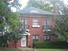 | Charles and Naomi Bachmann House | building | 2001 | 01000598 |
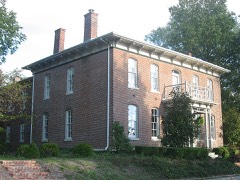 | Badollet House | building | 1990 | 90001839 |
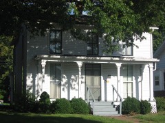 | William Jennings Bryan Boyhood Home | building | 1975 | 75000668 |
 | Centralia Commercial Historic District | district | 2012 | 12000060 |
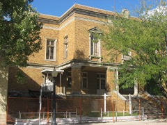 | Centralia Elk's Lodge, The | building | 2011 | 08001171 |
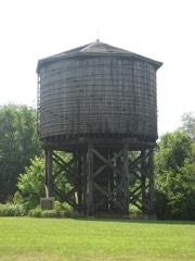 | Illinois Central Railroad Water Tower and Pump House | structure | 1998 | 98001355 |
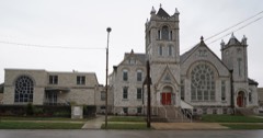 | Methodist Episcopal Church | building | 2018 | 100002823 |
 | Calendar Rohrbough House | building | 1979 | 79000857 |
 | Sentinel Building | building | 1978 | 78001169 |
Every wildfire the federal occurrence database records inside this county: 5 of them, burning under an acre. None started naturally and 3 were recorded as arson. Each settlement page carries the fires within five miles of it.
| Reported cause | Fires |
|---|---|
| Arson/incendiarism | 3 |
| Recreation and ceremony | 1 |
| Missing data/not specified/undetermined | 1 |
The five largest, by the area the report gives. Three of them were set deliberately.
| Date | Cause | Size | Reported by | Name on the report |
|---|---|---|---|---|
| 19 July 2004 | Recreation and ceremony | under an acre | Illinois State Fire Marshal's Office | not named |
| 6 March 2016 | Arson/incendiarism | under an acre | Illinois Division of Forestry Resources | 016-020 |
| 6 March 2016 | Arson/incendiarism | under an acre | Illinois Division of Forestry Resources | 016-022 |
| 6 March 2016 | Arson/incendiarism | under an acre | Illinois Division of Forestry Resources | 16-021 |
| 23 October 2010 | Missing data/not specified/undetermined | under an acre | Illinois Division of Forestry Resources | 10168 |
Every settlement page carries the fires within five miles of it - see the settlement index below.
The NOAA Storm Events Database holds 376 reports for this county, causing 7 deaths, 22 injuries and about $11,293,386 in recorded property damage. Each settlement page carries the reports that name it.
| Kind of event | Reports |
|---|---|
| Thunderstorm Wind | 206 |
| Hail | 100 |
| Tornado | 34 |
| Flash Flood | 31 |
| Heavy Rain | 3 |
| Flood | 2 |
The most serious of them, by death, then injury, then recorded damage. The accounts are quoted exactly as the forecast office filed them.
| When | Event | Place named | Harm | What the report says |
|---|---|---|---|---|
| December 2015 | Flash Flood | Vernon | 5 killed | Automated gauges in the area only measured about an inch of rain between 3 pm and 8 pm. However, this was enough for Louse Creek to rise, covering Farthing Road at a low water crossing, about half a mile north of intersection with Britt Road. A family of 5 was traveling from Kentucky to Minnesota and somehow got lost after getting off of I-57. The family ended up about 2 miles southeast of Patoka, going north on Farthing Road. In the dark, the driver probably did not see the rushing water over the roadway before it was too late. The vehicle was carried about 150 to 200 feet downstream and became lodged in some trees. An occupant of the vehicle called 911 about 730 pm, but shortly after a firefighter arrived on the scene, the car became dislodged and sank. Dive teams recovered the car from the water several hours later. All 5 occupants were pronounced dead from drowning just before midnight. The flooding did not affect any structures in the area, just road flooding in a few locations. Also, this area of flooding was well removed from the axis of the heaviest rain that stretched from the eastern Ozarks into central Illinois. |
| May 2002 | Tornado (F1) | Centralia | 2 killed | A small but deadly tornado struck the south part of Centralia and devastated the Rosewood and Collinsworth Mobile Home Parks. Forming quickly on the leading edge of a squall line, the tornado hit shortly after 200 am, when most residents were asleep. An Illinois Emergency Management Agency damage assessment listed 12 mobile homes as being destroyed, 1 home destroyed, 1 mobile home with major damage, 1 home with minor damage, and 3 mobile homes with minor damage. 2 people were killed, both in mobile homes. |
| April 1996 | Tornado (F2) | Odin | 7 hurt, $7,000,000 | no account filed |
| May 1999 | Tornado (F1) | Kell | 4 hurt | no account filed |
| July 2023 | Thunderstorm Wind | Junction City | 3 hurt | Widespread wind damage across the southern half of Marion County. Numerous tree limbs, power lines and trees were blown down in Sandoval, Junction City, Centralia, Odin, Salem, Cartter and Kell. About three miles south of Odin, a large tree fell onto an occupied mobile home. Three people were in the mobile home at the time, but were able to escape with only minor injuries. |
| March 2025 | Thunderstorm Wind | Cartter | 2 hurt, $150,000 | Thunderstorm winds knocked a tree on a home, trapping two residents in the house. |
| April 2006 | Thunderstorm Wind | Patoka | 2 hurt | no account filed |
| April 1994 | Thunderstorm Wind | Pakota | 1 hurt, $50,000 | A mobile home was severely damaged in Pakota causing one minor injury. The county sheriff also reported numerous trees down from Pakota to Kinmundy. |
| May 1996 | Thunderstorm Wind | Sandoval | 1 hurt, $25,000 | no account filed |
| June 2003 | Thunderstorm Wind | Centralia | 1 hurt | no account filed |
| May 1973 | Tornado (F1) | not stated | 1 hurt | no account filed |
| March 2023 | Tornado (EF1) | Selmaville | $2,000,000 | At 8:11 PM CDT, a tornado touched down to the southwest of Salem, IL, near the intersection of Selmaville Rd and Lowery Ln. There it damaged several trees before moving through a forested area. The tornado then moved through a neighborhood, resulting in more tree damage, roofing and siding damage to a number of homes, and the collapse of a newly built large garage. Next, the tornado intensified as it moved through the southern portion of Salem, IL, damaging several homes, businesses, and numerous trees. This includes significant damage to the roof and walls of a commercial building and a home that was shifted off of its foundation. The tornado continued east of town, moving through a golf course and more wooded areas before approaching U.S. Highway 50 east of Salem. As the tornado crossed the highway, it collapsed a large outbuilding before quickly dissipating. Overall, the tornado was rated EF1 with a max wind speed of 105 mph. The path length was 5.95 miles with a max path width of 250 yards. No deaths or injuries were reported. |
| August 1993 | Hail | Salem | $500,000 | The Illinois State Police reported 12-inch diameter tree limbs broken off in Salem. Park officials from Stephen A. Forbes State Park reported hail larger than baseballs fell several minutes later between Omega and Iuka. A total of 10 cars had their windshields and windows either damaged or smashed. Several nearby church windows were also broken and four homes had roof damage. Crops were leveled in a 3 mile long and 0.5 mile wide path. |
| May 1996 | Thunderstorm Wind | Salem | $250,000 | no account filed |
| March 1976 | Tornado (F2) | not stated | $250,000 | no account filed |
| April 1975 | Tornado (F1) | not stated | $250,000 | no account filed |
| April 2025 | Flash Flood | Fairman | $100,000 | Town Creek in Salem rose rapidly due to heavy rain and was level with Eastlawn Cemetery and Tully Park. The emergency manager in Salem issued a voluntary evacuation of Starlight Mobile Home Park, which occurs anytime flooding conditions of this scale are present. A majority of main routes in and out of Salem were inundated with water and closed with cars floating in the floodwater down West Main Street. The reservoir overflow channel was topped and water flowed into the town park and inundated homes to its south. In Centralia, 4 to 5 fete of water covered Locust Street near a major production facility. Heavy rains of up to 8.5 inches fell during the event. |
| February 1999 | Hail | Salem | $100,000 | no account filed |
| April 1996 | Tornado (F1) | Salem | $70,000 | no account filed |
| April 1994 | Thunderstorm Wind | Centralia | $50,000 | Trees and power lines were blown down damaging several parked cars. |
| April 1994 | Thunderstorm Wind | Kell | $50,000 | Numerous large trees were blown down from Kell extending eastward to the county line. One tree fell on a garage in Kell heavily damaging it. |
| April 1993 | Thunderstorm Wind | Central City | $50,000 | The county sheriff's office reported trees and power lines down southwest of Salem. The county ESDA director reported trees and power lines down in Centralia along with numerous mobile homes and a few garages damaged in Central City. |
| April 1998 | Tornado (F2) | Walnut Hill | $50,000 | no account filed |
| February 1999 | Thunderstorm Wind | Junction City | $40,000 | no account filed |
| April 2024 | Tornado (EF1) | Vernon | $30,000 | Around 5:21 pm, a brief tornado touched down just southeast of the intersection of North 600th Street and Davis Road, where it destroyed a farm outbuilding, lofting debris into surrounding trees and powerlines. The tornado continued to the northeast causing minor damage to the roof of a small farm shed on Flat Creek Drive before lifting and dissipating. The tornado was rated EF-1 with a maximum estimated wind speed of 90 mph. The path length was 1.26 miles with a maximum path width of 25 yards. No deaths or injuries were reported. |
| June 2022 | Thunderstorm Wind | Centralia | $30,000 | Thunderstorm winds blew down numerous large tree limbs, trees and power lines between Centralia and Salem. Half of Centralia was without power for a few hours due to the downed power lines. |
| July 2022 | Thunderstorm Wind | Iuka | $25,000 | Thunderstorm winds blew down several trees, numerous tree limbs, and power lines. Also, a couple of houses sustained minor to moderate damage from the fallen trees and tree limbs. |
| March 2008 | Flash Flood | Vernon | $25,000 | Up to 7 inches of rain fell on already saturated soils in Washington county from the late evening hours of March 17th through March 18th. Numerous roads were flooded throughout the county. Salem Town Creek which runs from the reservoir on the north side of Salem towards the east then southeast side of town where there is another reservoir, was overflowing. A mobile home park on the east side of town near the eastern reservoir had 6 to 8 inches of water surrounding 6 mobile homes, but did not flood the structures themselves. Just east of Central City, a combination of 16 homes and mobile homes were experiencing high water due to Raccoon Creek being out of its banks. |
| March 2026 | Thunderstorm Wind | Salem | $22,000 | Thunderstorm winds downed numerous tree limbs and power lines in Salem. At least one large tree was uprooted. Falling branches or a downed tree damaged at least one home. A farm outbuilding was destroyed. |
| April 2025 | Thunderstorm Wind | Salem | $20,000 | Thunderstorm winds knocked down a few powerlines in Salem. They also produced sporadic tree damage throughout the county. |
| June 1997 | Thunderstorm Wind | Alma | $20,000 | Wind gusts estimated at 75 mph downed trees and power lines and caused some roof damage. Much of the roof damage was caused by trees falling on structures. |
| February 1999 | Thunderstorm Wind | Salem | $20,000 | no account filed |
| May 2022 | Thunderstorm Wind | Texas Corner | $15,000 | Thunderstorm winds blew down numerous tree limbs around town. |
| March 2025 | Thunderstorm Wind | Salem | $10,000 | Thunderstorm winds downed power lines which caused a minor fire. |
| March 2025 | Thunderstorm Wind | Centralia | $10,000 | The Centralia emergency manager reported multiple power lines downed due to thunderstorm winds. |
| May 1996 | Tornado (F0) | Odin | $10,000 | no account filed |
| May 2024 | Thunderstorm Wind | Centralia Muni Arpt | $5,000 | A tree was reported down near Centralia, blocking Woods Lane. A power pole was over the roadway in Kell. |
| May 2024 | Thunderstorm Wind | Salem | $5,000 | There were numerous public reports of extensive tree damage around Salem. A light pole was also downed in town. The Salem AWOS measured a 64 mph gust as the storm moved through. |
| May 2024 | Tornado (EF0) | Fairman | $5,000 | The damage survey was not completed on the east side of Carlyle Lake including the portion of the track in Marion County. The survey relies on the support of subsequent reports until the tornado was suspected to have lifted just west of Hwy 51 north of Fairman where a small barn or farm outbuilding sustained major loss of its roof panels. The tornado was rated an EF1 in Marion County with a path length of 0.86 miles and a max path width of 25 yards. No deaths or injuries were reported. Overall, the tornado was rated EF1 with a path length of 18.5 miles and a max path width of 325 yards. |
| May 2024 | Tornado (EF1) | Omega | $5,000 | A tornado touched down just northwest of Omega and tracked eastward south of Forbes Lake primarily uprooting and snapping trees along its path and causing minor roof damage to a farm outbuilding on Seavers Road. The tornado then crossed into Clay County (WFO ILX) and strengthened to EF2 intensity. The tornado was rated EF1 in Marion County with a path length of 4.66 miles and a max path width of 500 yards. Overall, the tornado was rated EF2 with a path length of 8.28 miles and a max path width of 500 yards. No deaths or injuries were reported. |
| April 2024 | Thunderstorm Wind | Salem | $5,000 | A large tree was uprooted and fell onto a mobile home. |
| March 2023 | Thunderstorm Wind | Patoka | $5,000 | A large weighted patio table was blown into two trucks on the property, causing minor damage. |
| July 2021 | Thunderstorm Wind | Centralia Res | $5,000 | Thunderstorm winds blew down several trees just east of Central City. Another large tree, that was partially rotted, was snapped off at the base in Salem. |
| July 2001 | Thunderstorm Wind | Alma | $5,000 | Emergency management officials reported numerous trees and power lines down in the Alma area. One tree fell on a house and another on a car. |
| April 1994 | Thunderstorm Wind | Kinmundy | $5,000 | A mobile home was severely damaged in Pakota causing one minor injury. The county sheriff also reported numerous trees down from Pakota to Kinmundy. |
| April 1993 | Thunderstorm Wind | Salem | $5,000 | The county sheriff's office reported trees and power lines down southwest of Salem. The county ESDA director reported trees and power lines down in Centralia along with numerous mobile homes and a few garages damaged in Central City. |
| April 1993 | Thunderstorm Wind | Centralia | $5,000 | The county sheriff's office reported trees and power lines down southwest of Salem. The county ESDA director reported trees and power lines down in Centralia along with numerous mobile homes and a few garages damaged in Central City. |
| May 1995 | Thunderstorm Wind | Centralia | $4,100 | Numerous trees were snapped off and roofs damaged south of Odin while a mobile home south of Salem was completely destroyed. Several stores in Centralia also had broken windows and trees were blown down damaging parked cars. |
| May 1995 | Thunderstorm Wind | Odin | $3,500 | Numerous trees were snapped off and roofs damaged south of Odin while a mobile home south of Salem was completely destroyed. Several stores in Centralia also had broken windows and trees were blown down damaging parked cars. |
| June 1960 | Tornado (F1) | not stated | $2,500 | no account filed |
| July 1959 | Tornado (F1) | not stated | $2,500 | no account filed |
| June 2008 | Flash Flood | Tonti | $1,000 | Two to three inches of rain fell onto already saturated soils in Marion county. Several streets in Salem had over 6 inches of water on them causing them to be closed to traffic for a time until the water receded. |
| June 2008 | Flash Flood | Vernon | $1,000 | Two to four inches of rain fell in a short amount of time over northern Marion county. Numerous secondary roads were water covered and impassable especially in the Patoka, Vernon and Kinmundy areas. U.S. Highway 51 and Illinois Route 37 were affected as well in some locations. |
| August 1993 | Thunderstorm Wind | Salem | $500 | The Illinois State Police reported 12-inch diameter tree limbs broken off in Salem. Park officials from Stephen A. Forbes State Park reported hail larger than baseballs fell several minutes later between Omega and Iuka. A total of 10 cars had their windshields and windows either damaged or smashed. Several nearby church windows were also broken and four homes had roof damage. Crops were leveled in a 3 mile long and 0.5 mile wide path. |
| August 1995 | Thunderstorm Wind | Salem | $400 | The county sheriff's department reported trees and power lines down. |
| June 1995 | Thunderstorm Wind | Centralia | $300 | Large trees and tree limbs were blown down. Winds gusts in Centralia were estimated at 60 mph. |
| May 1995 | Thunderstorm Wind | Sandoval | $200 | Large trees were blown down along Highway 51. |
| June 1995 | Thunderstorm Wind | Odin | $200 | Large trees and tree limbs were blown down. Winds gusts in Centralia were estimated at 60 mph. |
| May 1995 | Thunderstorm Wind | Salem | $156 | Numerous trees were snapped off and roofs damaged south of Odin while a mobile home south of Salem was completely destroyed. Several stores in Centralia also had broken windows and trees were blown down damaging parked cars. |
| March 1974 | Tornado (F1) | not stated | $30 | no account filed |
The Survey's mineral resources record lists 4 workings inside this county. None of them still produces: all are closed or unrecorded. Each settlement page carries the workings within five miles of it.
| Commodity | Workings |
|---|---|
| Stone | 2 |
| Stone, Crushed/Broken | 2 |
The least common of them first, because a county's hundredth gravel pit says nothing its first ten did not.
| Where | Site | Commodity | Status | Recorded |
|---|---|---|---|---|
| Centralia City Pit | Stone | Past Producer | ||
| Limestone Prospect | Stone, Crushed/Broken | Occurrence | ||
| Marion County Pit | Stone | Past Producer | ||
| Shufeldt Property | Stone, Crushed/Broken | Past Producer |
Brinkerhoff's History of Marion County, Illinois devotes a chapter to each township: its boundaries and streams, who settled it and when, the mills, the schools and the churches. All 7 are reproduced here in full. Each row shows the township's own shape and where it lies in the county, drawn from the Census Bureau's boundary. Which settlements belong to which township is computed from that same boundary, not taken from the book.
| Shape and position in the county | Township | Settlements in it | Length | Sections |
|---|---|---|---|---|
| Alma Township | Alma, Brubaker | 746 words | 0 | |
| Centralia Township | Central City, Centralia, Walnut Hill | 3,494 words | 0 | |
| Kinmundy Township | Kinmundy | 629 words | 0 | |
| Odin Township | Odin | 2,243 words | 0 | |
| Omega Township | Omega | 969 words | 0 | |
| Salem Township | Salem, Selmaville | 1,715 words | 0 | |
| Stevenson Township | Bannister | 166 words | 0 |
One book written about this county, cut here where the book itself is cut, at its printed chapters: 1 chapter in all. Every chapter is public domain, machine-read from the scan and reproduced complete. A chapter already given under one of the county's towns is not repeated in this list.
| Chapter | Length |
|---|---|
| The whole text | 417,507 words in 27 parts |
Named settlements recorded in the Geographic Names Information System, each with the topographic sheets covering it. Villages, hamlets and abandoned places alike. Each is shown with the nearest named watercourse or landform and the survey quadrangle it falls on.
Centralia township · 62801 · On Turkey Creek · Centralia West quadrangle
12 sheets, 1914 to 1985
Romine township · 62889 · On Crooked Creek · Harmony quadrangle
11 sheets, 1933 to 1982
Centralia township · 62893 · Near Creeds Hill · Walnut Hill quadrangle
9 sheets, 1943 to 1985