 Block
Opdyke, Illinois
12 topographic sheets cover this place, the earliest surveyed in 1933 and the latest in 1982. It stands in Pendleton Township. It lies in ZIP code area 62872. The Survey maps it on the Opdyke quadrangle. 236 people lived here at the 2020 count. It stands 515 feet above sea level.
Population over time
2 figuresOpdyke fell from 254 to 236 between 2010 and 2020. These are the recorded population figures Wikidata holds for this place, reached through the Geographic Names Information System number this page is keyed on rather than by name, so they belong to this place and not to another of the same name. Most are census counts, but not all are: an early figure may be a founding or settlement estimate, and an estimate published within five years of a census is left out. The change column is computed, and is left blank where more than 20 years separate a figure from the one before it, because a gap that long is not a change between two counts.
| Year | People | Change |
|---|---|---|
| 2010 | 254 | |
| 2020 | 236 | -18 (-7%) |
Topographic sheets covering this place
7 surveys from 12 printed sheetsMatched by testing this settlement's coordinate against the published boundary of every sheet in the United States Geological Survey's historical collection. Each opens the scanned sheet at the Survey.
- 1933 USGS Mount Vernon quadrangle1:48000
- 1933 USGS Mount Vernon quadrangle1:62500, 2 printings
- 1940 USGS Mount Vernon quadrangle1:62500, 2 printings
- 1958 USGS Belleville quadrangle1:250000, 3 printings
- 1962 USGS Belleville quadrangle1:250000
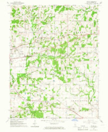
- 1964 USGS Opdyke quadrangle1:24000, 2 printings
- 1982 USGS Mount Vernon quadrangle1:100000


In the county-history sources
9,393 words on this townshipHistory of Jefferson County, Illinois, published 1883 names this settlement in its chapter on Pendleton Township. These are the passages that mention it, exactly as the scans read.
ORLANDO M. D. HAM, farmer. P. O. Opdyke. was born July 4, 1840, in Jefferson County, 111. His father, James Ham, was born 1805, in Kentucky; he died in 1845 He was classed among our best citizens. His father, Moses Ham, was also a native of Kentucky. James Ham followed farming, tanning and merchandising as his occupation. The mother of our subject, Frances T. Crisel, a native of Gallatin County, 111., was born February 8, 1817. Her parents, Henry and Sally (Truss) Crisel, were natives of North Carolina. Our subject has one brother living - Christopher C. , who is connected with the Mount Vernon National Bank. Mr. Ham early turned his attention to farming, and at present owns 160 acres of good land. He was joined in matrimony, February 10, 1862, in this county, to Marinda E. Goodner, who was born June 28, 1838, in Washington County, III. She was a daughter of Elijah Goodner. and is the mother of three children, viz., Charles R., born November 22, 1862; Orley T.. born January 18, 1868, and Ulah Duve, infant girl, deceased. Mr. and
Passage source: History of Jefferson County, Illinois, published 1883.
Machine-read from a century-old scan, so expect the errors a machine makes: misspelled names, dropped words, stray characters.
Read the whole chapter on Pendleton Township - it names this place 14 more 14 times.
Storms near this place
5 since 2008Regional context, not property-specific evidence. The National Weather Service names Opdyke in 5 storm reports between 2008 and 2013: 2 hail, 2 thunderstorm wind, 1 tornado. No death or injury is recorded in these reports. Each account below is quoted exactly as the forecast office filed it, from the NOAA Storm Events Database, and each date opens the federal record of that event.
| When | Event | Place named | Harm | What the report says |
|---|---|---|---|---|
| August 2010 | Thunderstorm Wind | Opdyke | $40,000 | Siding was pulled off homes and a boat was thrown into a woodpile. Trees were blown over, including a large oak tree. Vinyl fencing was blown across a yard. Tree limbs were down on roads. |
| November 2013 | Tornado (EF1) | Opdyke | $3,000 | Several trees were snapped during this brief touchdown on the north side of Interstate 64. Peak winds were estimated near 105 mph. |
| June 2010 | Thunderstorm Wind | Opdyke | $2,000 | Large tree limbs were blown down. |
| June 2008 | Hail | Opdyke | - | The second of three waves of hail in the Opdyke area produced nickel size hail. |
| June 2008 | Hail | Opdyke | - | Reports from the SHAVE (Severe Hazards Analysis and Verification Experiment) project and a local television station indicated hail up to golf ball size occurred. The hail damaged wheat crops. |
Nearest settlements
The eight closest, with where each one stands in the county. Distances are straight-line, computed from the Geographic Names Information System coordinates.
| Map | Place | Distance | Sheets |
|---|---|---|---|
| Lynchburg (historical) | 1.9 miles | 12 | |
| Harris Grove (historical) | 2.9 miles | 10 | |
| Shirley | 3.1 miles | 12 | |
| Belle Rive | 3.2 miles | 10 | |
| Marlow | 4.2 miles | 12 | |
| Bakerville | 5.7 miles | 12 | |
| Camp Ground | 5.9 miles | 12 | |
| Bluford | 6.0 miles | 10 |
Elsewhere
Matched on this settlement's Geographic Names Information System number rather than its name, so it cannot be a different place of the same name in another state.
| Wikipedia article on Opdyke | An encyclopaedic summary. Its text is share-alike, so it is linked here rather than copied. |
| Wikidata item Q7095650 | The structured record the population and elevation above come from. Public domain (CC0). |
Provenance
This settlement is recorded in the Geographic Names Information System as feature 415134. The sheet list is computed by point-in-boundary test against the United States Geological Survey's historical topographic inventory. Both are works of the United States government and carry no copyright under 17 U.S.C. 105.
Storms. NOAA National Centers for Environmental Information, Storm Events Database https://www.ncei.noaa.gov/stormevents/ A work of the United States government, no copyright under 17 U.S.C. 105. Narratives are quoted verbatim from the National Weather Service report and are not edited or summarised.