 Block
Paw Paw, Illinois
8 topographic sheets cover this place, the earliest surveyed in 1951 and the latest in 1985. It stands in Wyoming Township. It lies in ZIP code area 61353. The Survey maps it on the Paw Paw quadrangle. 830 people lived here at the 2020 count. It stands 945 feet above sea level.
On record in Paw Paw
Buildings and businesses the archive holds for this place. Each opens its own page, with the source record it came from.
On the National Register 1 record
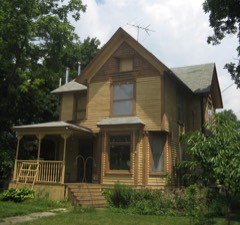 Stephen Wright Houselisted 2005
Population over time
2 figuresPaw Paw fell from 870 to 830 between 2010 and 2020. These are the recorded population figures Wikidata holds for this place, reached through the Geographic Names Information System number this page is keyed on rather than by name, so they belong to this place and not to another of the same name. Most are census counts, but not all are: an early figure may be a founding or settlement estimate, and an estimate published within five years of a census is left out. The change column is computed, and is left blank where more than 20 years separate a figure from the one before it, because a gap that long is not a change between two counts.
| Year | People | Change |
|---|---|---|
| 2010 | 870 | |
| 2020 | 830 | -40 (-5%) |
Topographic sheets covering this place
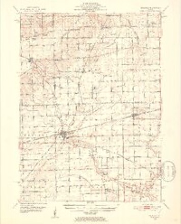
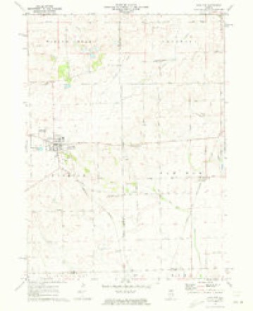
5 surveys from 8 printed sheetsMatched by testing this settlement's coordinate against the published boundary of every sheet in the United States Geological Survey's historical collection. Each opens the scanned sheet at the Survey.
- 1951 USGS Earlville quadrangle1:62500, 2 printings
- 1958 USGS Aurora quadrangle1:250000, 3 printings
- 1961 USGS Aurora quadrangle1:250000
- 1971 USGS Paw Paw quadrangle1:24000
- 1985 USGS Aurora quadrangle1:100000



What happened here
An account from the chapter on Wyoming township. The inset identifies its exact source book and publication year.
Cyclone Of 1890
"The first account of this frightful visitation is from a point twelve to fifteen miles, a little south of west from the village of Sublette, at what is known as the Blackburn Herd, where a number of cattle were killed; from there it took an easterly direction, a little north in a zig-zag course, from twenty to forty rods wide, mowing everytlung before it.
In the county-history sources
68,500 words on this townshipHistory of Lee County, published 1881 names this settlement in its chapter on Wyoming Township. These are the passages that mention it, exactly as the scans read.
Wyoming, the southeastern township of Lee county, is the congressional T. 37 N., E. 2 E. of the 3d P.M., and is bounded north by Willow creek, on the east by Paw Paw in De Kalb county, south by Earlville in La Salle county, and west by Brookljai. In the days of precincts it formed the south third of Paw Paw precinct, and when set off and organized as a township in 1850 was named Paw Paw township, and since the beautiful grove, hereafter described, that gave this name stands almost wholly in this township, and the post-office is named Paw Paw Grove, it would seem that this name should have been retained. But as the township next east chose the same name, it became necessary that one of the contending parties renounce its favorite name. It is reported, but by no means verified, that when contention began to wax hot the question was left to be decided by lot, and that the lot fell on our time-honored Paw Paw of Lee county. And it ma}^ be thought by some that this ill turn of luck is what has tended to give to the citizens of Wyoming their proverbial love for w^hatever is straight and honest and of good report, as opposed to games and " options " of luck and chance. Be that as it may, it cannot be doubted that the citizens of township 37 did then, and do to-day, fervently love their pioneer name. On the plat of their chief village we read : " Town of Paw Paw Grove." Two other villages on the township lines are designated South Paw Paw and East Paw Paw, and naturally the term West Paw Paw is much used, while the abrupt business man everywhere seems partial to the short old name, and the railroad authorities, in deference to a prevailing sentiment, so named the station. " But what's in a name," gays the poet, and so said the people. No ill-will seems to have been engendered. The change was ordered here, so at the suggestion of James Goble, and in deference to the wishes of the many w^ho came from the beautiful valley of Wyoming, the present name w^as adopted by the county commissioner's court, Isaac Harding, Warren Badger and Lorenzo Wood comprising said court, and on May 14, 1851, the board of supervisors ordered that "the township formerly called Paw Paw shall hereafter be called Wyoming."
Passage source: History of Lee County, published 1881.
The first settlers located around Paw Paw Grove. This is still a charming piece of forest. It is some three miles long, and from one to two miles wide. It lies east of the railroad station and about threefourths of it in Wyoming. From its northeast corner Paw Paw creek runs through it in a southeasterly direction, and after making a junction with Indian creek empties into the Illinois river. A small tree or shrub, unknown to many people in other parts of the United States, east and north, grows freely in this grove and bears a sweet, edible fruit, somewhat like the banana in flavor, but often larger in size.
Passage source: History of Lee County, published 1881.
This is the papaw. It was a favorite with the Indians, and gives its name (somewhat changed in spelling) to a considerable number of places. When the white settlers first came " the timber," as they called this tract, contained about two thousand acres. Unlike other groves, it was free from underbrush. The sugar maple was very abundant. There were many large black walnut trees, four kinds of oak, the hickory, and cottonwood, with a few butternuts and sycamores. " From one of the maples that grew here," says a well known physician, " in 1855, I sold considerable lumber and had left enough wood to supply all the fires of my family for a year." Plums, blackberries and gooseberries were also plentiful here. On the east side, near the county line, was an excellent spring, where the water bubbled up from the bottom, pure, sparkling and abundant, and never freezing in winter. At the northwest corner was another, in all respects equal to the former, and with a volume that seemed inexhaustible. It was the great and constant feeder to Paw Paw creek. These springs were treasures in those early days when water fit to drink was rarely seen by travelers in the west. James Goble, who came in 1837, says he has frequently seen an acre of wagons camped around the latter spring,where now stands the Oak Grove creamery, supplied by this same spring. The prairie grass of this region was remarkable in quantity, and equal to grain in quality, while in the lowlands a rider on horseback could tie the tall, rank slough-grass together above his head. Yet it was very healthy and free from ague. When Rev. Caleb Morris was seeking the most healthful location he learned from the Indians that this was their favorite resort for raising their papooses. Here then were great attractions for emigrants, but the tenure of the land was uncertain, for it was generally believed that this grove was included in Indian reservations ; and the old chief Wabonsie and his tribe still had their home within its limits when the whites began to reside here. As is well known, the Black Hawk war did not close till 1832. It had raged from Dixon southward, as well as elsewhere, and included this region. For at Indian creek, not far away, there had been a horrible massacre, and Wabonsie and his neighbor Shabbona had taken part in the campaign, though these noble red-men fought on the side of the whites. For a year later there were disturbances from disaifected Indians ; hence it was not until midwinter of 1833-4 that any white men came here and stayed even a short period, so as to make claims upon the land. It was nearly fifty years ago, yet quite a number of the early settlers are still living. Reminiscences of frontier life and adventure and the strange contrasts of the old times with the present, which they describe, have oftentimes a fascinating interest. At one period there were desperate men here, horse thieves, counterfeiters and gamblers, who gave their locality a hard name for a long time, down to as late as 1860 ; but it is matter of grateful record that those w^ho gave direction to affairs, the men who have made Wyoming what it is to-day, were strong, brave, fearless and shrewd. These old people will soon be gone. By their hearty cooperation in the effort of the historian they have done a service which all readers will appreciate. Dates and details are usually dry and tedious ; but the records of the first things that relate to our own hearthstones are specially valuable in local annals.
Passage source: History of Lee County, published 1881.
Machine-read from a century-old scan, so expect the errors a machine makes: misspelled names, dropped words, stray characters.
Read the whole chapter on Wyoming Township - it names this place 171 more 171 times.
Fires near this place
2 since 2008Regional context, not property-specific evidence. The federal wildfire occurrence database lists 2 fires within 5 miles of Paw Paw in 2008, burning about 5 acres in total. None started naturally. None was recorded as arson. Distance is straight-line from the map coordinates, so a fire counted here may appear on a neighbouring settlement's page as well.
| Reported cause | Fires |
|---|---|
| Smoking | 1 |
| Debris and open burning | 1 |
The most recent of them, most recent first, with the day each was reported and the service that recorded it.
| Date | Cause | Size | Reported by | Name on the report |
|---|---|---|---|---|
| 5 April 2008 | Debris and open burning | 2.0 acres | Illinois Division of Forestry Resources | 2 |
| 4 April 2008 | Smoking | 3.0 acres | Illinois Division of Forestry Resources | 3 |
Settlements close enough to share some of these fires:
Mines and quarries near this place
1 within 5 milesRegional context, not property-specific evidence. The federal mineral resources record lists 1 working within 5 miles of Paw Paw: 1 past producer. None of them still produces. What was taken out: Sand and Gravel, Construction. Distance is straight-line from the map coordinates, so a quarry counted here may appear on a neighbouring settlement's page as well.
| Where | Site | Commodity | Status | Recorded |
|---|---|---|---|---|
| Purdy Pit | Sand and Gravel, Construction | Past Producer |
Storms near this place
20 since 1998Regional context, not property-specific evidence. The National Weather Service names Paw Paw in 20 storm reports between 1998 and 2025: 12 hail, 7 thunderstorm wind, 1 flash flood. No death or injury is recorded in these reports. Each account below is quoted exactly as the forecast office filed it, from the NOAA Storm Events Database, and each date opens the federal record of that event.
| When | Event | Place named | Harm | What the report says |
|---|---|---|---|---|
| August 2025 | Flash Flood | Paw Paw | - | A couple of rounds of torrential rainfall brought flash flooding to parts of southeast Lee County. A video shared to social media showed a house in the Paw Paw area surrounded by floodwater with significant flooding in the yard and in nearby fields. Paw Paw Rd was flooded approximately one mile north of Paw Paw. In Compton, water was seen flowing over roads and parking lots. A private weather station in Paw Paw recorded 7.02 of storm total rain, 5.03 of which fell between 3:15 and 5:15 CST. Another private weather station near Dunn Airport northwest of Paw Paw recorded 4.67 of storm total rainfall. The flooding is estimated to have resulted in $5,000 worth of damages, mostly to crops. |
| April 2023 | Thunderstorm Wind | Paw Paw | - | A tree was blown down onto a power line. |
| March 2023 | Thunderstorm Wind | Paw Paw | - | A private weather station measured an 83 mph gust north of Meridian. |
| May 2020 | Thunderstorm Wind | Paw Paw | - | Numerous trees were blown down or snapped off in Paw Paw including along Chicago Road, Chapman Street and Maple Street. |
| June 2013 | Thunderstorm Wind | Paw Paw | - | A large oak tree was blown over along with several large branches from other trees. |
| September 2006 | Thunderstorm Wind | Paw Paw | - | Corn was flattened by wind east of Interstate 39, just southwest of Paw Paw. |
| March 2005 | Hail | Paw Paw | - | Golf ball sized hail was reported about 3 miles north of Paw Paw or 8 miles west of Shabbona. |
| July 2025 | Hail | Paw Paw | - | no account filed |
| September 2021 | Hail | Paw Paw | - | no account filed |
| September 2021 | Hail | Paw Paw | - | no account filed |
| April 2013 | Hail | Paw Paw | - | no account filed |
| May 2012 | Hail | Paw Paw | - | no account filed |
| May 2012 | Hail | Paw Paw | - | no account filed |
| March 2007 | Thunderstorm Wind | Paw Paw | - | no account filed |
| September 2006 | Hail | Paw Paw | - | no account filed |
| May 2004 | Hail | Paw Paw | - | no account filed |
| May 2003 | Hail | Paw Paw | - | no account filed |
| May 2003 | Hail | Paw Paw | - | no account filed |
| July 2003 | Thunderstorm Wind | Paw Paw | - | no account filed |
| May 1998 | Hail | Paw Paw | - | no account filed |
Nearest settlements
The eight closest, with where each one stands in the county. Distances are straight-line, computed from the Geographic Names Information System coordinates.
| Map | Place | Distance | Sheets |
|---|---|---|---|
| East Paw Paw | 2.2 miles | 8 | |
| South Paw Paw | 2.7 miles | 8 | |
| Roxbury | 3.2 miles | 11 | |
| Radley | 4.1 miles | 8 | |
| Compton | 5.3 miles | 11 | |
| The Burg | 6.3 miles | 11 | |
| Welland | 6.4 miles | 11 | |
| Scarboro | 7.0 miles | 11 |
Elsewhere
Matched on this settlement's Geographic Names Information System number rather than its name, so it cannot be a different place of the same name in another state.
| Wikipedia article on Paw Paw | An encyclopaedic summary. Its text is share-alike, so it is linked here rather than copied. |
| Wikidata item Q2225657 | The structured record the population and elevation above come from. Public domain (CC0). |
Provenance
This settlement is recorded in the Geographic Names Information System as feature 415463. The sheet list is computed by point-in-boundary test against the United States Geological Survey's historical topographic inventory. Both are works of the United States government and carry no copyright under 17 U.S.C. 105.
Wildfire. Short, Karen C. 2022. Spatial wildfire occurrence data for the United States, 1992-2020 [FPA_FOD_20221014]. 6th Edition. Fort Collins, CO: Forest Service Research Data Archive. https://doi.org/10.2737/RDS-2013-0009.6 Collected with United States Government funding and usable without additional permissions or fees.
Mines and quarries. USGS Mineral Resources Data System (MRDS) https://mrdata.usgs.gov/mrds/ A work of the United States government, no copyright under 17 U.S.C. 105.
Storms. NOAA National Centers for Environmental Information, Storm Events Database https://www.ncei.noaa.gov/stormevents/ A work of the United States government, no copyright under 17 U.S.C. 105. Narratives are quoted verbatim from the National Weather Service report and are not edited or summarised.