 Block
South Paw Paw, Illinois
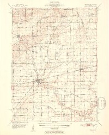
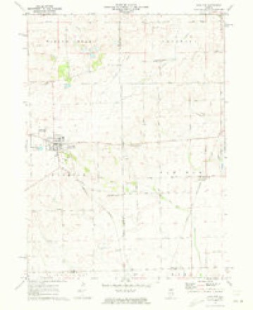
8 topographic sheets cover this place, the earliest surveyed in 1951 and the latest in 1985. It stands in Wyoming Township. It lies in ZIP code area 60518. The Survey maps it on the Paw Paw quadrangle.
Topographic sheets covering this place
5 surveys from 8 printed sheetsMatched by testing this settlement's coordinate against the published boundary of every sheet in the United States Geological Survey's historical collection. Each opens the scanned sheet at the Survey.
- 1951 USGS Earlville quadrangle1:62500, 2 printings
- 1958 USGS Aurora quadrangle1:250000, 3 printings
- 1961 USGS Aurora quadrangle1:250000
- 1971 USGS Paw Paw quadrangle1:24000
- 1985 USGS Aurora quadrangle1:100000



What happened here
An account from the chapter on Wyoming township. The inset identifies its exact source book and publication year.
Cyclone Of 1890
"The first account of this frightful visitation is from a point twelve to fifteen miles, a little south of west from the village of Sublette, at what is known as the Blackburn Herd, where a number of cattle were killed; from there it took an easterly direction, a little north in a zig-zag course, from twenty to forty rods wide, mowing everytlung before it.
In the county-history sources
68,500 words on this townshipHistory of Lee County, published 1881 names this settlement in its chapter on Wyoming Township. These are the passages that mention it, exactly as the scans read.
Wyoming, the southeastern township of Lee county, is the congressional T. 37 N., E. 2 E. of the 3d P.M., and is bounded north by Willow creek, on the east by Paw Paw in De Kalb county, south by Earlville in La Salle county, and west by Brookljai. In the days of precincts it formed the south third of Paw Paw precinct, and when set off and organized as a township in 1850 was named Paw Paw township, and since the beautiful grove, hereafter described, that gave this name stands almost wholly in this township, and the post-office is named Paw Paw Grove, it would seem that this name should have been retained. But as the township next east chose the same name, it became necessary that one of the contending parties renounce its favorite name. It is reported, but by no means verified, that when contention began to wax hot the question was left to be decided by lot, and that the lot fell on our time-honored Paw Paw of Lee county. And it ma}^ be thought by some that this ill turn of luck is what has tended to give to the citizens of Wyoming their proverbial love for w^hatever is straight and honest and of good report, as opposed to games and " options " of luck and chance. Be that as it may, it cannot be doubted that the citizens of township 37 did then, and do to-day, fervently love their pioneer name. On the plat of their chief village we read : " Town of Paw Paw Grove." Two other villages on the township lines are designated South Paw Paw and East Paw Paw, and naturally the term West Paw Paw is much used, while the abrupt business man everywhere seems partial to the short old name, and the railroad authorities, in deference to a prevailing sentiment, so named the station. " But what's in a name," gays the poet, and so said the people. No ill-will seems to have been engendered. The change was ordered here, so at the suggestion of James Goble, and in deference to the wishes of the many w^ho came from the beautiful valley of Wyoming, the present name w^as adopted by the county commissioner's court, Isaac Harding, Warren Badger and Lorenzo Wood comprising said court, and on May 14, 1851, the board of supervisors ordered that "the township formerly called Paw Paw shall hereafter be called Wyoming."
Passage source: History of Lee County, published 1881.
The following picturesque description of the man is by Andrew Breese : " David A. Town was a remarkable man, known all over this country. Smart, energetic, jolly,drank a little when away from home,but not so much as not to know what he was about ; square man ; wanted to rule; wanted others to come to him for advice; very resolute, large size, strong, rough man, cock of the walk ; as long as he lived was for Paw Paw."
Passage source: History of Lee County, published 1881.
About the time that Butterfield was making the first beginning in the township, on the present site of Paw Paw village, John Ploss made a small improvement on the south side of the grove, and in like manner led the way to the settlement of south Paw Paw. He built his house in the woods, on the bank of the creek, some forty rods north of Deacon Hallock's, and fenced five acres of ground, but remained not later than fall, when he went back to Michigan. Eber St. John bought the claim. This man had some property, was inoffensive, and too forceless to keep the best company. In a little while he moved to Shabbona, where he mysteriously disappeared, and it was supposed that he had been murdered for his money. His claim embraced the larger part of South Paw Paw, and was purchased by Deacon Orlando Boardman.
Passage source: History of Lee County, published 1881.
Machine-read from a century-old scan, so expect the errors a machine makes: misspelled names, dropped words, stray characters.
Read the whole chapter on Wyoming Township - it names this place 23 more 23 times.
Fires near this place
2 since 2008Regional context, not property-specific evidence. The federal wildfire occurrence database lists 2 fires within 5 miles of South Paw Paw in 2008, burning about 5 acres in total. None started naturally. None was recorded as arson. Distance is straight-line from the map coordinates, so a fire counted here may appear on a neighbouring settlement's page as well.
| Reported cause | Fires |
|---|---|
| Smoking | 1 |
| Debris and open burning | 1 |
The most recent of them, most recent first, with the day each was reported and the service that recorded it.
| Date | Cause | Size | Reported by | Name on the report |
|---|---|---|---|---|
| 5 April 2008 | Debris and open burning | 2.0 acres | Illinois Division of Forestry Resources | 2 |
| 4 April 2008 | Smoking | 3.0 acres | Illinois Division of Forestry Resources | 3 |
Settlements close enough to share some of these fires:
Mines and quarries near this place
1 within 5 milesRegional context, not property-specific evidence. The federal mineral resources record lists 1 working within 5 miles of South Paw Paw: 1 past producer. None of them still produces. What was taken out: Sand and Gravel, Construction. Distance is straight-line from the map coordinates, so a quarry counted here may appear on a neighbouring settlement's page as well.
| Where | Site | Commodity | Status | Recorded |
|---|---|---|---|---|
| Purdy Pit | Sand and Gravel, Construction | Past Producer |
Nearest settlements
The eight closest, with where each one stands in the county. Distances are straight-line, computed from the Geographic Names Information System coordinates.
Elsewhere
Matched on this settlement's Geographic Names Information System number rather than its name, so it cannot be a different place of the same name in another state.
| Wikidata item Q122591333 | The structured record the population and elevation above come from. Public domain (CC0). |
Provenance
This settlement is recorded in the Geographic Names Information System as feature 1816589. The sheet list is computed by point-in-boundary test against the United States Geological Survey's historical topographic inventory. Both are works of the United States government and carry no copyright under 17 U.S.C. 105.
Wildfire. Short, Karen C. 2022. Spatial wildfire occurrence data for the United States, 1992-2020 [FPA_FOD_20221014]. 6th Edition. Fort Collins, CO: Forest Service Research Data Archive. https://doi.org/10.2737/RDS-2013-0009.6 Collected with United States Government funding and usable without additional permissions or fees.
Mines and quarries. USGS Mineral Resources Data System (MRDS) https://mrdata.usgs.gov/mrds/ A work of the United States government, no copyright under 17 U.S.C. 105.