 Block
Peoria, Illinois
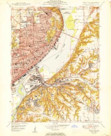
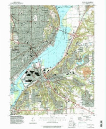
21 topographic sheets cover this place, the earliest surveyed in 1905 and the latest in 1996. It stands in Peoria City Township. It lies in ZIP code area 61602. The Survey maps it on the Peoria East quadrangle. 113,150 people lived here at the 2020 count. It stands 502 feet above sea level.
Research this city
On record in Peoria
Buildings and businesses the archive holds for this place. Each opens its own page, with the source record it came from.
On the National Register 12 of 27 shown
 Central National Park Buildinglisted 1978
 Cumberland Presbyterian Churchlisted 1980
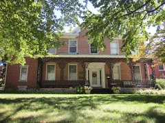 Judge Flanagan Residencelisted 1975
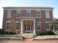 Judge Jacob Gale Houselisted 1982
 Grand Army of the Republic Memorial Halllisted 1976
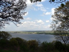 Grand View Drivelisted 1996
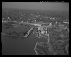 Illinois Waterway Project Officelisted 2004
 International Harvester Buildinglisted 2005
 Lincoln Branch Peoria Public Librarylisted 2014
 Madison Theatrelisted 1980
 Marquette Apartmentslisted 2016
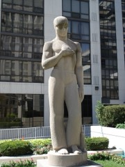 Peace and Harvestlisted 1994
Population over time
2 figuresPeoria fell from 115,007 to 113,150 between 2010 and 2020. These are the recorded population figures Wikidata holds for this place, reached through the Geographic Names Information System number this page is keyed on rather than by name, so they belong to this place and not to another of the same name. Most are census counts, but not all are: an early figure may be a founding or settlement estimate, and an estimate published within five years of a census is left out. The change column is computed, and is left blank where more than 20 years separate a figure from the one before it, because a gap that long is not a change between two counts.
| Year | People | Change |
|---|---|---|
| 2010 | 115,007 | |
| 2020 | 113,150 | -1,857 (-2%) |
Topographic sheets covering this place
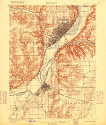
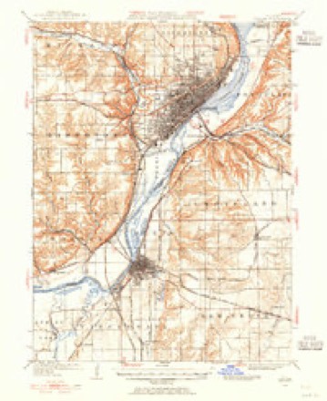
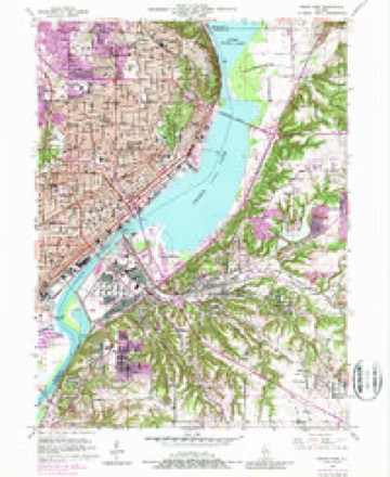
11 surveys from 21 printed sheetsMatched by testing this settlement's coordinate against the published boundary of every sheet in the United States Geological Survey's historical collection. Each opens the scanned sheet at the Survey.
- 1905 USGS Peoria quadrangle1:62500, 4 printings
- 1927 USGS Peoria quadrangle1:62500
- 1949 USGS Peoria East quadrangle1:24000, 5 printings
- 1950 USGS Peoria East quadrangle1:24000
- 1958 USGS Peoria quadrangle1:250000, 4 printings
- 1961 USGS Peoria quadrangle1:250000
- 1963 USGS Peoria quadrangle1:250000
- 1985 USGS Peoria quadrangle1:100000
- 1989 USGS Peoria quadrangle1:100000
- 1990 USGS Peoria quadrangle1:250000
- 1996 USGS Peoria East quadrangle1:24000






In the county-history sources
43,882 words on this townshipThe History of Peoria County, Illinois. Containing a History of the Northwest--history of Illinois--history of the County, Its Early Settlement, Growth, Development, Resources, Etc., Etc. .., published 1880 names this settlement in its chapter on Peoria City Township. These are the passages that mention it, exactly as the scans read.
Near the lower end of the expansion of the Illinois river denominated Lake Peoria, and on its north-western margin, midway between the two great cities of the We.st, in latitude 40°40' north and longitude 12 10' west from Wiu-^hington. upon a sandy plateau, nestles the beautiful, tlirifty city of Peoria. Were a person to ascend to the brow of the bluff three-fourths of a mile back from the margin of the lake and there leisurely survey the magnificent landscape spread out before him ; the busy city four or five miles in lengtli. witli its broad avenues, lined hy superb business blocks or palatial jirivate dwellings, nestling at its feet, semi-girdled beyond l)y T^ake Peoria and the Illinois river - a great silver mirror, upon whose surface the sunbeams dance in joyous glee - ; the many miles of fertile valley skirting their borders ; and in the distance the variegated declivities of the bluff - the frame to the picture ; and in addition to this inspiring spectacle the beholder contemplates the practical advantages of natural drainages of this gently sloping gravelly plateau ; and the furtlier grand fact tliat the country within a radius of a hunilred miles of Peoria is prf>l)ably uiiequaled by a like area in the world for productiveness, he at once recognizes a Divine handiwork in shaping this as a site for a great commercial metropolis. The observer is not surprise that tlie Indians selected it as their favorite camping ground, nor that those heroic French explorers. Father P. Manjuette, M. Joliel, Father Ilcnntpin, and M. De LaSalle, fell in love with this diarming spot and resolved to plant the first seeds of civilization here more than two luindred years ago.
Passage source: The History of Peoria County, Illinois. Containing a History of the Northwest--history of Illinois--history of the County, Its Early Settlement, Growth, Development, Resources, Etc., Etc. .., published 1880.
The site upon which the most populous portion of the city of I'eoria is built rises from the lake and river bank with a gradual slope to the height of s:'. feet at the liase of the bluff above the low water horizon ; and varies in widtli from le.ss than three-fourths of a mile at the upper end of the city to a mile and a half al the lower end. The bluffs rise from a hundreil to a luindred and twenty feet above the plateau. On the top of the bluffs are situatccl numerous priin'dy n.-sidences, surrounilfd liy amph- and ricldy decorated grounds, commanding a view of many miles of tiie city, lake, river and valley below. Farther back also rise church edifices and imposing school buildings, among which are interspersed dwellings and business houses, constituting a city of several thousand inhabitants on the highlands. The conntiy beyond presents a gently undulating surface of fertile prairie and woodland, which is converted into finely improved farms of rare productiveness. About four miles up the lake from the Court-house is Prospect Hill, which rises nearly a thousand feet above the lake, and from its summit is presented one of the most extended and charming landscape views in tlie West. Tlie upper end of Lake Peoria, some fifteen miles away, is plainly visible, as are the city of Chiliicothe still beyond and the villages of Rome and Mossville along its border. Wlien the atmosphere is veiy clear the city of Lacon, on the opposite shore of the river, twenty-five miles distant, can be seen. In 1850 a hotel costing if .5, 000 was erected there, covering an area of 53x76 feet, containing a fine ball room and other attractions for visitors. It was called Prospect Hill Pavillion, and was kept by Mason Gass. It was destroj^ed by fire some years ago, and was never rebuilt.
Passage source: The History of Peoria County, Illinois. Containing a History of the Northwest--history of Illinois--history of the County, Its Early Settlement, Growth, Development, Resources, Etc., Etc. .., published 1880.
Lake Peoria is simply an expansion of the Illinois river, about "20 miles long and varying in width from a half a mile to a mile and a half in common stage of water. At the narrows, three miles above the cit3% the river is compressed into its usual width of channel, thus virtually dividing the lake into two. The lake formerly abounded with a variety of water fowls, such as swans, white and blue cranes, wild geese, ducks and brants ; and fish in great quantities and variety iidiabited its waters. But now the wild fowls are greatl}^ reduced in number, and fish are not nearh' so plentiful as of yore.
Passage source: The History of Peoria County, Illinois. Containing a History of the Northwest--history of Illinois--history of the County, Its Early Settlement, Growth, Development, Resources, Etc., Etc. .., published 1880.
Machine-read from a century-old scan, so expect the errors a machine makes: misspelled names, dropped words, stray characters.
Read the whole chapter on Peoria City Township - it names this place 137 more 137 times.
Fires near this place
3 since 2009Regional context, not property-specific evidence. The federal wildfire occurrence database lists 3 fires within 5 miles of Peoria in 2009, burning about 3 acres in total. None started naturally. None was recorded as arson. Distance is straight-line from the map coordinates, so a fire counted here may appear on a neighbouring settlement's page as well.
| Reported cause | Fires |
|---|---|
| Debris and open burning | 3 |
The most recent of them, most recent first, with the day each was reported and the service that recorded it.
| Date | Cause | Size | Reported by | Name on the report |
|---|---|---|---|---|
| 3 March 2009 | Debris and open burning | 1.0 acres | Illinois Division of Forestry Resources | MURR |
| 23 March 2009 | Debris and open burning | under an acre | Illinois Division of Forestry Resources | 9273 |
| 20 March 2009 | Debris and open burning | 2.0 acres | Illinois Division of Forestry Resources | DUNDEE |
Settlements close enough to share some of these fires:
Mines and quarries near this place
10 of 12 shownRegional context, not property-specific evidence. The federal mineral resources record lists 12 workings within 5 miles of Peoria: 7 past producers, 3 producers, 1 occurrence, 1 plant. 4 still produce. What was taken out: Sand and Gravel, Construction, Stone, Crushed/Broken, Fire Clay (Refractory), Clay. Distance is straight-line from the map coordinates, so a quarry counted here may appear on a neighbouring settlement's page as well.
| Where | Site | Commodity | Status | Recorded |
|---|---|---|---|---|
| Clay Pit No 3 Peoria Brick & Tile | Clay | Producer | ||
| Peoria Blacktop S & G | Fire Clay (Refractory) | Plant | ||
| Limestone Prospect | Stone, Crushed/Broken | Occurrence | ||
| Peoria City Pit | Stone, Crushed/Broken | Past Producer | ||
| Farmdale Sand & Gravel Pit | Sand and Gravel, Construction | Producer | ||
| Joos Sand Pit | Sand and Gravel, Construction | Past Producer | ||
| Jubilee Materials Inc. | Sand and Gravel, Construction | Past Producer | ||
| Moushon Construction Co. Pit #1 | Sand and Gravel, Construction | Past Producer | ||
| Moushon Construction Co. Pit #2 | Sand and Gravel, Construction | Producer | ||
| Peoria Blacktop Sand Pit | Sand and Gravel, Construction | Past Producer |
Storms near this place
60 of 106 shownRegional context, not property-specific evidence. The National Weather Service names Peoria in 106 storm reports between 1993 and 2025: 67 thunderstorm wind, 35 hail, 2 flash flood, 2 lightning. The reports record 2 injuries. Each account below is quoted exactly as the forecast office filed it, from the NOAA Storm Events Database, and each date opens the federal record of that event.
| When | Event | Place named | Harm | What the report says |
|---|---|---|---|---|
| July 1994 | Thunderstorm Wind | Peoria | 1 hurt, $5,000 | A 30-square-foot brick facade of a building collapsed, injuring one person in a car, near downtown Peoria. |
| June 2005 | Thunderstorm Wind | Peoria | 1 hurt | A large tree limb was blown down onto a van. A roofer was blown off a roof and injured. |
| June 2009 | Thunderstorm Wind | Peoria | $100,000 | A 14-inch tree was snapped at the junction of US-150 and IL-6. Numerous other trees were blown down around the city of Peoria. In addition, multiple power outages were reported. |
| June 2010 | Thunderstorm Wind | Peoria | $75,000 | Numerous tree limbs and power lines were blown down near the Peoria Airport. Siding and shingles were stripped off several houses east of the airport. |
| June 2010 | Thunderstorm Wind | Peoria | $65,000 | Numerous large tree branches were blown down around Peoria. A firetruck was struck by a falling tree. |
| May 2011 | Thunderstorm Wind | Peoria | $60,000 | Numerous tree limbs were blown onto powerlines throughout the city of Peoria. |
| July 2016 | Thunderstorm Wind | Peoria | $50,000 | Numerous tree limbs were blown down in Peoria. |
| July 2020 | Thunderstorm Wind | Peoria | $25,000 | The roof and sheeting were torn off a building. |
| July 2009 | Thunderstorm Wind | Peoria | $25,000 | Several 6-inch diameter tree branches were blown down in Peoria. |
| August 2008 | Thunderstorm Wind | Peoria | $25,000 | Numerous trees were blown down around the city of Peoria. |
| July 2020 | Thunderstorm Wind | Peoria | $20,000 | A tree was blown onto a house. |
| June 2010 | Thunderstorm Wind | West Peoria | $20,000 | A large tree was blown down onto a house. |
| July 2008 | Thunderstorm Wind | West Peoria | $15,000 | Several trees and tree limbs were blown down. |
| July 2008 | Lightning | West Peoria | $15,000 | Lightning struck an apartment complex near Bradley University setting fire to a third floor apartment ceiling, the attic and the roof. There were no injuries. |
| June 2011 | Lightning | Peoria | $10,000 | A two story house was struck by lightning, which started an upper floor fire. The seven occupants in the house were able to escape without injury. |
| June 2009 | Thunderstorm Wind | Peoria | $6,000 | Several tree limbs were blown down. |
| July 2009 | Thunderstorm Wind | Peoria | $5,000 | Eight inch diameter tree branches were blown down onto Route 150 and Route 29. |
| September 2008 | Thunderstorm Wind | Peoria | $5,000 | A tree was blown down onto a house in Peoria. |
| July 1994 | Thunderstorm Wind | Peoria | $5,000 | Trees were blown down. Tazewell County Morton,20,1735CST,,,0,0,1,0,Thunderstorm Winds Power lines were blown down. Lightning started a tree on fire. |
| June 2013 | Thunderstorm Wind | Peoria | $4,000 | A 3-foot diameter tree was blown down in Laura Bradley Park in Peoria. A 2-foot diameter tree was snapped at the base on West Ayers Avenue and a 10-inch diameter tree was blown down onto the 700 block of West Main Street. |
| June 2013 | Thunderstorm Wind | Peoria | $3,000 | An 18-inch diameter tree was snapped off about 15 feet above the ground near the intersection of University and Gale in Peoria. A 12-inch diameter tree limb was blown down onto the road, blocking traffic on Glenwood and Columbia Terrace. |
| August 2009 | Thunderstorm Wind | Peoria | $2,000 | A 9-inch diameter tree was blown down onto Grandview Drive in Peoria. |
| July 2008 | Thunderstorm Wind | Peoria | $2,000 | An 18-inch diameter tree limb was blown down at Bradley University. |
| June 2013 | Thunderstorm Wind | Peoria | $1,000 | A 6 to 8-inch diameter tree limb was blown down onto Grand Boulevard north of War Memorial Drive. |
| July 1994 | Thunderstorm Wind | Peoria | $50 | A flag pole was blown over near Weaver Farms. |
| July 1994 | Thunderstorm Wind | Peoria | $50 | A 2-foot diameter tree was blown down across Knoxville Avenue near the American Red Cross Office. |
| August 1993 | Thunderstorm Wind | Peoria | $50 | Tree limbs were blown down. |
| May 2025 | Thunderstorm Wind | Peoria | - | Several small tree branches were blown down across Peoria. |
| June 2024 | Thunderstorm Wind | Peoria | - | A tree was blown onto a home. |
| July 2020 | Thunderstorm Wind | Peoria | - | A large maple tree was blown down on Glen Oak Avenue. |
| July 2020 | Thunderstorm Wind | West Peoria | - | An 8-inch diameter tree was blown down at Bradley University. |
| July 2020 | Thunderstorm Wind | Peoria | - | A large tree and power lines were blown down on High Street. |
| July 2020 | Thunderstorm Wind | Peoria | - | A power line was blown down. |
| August 2020 | Thunderstorm Wind | West Peoria | - | Two trees were blown down, one of which blocked a roadway. |
| June 2015 | Thunderstorm Wind | Peoria | - | A ten to eleven-inch diameter tree was snapped off. |
| April 2015 | Thunderstorm Wind | Peoria | - | Plastic panel was blown down. |
| June 2012 | Thunderstorm Wind | Peoria | - | Several power lines were blown down. |
| May 2011 | Thunderstorm Wind | Peoria | - | A 10-inch diameter tree was blown down across a road. |
| May 2011 | Thunderstorm Wind | Peoria | - | Numerous trees and power lines were blown down across the city of Peoria. |
| May 2011 | Thunderstorm Wind | Peoria | - | A tree was blown down across a road near the corner of Route 8 and Heinz Lane. |
| July 2008 | Thunderstorm Wind | Peoria | - | A ten-inch diameter tree was split by high winds. |
| September 2008 | Flash Flood | Peoria | - | I-74 near the North University Street exit in Peoria was flooded due to heavy rainfall. A vehicle became stranded in the high water. |
| June 2007 | Thunderstorm Wind | Peoria | - | A 1 foot diameter tree was blown down, as well as a few other smaller trees.| |
| April 2006 | Thunderstorm Wind | Peoria | - | Numerous trees and power lines blown down. A billboard was also blown down. |
| April 2006 | Thunderstorm Wind | Peoria | - | Numerous 2 to 4 inch tree limbs blown down. |
| May 2006 | Thunderstorm Wind | Peoria | - | A tree was blown down. |
| May 2005 | Thunderstorm Wind | Peoria | - | Numerous trees and power lines blown down. |
| July 2005 | Thunderstorm Wind | Peoria | - | Numerous large tree branches blown down. |
| September 2005 | Thunderstorm Wind | Peoria | - | Several large tree limbs were blown down on the Bradley University campus. |
| May 2004 | Flash Flood | Peoria | - | Brief heavy rains caused several roads in Peoria to become flooded. |
| May 2004 | Thunderstorm Wind | Peoria | - | Numerous trees were blown down throughout town, as well as numerous power lines. No injuries were reported. |
| July 2003 | Thunderstorm Wind | Peoria | - | Numerous tree limbs, trees and power lines were blown down. |
| February 2003 | Thunderstorm Wind | Peoria | - | Several trees and large power poles were blown down on the west and south sides of the city. No one was injured by the fallen trees or power poles. |
| July 2002 | Thunderstorm Wind | Peoria | - | Thunderstorm winds blew over a small metal shed, as well as several large tree limbs. |
| May 2001 | Thunderstorm Wind | Peoria | - | Several shingles were blown off the roof of a local restaurant. |
| August 2001 | Thunderstorm Wind | Peoria | - | An 8 to 9 inch diameter branch was blown down, blocking an alley in the city of Peoria. |
| May 2000 | Thunderstorm Wind | Peoria | - | Numerous large tree limbs were blown down. |
| June 2000 | Thunderstorm Wind | Peoria | - | Major damage to trees throughout the city. |
| June 1999 | Thunderstorm Wind | Peoria | - | In Peoria, a large tree was blown over onto a house causing minor damage. Also, several power lines were blown down as well. |
| June 1999 | Thunderstorm Wind | Peoria | - | Numerous trees and tree limbs were blown down in Peoria. Some caused minor damage to a few homes, mainly to porches and roofs. No injuries were reported. |
Nearest settlements
The eight closest, with where each one stands in the county. Distances are straight-line, computed from the Geographic Names Information System coordinates.
| Map | Place | Distance | Sheets |
|---|---|---|---|
| North Peoria | 1.7 miles | 21 | |
| West Peoria | 2.1 miles | 19 | |
| Averyville | 2.1 miles | 21 | |
| El Vista | 3.2 miles | 19 | |
| Peoria Heights | 3.8 miles | 21 | |
| Kickapoo | 3.8 miles | 19 | |
| Pottstown | 4.1 miles | 19 | |
| Golden Acres | 4.1 miles | 19 |
Elsewhere
Matched on this settlement's Geographic Names Information System number rather than its name, so it cannot be a different place of the same name in another state.
| Wikipedia article on Peoria | An encyclopaedic summary. Its text is share-alike, so it is linked here rather than copied. |
| Wikidata item Q233129 | The structured record the population and elevation above come from. Public domain (CC0). |
Provenance
This settlement is recorded in the Geographic Names Information System as feature 415536. The sheet list is computed by point-in-boundary test against the United States Geological Survey's historical topographic inventory. Both are works of the United States government and carry no copyright under 17 U.S.C. 105.
Wildfire. Short, Karen C. 2022. Spatial wildfire occurrence data for the United States, 1992-2020 [FPA_FOD_20221014]. 6th Edition. Fort Collins, CO: Forest Service Research Data Archive. https://doi.org/10.2737/RDS-2013-0009.6 Collected with United States Government funding and usable without additional permissions or fees.
Mines and quarries. USGS Mineral Resources Data System (MRDS) https://mrdata.usgs.gov/mrds/ A work of the United States government, no copyright under 17 U.S.C. 105.
Storms. NOAA National Centers for Environmental Information, Storm Events Database https://www.ncei.noaa.gov/stormevents/ A work of the United States government, no copyright under 17 U.S.C. 105. Narratives are quoted verbatim from the National Weather Service report and are not edited or summarised.