 Block
Peotone, Illinois
14 topographic sheets cover this place, the earliest surveyed in 1949 and the latest in 1991. It stands in Will Township. It lies in ZIP code area 60468. The Survey maps it on the Peotone quadrangle. 4,150 people lived here at the 2020 count. It stands 705 feet above sea level.
On record in Peotone
Buildings and businesses the archive holds for this place. Each opens its own page, with the source record it came from.
On the National Register 2 records
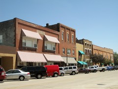 Downtown Peotone Historic Districtlisted 2005
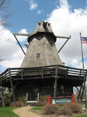 Peotone Milllisted 1982
Population over time
2 figuresPeotone grew from 4,142 to 4,150 between 2010 and 2020. These are the recorded population figures Wikidata holds for this place, reached through the Geographic Names Information System number this page is keyed on rather than by name, so they belong to this place and not to another of the same name. Most are census counts, but not all are: an early figure may be a founding or settlement estimate, and an estimate published within five years of a census is left out. The change column is computed, and is left blank where more than 20 years separate a figure from the one before it, because a gap that long is not a change between two counts.
| Year | People | Change |
|---|---|---|
| 2010 | 4,142 | |
| 2020 | 4,150 | +8 (+0%) |
Topographic sheets covering this place
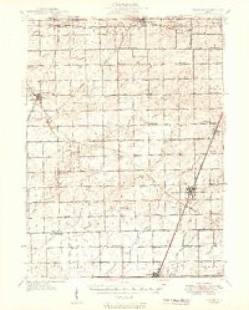
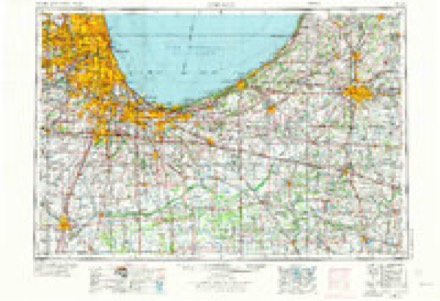
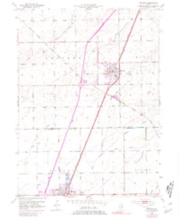
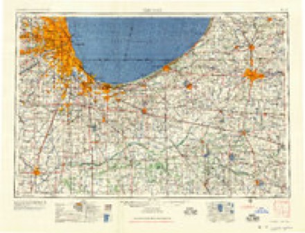
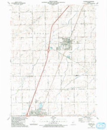
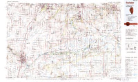
7 surveys from 14 printed sheetsMatched by testing this settlement's coordinate against the published boundary of every sheet in the United States Geological Survey's historical collection. Each opens the scanned sheet at the Survey.
- 1949 USGS Peotone quadrangle1:62500, 2 printings
- 1953 USGS Chicago quadrangle1:250000, 5 printings
- 1953 USGS Peotone quadrangle1:24000, 3 printings
- 1957 USGS Chicago quadrangle1:250000
- 1984 USGS Kankakee quadrangle1:100000
- 1990 USGS Peotone quadrangle1:24000
- 1991 USGS Kankakee quadrangle1:100000

Fires near this place
19 since 2012Regional context, not property-specific evidence. The federal wildfire occurrence database lists 19 fires within 5 miles of Peotone between 2012 and 2020, burning about 17 acres in total. 1 started naturally. 1 was recorded as arson. Distance is straight-line from the map coordinates, so a fire counted here may appear on a neighbouring settlement's page as well.
| Reported cause | Fires |
|---|---|
| Missing data/not specified/undetermined | 13 |
| Debris and open burning | 2 |
| Railroad operations and maintenance | 2 |
| Natural | 1 |
| Arson/incendiarism | 1 |
The most recent of them, most recent first, with the day each was reported and the service that recorded it.
| Date | Cause | Size | Reported by | Name on the report |
|---|---|---|---|---|
| 30 September 2012 | Missing data/not specified/undetermined | under an acre | Illinois Division of Forestry Resources | 12-690 |
| 1 September 2020 | Natural | under an acre | Illinois Division of Forestry Resources | 2020-1847 |
| 15 August 2017 | Debris and open burning | 1.0 acres | Illinois Division of Forestry Resources | 1700715 |
| 11 July 2012 | Missing data/not specified/undetermined | under an acre | Illinois Division of Forestry Resources | 12-485 |
| 26 June 2012 | Missing data/not specified/undetermined | under an acre | Illinois Division of Forestry Resources | 12-434 |
| 17 June 2017 | Railroad operations and maintenance | 1.0 acres | Illinois Division of Forestry Resources | 1700526 |
| 12 June 2017 | Arson/incendiarism | 7.0 acres | Illinois Division of Forestry Resources | 1700515 |
| 12 June 2012 | Missing data/not specified/undetermined | 1.0 acres | Illinois Division of Forestry Resources | 12-401 |
Settlements close enough to share some of these fires:
Storms near this place
48 since 1993Regional context, not property-specific evidence. The National Weather Service names Peotone in 48 storm reports between 1993 and 2025: 27 thunderstorm wind, 11 hail, 5 flood, 3 tornado. The reports record 3 injuries. Each account below is quoted exactly as the forecast office filed it, from the NOAA Storm Events Database, and each date opens the federal record of that event.
| When | Event | Place named | Harm | What the report says |
|---|---|---|---|---|
| October 2010 | Tornado (EF2) | Peotone | 2 hurt, $500,000 | A tornado touched down about 4 miles east of Peotone. The tornado produced its most intense damage along South Will Center Road, about halfway between Corning Road and Peotone-Beacher Road, removing a house's roof, collapsing exterior walls on the second floor of the house, and completely destroying a garage and three other outbuildings. Two teenage boys were injured in the house. Four power poles were also downed just northeast of the area along Peotone-Beecher Road. Additional EF1 and EF0 damage was found along a path running southwest toward Kennedy Road. This damage consisted of collapsed outbuildings, snapped cedar trees, and damage to homes. One home on Corning Road was pushed off its foundation and the chimney collapsed. |
| May 2007 | Thunderstorm Wind | Peotone | 1 hurt, $10,000 | A semi truck was blown over on Interstate 57, one mile north of Will-Peotone Road. The driver was taken to a hospital with minor injuries. Trees and tree limbs were blown down in Peotone. |
| August 2014 | Thunderstorm Wind | Peotone | $100,000 | Numerous branches larger than eight inches in diameter were blown down within a couple block radius in Peotone. A tent was blown down and there was some damage to a couple rides at the Will County Fair. A car was crushed by a downed tree on Louise Street. Tree limbs and power lines were blown down on the west side of Rathje Road. A tree around a foot in diameter snapped to the south of Conner Shaw School. |
| June 2013 | Thunderstorm Wind | Peotone | $25,000 | A semi was lifted upwards of 10 feet into the air and blown over on Interstate 57 near the northbound rest area. |
| August 2007 | Flood | Peotone | $25,000 | Minor street and basement flooding with storm total rainfall of 4.61 inches. |
| February 2017 | Thunderstorm Wind | Peotone | $5,000 | A metal roof was blown off a large barn but the rafters were still intact. |
| June 2007 | Thunderstorm Wind | Peotone | $3,000 | A 14 inch diameter tree limb was blown down and an empty pool caved in. |
| May 2025 | Thunderstorm Wind | Peotone | - | A 14 inch diameter tree limb was snapped on Crawford Street. |
| May 2025 | Thunderstorm Wind | Peotone | - | A private weather station measured a wind gust to 62 mph. |
| July 2024 | Tornado (EF0) | Peotone | - | A tornado with estimated peak winds of 85 mph touched down near the intersection of Drecksler Road and Kennedy Road where numerous large tree limbs were blown down. The tops of approximately 20 trees were sheared off about a quarter mile south of Kennedy Road. The tornado tracked nearly due east along Kennedy Road producing tree damage until it crossed Egyptian Trail where it turned to the northeast. A collapsed outbuilding and broken windows were observed to two homes near Egyptian Trail. The tornado continued producing tree damage and caused significant roof damage to a house on Will Center Road. The tornado began moving to the east near Crawford Avenue and Corning Road, producing significant tree damage in this area. Shingles were blown off a roof and a chicken coop was destroyed along Corning Road, just west of Western Avenue. The tornado then ended east of Western Avenue. |
| March 2023 | Hail | Peotone | - | A report was received of penny size to quarter size hail. |
| July 2023 | Tornado (EFU) | Peotone | - | Drone footage and high resolution satellite data revealed that a tornado touched down near north of E 12000N Road just east of S Rathje Road south of Peotone and lifted in a field between S Drecksler Road and S Ridgeland Avenue. This tornado was on the ground for less than 2 minutes and was around 15 yards wide. The only damage noted was to crops, namely soybeans. |
| August 2022 | Thunderstorm Wind | Peotone | - | A private weather station measured a wind gust to 74 mph. |
| August 2022 | Thunderstorm Wind | Peotone | - | Widespread tree damage was reported on the northwest side of Peotone. |
| August 2022 | Thunderstorm Wind | Peotone | - | Large tree limbs were blown down near Interstate 57 and Wilmington Road. |
| August 2022 | Thunderstorm Wind | Peotone | - | A wind gust to 69 mph was measured 35 feet above the ground on the police station near 3rd Street and Main Street. Numerous 4 to 5 inch diameter tree limbs were blown down with debris in roadways. |
| July 2022 | Thunderstorm Wind | Peotone | - | Several large tree limbs were blown down. |
| August 2022 | Thunderstorm Wind | Peotone | - | A nine inch diameter tree limb was blown down near Corning Avenue and Conrad Avenue. |
| September 2021 | Thunderstorm Wind | Peotone | - | Tree limbs 8 inches in diameter were blown down. |
| September 2021 | Thunderstorm Wind | Peotone | - | Ten to twelve utility poles were blown down. |
| July 2020 | Thunderstorm Wind | Peotone | - | A rotten tree fell onto a house in the 100 block of West Street. |
| June 2019 | Thunderstorm Wind | Peotone | - | Tree limbs 6 to 8 inches in diameter were blown down. |
| August 2019 | Hail | Peotone | - | Large hail to the size of golf balls fell for several minutes over much of Peotone causing damage to roofs, siding and vehicles. |
| August 2019 | Thunderstorm Wind | Peotone | - | Wind gusts were estimated to 75 mph. |
| August 2019 | Thunderstorm Wind | Peotone | - | Several large tree limbs were blown down and the roof an old barn was damaged. |
| February 2018 | Flood | Peotone | - | A 52 year old woman drown inside a car that was found submerged in a flooded ditch. |
| June 2013 | Thunderstorm Wind | Peotone | - | Large tree limbs were blown down near the corner of 3rd Street and Corning Avenue. |
| May 2013 | Thunderstorm Wind | Peotone | - | A large tree was blown down. |
| June 2011 | Flood | Peotone | - | Heavy rain measuring 2.74 inches caused 8 inches of standing water at the intersection of North Peotone Road and Center Road. |
| July 2010 | Flood | Peotone | - | Standing water was reported in streets and parking lots in Peotone. Rainfall of 2.48 inches was measured in a three hour period. |
| March 2009 | Flood | Peotone | - | Flooding was reported on rural roads outside of Peotone. Standing water of 8 to 10 inches was reported on Joliet Road one half mile east of Interstate 57. Standing water of 4 to 5 inches was reported on north Peotone Road one quarter mile west of Harlem. |
| August 2009 | Heavy Rain | Peotone | - | Rainfall of 2.06 inches was reported in the past 24 hours. |
| January 2008 | Hail | Peotone | - | Penny size hail was reported at Interstate 57 and Wilmington-Peotone Road. |
| February 1999 | Thunderstorm Wind | Peotone | - | A greenhouse was damaged at Peotone. Tree limbs and power lines were blown down in Monee. |
| July 1997 | Hail | Peotone | - | Hail measuring 1.75 inches in diameter, damaged a police car at I-57 and Harlem, just north of Peotone. |
| March 2023 | Thunderstorm Wind | Peotone | - | no account filed |
| August 2019 | Thunderstorm Wind | Peotone | - | no account filed |
| September 2019 | Hail | Peotone | - | no account filed |
| August 2014 | Thunderstorm Wind | Peotone | - | no account filed |
| June 2012 | Hail | Peotone | - | no account filed |
| June 2012 | Hail | Peotone | - | no account filed |
| October 2012 | Thunderstorm Wind | Peotone | - | no account filed |
| August 2011 | Hail | Peotone | - | no account filed |
| May 2010 | Hail | Peotone | - | no account filed |
| May 2010 | Hail | Peotone | - | no account filed |
| May 2001 | Funnel Cloud | Peotone | - | no account filed |
| June 1998 | Thunderstorm Wind | Peotone | - | no account filed |
| April 1993 | Hail | Peotone | - | no account filed |
Nearest settlements
The eight closest, with where each one stands in the county. Distances are straight-line, computed from the Geographic Names Information System coordinates.
| Map | Place | Distance | Sheets |
|---|---|---|---|
| Country Hills | 4.8 miles | 17 | |
| Heatherbrook Estates | 5.2 miles | 17 | |
| Gorman Farm | 5.4 miles | 17 | |
| Andres | 5.8 miles | 13 | |
| Ridgeland Lakes Estates | 6.0 miles | 17 | |
| Country Oaks | 6.4 miles | 17 | |
| Monee | 6.5 miles | 17 | |
| Country Meadows | 6.8 miles | 17 |
Elsewhere
Matched on this settlement's Geographic Names Information System number rather than its name, so it cannot be a different place of the same name in another state.
| Wikipedia article on Peotone | An encyclopaedic summary. Its text is share-alike, so it is linked here rather than copied. |
| Wikidata item Q2671990 | The structured record the population and elevation above come from. Public domain (CC0). |
Provenance
This settlement is recorded in the Geographic Names Information System as feature 415542. The sheet list is computed by point-in-boundary test against the United States Geological Survey's historical topographic inventory. Both are works of the United States government and carry no copyright under 17 U.S.C. 105.
Wildfire. Short, Karen C. 2022. Spatial wildfire occurrence data for the United States, 1992-2020 [FPA_FOD_20221014]. 6th Edition. Fort Collins, CO: Forest Service Research Data Archive. https://doi.org/10.2737/RDS-2013-0009.6 Collected with United States Government funding and usable without additional permissions or fees.
Storms. NOAA National Centers for Environmental Information, Storm Events Database https://www.ncei.noaa.gov/stormevents/ A work of the United States government, no copyright under 17 U.S.C. 105. Narratives are quoted verbatim from the National Weather Service report and are not edited or summarised.