 Block
Piper City, Illinois
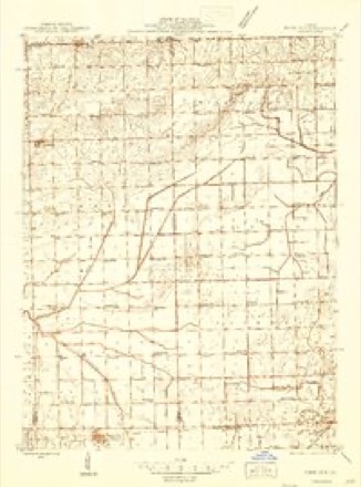
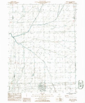
13 topographic sheets cover this place, the earliest surveyed in 1944 and the latest in 1990. It stands in Brenton Township. It lies in ZIP code area 60959. The Survey maps it on the Piper City quadrangle. 745 people lived here at the 2020 count. It stands 672 feet above sea level.
Population over time
2 figuresPiper City fell from 826 to 745 between 2010 and 2020. These are the recorded population figures Wikidata holds for this place, reached through the Geographic Names Information System number this page is keyed on rather than by name, so they belong to this place and not to another of the same name. Most are census counts, but not all are: an early figure may be a founding or settlement estimate, and an estimate published within five years of a census is left out. The change column is computed, and is left blank where more than 20 years separate a figure from the one before it, because a gap that long is not a change between two counts.
| Year | People | Change |
|---|---|---|
| 2010 | 826 | |
| 2020 | 745 | -81 (-10%) |
Topographic sheets covering this place
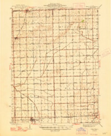
9 surveys from 13 printed sheetsMatched by testing this settlement's coordinate against the published boundary of every sheet in the United States Geological Survey's historical collection. Each opens the scanned sheet at the Survey.
- 1944 USGS Piper City quadrangle1:48000
- 1944 USGS Piper City quadrangle1:62500
- 1947 USGS Piper City quadrangle1:62500
- 1958 USGS Peoria quadrangle1:250000, 4 printings
- 1961 USGS Peoria quadrangle1:250000
- 1963 USGS Peoria quadrangle1:250000
- 1985 USGS Fairbury quadrangle1:100000, 2 printings
- 1986 USGS Piper City quadrangle1:24000
- 1990 USGS Peoria quadrangle1:250000




In the county-history sources
2,523 words on this townshipHistorical Atlas of Ford County Illinois, published 1884 names this settlement in its chapter on Brenton Township. These are the passages that mention it, exactly as the scans read.
The first schoolhouse built was the Wagner Schoolhouse, in the southeast quarter of Section 28. There are now nine school buildings in the township, and one in the village of Piper City, employing four teachers, with an average* attendance of 200 scholars.
Passage source: Historical Atlas of Ford County Illinois, published 1884.
Piper City is the principal village in the Pan Handle, and the third village in population in Ford County. It was laid out in Sec¬ tion 4, Brenton Township, by H. J. Howe, County Surveyor, for Dr. William A. Piper, of Philadelphia, Penn., and Samuel Cross, of Chicago, in 1867, and contains about 750 inhabitants. The village lies on both sides of the Wabash Railroad. It has a fine school building, four ohurches, one hotel, two newspapers - the Advertiter and Advocate - a bank, four general stores, two hard¬ ware stores, one lumber yard, three elevators, one creamery, one livery stable, one agricultural warehouse, two drug stores, two wagon and three blacksmith shops, and many other minor indus¬ tries incidental to a thriving, prosperous village.
Passage source: Historical Atlas of Ford County Illinois, published 1884.
The Piper City Dairy Association was incorporated in 1881, with Joseph Burger, President; J. A. Montelius, Secretary and Treasurer; E. H. Brooks, Manager; and Joseph Burger, J. A. Montelius, E. H. Brooks, John McKinney, Columbus Jennings, John Clark and B. F. Church, Directors. This creamery is located 6n the east side of the village, and the butter manufact¬ ured is about twenty tons per year, which is mostly sold in New Orleans at a price varying from 20 to 85 cents a pound. Their water supply is from an artesian well, which is constantly running. They use horse-power to do the churning. In summer, they churn four times a day, in winter about eight times a week. They go around among the farmers collecting the cream, which isplaced in large cans holding about twenty-five gallons each. They have about 1,000 of these cans scattered through their milk distriet.
Passage source: Historical Atlas of Ford County Illinois, published 1884.
Machine-read from a century-old scan, so expect the errors a machine makes: misspelled names, dropped words, stray characters.
Read the whole chapter on Brenton Township - it names this place 11 more 11 times.
Storms near this place
28 since 1998Regional context, not property-specific evidence. The National Weather Service names Piper City in 28 storm reports between 1998 and 2025: 14 thunderstorm wind, 8 hail, 4 tornado, 1 lightning. No death or injury is recorded in these reports. Each account below is quoted exactly as the forecast office filed it, from the NOAA Storm Events Database, and each date opens the federal record of that event.
| When | Event | Place named | Harm | What the report says |
|---|---|---|---|---|
| May 2006 | Thunderstorm Wind | Piper City | $15,000 | Trees and tree limbs were blown down. A brick garage was destroyed. |
| April 2006 | Tornado (F0) | Piper City | $10,000 | A brief tornado touched down near US 24, east of 1700E. A tool shed was knocked over. |
| May 2013 | Thunderstorm Wind | Piper City | $5,000 | Eight to ten power poles were blown down. A few sheds were blown down. A big evergreen tree was blown down along with numerous large tree limbs. |
| May 2018 | Thunderstorm Wind | Piper City | $2,000 | Utility poles were blown down. |
| May 2006 | Thunderstorm Wind | Piper City | $1,000 | Trees and power lines were blown down. |
| June 2025 | Heavy Rain | Piper City | - | A personal weather station near Piper City recorded 1.7 in the first roughly 90 minutes since rain had begun, 1.45 of which fell in about 15 minutes. |
| July 2025 | Thunderstorm Wind | Piper City | - | A 6 inch diameter tree limb was snapped along Route 115, one half mile south of Route 24. |
| August 2025 | Thunderstorm Wind | Piper City | - | A tree was down in the road and power lines were down near the intersection of CRs 1300E and 2450N near Piper City. |
| July 2024 | Thunderstorm Wind | Piper City | - | Trees and tree limbs were blown down across Piper City. Wind gusts were estimated to 80 mph. |
| May 2023 | Thunderstorm Wind | Piper City | - | Numerous trees were reported downed in and around Piper City, including one that had fallen onto a house. Time was estimated based on radar. |
| April 2022 | Hail | Piper City | - | A photo shared on social media showed nickel to quarter size hail. |
| June 2020 | Tornado (EFU) | Piper City | - | Photos from trained spotters showed a brief tornado that touched down southeast of Piper City and continued northeast into Iroquois County. No damage was reported and the path was estimated based on reports from trained spotters. |
| May 2019 | Thunderstorm Wind | Piper City | - | Wind gusts were measured to 70 mph at Stuckley Farm. |
| May 2013 | Thunderstorm Wind | Piper City | - | Pine trees were uprooted and power lines were blown down. |
| October 2006 | Thunderstorm Wind | Piper City | - | A large tree limb down was blown down blocking a road. |
| July 2005 | Thunderstorm Wind | Piper City | - | Large tree limbs were blown down. |
| April 2004 | Tornado (F0) | Piper City | - | A weak tornado originated in Ford County 9 NNE of Piper City and moved into Iroquois County 10.5 NNE of Piper City. This tornado moved through open farm land. There was no damage. This data is for the portion of the tornado path in Ford County. |
| April 2004 | Tornado (F0) | Piper City | - | The tornado occurred briefly at a farm, damaging a grain bin and an outbuilding. |
| May 2004 | Thunderstorm Wind | Piper City | - | Downburst winds damaged large trees in northern Ford County at County Roads 1300 East and 3400 North. This is about 2.5 miles northeast of Cullom. |
| June 2000 | Lightning | Piper City | - | Lightning struck a home, causing severe fire damage. |
| May 2018 | Hail | Piper City | - | no account filed |
| March 2017 | Hail | Piper City | - | no account filed |
| May 2011 | Hail | Piper City | - | no account filed |
| April 2006 | Hail | Piper City | - | no account filed |
| April 2006 | Hail | Piper City | - | no account filed |
| July 2005 | Hail | Piper City | - | no account filed |
| May 2003 | Thunderstorm Wind | Piper City | - | no account filed |
| May 1998 | Hail | Piper City | - | no account filed |
Nearest settlements
The eight closest, with where each one stands in the county. Distances are straight-line, computed from the Geographic Names Information System coordinates.
Elsewhere
Matched on this settlement's Geographic Names Information System number rather than its name, so it cannot be a different place of the same name in another state.
| Wikipedia article on Piper City | An encyclopaedic summary. Its text is share-alike, so it is linked here rather than copied. |
| Wikidata item Q2548286 | The structured record the population and elevation above come from. Public domain (CC0). |
Provenance
This settlement is recorded in the Geographic Names Information System as feature 415733. The sheet list is computed by point-in-boundary test against the United States Geological Survey's historical topographic inventory. Both are works of the United States government and carry no copyright under 17 U.S.C. 105.
Storms. NOAA National Centers for Environmental Information, Storm Events Database https://www.ncei.noaa.gov/stormevents/ A work of the United States government, no copyright under 17 U.S.C. 105. Narratives are quoted verbatim from the National Weather Service report and are not edited or summarised.