 Block
Rio, Illinois
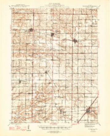
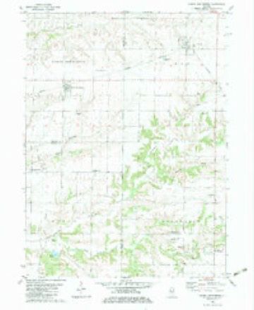
9 topographic sheets cover this place, the earliest surveyed in 1947 and the latest in 1989. It stands in Rio Township. It lies in ZIP code area 61472. The Survey maps it on the North Henderson quadrangle.
Topographic sheets covering this place
7 surveys from 9 printed sheetsMatched by testing this settlement's coordinate against the published boundary of every sheet in the United States Geological Survey's historical collection. Each opens the scanned sheet at the Survey.
- 1947 USGS Woodhull quadrangle1:62500, 2 printings
- 1958 USGS Davenport quadrangle1:250000, 2 printings
- 1961 USGS Davenport quadrangle1:250000
- 1962 USGS Davenport quadrangle1:250000
- 1982 USGS North Henderson quadrangle1:24000
- 1984 USGS Aledo quadrangle1:100000
- 1989 USGS Aledo quadrangle1:100000





Fires near this place
1 since 2008Regional context, not property-specific evidence. The federal wildfire occurrence database lists 1 fire within 5 miles of Rio in 2008, burning under an acre in total. None started naturally. 1 was recorded as arson. Distance is straight-line from the map coordinates, so a fire counted here may appear on a neighbouring settlement's page as well.
| Reported cause | Fires |
|---|---|
| Arson/incendiarism | 1 |
The most recent of them, most recent first, with the day each was reported and the service that recorded it.
| Date | Cause | Size | Reported by | Name on the report |
|---|---|---|---|---|
| 30 March 2008 | Arson/incendiarism | under an acre | Illinois Division of Forestry Resources | LOT |
Settlements close enough to share some of these fires:
Storms near this place
22 since 2009Regional context, not property-specific evidence. The National Weather Service names Rio in 22 storm reports between 2009 and 2019: 12 flash flood, 6 hail, 2 flood, 2 thunderstorm wind. No death or injury is recorded in these reports. Each account below is quoted exactly as the forecast office filed it, from the NOAA Storm Events Database, and each date opens the federal record of that event.
| When | Event | Place named | Harm | What the report says |
|---|---|---|---|---|
| May 2013 | Flash Flood | Rio | $1,000,000 | Thunderstorms with torrential rainfall produced nearly 3.00 inches of rain in just one hour. Due to the already saturated ground, much of this additional rainfall rapidly caused flash flooding in the northern half of Knox County. The city of Galesburg was impacted the greatest. Rapidly rising water on many city streets led to at least 30 stranded motorists and one water rescue. Water flooded parts of Carl Sandburg College as well, causing nearly $300,000 in damage to flooring, furniture, and equipment. Numerous homes and businesses also sustained considerable flood damage.|Nearly all rural roads in the northern half of Knox County were closed due to the flooding. |
| May 2011 | Flash Flood | Rio | $100,000 | Severe thunderstorms produced heavy rainfall for the second time within five days in northwest Knox County. Once again, the greatest impacts were near the town of Rio where 3.00 to 5.00 of rain occurred during the morning of May 29th. Many roads in this area were impassable, including U.S. Highway 150 about one mile north of Rio, where Polk Creek overflowed its banks and a landslide blocked one lane of the highway. |
| June 2015 | Thunderstorm Wind | Rio | $15,000 | Several trees were blown down in Rio. |
| July 2016 | Thunderstorm Wind | Rio | $2,000 | A tree was snapped at the base just west of Rio. |
| May 2019 | Flash Flood | Rio | - | A line of thunderstorms produced 1.00 to 2.00 inches of rain in less than one hour during the late evening of May 28th. Due to recent heavy rain and an already saturated ground, flash flooding developed rapidly in Knox County. Multiple streets were flooded in Galesburg and numerous rural roads were impassable. The flooding subsided during the early morning hours of May 29th. |
| September 2018 | Flash Flood | Rio | - | Persistent thunderstorms in northern Knox County resulted periods of heavy rain during the early morning of September 7th. Rainfall rates of 1.00 to 3.00 inches per hour for nearly two hours, on already saturated ground resulted in flash flooding. Numerous streets were inundated in Galesburg during the morning commute. Many rural roads were also flooded between Galesburg and Victoria through late morning. |
| September 2014 | Flash Flood | Rio | - | Persistent thunderstorms with heavy rainfall developed over the same areas of western Knox County during the early morning hours of September 4th. Observers reported 3.00 to 5.00 inches of rain in the two hours between 0330 and 0530 local time. Numerous streets within Galesburg and Knoxville were flooded. Multiple viaducts flooded which caused several stalled vehicles to become trapped in the rising water during the morning commute. The flooding subsided before late morning. |
| May 2013 | Flood | Rio | - | Thunderstorms with torrential rainfall produced nearly 3.00 inches of rain in just one hour. Due to the already saturated ground, much of this additional rainfall rapidly caused flash flooding in the northern half of Knox County. The city of Galesburg was impacted the greatest. Rapidly rising water on many city streets led to at least 30 stranded motorists and one water rescue. Water flooded parts of Carl Sandburg College as well, causing nearly $300,000 in damage to flooring, furniture, and equipment. Numerous homes and businesses also sustained considerable flood damage.|Nearly all rural roads in the northern half of Knox County were closed due to the flooding. Additional periods of rainfall during much of the day on May 29th kept most of the roads flooded for nearly 36 hours. The flooding finally subsided during the late morning hours of May 30th. |
| May 2011 | Flash Flood | Rio | - | Severe thunderstorms produced very heavy rainfall with nearly 3.00 of rain in 90 minutes near the town of Rio, and around 2.00 of rain in 30 minutes at Altona in northwest Knox County. The biggest impacts were from Rio to the Mercer County line where 4.00 to 5.00 of rain during the early evening resulted in extensive flash flooding of roads and creeks. |
| May 2010 | Flash Flood | Rio | - | Rainfall rates of 2.00 to 2.5 in a two hour period resulted in areas of flash flooding in Knox County. The heavy rain also resulted in the overflowing of small streams near the town of Altona. |
| June 2010 | Flash Flood | Rio | - | Rainfall amounts of 2.00 to 2.50 during the evening fell on saturated ground from previous flooding. This resulted in widespread flash flooding across much of Knox County. Numerous roads had several inches of water flowing over them, viaducts were flooded, drainage ditches were overflowing, and fields were inundated with water. |
| June 2010 | Flash Flood | Rio | - | More than 3.00 of rain was measured in three hours, 2.00 of which occurred in one hour. The rain produced flooding of rural roads as well as city streets within Galesburg. |
| June 2010 | Flash Flood | Rio | - | Several rounds of heavy rain in northwest and southern Knox County produced areas of flash flooding. Numerous city streets were flooded in Galesburg and Knoxville. Rainfall totals in the flash flood area ranged from 2.75 to nearly 4.00. |
| March 2009 | Flood | Rio | - | Highway 17 was closed due to high water. In addition, water was flowing across numerous other county roads across Knox County. |
| May 2009 | Flash Flood | Rio | - | Heavy rainfall of 2.00 to 3.00 inches on already saturated ground produced widespread flash flooding in northern Knox County. Many roads were covered with water, and several rural roads were closed to traffic. Numerous streets in the city of Galesburg were also closed due to high water. |
| May 2009 | Flash Flood | Rio | - | Another round of thunderstorms resulted in renewed flash flooding in Knox County. The heavy rain caused many roads, particularly in rural areas, to be impassible. |
| May 2018 | Hail | Rio | - | no account filed |
| May 2018 | Hail | Rio | - | no account filed |
| June 2016 | Hail | Rio | - | no account filed |
| April 2012 | Hail | Rio | - | no account filed |
| May 2011 | Hail | Rio | - | no account filed |
| May 2011 | Hail | Rio | - | no account filed |
Nearest settlements
The eight closest, with where each one stands in the county. Distances are straight-line, computed from the Geographic Names Information System coordinates.
| Map | Place | Distance | Sheets |
|---|---|---|---|
| Ontario | 5.3 miles | 9 | |
| Henderson Grove | 6.2 miles | 9 | |
| Henderson | 6.3 miles | 9 | |
| Soperville | 6.9 miles | 9 | |
| Wataga | 8.6 miles | 9 | |
| Oneida | 9.6 miles | 12 | |
| Galesburg | 11.2 miles | 17 | |
| East Galesburg | 12.1 miles | 17 |
Provenance
This settlement is recorded in the Geographic Names Information System as feature 416687. The sheet list is computed by point-in-boundary test against the United States Geological Survey's historical topographic inventory. Both are works of the United States government and carry no copyright under 17 U.S.C. 105.
Wildfire. Short, Karen C. 2022. Spatial wildfire occurrence data for the United States, 1992-2020 [FPA_FOD_20221014]. 6th Edition. Fort Collins, CO: Forest Service Research Data Archive. https://doi.org/10.2737/RDS-2013-0009.6 Collected with United States Government funding and usable without additional permissions or fees.
Storms. NOAA National Centers for Environmental Information, Storm Events Database https://www.ncei.noaa.gov/stormevents/ A work of the United States government, no copyright under 17 U.S.C. 105. Narratives are quoted verbatim from the National Weather Service report and are not edited or summarised.