 Block
Robinson, Illinois
14 topographic sheets cover this place, the earliest surveyed in 1953 and the latest in 1986. It stands in Robinson Township. It lies in ZIP code area 62454. The Survey maps it on the Hutsonville quadrangle. 7,150 people lived here at the 2020 count. It stands 525 feet above sea level.
Research this city
On record in Robinson
Buildings and businesses the archive holds for this place. Each opens its own page, with the source record it came from.
On the National Register 2 records
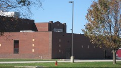 Robinson High School Auditorium-Gymnasiumlisted 2005
- Dr. Arthur W. Allen Homelisted 2020
Population over time
3 figuresRobinson grew from 6,822 to 7,150 between 2000 and 2020. These are the recorded population figures Wikidata holds for this place, reached through the Geographic Names Information System number this page is keyed on rather than by name, so they belong to this place and not to another of the same name. Most are census counts, but not all are: an early figure may be a founding or settlement estimate, and an estimate published within five years of a census is left out. The change column is computed, and is left blank where more than 20 years separate a figure from the one before it, because a gap that long is not a change between two counts.
| Year | People | Change |
|---|---|---|
| 2000 | 6,822 | |
| 2010 | 7,713 | +891 (+13%) |
| 2020 | 7,150 | -563 (-7%) |
Topographic sheets covering this place
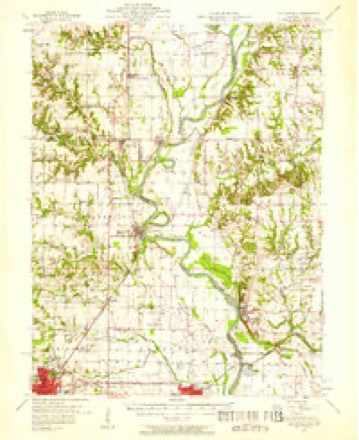
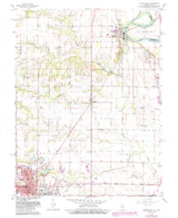
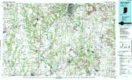
7 surveys from 14 printed sheetsMatched by testing this settlement's coordinate against the published boundary of every sheet in the United States Geological Survey's historical collection. Each opens the scanned sheet at the Survey.
- 1953 USGS Indianapolis quadrangle1:250000, 4 printings
- 1956 USGS Indianapolis quadrangle1:250000
- 1957 USGS Hutsonville quadrangle1:62500, 2 printings
- 1957 USGS Indianapolis quadrangle1:250000, 2 printings
- 1962 USGS Indianapolis quadrangle1:250000
- 1966 USGS Hutsonville quadrangle1:24000, 2 printings
- 1986 USGS Terre Haute quadrangle1:100000, 2 printings




In the county-history sources
1,391 words on this townshipILLINOIS HISTORICAL CRAWFORD COUNTY, published 1909 names this settlement in its chapter on Robinson Township. These are the passages that mention it, exactly as the scans read.
Under the first partition what is now Robinson Township constituted the central portion of Lamotte Precinct, the name being changed when the county-seat was removed from Palestine to Robinson, which took its name from J. M. Robinson, a prominent lawyer of Carmi, White County. The new township was made up of 56 sections, of which 36 were part of T. 7 M., B. 12 W.; 18 sections in T. 6 N, B. 12 W.; three sections of T. 6 N. B. 13 W; and five sections of T. 7 N., R. 13 W. Sugar Creek, with two small affluents, Honey Creek and an arm of Big Creek, furnished the natural drainage of the township, and the surface of the county was originally partly "barrens" and partly "true prairie with evidence of devastation from sweeping fires. The first entries of land in Section 9, T. 7 N., R. 12 W., was made in 1817, by Jesse Page and Harmon Gregg. Others who came during the same year were W. T. Barry, Wilson Lagow, William Barbee, John Mars and William Mitchell. In 1818 there came to the same township James Newlin, John Hill, Thomas Young, Nathan Mars, Thomas Newlin, Joshua Barbee, William Dunlap, William Everman, James J. Nelson, Armstead Bennett, and William Nelson. In T. 6 N., R. 12, during the same year, land was entered by Charles Dawson and Richard Easton, and in 1819, by John and Jonathan Wood.
Passage source: ILLINOIS HISTORICAL CRAWFORD COUNTY, published 1909.
Others who made entries in 1818 were Ithra Brashears, Lewis Little and Barnett Starr. Some of these tracts were taken up for speculation, and other pre-emptors left after temporary sojourn, without securing titles, so that the above mentioned entries are not conclusive as to those permanently settling in Robinson Township in 1817-18. The Newlin family was one of the best known of the early settlers. Nathaniel, John and Eli, brothers, with their father, John Newlin, Sr, came from North Carolina, locating Indiana, whence they moved to Crawford County, establishing themselves on Section 10, T. 7 N. K. 12 W. It is probable that William Mitchell, an Englishman, was the first permanent settler of Robinson Township, his arrival occurring in 1817, and his subsequent life being spent there. From 1820, the year in which Enoch Wilhoit, another permanent settler, came from Kentueky, to 1830, there was little increase in the number of settlers. Occasionally a home- Seeker would come from some quarter, put up a log cabin, raise one crop and then depart, leaving an empty dwelling for the temporary shelter of another hardy pioneer. Among those utilizing abandoned dwellings in this way was John Nichols, who came from Virginia in 1830, and oceupied land which remained in the possession of his family for half a century. John Cable and John Givin, well known farmers, located near the village of Robinson about this period, and F. M. Brown, who arrived in 1832, was one of those who moved into a deserted cabin in that locality.
Passage source: ILLINOIS HISTORICAL CRAWFORD COUNTY, published 1909.
In 1833 arrived John Blankenship, a soldier of the War of 1812, and the cabin built by him was the first dwelling place on the site of the present town of Robinson. From this time until 1850 there were few "newcomers," but within a year or two after the latter date, the last of the public lands in the vicinity were taken up. The first settlers followed closely the termination of Indian hostilities, finding the redskins still camping in their accustomed haunts. At that day an Indian trail, well trodden, ran from Vineennes to Vandalia, through Palestine. The wagons conveying the families of the pioneers earried but scanty household effects, usually a couple of chairs, some bedding and provisions and a few tools. In the case of the Newlins, the household furniture consisted of three chairs, fastened to the feed-box of the wagon, and one of the first acts of Thomas Newlin, after placing the family under shelter, was to drive to Vincennes and buy a barrel of salt, costing $18, a cow and a calf, and certain implements for blacksmithing.
Passage source: ILLINOIS HISTORICAL CRAWFORD COUNTY, published 1909.
Machine-read from a century-old scan, so expect the errors a machine makes: misspelled names, dropped words, stray characters.
Read the whole chapter on Robinson Township - it names this place 1 more 1 time.
Mines and quarries near this place
1 within 5 milesRegional context, not property-specific evidence. The federal mineral resources record lists 1 working within 5 miles of Robinson: 1 past producer. None of them still produces. What was taken out: Stone. Distance is straight-line from the map coordinates, so a quarry counted here may appear on a neighbouring settlement's page as well.
| Where | Site | Commodity | Status | Recorded |
|---|---|---|---|---|
| Robinson City Eng. Pit | Stone | Past Producer |
Storms near this place
60 of 68 shownRegional context, not property-specific evidence. The National Weather Service names Robinson in 68 storm reports between 1994 and 2025: 40 thunderstorm wind, 19 hail, 6 flash flood, 2 tornado. The reports record 3 deaths and 1 injury. Each account below is quoted exactly as the forecast office filed it, from the NOAA Storm Events Database, and each date opens the federal record of that event.
| When | Event | Place named | Harm | What the report says |
|---|---|---|---|---|
| August 2000 | Flash Flood | Robinson | 3 killed, $1,000,000 | A cluster of thunderstorms persisted over mainly the far northern parts of the county into the overnight hours. Radar estimates indicated from 4 to over 5 inches of rain falling over a period of less than 6 hours. This resulted in flash flooding occurring in the far northwestern part of the county. A culvert went over its banks, resulting in an 80 foot long, 25 foot deep section of secondary roadway being washed away during the overnight hours. During the early morning hours, a female driver, unaware of the washout, drove off the roadway, into the hole. Shortly thereafter, a truck with two occupants went off the roadway as well. The truck stuck the car's gas tank, resulting in a fire. All three occupants were killed. A rail road bridge, 60 feet long, was also washed out completely in the area. |
| September 2000 | Flash Flood | Robinson | 1 hurt, $1,000,000 | Thunderstorms persisted during the daylight hours across the county. Ground saturated from the rainfall all day, eventually caused storm drains in Robinson to overflow and create widespread flooding and damage in much of the town. A local observer reported over 4.5 inches of rain during the event. Widespread basement and street flooding was noted. The hardest hit business in the city was a local Chevrolet dealership that sustained extensive damage to over 40 vehicles as well as the buildings on the lot. Water was reported nearly three and a half feet deep in the showroom of the dealership. Damage was noted to much of the building and its contents. The basement of a local health spa was reported as flooded, with several thousand dollars in damage. A building at WTYE-WTAY radio was reported to have water in it, but the station never went off the air. One injury was related to the event. A 20-year old male driver was involved in an accident on Illinois Route 33, just north of the Larwence county line. Water washed mud across the road, causing him to lose control of his car. He was taken to a local hospital complaining of neck and back pain. No other injuries were reported. |
| April 2006 | Thunderstorm Wind | Robinson | $775,000 | A swath of severe straight-line winds impacted the north side of Robinson. The damage swath started near the 1800 block of N. Argus St., and continued east-southeast, before ending near the 1300 block of N. Jackson St. These winds caused tree and roofing damage along the path, with the most significant damage noted toward the end of the swath. The high school and nursing home were among the structures damaged. One home and garage were destroyed by falling trees. A wind sensor at the high school measured a 65 knot wind gust. A 56 knot wind gust was measured 6 miles east of Robinson, but no significant damage was noted. |
| June 2011 | Lightning | Robinson | $100,000 | Lightning strikes from an isolated thunderstorm produced damage to electrical equipment and computers at the Crawford County 9-1-1 center, and at several nearby businesses and a church. |
| June 2019 | Thunderstorm Wind | Robinson | $70,000 | Numerous trees and power poles were blown down in Robinson. The doors and a couple windows of the courthouse were blown out. Damage occurred to the Bradford Supply building. |
| April 2020 | Thunderstorm Wind | Robinson | $60,000 | Numerous trees and power poles were blown down. |
| May 2018 | Thunderstorm Wind | Robinson | $50,000 | Numerous trees and tree branches were blown down across Crawford County. |
| June 2011 | Thunderstorm Wind | Robinson | $45,000 | Numerours tree limbs and power lines were blown down in Robinson. |
| July 2016 | Thunderstorm Wind | Robinson | $40,000 | Several trees and power lines were blown down. |
| May 2014 | Thunderstorm Wind | Robinson | $40,000 | Large tree branches were blown down into power lines in Robinson. |
| June 2010 | Thunderstorm Wind | Robinson | $25,000 | A roof was blown off a mobile home south of Robinson. Also, numerous trees and power lines were blown down in and around town. |
| December 2015 | Thunderstorm Wind | Robinson | $20,000 | Several trees and tree branches were blown down in Robinson. |
| July 2010 | Thunderstorm Wind | Robinson | $20,000 | Numerous trees and tree branches were blown down around Robinson. |
| October 2010 | Thunderstorm Wind | Robinson | $20,000 | Numerous trees and tree branches were blown down in Robinson. |
| June 2009 | Thunderstorm Wind | Robinson | $20,000 | Tree limbs were blown down on Clearwater Street in Robinson, causing a small fire to a storage building. |
| June 1998 | Thunderstorm Wind | Robinson | $15,000 | Thunderstorm winds damaged a barn and blew down several trees 2 miles southeast of Robinson. Debris from the barn caused minor damage to two mobile homes in the area. In Palestine, the winds blew down a tree which fell onto a mobile home causing minor damage. No injuries were reported and damage was estimated around $15,000. |
| July 2016 | Thunderstorm Wind | Robinson | $12,000 | Several trees were blown down just south of Robinson. |
| August 2009 | Thunderstorm Wind | Robinson | $10,000 | Several large tree limbs were blown down in Robinson. |
| October 2007 | Thunderstorm Wind | Robinson | $10,000 | Several tree limbs and power lines were blown down.| |
| April 1994 | Thunderstorm Wind | Robinson | $5,000 | A porch was destroyed and trees were blown down at Robinson. At Flat Rock, limbs were downed, siding was torn off a home and outbuildings were damaged. Power lines and trees were downed at Heathsville. |
| April 2015 | Thunderstorm Wind | Robinson | $4,000 | Approximately 100 feet of fence was blown down at the Robinson Correctional Facility. |
| July 1995 | Hail | Robinson | $1,000 | no account filed |
| June 2023 | Thunderstorm Wind | Robinson | - | Numerous tree branches were blown down and one house had shingles torn off the roof. |
| August 2022 | Flash Flood | Robinson | - | The intersection of Main Street and South Jackson Street was closed due to water flowing across the roadway. |
| May 2020 | Thunderstorm Wind | Robinson | - | Shingles were blown off a house and a few small tree branches were knocked down. |
| August 2020 | Flash Flood | Robinson | - | Several roads were flooded in Robinson. In addition, the Tempco Products building flooded due to rising water from a nearby creek. |
| May 2016 | Thunderstorm Wind | Robinson | - | Several trees and power lines were blown down. |
| June 2013 | Thunderstorm Wind | Robinson | - | A tree was blown down onto a house at Schuyler and Jefferson Streets in Robinson. |
| August 2012 | Thunderstorm Wind | Robinson | - | Several trees were blown down in Robinson. |
| April 2006 | Tornado (F0) | Robinson | - | A tornado briefly touched down in a field. No damage or injuries were reported. |
| April 2006 | Tornado (F1) | Robinson | - | A tornado briefly touched down near the intersection of N. Jackson St. and state route 1A. The tornado traveled east-northeast and dissipated in the woods behind a church, along the east side of route 1A. The tornado destroyed a garage, caused significant tree damage, flattened a highway sign, and caused siding and roof damage to another home and two churches. |
| April 2006 | Flash Flood | Robinson | - | Very heavy rain fell in the City of Robinson in a short period of time. Main street had water flowing across it and numerous other streets in town had minor flooding. |
| May 2006 | Thunderstorm Wind | Robinson | - | Power lines were blown down. |
| May 2004 | Thunderstorm Wind | Robinson | - | Several trees and power lines were blown down. |
| July 2004 | Thunderstorm Wind | Robinson | - | Several trees and tree limbs were blown down. One tree fell onto Illinois Route 133 west of Robinson. |
| July 2004 | Thunderstorm Wind | Robinson | - | Several trees, tree limbs and power lines were blown down. One tree fell onto the porch of a house in Robinson, damaging it. |
| May 2003 | Thunderstorm Wind | Robinson | - | Several tree limbs and power lines were blown down around town. |
| May 2003 | Thunderstorm Wind | Robinson | - | Several trees and tree limbs were blown down as well as a power pole. |
| May 2002 | Thunderstorm Wind | Robinson | - | Several large trees were blown down around town. Two caused minor damage to two houses. Another tree fell onto an unoccupied minivan, destroying it. |
| July 2002 | Thunderstorm Wind | Robinson | - | Three large trees, as well as several power lines blown down in Robinson. |
| August 2000 | Thunderstorm Wind | Robinson | - | Several trees, tree limbs, power and phone lines were blown down as a result of the thunderstorm winds. |
| September 2000 | Thunderstorm Wind | Robinson | - | Trees, tree limbs and power lines were blown down in the city. A tree fell on top of a car in an alleyway. No damage estimates were given. |
| August 2000 | Thunderstorm Wind | Robinson | - | Several trees were blown down in an area from Robinson to Palestine. |
| August 2000 | Thunderstorm Wind | Robinson | - | Numerous trees, tree limbs, and power lines were blown down. In Palestine, one tree fell onto a house causing minor damage. |
| November 1998 | Thunderstorm Wind | Robinson | - | A large maple tree was snapped in half in Robinson and numerous tree limbs and power lines were blown down throughout the county. Three miles south of Flat Rock a tree was blown onto Route 1. |
| April 1998 | Thunderstorm Wind | Robinson | - | Thunderstorm winds blew down several large trees and power lines in Robinson. No injuries were reported. |
| July 1998 | Thunderstorm Wind | Robinson | - | A large section of a tree was blown down in Robinson, it blocked a nearby street for a time. No structural damage was reported. |
| July 1997 | Thunderstorm Wind | Robinson | - | Severe thunderstorms moved through Crawford County knocking down numerous trees, tree limbs and power lines in the Robinson, Palestine, and Flat Rock areas. In Palestine, a large tree was blown down onto a garage destroying it and caused minor damage to the house next door. No injuries were reported and no damage estimate was available. |
| May 2025 | Hail | Robinson | - | no account filed |
| May 2025 | Hail | Robinson | - | no account filed |
| May 2025 | Hail | Robinson | - | no account filed |
| May 2025 | Hail | Robinson | - | no account filed |
| April 2012 | Hail | Robinson | - | no account filed |
| April 2012 | Hail | Robinson | - | no account filed |
| June 2011 | Hail | Robinson | - | no account filed |
| April 2011 | Hail | Robinson | - | no account filed |
| May 2009 | Hail | Robinson | - | no account filed |
| April 2006 | Hail | Robinson | - | no account filed |
| September 2006 | Hail | Robinson | - | no account filed |
| May 2004 | Hail | Robinson | - | no account filed |
Nearest settlements
The eight closest, with where each one stands in the county. Distances are straight-line, computed from the Geographic Names Information System coordinates.
| Map | Place | Distance | Sheets |
|---|---|---|---|
| Gordon | 2.9 miles | 14 | |
| New Hebron | 3.8 miles | 13 | |
| Duncanville | 4.2 miles | 13 | |
| Trimble | 4.9 miles | 14 | |
| Stoy | 5.0 miles | 13 | |
| Oil Center | 5.6 miles | 13 | |
| Porterville | 6.7 miles | 14 | |
| Palestine | 6.7 miles | 20 |
Elsewhere
Matched on this settlement's Geographic Names Information System number rather than its name, so it cannot be a different place of the same name in another state.
| Wikipedia article on Robinson | An encyclopaedic summary. Its text is share-alike, so it is linked here rather than copied. |
| Wikidata item Q371281 | The structured record the population and elevation above come from. Public domain (CC0). |
Provenance
This settlement is recorded in the Geographic Names Information System as feature 416765. The sheet list is computed by point-in-boundary test against the United States Geological Survey's historical topographic inventory. Both are works of the United States government and carry no copyright under 17 U.S.C. 105.
Mines and quarries. USGS Mineral Resources Data System (MRDS) https://mrdata.usgs.gov/mrds/ A work of the United States government, no copyright under 17 U.S.C. 105.
Storms. NOAA National Centers for Environmental Information, Storm Events Database https://www.ncei.noaa.gov/stormevents/ A work of the United States government, no copyright under 17 U.S.C. 105. Narratives are quoted verbatim from the National Weather Service report and are not edited or summarised.