 Block
Rochester, Illinois
14 topographic sheets cover this place, the earliest surveyed in 1922 and the latest in 1998. It stands in Rochester Township. It lies in ZIP code area 62563. It stands on McCoy Branch. The Survey maps it on the New City quadrangle. 3,863 people lived here at the 2020 count. It stands 558 feet above sea level.
On record in Rochester
Buildings and businesses the archive holds for this place. Each opens its own page, with the source record it came from.
On the National Register 4 records
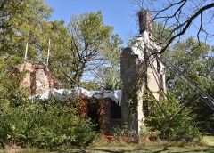 Brunk Farmsteadlisted 1999
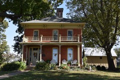 Joseph Ross Houselisted 2006
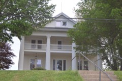 Taft Farmsteadlisted 1980
- Joseph Miller Houselisted 1980
Population over time
2 figuresRochester grew from 3,689 to 3,863 between 2010 and 2020. These are the recorded population figures Wikidata holds for this place, reached through the Geographic Names Information System number this page is keyed on rather than by name, so they belong to this place and not to another of the same name. Most are census counts, but not all are: an early figure may be a founding or settlement estimate, and an estimate published within five years of a census is left out. The change column is computed, and is left blank where more than 20 years separate a figure from the one before it, because a gap that long is not a change between two counts.
| Year | People | Change |
|---|---|---|
| 2010 | 3,689 | |
| 2020 | 3,863 | +174 (+5%) |
Topographic sheets covering this place
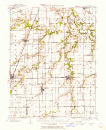
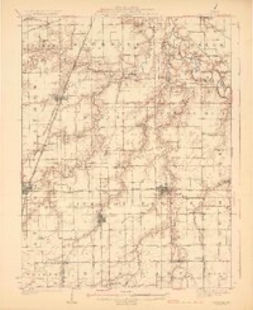
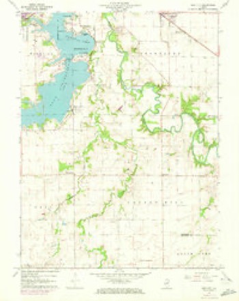
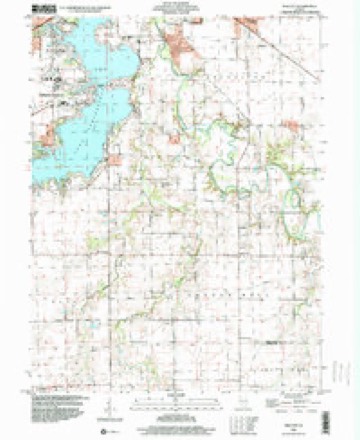
7 surveys from 14 printed sheetsMatched by testing this settlement's coordinate against the published boundary of every sheet in the United States Geological Survey's historical collection. Each opens the scanned sheet at the Survey.
- 1922 USGS Divernon quadrangle1:62500
- 1924 USGS Divernon quadrangle1:62500, 2 printings
- 1958 USGS Decatur quadrangle1:250000, 3 printings
- 1961 USGS Decatur quadrangle1:250000, 2 printings
- 1961 USGS New City quadrangle1:24000, 3 printings
- 1985 USGS Springfield quadrangle1:100000, 2 printings
- 1998 USGS New City quadrangle1:24000



In the county-history sources
12,276 words on this townshipHistory of Sangamon County, Illinois; Together with Sketches of Its Cities, Villages and Townships ... Portraits of Prominent Persons, and Biographies of Representative Citizens. History of Illinois, published 1881 names this settlement in its chapter on Rochester Township. These are the passages that mention it, exactly as the scans read.
The village of Rochester is one of the oldest in the county. The lands on which the village was located were entered by Archibald and Robert Sattley, and transferred by them to L. V. Ilollenbeck, one of four brothers - Lawrence V., Andrew F., William Henry and Henry William - who came to what is now Rochester township in 1829 or 1830.
Passage source: History of Sangamon County, Illinois; Together with Sketches of Its Cities, Villages and Townships ... Portraits of Prominent Persons, and Biographies of Representative Citizens. History of Illinois, published 1881.
The town of Rochester was surveyed and platted by James Gregory, Esq., December 16, 1831. L. Y. Hollenbeck was proprietor of all north of Main street. A. F. Hollenbeck, administrator, acknowledged the plat before C. B. Stafford, justice of the peace, which is recorded in book H, page 141 of records.
Passage source: History of Sangamon County, Illinois; Together with Sketches of Its Cities, Villages and Townships ... Portraits of Prominent Persons, and Biographies of Representative Citizens. History of Illinois, published 1881.
C. B. Stafford built a two-story log cabin, where he kept the post office and stage stand. It stood on the corner of Main and Water streets, east of the Iron Bridge. Robert Sattley built his rude cabin a ehort distance to the westwaid of this, and near the spot where stands the Rochester House. A third log cabin was built by Micas Johnson, on the lot just west of the railroad depot. Several of the primitive cabins of these hardy pioneers may yet be seen.
Passage source: History of Sangamon County, Illinois; Together with Sketches of Its Cities, Villages and Townships ... Portraits of Prominent Persons, and Biographies of Representative Citizens. History of Illinois, published 1881.
Machine-read from a century-old scan, so expect the errors a machine makes: misspelled names, dropped words, stray characters.
Read the whole chapter on Rochester Township - it names this place 59 more 59 times.
Fires near this place
2 since 2001Regional context, not property-specific evidence. The federal wildfire occurrence database lists 2 fires within 5 miles of Rochester between 2001 and 2012, burning about 201 acres in total. None started naturally. None was recorded as arson. Distance is straight-line from the map coordinates, so a fire counted here may appear on a neighbouring settlement's page as well.
| Reported cause | Fires |
|---|---|
| Missing data/not specified/undetermined | 1 |
| Recreation and ceremony | 1 |
The most recent of them, most recent first, with the day each was reported and the service that recorded it.
| Date | Cause | Size | Reported by | Name on the report |
|---|---|---|---|---|
| 28 July 2012 | Missing data/not specified/undetermined | 200 acres | Illinois Division of Forestry Resources | BUCKHART |
| 13 May 2001 | Recreation and ceremony | 1.0 acres | Illinois State Fire Marshal's Office | not named |
Settlements close enough to share some of these fires:
Mines and quarries near this place
6 within 5 milesRegional context, not property-specific evidence. The federal mineral resources record lists 6 workings within 5 miles of Rochester: 3 producers, 2 past producers, 1 prospect. 3 still produce. What was taken out: Sand and Gravel, Construction, Fire Clay (Refractory), Clay. Distance is straight-line from the map coordinates, so a quarry counted here may appear on a neighbouring settlement's page as well.
| Where | Site | Commodity | Status | Recorded |
|---|---|---|---|---|
| Poston Brick & Concrete Prod. Clay | Clay | Prospect | ||
| Springfield Clay Prod.Co.Pitclay | Fire Clay (Refractory) | Past Producer | ||
| Clear Lake Dredge | Sand and Gravel, Construction | Producer | ||
| Sangamon Valley Dredge | Sand and Gravel, Construction | Producer | ||
| Springfield Sand & Gravel Pit | Sand and Gravel, Construction | Past Producer | ||
| Springfield Sand&Gravel Co. Dredge | Sand and Gravel, Construction | Producer |
Storms near this place
7 since 2013Regional context, not property-specific evidence. The National Weather Service names Rochester in 7 storm reports between 2013 and 2023: 6 thunderstorm wind, 1 hail. No death or injury is recorded in these reports. Each account below is quoted exactly as the forecast office filed it, from the NOAA Storm Events Database, and each date opens the federal record of that event.
| When | Event | Place named | Harm | What the report says |
|---|---|---|---|---|
| June 2019 | Thunderstorm Wind | Rochester | $80,000 | Multiple trees and power lines were blown down throughout Rochester. One tree fell onto a house and car. |
| April 2013 | Thunderstorm Wind | Rochester | $7,000 | A fruit tree was snapped in half. A large fence was blown down and a few shingles were ripped from a roof. |
| June 2023 | Thunderstorm Wind | Rochester | - | Several large tree branches were blown down. |
| May 2019 | Thunderstorm Wind | Rochester | - | A tree limb was blown onto a power line. |
| July 2017 | Thunderstorm Wind | Rochester | - | A 4-inch diameter tree branch was blown down. |
| June 2015 | Thunderstorm Wind | Rochester | - | Two power poles were blown down on Buckhart Road just east of Rochester. |
| March 2020 | Hail | Rochester | - | no account filed |
Nearest settlements
The eight closest, with where each one stands in the county. Distances are straight-line, computed from the Geographic Names Information System coordinates.
| Map | Place | Distance | Sheets |
|---|---|---|---|
| Keys | 3.0 miles | 20 | |
| Berry | 4.1 miles | 12 | |
| Shale Bluff | 4.6 miles | 20 | |
| Buckhart | 4.6 miles | 12 | |
| Southlawn | 4.8 miles | 20 | |
| Clear Lake | 4.8 miles | 20 | |
| New City | 5.5 miles | 14 | |
| Mildred | 5.5 miles | 19 |
Elsewhere
Matched on this settlement's Geographic Names Information System number rather than its name, so it cannot be a different place of the same name in another state.
| Wikipedia article on Rochester | An encyclopaedic summary. Its text is share-alike, so it is linked here rather than copied. |
| Wikidata item Q2514320 | The structured record the population and elevation above come from. Public domain (CC0). |
Provenance
This settlement is recorded in the Geographic Names Information System as feature 416785. The sheet list is computed by point-in-boundary test against the United States Geological Survey's historical topographic inventory. Both are works of the United States government and carry no copyright under 17 U.S.C. 105.
Wildfire. Short, Karen C. 2022. Spatial wildfire occurrence data for the United States, 1992-2020 [FPA_FOD_20221014]. 6th Edition. Fort Collins, CO: Forest Service Research Data Archive. https://doi.org/10.2737/RDS-2013-0009.6 Collected with United States Government funding and usable without additional permissions or fees.
Mines and quarries. USGS Mineral Resources Data System (MRDS) https://mrdata.usgs.gov/mrds/ A work of the United States government, no copyright under 17 U.S.C. 105.
Storms. NOAA National Centers for Environmental Information, Storm Events Database https://www.ncei.noaa.gov/stormevents/ A work of the United States government, no copyright under 17 U.S.C. 105. Narratives are quoted verbatim from the National Weather Service report and are not edited or summarised.