 Block
Rock Falls, Illinois
12 topographic sheets cover this place, the earliest surveyed in 1930 and the latest in 1985. It stands in Coloma Township. It lies in ZIP code area 61071. The Survey maps it on the Sterling quadrangle. 8,789 people lived here at the 2020 count. It stands 646 feet above sea level.
On record in Rock Falls
Buildings and businesses the archive holds for this place. Each opens its own page, with the source record it came from.
On the National Register within a mile 3 records
The National Register names another town for these. They stand within one mile of this settlement's coordinate.
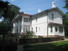 Col. Edward N. Kirk Houselisted 1980 · 0.4 miles away
 First Congregational Church of Sterlinglisted 1995 · 0.7 miles away
 Sterling Masonic Templelisted 1996 · 0.7 miles away
Population over time
2 figuresRock Falls fell from 9,266 to 8,789 between 2010 and 2020. These are the recorded population figures Wikidata holds for this place, reached through the Geographic Names Information System number this page is keyed on rather than by name, so they belong to this place and not to another of the same name. Most are census counts, but not all are: an early figure may be a founding or settlement estimate, and an estimate published within five years of a census is left out. The change column is computed, and is left blank where more than 20 years separate a figure from the one before it, because a gap that long is not a change between two counts.
| Year | People | Change |
|---|---|---|
| 2010 | 9,266 | |
| 2020 | 8,789 | -477 (-5%) |
Topographic sheets covering this place
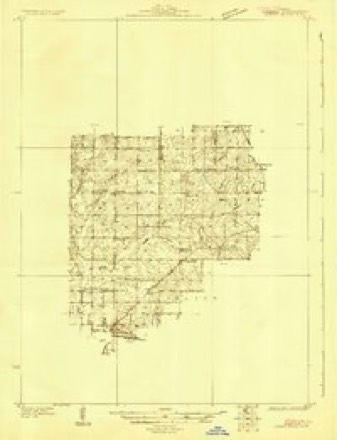
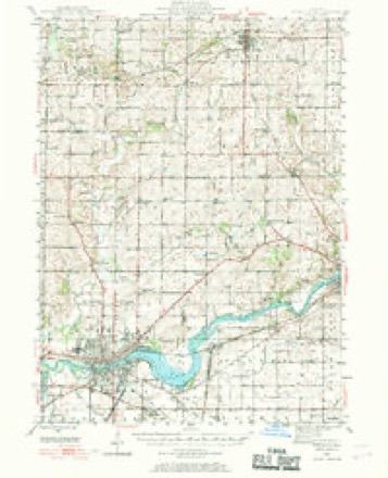
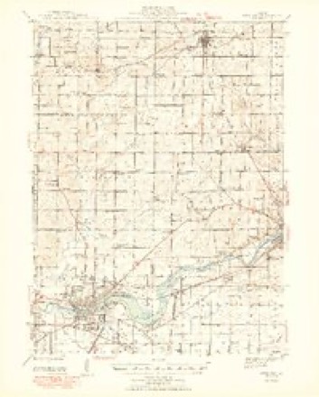
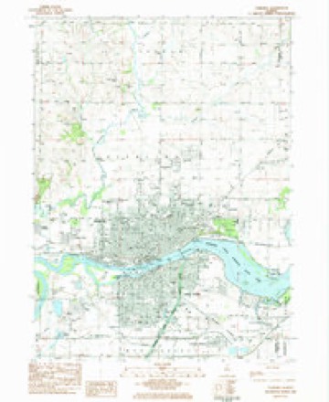
7 surveys from 12 printed sheetsMatched by testing this settlement's coordinate against the published boundary of every sheet in the United States Geological Survey's historical collection. Each opens the scanned sheet at the Survey.
- 1930 USGS Woodsung quadrangle1:48000
- 1946 USGS Sterling quadrangle1:62500
- 1948 USGS Sterling quadrangle1:62500, 2 printings
- 1958 USGS Aurora quadrangle1:250000, 3 printings
- 1961 USGS Aurora quadrangle1:250000
- 1983 USGS Sterling quadrangle1:24000, 2 printings
- 1985 USGS Dixon quadrangle1:100000, 2 printings



What happened here
An account from the chapter on Coloma township. The inset identifies its exact source book and publication year.
Forty-Sixth Illinois Infantry
This regiment had its share of hard fighting and hard luck. At the slaughter of Shiloh, April 6-7, 1862, with Hurlburt's Fourth Division under Grant, one-half of its officers and men were killed, wounded and missing. They were at Corinth in May when Beauregard retired before Halleck, and at the siege of Vicksburg when Grant starved Pemberton into surrender, July 4, 1863.
In the county-history sources
29,462 words on this townshipPortrait and Biographical Album of Whiteside County, Illinois : Containing Full-page Portraits and Biographies of All the Governors of Illinois, and of the Presidents of the United States, published 1885 names this settlement in its chapter on Coloma Township. These are the passages that mention it, exactly as the scans read.
Edward Atkins was a native of Ireland, but came to this county from Canada. He was one of the proprietors of Rapids City. It is said that in Canada he went by the name of Watson, was there married and had a family of seven children. Leaving, his family there he came here, married again and by the second wife had seven more children. While he was in California the second wife obtained a divorce. Returning, he went to Canada, was reconciled to his first wife, re-married, and lived with her till her death. In the meantime his second wife secured a divorce from the man she married, and Mr. Atkins sought her out, and they were again married. After remaining here for a time the family removed to McDonough County.
Passage source: Portrait and Biographical Album of Whiteside County, Illinois : Containing Full-page Portraits and Biographies of All the Governors of Illinois, and of the Presidents of the United States, published 1885.
Noah Merrill was a native of Connecticut. He located near the present village of Rock Falls, opposite Eagle Island. The land had been claimed by Elijah Worthington, and Mr. Merrill was ordered off by the Anti-Claim-Jumping Association, but declined to go. He afterwards sold his claim, went to California in 1850, returned and located at Sterling. Daniel Brooks was a native of Ohio. He was elected Justice of the Peace in Rapids Precinct at an early day. In 1849 he sold out, went to California, and died in San Francisco, of Asiatic cholera, after a few hours' illness.
Passage source: Portrait and Biographical Album of Whiteside County, Illinois : Containing Full-page Portraits and Biographies of All the Governors of Illinois, and of the Presidents of the United States, published 1885.
L. H. Woodworth was born in Vermont. He was a well educated man, and was for a time a teacher in the military school at Perth Amboy, N. J., and afterwards Assistant Professor of Mathematics in Mississippi. In 1839 he located in this township. He held the office of County Surveyor from 1863 to to 1865, was a member of the Board of Supervisors for a time, and was also Swamp Land Commissioner.
Passage source: Portrait and Biographical Album of Whiteside County, Illinois : Containing Full-page Portraits and Biographies of All the Governors of Illinois, and of the Presidents of the United States, published 1885.
Machine-read from a century-old scan, so expect the errors a machine makes: misspelled names, dropped words, stray characters.
Read the whole chapter on Coloma Township - it names this place 46 more 46 times.
Fires near this place
5 since 2018Regional context, not property-specific evidence. The federal wildfire occurrence database lists 5 fires within 5 miles of Rock Falls between 2018 and 2019, burning about 4 acres in total. None started naturally. None was recorded as arson. Distance is straight-line from the map coordinates, so a fire counted here may appear on a neighbouring settlement's page as well.
| Reported cause | Fires |
|---|---|
| Missing data/not specified/undetermined | 3 |
| Debris and open burning | 2 |
The most recent of them, most recent first, with the day each was reported and the service that recorded it.
| Date | Cause | Size | Reported by | Name on the report |
|---|---|---|---|---|
| 2 May 2018 | Missing data/not specified/undetermined | under an acre | Illinois Division of Forestry Resources | 18-369 |
| 18 May 2018 | Missing data/not specified/undetermined | under an acre | Illinois Division of Forestry Resources | 18-414 |
| 9 April 2019 | Missing data/not specified/undetermined | under an acre | Illinois Division of Forestry Resources | 19-322 |
| 31 March 2019 | Debris and open burning | under an acre | Illinois Division of Forestry Resources | 19-294 |
| 23 March 2019 | Debris and open burning | 1.0 acres | Illinois Division of Forestry Resources | 19-274 |
Settlements close enough to share some of these fires:
Mines and quarries near this place
9 within 5 milesRegional context, not property-specific evidence. The federal mineral resources record lists 9 workings within 5 miles of Rock Falls: 6 past producers, 2 plants, 1 producer. 3 still produce. What was taken out: Sand and Gravel, Construction, Stone, Crushed/Broken. Distance is straight-line from the map coordinates, so a quarry counted here may appear on a neighbouring settlement's page as well.
| Where | Site | Commodity | Status | Recorded |
|---|---|---|---|---|
| Emerson Quarry & Mill | Stone, Crushed/Broken | Plant | ||
| L. Deets Quarry | Stone, Crushed/Broken | Past Producer | ||
| Como Pit | Sand and Gravel, Construction | Past Producer | ||
| Mccue Pit | Sand and Gravel, Construction | Past Producer | ||
| Nelson Sand & Gravel Pit #2 & | Sand and Gravel, Construction | Producer | ||
| Propheter Pit | Sand and Gravel, Construction | Past Producer | ||
| Propheter Pit & Mill | Sand and Gravel, Construction | Past Producer | ||
| Rock Falls Pit and Mill | Sand and Gravel, Construction | Plant | ||
| Whiteside Blacktop Company Pit | Sand and Gravel, Construction | Past Producer |
Storms near this place
29 since 1995Regional context, not property-specific evidence. The National Weather Service names Rock Falls in 29 storm reports between 1995 and 2024: 15 thunderstorm wind, 10 hail, 2 flash flood, 1 tornado. No death or injury is recorded in these reports. Each account below is quoted exactly as the forecast office filed it, from the NOAA Storm Events Database, and each date opens the federal record of that event.
| When | Event | Place named | Harm | What the report says |
|---|---|---|---|---|
| May 2005 | Lightning | Rock Falls | $200,000 | Lightning struck the chimney of the Montmorency School south of Rock Falls while students were being dismissed for the day. Luckily the chimney was located in the back of the school and the school bus boarding area is in the front so there were no injuries. The chimney had to be toppled by a wrecking company that evening for safety reasons. Repairs from the lightning strike and subsequent damage to part of the roof and a boiler were briefly put on hold when asbestos was discovered in the damaged area. |
| June 2011 | Flash Flood | Rock Falls | $100,000 | Heavy rains resulted in flash flooding of several streets in Rock Falls, IL during the morning of June 9. The flood waters were 2 to 4 feet deep in some areas. |
| June 2010 | Thunderstorm Wind | Rock Falls | $30,000 | One-third of the roof was torn off a steel warehouse at a trucking company. |
| July 2003 | Hail | Rock Falls | $20,000 | Small tree limbs down in estimated 43 knot (50 mph) winds |
| July 2003 | Hail | Rock Falls | $20,000 | At Oppold Marina Park |
| June 2010 | Thunderstorm Wind | Rock Falls | $10,000 | Wind gusts estimated to be near 70 mph blew the roof off of a mobile home on Harbor Drive. |
| June 2010 | Thunderstorm Wind | Rock Falls | $5,000 | Wind gusts estimated to be 65 mph blew down several tree limbs in Rock Falls, IL at 849 pm June 18. A power outage was observed in half of the town. |
| June 2010 | Thunderstorm Wind | Rock Falls | $5,000 | Wind gusts estimated to be 60 mph blew down a 4 to 5 inch diameter tree limb onto a gas station in Rock Falls, IL at 230 pm June 18. Widespread tree debris was observed in the area. |
| March 2024 | Hail | Rock Falls | - | Report received from mping. |
| November 2022 | Thunderstorm Wind | Rock Falls | - | A member of the public reported apple trees down in town. |
| May 2017 | Thunderstorm Wind | Rock Falls | - | KWQC relayed a report of a tree blown down onto a home on 6th Avenue. |
| May 2016 | Hail | Rock Falls | - | Reported hail up to the size of dimes along with 40 MPH winds. |
| June 2015 | Thunderstorm Wind | Rock Falls | - | A strong wind gust was reported near Route 40 and Highway 30 intersection. |
| August 2014 | Thunderstorm Wind | Rock Falls | - | Wind gusts estimated to be 65 mph blew down several tree limbs in Rock Falls, IL around 235 pm CDT August 25. Power outages were also observed. |
| June 2014 | Flash Flood | Rock Falls | - | A trained spotter reported street flooding with water up to car doors. |
| June 2013 | Thunderstorm Wind | Rock Falls | - | The fire department reported a large tree down on a house. |
| June 2013 | Thunderstorm Wind | Rock Falls | - | Thunderstorm wind gusts were estimated at 55 to 60 mph. |
| November 2013 | Thunderstorm Wind | Rock Falls | - | The Sterling Airport measured a 69kt wind gust. |
| May 2011 | Hail | Rock Falls | - | Quarter sized hail fell in Rock Falls, IL at 442 pm CDT May 22. |
| July 2011 | Thunderstorm Wind | Rock Falls | - | Wind gusts estimated to be 50 to 60 mph were observed in Rock Falls, IL at 653 am CDT July 11. This report was relayed by the Rock Falls ESDA. |
| November 2010 | Thunderstorm Wind | Rock Falls | - | Law enforcement reported trees and power lines down on Rock Island Road near Rock Falls. Winds were estimated at over 70 mph. |
| June 2009 | Thunderstorm Wind | Rock Falls | - | Wind gusts estimated to be 70 mph blew some trees down in Rock Falls, IL around 622 pm June 19. |
| May 2008 | Hail | Rock Falls | - | The public estimated hail the size of nickels near Rock Falls. |
| September 2006 | Hail | Rock Falls | - | A spotter reported hail up to nickel size. |
| October 2006 | Hail | Rock Falls | - | Trained spotter reported quarter size hail mixed with smaller sizes. |
| May 1995 | Tornado (F0) | Rock Falls | - | A small tornado touched down briefly causing little if any damage. A major outbreak of tornado and severe weather occurred across eastern Iowa and parts of northwest and west-central Illinois. There were no injuries or fatalities. Total damage estimates across northwest Illinois were well in excess of $5 million. |
| June 2017 | Hail | Rock Falls | - | no account filed |
| May 2000 | Hail | Rock Falls | - | no account filed |
| April 1997 | Thunderstorm Wind | Rock Falls | - | no account filed |
Nearest settlements
The eight closest, with where each one stands in the county. Distances are straight-line, computed from the Geographic Names Information System coordinates.
| Map | Place | Distance | Sheets |
|---|---|---|---|
| Sterling | 0.7 miles | 12 | |
| Yeoward Addition | 2.1 miles | 12 | |
| Woodland Hills | 2.5 miles | 12 | |
| Douglas Park | 2.6 miles | 12 | |
| Grimes Addition | 3.4 miles | 12 | |
| Galt | 3.9 miles | 11 | |
| Como | 4.2 miles | 11 | |
| Emerson | 4.4 miles | 11 |
Elsewhere
Matched on this settlement's Geographic Names Information System number rather than its name, so it cannot be a different place of the same name in another state.
| Wikipedia article on Rock Falls | An encyclopaedic summary. Its text is share-alike, so it is linked here rather than copied. |
| Wikidata item Q578614 | The structured record the population and elevation above come from. Public domain (CC0). |
Provenance
This settlement is recorded in the Geographic Names Information System as feature 416812. The sheet list is computed by point-in-boundary test against the United States Geological Survey's historical topographic inventory. Both are works of the United States government and carry no copyright under 17 U.S.C. 105.
Wildfire. Short, Karen C. 2022. Spatial wildfire occurrence data for the United States, 1992-2020 [FPA_FOD_20221014]. 6th Edition. Fort Collins, CO: Forest Service Research Data Archive. https://doi.org/10.2737/RDS-2013-0009.6 Collected with United States Government funding and usable without additional permissions or fees.
Mines and quarries. USGS Mineral Resources Data System (MRDS) https://mrdata.usgs.gov/mrds/ A work of the United States government, no copyright under 17 U.S.C. 105.
Storms. NOAA National Centers for Environmental Information, Storm Events Database https://www.ncei.noaa.gov/stormevents/ A work of the United States government, no copyright under 17 U.S.C. 105. Narratives are quoted verbatim from the National Weather Service report and are not edited or summarised.