 Block
Rossville, Illinois
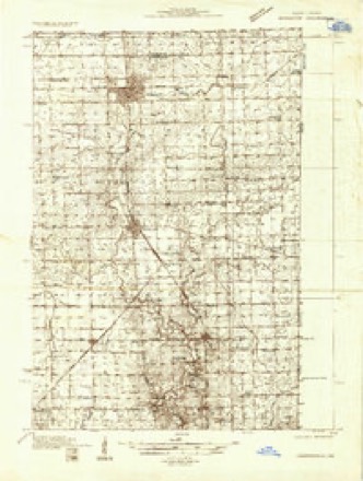
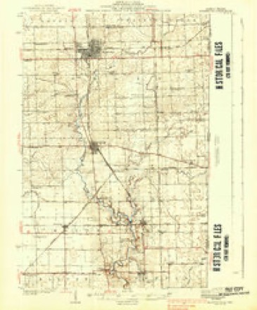
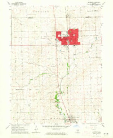
12 topographic sheets cover this place, the earliest surveyed in 1933 and the latest in 1987. It stands in Ross Township. It lies in ZIP code area 60963. The Survey maps it on the Hoopeston quadrangle. 1,221 people lived here at the 2020 count. It stands 686 feet above sea level.
Population over time
2 figuresRossville fell from 1,331 to 1,221 between 2010 and 2020. These are the recorded population figures Wikidata holds for this place, reached through the Geographic Names Information System number this page is keyed on rather than by name, so they belong to this place and not to another of the same name. Most are census counts, but not all are: an early figure may be a founding or settlement estimate, and an estimate published within five years of a census is left out. The change column is computed, and is left blank where more than 20 years separate a figure from the one before it, because a gap that long is not a change between two counts.
| Year | People | Change |
|---|---|---|
| 2010 | 1,331 | |
| 2020 | 1,221 | -110 (-8%) |
Topographic sheets covering this place
8 surveys from 12 printed sheetsMatched by testing this settlement's coordinate against the published boundary of every sheet in the United States Geological Survey's historical collection. Each opens the scanned sheet at the Survey.
- 1933 USGS Hoopeston quadrangle1:48000
- 1938 USGS Hoopeston quadrangle1:62500, 3 printings
- 1953 USGS Danville quadrangle1:250000, 3 printings
- 1955 USGS Danville quadrangle1:250000
- 1956 USGS Danville quadrangle1:250000
- 1964 USGS Hoopeston quadrangle1:24000
- 1984 USGS Danville quadrangle1:100000
- 1987 USGS Danville quadrangle1:100000





In the county-history sources
23,984 words on this townshipHistory of Vermilion County, Together with Historic Notes on the Northwest, Gleaned from Early Authors, Old Maps and Manuscripts, Private and Official Correspondence, and Other Authentic, Though, for the Most Part, Out-of-the-way Sources, published 1879 names this settlement in its chapter on Ross Township. These are the passages that mention it, exactly as the scans read.
Ross is preeminently a farming township. With the exception of the pleasant little village of Rossville, on its northern border, where a few families collected along the timber long known as Liggett's grove, where the Attica road crosses the Chicago road, and which in time grew into one of the prettiest little western villages in all this country, and one or two mills, her entire enterprise was agricultural. The sick- ness which is consequent upon every early settlement, made havoc with the early calculations of many a family ; but the great natural resources of the rich country they had come into, needing only the rasping of the plow and the raking in of the golden grain to put its energetic laborers into the possession of competence and wealth, those who first learned that the prairies would support human life reaped the richest rewards of their superior judgment or experiments. The Gundys, Gilberts, Greens, Davisons, Chenoweths, Manns and others found in Ross the full fruition of youthful hope in the landed prosperity of maturer years. For a long time, and up to within the last decade, the people were not vexed with railroads or "those bonds" which even in apostolic times were a chief source of regret. In 1872 the Chicago, Danville & Vincennes, now known as the Chicago & Eastern Illinois railroad, was built through the center of the town, giving rail connection with the county seat on the south and Chicago, and in 1877 the Havana, Rantoul & Eastern road was built through nearly the center of the township east and west, so that they are supplied with all the railroads they will ever need, to the remotest point of time. The latter is a narrow-gauge road, and as far as this portion of the state is concerned, is a pioneer effort. While it is claimed to be a financial success, it is still, probably, a problem to be solved by time, whether it will follow the wake of all the more recently built roads into the wreckers' hands.
Passage source: History of Vermilion County, Together with Historic Notes on the Northwest, Gleaned from Early Authors, Old Maps and Manuscripts, Private and Official Correspondence, and Other Authentic, Though, for the Most Part, Out-of-the-way Sources, published 1879.
Andrew Davison and wife came here from Franklin county, Ohio, after they had brought up a considerable family, in 1828, and took up land in section 13 (21-12), near Myersville. He had a little means, and his children a good deal of pioneer strength and energy. He had long hoped to find a new home, where land was cheaper, so that his children could secure farms for themselves. They had seven children : James, Robert, Sally, Jane, Susana, Betty and Polly. Two of these, James and Mrs. Joseph Gundy, were married when they came, and soon after, young Joseph Kerr took the trail which the retreating Davisons had followed, and came through the timber of Indiana and married the Davison of his choice. Andrew Davison saw his children all nicely fixed, having taken up land all around him, before death called him away in 1841. The land office at this time was in Palestine, in Crawford county, a now almost forgotten country village, but there the pioneers of Vermilion had to go to enter their land, until the land department was convinced that it ought to be removed to Danville. The seven children of Mr. Davison grew up and became one of the most important families in settling this wild country. James lived on the farm which he had entered until 1873, when he moved to Danville, where he died. He left two children : a son at Myersville, and a daughter, Mrs. Tattle, at Danville. Robert carried on a farm in section 8 (21-11), one mile south of the present village of Alvin, till 1843, when he died, leaving a family of five children. His son, John, continued to work the farm until the first call for troops rung along the banks of North Fork, when he enlisted in the 4th Cavalry, and did as valiant service, stamping out rebellion as he had done in killing out the rattlesnakes on his ancestral acres. Since his return he has been engaged in mercantile pursuits at Rossville. James, another son, lives on the old homestead. He also served in the army. Robert, the third son, a young man of much promise, went with his brothers, but did not return with them. He gave his young life to his country, - a sacrifice to national unity. He died at Salem, Arkansas, a member of the 25th 111. Mrs. Ingruham lives near the old homestead, and Mrs. Magee in Indiana. Of the daughters of Mr. Andrew Davison, Mrs. Joseph Gundy died before her husband ; Mrs. Joseph Kerr died some years since, leaving five children, who live in the vicinity of Myersville ; Mrs. Josiah Henkle died early, leaving three daughters; Mrs. Mathers lived with her parents, and at her death left one daughter. Jacob Gnndy, the father of the family of that name, who have been prominent for half a century in the history of Ross and of Yermilion county, had been a soldier in the revolutionary wrar, and had moved early from Pennsylvania to Chillicothe, Ohio, where he lived on a farm until he followed his son Joseph here in 1830. Joseph had immigrated here with the Davisons. William and Thomas, and Mrs. Abram Woods came with their father. Jacob, Jr., came here a few years afterward, and soon after went to Missouri. Mr. Gundy, Sen., was a widower, and made his home around with his children ; he died at a good old age, in 1842, and was buried at the Gundy burial ground near Myersville. They made their first settlement near the south line of Ross township, near where Joseph lived. Joseph came here to find a new country, where land would be cheap, and as soon as he got across the state line he expected to find things as he wanted. He took up the first land he could find, subject to " squatter sovereignty,'' or entry. He carried on farming very successfully, and acquired nine hundred acres of land ; raised stock largely, bought and fed, but did not adopt the more hazardous and speculative undertakings; he sold his stock to drovers. He often sold to the Funks, to Williamson on Sugar Creek, to Ohio men, and to others from Pennsylvania. He had two children when he came here, and ten were born to them here, four of whom are now dead. Of the eight living children all but one live in the county : Mrs. Isaac Chrisman, in Ross ; Mrs. Dr. Henton, in Danville ; Mrs. John Davison and Mrs. Milton Lee, at Rossville ; Andrew was a large and successful farmer and engaged in mercantile pursuits, was largely interested in public affairs, was a member of the legislature in 1875, and proved by his long acquaintance with the wants of the people and the breadth of his general intelligence a useful and safe legislator. After the failure of Hon. John C. Short, Mr. Gundy and some others undertook to stand in the breach and save the important coal interest which Mr. Short held, but the continued depression of trade and the large shrinkage of values was more than they could stand, and financial failure followed. There was little reason to doubt that the immense coal fields controlled and owned by the Exchange bank, would eventually pay all the debts of that concern, but the depression of the coal trade so reduced the profit that they ceased to be a source of revenue. Mr. Gundy is now engaged in farming near Bismark. Francis and Joseph have been engaged in farming and in trade. Thomas Gundy was killed by lightning in 1855 ; he was fixing a fence when the storm approached, and started to go across the field to the house when the sad accident occurred. Joseph Gundy, Sen., died at Myersville in 1865, closing a useful and successful life. William Gundy, the other brother, who came with his father in 1830, married and raised a family of seven children, who are now scattered, the sons living in Missouri. He and his wife died in 1851. Mrs. Abram Woods, after her husband's death, went with her five children to Missouri. Thomas Gundy, who now lives at Rossville, has been a prosperous farmer, and now has practically retired from hard work. He owns the Abram Woods farm, a farm near Alvin, one at Gilbert Station, and three small farms east of Bismark. He has been remarkably prosperous in all respects. He has, however, never aspired to official position, though he has been occasionally pressed into township office. He has seen this county grow from a wilderness to a fruitful field.
Passage source: History of Vermilion County, Together with Historic Notes on the Northwest, Gleaned from Early Authors, Old Maps and Manuscripts, Private and Official Correspondence, and Other Authentic, Though, for the Most Part, Out-of-the-way Sources, published 1879.
Probably no person has ever been identified more largely in everything which pertains to the welfare of Ross than Alvan Gilbert. His father, Samuel Gilbert, writh two brothers, came from Ontario county, New York, to Danville, in 1826. They had but little idea where they were going when they made their way down the Alleghany River, and were probably attracted here more by the fact that the salt works were here in the county than any other one thing. The Gilberts established a ferry at Danville, and built a mill. It w7as rather a cheap affair, but was not cheaper than the custom of the country. With corn only six cents to ten cents per bushel, and wheat about fifty cents per bushel, it could hardly be expected that grinding for the tenth bushel would pay a return on a very large investment. Alvan worked around Danville about six years, tending mill and such other work as he could find to do, until 1832, when he married a daughter of Robert Horr, and bought his interest in the land he (Horr) had lived on, in section 25, where the Chicago road crosses the north fork. His house was a little log cabin directly in the road leading to the old bridge before the road was changed to the new bridge. He afterward, in 1839, sold this place to his father, Samuel Gilbert, and bought the Liggett farm at what is now Rossville. Mr. Samuel Gilbert was soon after appointed postmaster of the new post-office, North Fork. Dr. Brickwell, who was a neighbor of Gilbert's at this time, says that at one time the mail was delayed six weeks by high water, and when it did finally arrive, and the great rush of mail matter, dammed up for six long weeks, fell into the goodly people around where Mann's chapel now stands, and postmaster Gilbert had called in a bee of the citizens to help him open, sort, distribute, arrange, count, and deliver - for there were no railroad post-offices in those times - it was found that there was just one letter in the mail, all told ; and the Doctor thinks that had the flood lasted another six weeks it would have "dried up" the post-office itself, so that no further mail matter would ever have come there. Samuel Gilbert's house was one of the early preaching-places of the Methodists, and was the real forerunner of Mann's chapel, which stands very near the spot where his house was. It was cnstomaiw for the worshipers to take their rifles along with them when they went to church, and, when returning, should a stray deer come waltzing around in an ungodly crusade against the quiet of the Sabbath, he was very apt to get shot for his temerity. Few such Sabbath-breaking deer were ever actually known to return to the cool retreats. Samuel Gilbert died in 1855, leaving four children. His two daughters had married, and gone west, his two sons living here. Both are now dead.
Passage source: History of Vermilion County, Together with Historic Notes on the Northwest, Gleaned from Early Authors, Old Maps and Manuscripts, Private and Official Correspondence, and Other Authentic, Though, for the Most Part, Out-of-the-way Sources, published 1879.
Machine-read from a century-old scan, so expect the errors a machine makes: misspelled names, dropped words, stray characters.
Read the whole chapter on Ross Township - it names this place 60 more 60 times.
Fires near this place
3 since 2010Regional context, not property-specific evidence. The federal wildfire occurrence database lists 3 fires within 5 miles of Rossville between 2010 and 2011, burning about 13 acres in total. None started naturally. None was recorded as arson. Distance is straight-line from the map coordinates, so a fire counted here may appear on a neighbouring settlement's page as well.
| Reported cause | Fires |
|---|---|
| Debris and open burning | 2 |
| Missing data/not specified/undetermined | 1 |
The most recent of them, most recent first, with the day each was reported and the service that recorded it.
| Date | Cause | Size | Reported by | Name on the report |
|---|---|---|---|---|
| 3 April 2011 | Debris and open burning | 3.0 acres | Illinois Division of Forestry Resources | 14503 |
| 3 April 2011 | Debris and open burning | 5.0 acres | Illinois Division of Forestry Resources | 15205 |
| 7 November 2010 | Missing data/not specified/undetermined | 5.0 acres | Illinois Division of Forestry Resources | 1428 |
Settlements close enough to share some of these fires:
Mines and quarries near this place
3 within 5 milesRegional context, not property-specific evidence. The federal mineral resources record lists 3 workings within 5 miles of Rossville: 2 producers, 1 past producer. 2 still produce. What was taken out: Sand and Gravel, Construction. Distance is straight-line from the map coordinates, so a quarry counted here may appear on a neighbouring settlement's page as well.
| Where | Site | Commodity | Status | Recorded |
|---|---|---|---|---|
| Barrick Pit | Sand and Gravel, Construction | Past Producer | ||
| Bush Gravel Pit | Sand and Gravel, Construction | Producer | ||
| National Gravel Co., Inc. | Sand and Gravel, Construction | Producer |
Storms near this place
41 since 1998Regional context, not property-specific evidence. The National Weather Service names Rossville in 41 storm reports between 1998 and 2024: 24 thunderstorm wind, 14 hail, 2 tornado, 1 flash flood. No death or injury is recorded in these reports. Each account below is quoted exactly as the forecast office filed it, from the NOAA Storm Events Database, and each date opens the federal record of that event.
| When | Event | Place named | Harm | What the report says |
|---|---|---|---|---|
| May 2017 | Thunderstorm Wind | Rossville | $2,800,000 | Extensive tree damage occurred across Rossville due to wind gusts of 80-90mph. Many homes and cars were damaged due to falling trees and tree branches. Numerous power poles and power lines were blown down and a few street lights were broken. |
| May 2017 | Thunderstorm Wind | Rossville | $65,000 | A farmstead had an outbuilding destroyed and several trees damaged. |
| May 2017 | Hail | Rossville | $65,000 | Wind-driven hail did extensive damage to the siding and roof of a house. |
| May 2017 | Thunderstorm Wind | Rossville | $60,000 | A farmstead had an outbuilding destroyed and several trees damaged. |
| November 2011 | Hail | Rossville | $60,000 | The ground was covered with hailstones. Some minor damage to vehicles and buildings was reported. |
| May 2017 | Thunderstorm Wind | Rossville | $45,000 | A pole barn was destroyed, with its roof and walls being blown about 300 yards to the southwest into a field. A tree was snapped in half. |
| July 2006 | Tornado (F1) | Rossville | $40,000 | A tornado touched down 2 miles west of Rossville and tracked to the northeast. Numerous trees were blown down, a tool shed was destroyed, several outbuildings were damaged, and a 16 foot box trailer was moved 20 feet. |
| April 2003 | Thunderstorm Wind | Rossville | $40,000 | Thunderstorm winds uprooted several large trees, destroyed an above ground pool and destroyed several sheds. |
| April 2011 | Thunderstorm Wind | Rossville | $35,000 | Numerous trees were blown down west of Rossville. One car was damaged when a tree fell onto it. |
| October 2018 | Thunderstorm Wind | Rossville | $30,000 | Powerlines were blown down from Rossville northward to Hoopeston. |
| March 2009 | Thunderstorm Wind | Rossville | $25,000 | Several large trees were knocked down and power lines were blown down across Attica Road just west of Rossville. |
| May 2024 | Thunderstorm Wind | Rossville | - | Power lines blown down resulting in power outages in Rossville. |
| May 2024 | Thunderstorm Wind | Rossville | - | A trained spotter reported 60 mph winds on the west side of Rossville. |
| May 2024 | Thunderstorm Wind | Rossville | - | A tree was blown down onto power lines, resulting in a power outage. |
| July 2024 | Thunderstorm Wind | Rossville | - | A large tree was blown down blocking Route 1. |
| June 2023 | Thunderstorm Wind | Rossville | - | A tree was blown onto a vehicle, trapping two people inside. |
| June 2019 | Thunderstorm Wind | Rossville | - | Power lines were blown down in Rossville. |
| June 2010 | Tornado (EF0) | Rossville | - | A tornado briefly touched down in a field. No damage was reported. |
| June 2006 | Thunderstorm Wind | Rossville | - | Winds were estimated at 60 miles per hour, but no damage was reported. |
| May 2006 | Thunderstorm Wind | Rossville | - | Doors blown out on a tool shed. Several trees were blown down. |
| July 2006 | Thunderstorm Wind | Rossville | - | Two large trees were blown down and some shingles were torn off a roof. |
| June 2005 | Thunderstorm Wind | Rossville | - | Several tree limbs blown down. |
| June 2005 | Thunderstorm Wind | Rossville | - | Extensive damage to a shed and a dog house was blown across a yard. |
| May 2004 | Thunderstorm Wind | Rossville | - | Several large trees were blown down in Rossville. |
| May 2004 | Flash Flood | Rossville | - | Over 2 inches of rain fell in under half an hour in the Rossville area. This caused several streets to become flooded. |
| July 2003 | Thunderstorm Wind | Rossville | - | Several large trees were blown down. |
| July 2003 | Thunderstorm Wind | Rossville | - | Several trees and power lines were blown down. |
| September 1999 | Thunderstorm Wind | Rossville | - | Microburst winds from a severe thunderstorm moved through an area just north of Rossville. The winds blew down several trees and numerous tree limbs. One tree split in half. One half of the tree fell onto a house causing minor damage. An old barn nearby was blown down. No injuries were reported and no damage estimate was available. |
| July 2024 | Thunderstorm Wind | Rossville | - | no account filed |
| May 2017 | Hail | Rossville | - | no account filed |
| May 2014 | Hail | Rossville | - | no account filed |
| May 2014 | Hail | Rossville | - | no account filed |
| March 2012 | Hail | Rossville | - | no account filed |
| May 2012 | Hail | Rossville | - | no account filed |
| November 2011 | Hail | Rossville | - | no account filed |
| August 2010 | Hail | Rossville | - | no account filed |
| August 2007 | Hail | Rossville | - | no account filed |
| June 2005 | Hail | Rossville | - | no account filed |
| July 2001 | Hail | Rossville | - | no account filed |
| May 2000 | Hail | Rossville | - | no account filed |
| August 1998 | Hail | Rossville | - | no account filed |
Nearest settlements
The eight closest, with where each one stands in the county. Distances are straight-line, computed from the Geographic Names Information System coordinates.
| Map | Place | Distance | Sheets |
|---|---|---|---|
| Rossville Junction | 2.0 miles | 12 | |
| College Corners | 4.3 miles | 12 | |
| Heaton | 4.7 miles | 12 | |
| Rayville | 5.0 miles | 12 | |
| Barlow Park | 5.4 miles | 13 | |
| Henning | 5.4 miles | 12 | |
| Coalton | 5.6 miles | 12 | |
| Village of Alvan (Alvin) | 5.8 miles | 13 |
Elsewhere
Matched on this settlement's Geographic Names Information System number rather than its name, so it cannot be a different place of the same name in another state.
| Wikipedia article on Rossville | An encyclopaedic summary. Its text is share-alike, so it is linked here rather than copied. |
| Wikidata item Q2671893 | The structured record the population and elevation above come from. Public domain (CC0). |
Provenance
This settlement is recorded in the Geographic Names Information System as feature 424549. The sheet list is computed by point-in-boundary test against the United States Geological Survey's historical topographic inventory. Both are works of the United States government and carry no copyright under 17 U.S.C. 105.
Wildfire. Short, Karen C. 2022. Spatial wildfire occurrence data for the United States, 1992-2020 [FPA_FOD_20221014]. 6th Edition. Fort Collins, CO: Forest Service Research Data Archive. https://doi.org/10.2737/RDS-2013-0009.6 Collected with United States Government funding and usable without additional permissions or fees.
Mines and quarries. USGS Mineral Resources Data System (MRDS) https://mrdata.usgs.gov/mrds/ A work of the United States government, no copyright under 17 U.S.C. 105.
Storms. NOAA National Centers for Environmental Information, Storm Events Database https://www.ncei.noaa.gov/stormevents/ A work of the United States government, no copyright under 17 U.S.C. 105. Narratives are quoted verbatim from the National Weather Service report and are not edited or summarised.