 Block
San Jose, Illinois
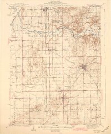
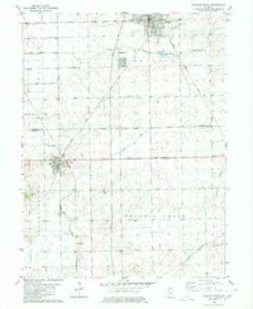
13 topographic sheets cover this place, the earliest surveyed in 1942 and the latest in 1990. It lies in ZIP code area 62682. The Survey maps it on the Delavan South quadrangle.
Topographic sheets covering this place
8 surveys from 13 printed sheetsMatched by testing this settlement's coordinate against the published boundary of every sheet in the United States Geological Survey's historical collection. Each opens the scanned sheet at the Survey.
- 1942 USGS Delavan quadrangle1:62500, 3 printings
- 1958 USGS Peoria quadrangle1:250000, 4 printings
- 1961 USGS Peoria quadrangle1:250000
- 1963 USGS Peoria quadrangle1:250000
- 1980 USGS Delavan South quadrangle1:24000
- 1985 USGS Lincoln quadrangle1:100000
- 1989 USGS Lincoln quadrangle1:100000
- 1990 USGS Peoria quadrangle1:250000




Storms near this place
20 since 1998Regional context, not property-specific evidence. The National Weather Service names San Jose in 20 storm reports between 1998 and 2018: 9 thunderstorm wind, 6 hail, 5 flash flood. The reports record 1 injury. Each account below is quoted exactly as the forecast office filed it, from the NOAA Storm Events Database, and each date opens the federal record of that event.
| When | Event | Place named | Harm | What the report says |
|---|---|---|---|---|
| April 2000 | Thunderstorm Wind | San Jose | 1 hurt, $750,000 | As a line of severe thunderstorms raced across Logan County, extensive damage was reported in northern sections of the county from San Jose to Atlanta. In San Jose, a mobile home was blown off of its foundation. No injuries were reported. In the Emden area, 3 homes sustained major damage and one home sustained minor damage. Also, numerous outbuildings and grain bins were either damaged or destroyed. Two miles east of Emden, a semi was blown over on the off ramp of I-155. The driver received minor injuries. |
| June 2015 | Flash Flood | San Jose | $40,000 | Rainfall amounts of 2.00 to 3.00, on top of waterlogged ground, were reported during the evening of June 28th. This resulted in the flooding of several rural roads from Lincoln through Hartsburg to San Jose. Part of a road two miles southeast of Lincoln washed out due to extreme rainfall during much of the month of June. |
| June 2009 | Thunderstorm Wind | San Jose | $10,000 | Power lines were blown down in San Jose. |
| August 2018 | Thunderstorm Wind | San Jose | $6,000 | A power pole was blown down. |
| August 2016 | Flash Flood | San Jose | - | Persistent thunderstorms produced heavy rainfall during the early evening in northern and western Logan County with 2.50 to 6.00 inches in three hours. The heaviest rain and flooding extended from San Jose to Emden to New Holland. Multiple rural roads in northwest Logan County were inundated. U.S. Highway 136 from I-155 to the Mason County line was impassable in several locations. The flash flooding subsided by late evening. |
| February 2014 | Flash Flood | San Jose | - | Rainfall of 0.50 to 1.00 combined with 2 of snow depth and a frozen ground to produce flash flooding across most of Logan County. Many streets in Lincoln were flooded and most rural roads were impassable. The water was one foot deep in spots and several cars had to be abandoned. |
| June 2008 | Flash Flood | San Jose | - | Extensive flooding was reported along U.S. Route 136 near Emden in northwest Logan County. |
| April 2006 | Thunderstorm Wind | San Jose | - | Significant tree and power line damage. A 50 foot antenna was blown down. A concrete silo was completely destroyed just north of town. |
| July 2005 | Thunderstorm Wind | San Jose | - | Tree blown down across County Road 14. |
| August 2004 | Flash Flood | San Jose | - | Very heavy rain caused numerous roads to become flooded between San Jose and Lincoln. US Route 136 was closed for a time due to standing water. |
| April 2001 | Thunderstorm Wind | San Jose | - | One semi truck was blown off US 136, near San Jose and another one was blown over on I-155 between mile markers 7 and 8. |
| August 2001 | Hail | San Jose | - | Hail varying in size from 3/4 inch to 3.75 inches fell across northern Logan County. The largest hail occurred in San Jose. |
| September 2000 | Thunderstorm Wind | San Jose | - | A 12 inch diameter tree was blown down onto power lines in Lincoln. Four miles southeast of Lincoln, an 18 inch diameter tree was blown down onto a house. Several tree limbs were blown down onto power lines in San Jose. No damage estimates were available and no injuries were reported. |
| May 1998 | Thunderstorm Wind | San Jose | - | As a severe thunderstorm moved across the northern portions of Logan county it caused spotty damage. In San Jose, the winds blew some siding off of a home on the north side of town. In Atlanta on the northeast side of town, thunderstorm winds estimated around 75 mph blew down 6 power poles, caused roof and siding damage to one home, and a 4.5 foot diameter tree was broken off three feet above the ground. No injuries were reported and no damage estimate was available. |
| March 1998 | Thunderstorm Wind | San Jose | - | As a line of severe thunderstorms moved through Logan county, numerous reports of damage were received. A greenhouse in San Jose was damaged and in Mt. Pulaski two buildings sustained roof damage, a storage shed was damaged, and numerous large tree limbs were blown down. In Chestnut, a 1-ton truck was blown over on Route 54. No injuries were reported and no damage estimate was available. |
| June 2008 | Hail | San Jose | - | no account filed |
| June 2008 | Hail | San Jose | - | no account filed |
| May 2004 | Hail | San Jose | - | no account filed |
| June 1999 | Hail | San Jose | - | no account filed |
| April 1999 | Hail | San Jose | - | no account filed |
Nearest settlements
The eight closest, with where each one stands in the county. Distances are straight-line, computed from the Geographic Names Information System coordinates.
| Map | Place | Distance | Sheets |
|---|---|---|---|
| Harness | 4.0 miles | 14 | |
| Emden | 6.3 miles | 14 | |
| New Holland | 8.4 miles | 14 | |
| Hartsburg | 9.4 miles | 14 | |
| Burton View | 11.2 miles | 15 | |
| Lucas | 12.5 miles | 13 | |
| Union | 12.6 miles | 13 | |
| Bell | 13.8 miles | 15 |
Provenance
This settlement is recorded in the Geographic Names Information System as feature 417923. The sheet list is computed by point-in-boundary test against the United States Geological Survey's historical topographic inventory. Both are works of the United States government and carry no copyright under 17 U.S.C. 105.
Storms. NOAA National Centers for Environmental Information, Storm Events Database https://www.ncei.noaa.gov/stormevents/ A work of the United States government, no copyright under 17 U.S.C. 105. Narratives are quoted verbatim from the National Weather Service report and are not edited or summarised.