 Block
New Holland, Illinois
14 topographic sheets cover this place, the earliest surveyed in 1948 and the latest in 1990. It stands in Sheridan Township. It lies in ZIP code area 62671. The Survey maps it on the New Holland quadrangle. 275 people lived here at the 2020 count. It stands 555 feet above sea level.
Population over time
2 figuresNew Holland grew from 269 to 275 between 2010 and 2020. These are the recorded population figures Wikidata holds for this place, reached through the Geographic Names Information System number this page is keyed on rather than by name, so they belong to this place and not to another of the same name. Most are census counts, but not all are: an early figure may be a founding or settlement estimate, and an estimate published within five years of a census is left out. The change column is computed, and is left blank where more than 20 years separate a figure from the one before it, because a gap that long is not a change between two counts.
| Year | People | Change |
|---|---|---|
| 2010 | 269 | |
| 2020 | 275 | +6 (+2%) |
Topographic sheets covering this place
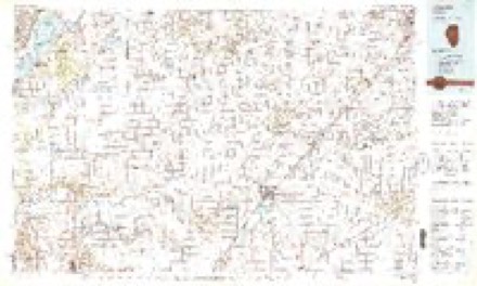
9 surveys from 14 printed sheetsMatched by testing this settlement's coordinate against the published boundary of every sheet in the United States Geological Survey's historical collection. Each opens the scanned sheet at the Survey.
- 1948 USGS Mason City quadrangle1:62500, 2 printings
- 1949 USGS Mason City quadrangle1:62500, 2 printings
- 1958 USGS Peoria quadrangle1:250000, 4 printings
- 1961 USGS Peoria quadrangle1:250000
- 1963 USGS Peoria quadrangle1:250000
- 1980 USGS New Holland quadrangle1:24000
- 1985 USGS Lincoln quadrangle1:100000
- 1989 USGS Lincoln quadrangle1:100000
- 1990 USGS Peoria quadrangle1:250000




In the county-history sources
7,793 words on this townshipHistory of Logan County, Illinois : Its Past and Present .., published 1878; History of Logan County, Illinois, Together with Sketches of Its Cities, Villages, and Towns, Educational, Religious, Civil, Military, and Political History, Portraits of Prominent Person, and Biographies of Representative Citizens : Also a Condensed History of Illinois, Embodying Accounts of Prehistoric Races, Indian Wars, and a Brief Review of Its Civil and Political History, published 1886 names this settlement in its chapter on Sheridan Township. These are the passages that mention it, exactly as the scans read.
WINDLE GEORGE, farmer and stock-raiser. Sec. 30; P.O. New Holland; dem; liberal; was born in Ohio, Dec. 30, 1845; came to this county m 1861; marrien Sarah C. Ohmart, Sept. 18, 1872; she was bom in Menard Co. in 1850; have two, children living, Lulu May and Lizzie Ellen, and one dead, Charles O; has held the office of collector and town clerk; he has a fine lot of thorough-bred Berkshire hogs, and also thorough-bred short-horn Durham cattle
Passage source: History of Logan County, Illinois : Its Past and Present .., published 1878.
In political affiliation Sheridan is a strong Democratic township, as shown by the following abstract of the vote for President at each election since 1868: a thriving village on the Indianapolis, Bloomington & Western Railroad, in Sheridan Township, was laid out by Oliver Holland in April, 1875. The first building erected in town was a dwelling by "William Towberman, who soon after built a store. He had been preceded a short time by Randolph & Co., who were the first to open a stock of goods here. An elevator was built in 1875 by M. La Forge, which is now operated by Y. E. St. John. The shipments of grain from town are enormous. It is in the midst of an excellent farming community, and the handling of cattle and grain, especially the latter, forms the chief business of town. The population is now 300.
JVew Holland Lodge, No. 741, A. Jf. & A. M., was chartered October 3, 1876, the following being the first officers: T. P. Garretson, Worthy Master; A. M. Caldwell, Senior Warden; D. M. Burner, Junior Warden. The other charter members were: Jacob and John Bolinger, Ed. Beaver, John Harter, S. E. Bickford, S. F. Jackson, George W. Gayle, Lee Chance, William Towberman, Eli Thomas, E. A. Baxter and Robert Miller. The present officers are: A. M. Caldwell, Worthy Master; Ed. Beaver, Senior Warden ; Sam. Faverty, Junior Warden; V. R. St. John, Secretary; D. M. Burner, Treasurer; George Harmon, Tyler; James Derr, Senior Deacon; Jonas White, Junior Deacon. The lodge has twenty-two members, and meets on Saturday evening on or before the full moon of each month.
Machine-read from a century-old scan, so expect the errors a machine makes: misspelled names, dropped words, stray characters.
Read the whole chapter on Sheridan Township - it names this place 19 more 19 times.
Storms near this place
18 since 1996Regional context, not property-specific evidence. The National Weather Service names New Holland in 18 storm reports between 1996 and 2023: 10 thunderstorm wind, 4 hail, 3 flash flood, 1 tornado. No death or injury is recorded in these reports. Each account below is quoted exactly as the forecast office filed it, from the NOAA Storm Events Database, and each date opens the federal record of that event.
| When | Event | Place named | Harm | What the report says |
|---|---|---|---|---|
| April 2012 | Thunderstorm Wind | New Holland | $250,000 | A large shed was destroyed just east of New Holland, with pieces of it blown across Illinois Route 10. In addition, most of the roof was torn off an agricultural supply building. |
| December 2008 | Thunderstorm Wind | New Holland | $60,000 | High winds damaged two homes in New Holland. Three outbuildings were blown down and numnerous trees were damaged as well. |
| June 2014 | Thunderstorm Wind | New Holland | $20,000 | Several large trees were blown down in New Holland. |
| June 2011 | Thunderstorm Wind | New Holland | $20,000 | Several power poles were blown down in New Holland. |
| June 2016 | Thunderstorm Wind | New Holland | $10,000 | Numerous large tree branches were blown down in New Holland. |
| August 2009 | Thunderstorm Wind | New Holland | $2,000 | A power line was blown down in New Holland. |
| February 2023 | Flash Flood | New Holland | - | Water was flowing across State Route 10 in New Holland. |
| June 2010 | Flash Flood | New Holland | - | Heavy rain of 2.50 in two hours produced flash flooding in central Logan County, including the city of Lincoln. Numerous roads were inundated with more than a foot of flowing water. |
| April 2006 | Hail | New Holland | - | Penny size hail covered the ground. |
| March 2006 | Thunderstorm Wind | New Holland | - | Silo blown over west of Sugar Creek. |
| July 2006 | Thunderstorm Wind | New Holland | - | Several tree limbs and power lines were blown down. |
| July 2006 | Thunderstorm Wind | New Holland | - | Numerous trees and power lines were blown down across the county. |
| July 2002 | Flash Flood | New Holland | - | Heavy rains caused flooding on Illinois Route 10 near New Holland, as well as numerous rural roads. |
| May 1998 | Thunderstorm Wind | New Holland | - | Thunderstorm winds blew down several trees 2 miles south of New Holland. No injuries or structural damage were reported. |
| June 2011 | Hail | New Holland | - | no account filed |
| April 2003 | Hail | New Holland | - | no account filed |
| August 2001 | Hail | New Holland | - | no account filed |
| June 1996 | Tornado (F0) | New Holland | - | no account filed |
Nearest settlements
The eight closest, with where each one stands in the county. Distances are straight-line, computed from the Geographic Names Information System coordinates.
| Map | Place | Distance | Sheets |
|---|---|---|---|
| Harness | 4.4 miles | 14 | |
| Burton View | 5.2 miles | 15 | |
| Middletown | 5.9 miles | 13 | |
| San Jose | 8.4 miles | 13 | |
| Hartsburg | 8.7 miles | 14 | |
| Emden | 9.4 miles | 14 | |
| Bell | 10.3 miles | 15 | |
| Fogarty | 10.6 miles | 14 |
Elsewhere
Matched on this settlement's Geographic Names Information System number rather than its name, so it cannot be a different place of the same name in another state.
| Wikipedia article on New Holland | An encyclopaedic summary. Its text is share-alike, so it is linked here rather than copied. |
| Wikidata item Q2456409 | The structured record the population and elevation above come from. Public domain (CC0). |
Provenance
This settlement is recorded in the Geographic Names Information System as feature 414407. The sheet list is computed by point-in-boundary test against the United States Geological Survey's historical topographic inventory. Both are works of the United States government and carry no copyright under 17 U.S.C. 105.
Storms. NOAA National Centers for Environmental Information, Storm Events Database https://www.ncei.noaa.gov/stormevents/ A work of the United States government, no copyright under 17 U.S.C. 105. Narratives are quoted verbatim from the National Weather Service report and are not edited or summarised.