 Block
Steward, Illinois
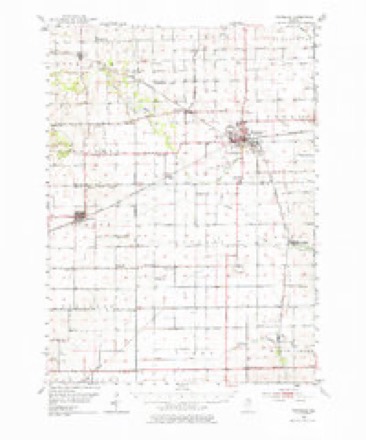
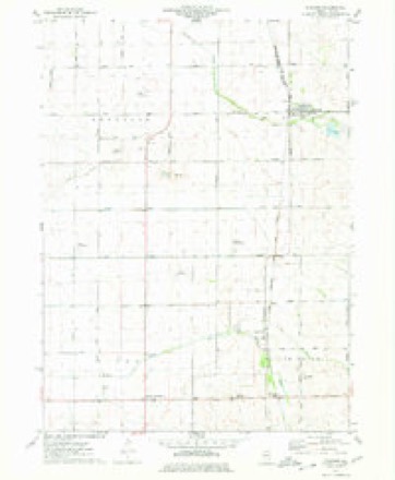
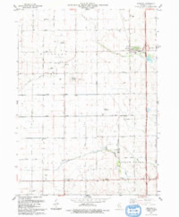
11 topographic sheets cover this place, the earliest surveyed in 1952 and the latest in 1993. It stands in Alto Township. It lies in ZIP code area 60553. The Survey maps it on the Steward quadrangle. 229 people lived here at the 2020 count. It stands 823 feet above sea level.
Population over time
2 figuresSteward fell from 256 to 229 between 2010 and 2020. These are the recorded population figures Wikidata holds for this place, reached through the Geographic Names Information System number this page is keyed on rather than by name, so they belong to this place and not to another of the same name. Most are census counts, but not all are: an early figure may be a founding or settlement estimate, and an estimate published within five years of a census is left out. The change column is computed, and is left blank where more than 20 years separate a figure from the one before it, because a gap that long is not a change between two counts.
| Year | People | Change |
|---|---|---|
| 2010 | 256 | |
| 2020 | 229 | -27 (-11%) |
Topographic sheets covering this place
6 surveys from 11 printed sheetsMatched by testing this settlement's coordinate against the published boundary of every sheet in the United States Geological Survey's historical collection. Each opens the scanned sheet at the Survey.
- 1952 USGS Rochelle quadrangle1:62500, 3 printings
- 1958 USGS Aurora quadrangle1:250000, 3 printings
- 1961 USGS Aurora quadrangle1:250000
- 1975 USGS Steward quadrangle1:24000
- 1985 USGS Dixon quadrangle1:100000, 2 printings
- 1993 USGS Steward quadrangle1:24000



What happened here
An account from the chapter on Alto township. The inset identifies its exact source book and publication year.
Tragedy
TRAGEDY. The history of China records but one criminal murder, and this, too, in the pure, primitive days. In the fall of 1847, or early the following winter, Moody Thompson, a widower, had bought a small place on the bank of the creek, in the grove, about one and a half miles " west of town." During the winter Thompson lived with the family of whom he had purchased.
In the county-history sources
32,762 words on this townshipHistory of Lee County, published 1881 names this settlement in its chapter on Alto Township. These are the passages that mention it, exactly as the scans read.
In the winter of 1869 and 1870 there was an agitation commenced as to a railroad through Alto township from the southeast to the northwest, known first as the Hinckley road, now the Chicago & Iowa railroad. Great excitement was caused and much opposition made toward the enterprise. A call was made for a meeting to see if the citizens were willing to subscribe for $32,000 bonds, payable when the track was laid, and cars running on the same. The meeting was held, and upon vote being taken it showed as a result nearly two-thirds in favor of the scheme, or 93 for and 50 against. A surVey was made and grading commenced on Monday, September 26, 1870, and the enterprise was pushed ahead rapidly, and on December 31, 1870, it was finished to Rochelle, Ogle county, and trains sent over. Then there was a lull and no regular trains were run till April 1871, and only once a day till 1872. The great Chicago fire and the panic occurring about that time had a depressing effect through this section, and a few years later the $32,000 bonds were compromised and reduced to $25,000, and at a lower rate of interest, and have since been reduced to about $15,000. The railroad offices and warehouse were in Wesley Steward's barn for some time after the road was in operation.
Passage source: History of Lee County, published 1881.
A meeting was called and held in the railroad depot April 1874. At this meeting a building committee was chosen and elected. The committee were J. C. Curry, H. A. Robinson, II. Yan Patten, Y. W. Wells, Jeremiah Tyler, Jas. A, Smith, Merritt Miller, E, M, Piele, and John Yetter. M. L. Barnett was elected treasurer, and J. C. Curry clerk. The committee proceeded at once toward their work, having a plan drawn by Perkins Richardson, of Aurora. The plan was adopted and the contract was at once made with T. J. Labdell, of Paw Paw, for its erection. The building was completed and ready for dedication September 6, 1874. Trains were run free from Chicago and Mount Morris, and a free dinner was served on the day of dedication. The church is the finest building of its kind between Aurora and Rochelle. It is 36x52, and 28 feet high to the eaves, with steeple about 80 feet high. It has a fine basement room, the whole size of the building, for Sunday-school purposes. The church has seating for about 500. It is free from debt and both church and Sunday-school are in a flourishing condition under the pastoral care of Rev. W. H. Tibbals and T. J. Lawton, superintendent of Sabbath-school. The original cost of church building was about $5,000. Its present ofticers are Wesley Steward, T. J. Lawton, Y. W. Wells, IL Yan Patten, and C, W. Herbert, trustees, and T. J. Lawton, treasurer.
Passage source: History of Lee County, published 1881.
C. W. Younggren, secretary ; C. Yanderventer, treasurer. The other charter members were J. L. Dyas, H. W. Bryant, F. Fitzgerald, W. R. Baumbach, J. N. Prentice, J. Mullins, C. W. Yonnggren, and C Yanderventer. On May 22, 1880, the N.G. of Fidelia Lodge, No. 635, by request, appointed a committee, consisting of Brethren Harris, Hallet and Younggren, to confer with brethren of the order residing at Steward and vicinity to consider the propriety of removal of Fidelia Lodge to Steward. At a subsequent meeting the committee reported favorable, and upon vote being taken it was unanimously carried to petition the Grand Lodge for removal, and upon receipt of the petition the M.W.G.M., G. W. Berggren, deeming it for the best interest of the order, granted a warrant for removal. The lodge as now situated in the village of Steward is in a very healthy condition, being financially and socially strong. Its present officers are A. R. Michael, N.G. ; W. B. Griffith, Y.G. ; John Dunn, treasurer, and S. J. Whetston, secretary.
Passage source: History of Lee County, published 1881.
Machine-read from a century-old scan, so expect the errors a machine makes: misspelled names, dropped words, stray characters.
Read the whole chapter on Alto Township - it names this place 36 more 36 times.
Mines and quarries near this place
2 within 5 milesRegional context, not property-specific evidence. The federal mineral resources record lists 2 workings within 5 miles of Steward: 1 producer, 1 past producer. 1 still produces. What was taken out: Limestone, Dimension, Stone, Crushed/Broken. Distance is straight-line from the map coordinates, so a quarry counted here may appear on a neighbouring settlement's page as well.
| Where | Site | Commodity | Status | Recorded |
|---|---|---|---|---|
| Stoneridge Quarry | Limestone, Dimension | Producer | ||
| W. Hemenway Quarry | Stone, Crushed/Broken | Past Producer |
Storms near this place
12 since 2003Regional context, not property-specific evidence. The National Weather Service names Steward in 12 storm reports between 2003 and 2023: 9 thunderstorm wind, 2 hail, 1 funnel cloud. No death or injury is recorded in these reports. Each account below is quoted exactly as the forecast office filed it, from the NOAA Storm Events Database, and each date opens the federal record of that event.
| When | Event | Place named | Harm | What the report says |
|---|---|---|---|---|
| March 2023 | Thunderstorm Wind | Steward | - | Photo shared shows a semi truck blown over to the east on I-39 just north of the Prairie Road exit. Wind gust was estimated from trained spotter. Time was estimated based on radar. |
| March 2022 | Funnel Cloud | Steward | - | A photo showed a couple of funnel clouds. |
| June 2021 | Thunderstorm Wind | Steward | - | Photos shared on social media showed two small trees snapped in half. |
| May 2018 | Thunderstorm Wind | Steward | - | A large tree was blown down. |
| November 2013 | Thunderstorm Wind | Steward | - | Two older 8 to 10 inch diameter trees were blown down. |
| June 2012 | Thunderstorm Wind | Steward | - | Wind gusts to 60 mph were estimated near the Interstate 88 and Interstate 39 interchange. |
| July 2012 | Thunderstorm Wind | Steward | - | A trained spotter estimated wind gusts to 60 mph. |
| June 2010 | Thunderstorm Wind | Steward | - | Tree limbs were blown down. |
| June 2009 | Thunderstorm Wind | Steward | - | Part of a large tree was blown down onto a house. Part of a second, much smaller tree was also blown down. |
| August 2007 | Thunderstorm Wind | Steward | - | Tree limbs were blown down. |
| May 2019 | Hail | Steward | - | no account filed |
| July 2003 | Hail | Steward | - | no account filed |
Nearest settlements
The eight closest, with where each one stands in the county. Distances are straight-line, computed from the Geographic Names Information System coordinates.
| Map | Place | Distance | Sheets |
|---|---|---|---|
| Scarboro | 4.6 miles | 11 | |
| Lee | 5.5 miles | 9 | |
| Twelvemile Corner | 7.0 miles | 11 | |
| Roxbury | 10.2 miles | 11 | |
| The Burg | 10.6 miles | 11 | |
| Ashton | 10.7 miles | 10 | |
| Melugin Grove (historical) | 10.9 miles | 11 | |
| Compton | 11.1 miles | 11 |
Elsewhere
Matched on this settlement's Geographic Names Information System number rather than its name, so it cannot be a different place of the same name in another state.
| Wikipedia article on Steward | An encyclopaedic summary. Its text is share-alike, so it is linked here rather than copied. |
| Wikidata item Q2194507 | The structured record the population and elevation above come from. Public domain (CC0). |
Provenance
This settlement is recorded in the Geographic Names Information System as feature 419121. The sheet list is computed by point-in-boundary test against the United States Geological Survey's historical topographic inventory. Both are works of the United States government and carry no copyright under 17 U.S.C. 105.
Mines and quarries. USGS Mineral Resources Data System (MRDS) https://mrdata.usgs.gov/mrds/ A work of the United States government, no copyright under 17 U.S.C. 105.
Storms. NOAA National Centers for Environmental Information, Storm Events Database https://www.ncei.noaa.gov/stormevents/ A work of the United States government, no copyright under 17 U.S.C. 105. Narratives are quoted verbatim from the National Weather Service report and are not edited or summarised.