 Block
Virgil, Illinois
9 topographic sheets cover this place, the earliest surveyed in 1937 and the latest in 1985. It stands in Virgil Township. It lies in ZIP code area 60151. The Survey maps it on the Maple Park quadrangle. 289 people lived here at the 2020 count. It stands 866 feet above sea level.
Population over time
2 figuresVirgil fell from 329 to 289 between 2010 and 2020. These are the recorded population figures Wikidata holds for this place, reached through the Geographic Names Information System number this page is keyed on rather than by name, so they belong to this place and not to another of the same name. Most are census counts, but not all are: an early figure may be a founding or settlement estimate, and an estimate published within five years of a census is left out. The change column is computed, and is left blank where more than 20 years separate a figure from the one before it, because a gap that long is not a change between two counts.
| Year | People | Change |
|---|---|---|
| 2010 | 329 | |
| 2020 | 289 | -40 (-12%) |
Topographic sheets covering this place
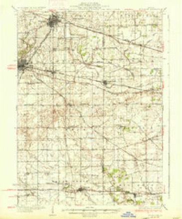
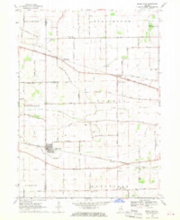
5 surveys from 9 printed sheetsMatched by testing this settlement's coordinate against the published boundary of every sheet in the United States Geological Survey's historical collection. Each opens the scanned sheet at the Survey.
- 1937 USGS Sycamore quadrangle1:62500, 2 printings
- 1958 USGS Aurora quadrangle1:250000, 3 printings
- 1961 USGS Aurora quadrangle1:250000
- 1968 USGS Maple Park quadrangle1:24000, 2 printings
- 1985 USGS Aurora quadrangle1:100000



In the county-history sources
615 words on this townshipHistory of Kane County, Ill., published 1908 names this settlement in its chapter on Virgil Township. These are the passages that mention it, exactly as the scans read.
Virgil, on the extreme west of the county, was settled a year or two later than the river townships. The first settler was Luther Merrill from New Hampshire, who came in 1836, and laid claim to all the land included in the thirty-six sections that now include Mrgil township. A large part of it was swamp and shallow lakes at that time. For a time every settler had to buy of Merrill, but they soon came in so fast that he was unable to keep them off, and he gave up the idea of holding the entire county. Milton Thornton came in early, as did John B. Moore, Daniel McKinley, William H. Robinson. Joseph Gray, Joshua Read, Daniel Smith. Lyman German, Charles Jackson, Harrison Chambers, Henry Krows (1840). Until 1840 most of the pioneers came from New York state.
Passage source: History of Kane County, Ill., published 1908.
Machine-read from a century-old scan, so expect the errors a machine makes: misspelled names, dropped words, stray characters.
Fires near this place
3 since 2003Regional context, not property-specific evidence. The federal wildfire occurrence database lists 3 fires within 5 miles of Virgil between 2003 and 2013, burning about 4 acres in total. None started naturally. None was recorded as arson. Distance is straight-line from the map coordinates, so a fire counted here may appear on a neighbouring settlement's page as well.
| Reported cause | Fires |
|---|---|
| Recreation and ceremony | 2 |
| Debris and open burning | 1 |
The most recent of them, most recent first, with the day each was reported and the service that recorded it.
| Date | Cause | Size | Reported by | Name on the report |
|---|---|---|---|---|
| 5 April 2013 | Debris and open burning | under an acre | Illinois Division of Forestry Resources | 2013-292 |
| 2 April 2003 | Recreation and ceremony | 2.0 acres | Illinois State Fire Marshal's Office | not named |
| 23 March 2003 | Recreation and ceremony | 2.0 acres | Illinois State Fire Marshal's Office | not named |
Settlements close enough to share some of these fires:
Mines and quarries near this place
2 within 5 milesRegional context, not property-specific evidence. The federal mineral resources record lists 2 workings within 5 miles of Virgil: 1 producer, 1 past producer. 1 still produces. What was taken out: Iron, Sand and Gravel, Construction. Distance is straight-line from the map coordinates, so a quarry counted here may appear on a neighbouring settlement's page as well.
| Where | Site | Commodity | Status | Recorded |
|---|---|---|---|---|
| Highland Avenue Pit | Sand and Gravel, Construction | Past Producer | ||
| Smith Chemical Plant | Iron | Producer |
Storms near this place
11 since 2008Regional context, not property-specific evidence. The National Weather Service names Virgil in 11 storm reports between 2008 and 2025: 7 thunderstorm wind, 4 tornado. No death or injury is recorded in these reports. Each account below is quoted exactly as the forecast office filed it, from the NOAA Storm Events Database, and each date opens the federal record of that event.
| When | Event | Place named | Harm | What the report says |
|---|---|---|---|---|
| October 2010 | Tornado (EF1) | Virgil | $100,000 | The tornado that was northwest of Elburn touched down in a corn field about one mile north of Route 38, west of Francis Road. The tornado closely followed Francis Road and was on the ground for about of a mile. At the max width, the tornado was about 20 yards wide. The path touched three farmsteads and one home. The first farmstead that was affected sustained high end EF0 damage. An old garage and a small barn were leveled on the property, the roof was damaged on another building, and the trees on the property also sustained damage. There were several tree branches down around the property, and the trunk of a healthy pine tree was completely snapped. The second farmstead affected was located about a half mile up Francis Road. A temporary storage structure on the property was not constructed with any sort of wood or metal covering, but a heavy duty tarp-like material, heavily secured to the metal skeleton. The tarp was torn away from most of the metal structure, but still remained attached at one end. Several other buildings on the property, which were permanent, remained undamaged. The third and final farmstead affected was the most heavily affected area along the tornado's path. The farmstead was located about a quarter mile up Francis Road. Two large barns and one grain bin were completely destroyed on this property, and a telephone pole was completely snapped at the base. |
| June 2008 | Thunderstorm Wind | Virgil | $10,000 | A tree was blown down onto a police car at Route 64 and Meredith Road. |
| March 2025 | Thunderstorm Wind | Virgil | - | Trees were reported down in many locations along Beith Rd northeast of Maple Park. |
| March 2025 | Thunderstorm Wind | Virgil | - | Several trees were snapped near CR-14 and McNulty Rd northeast of Maple Park. |
| March 2025 | Thunderstorm Wind | Virgil | - | A tree or large tree branch was down on McNulty Rd northeast of Maple Park. |
| March 2025 | Thunderstorm Wind | Virgil | - | A large 3-foot diameter pine tree was snapped at the base along Beith Rd. It was moved, but appeared to have fallen toward the north. |
| July 2024 | Thunderstorm Wind | Virgil | - | A tree and power lines were blown down onto Meredith Road. |
| July 2024 | Tornado (EF1) | Virgil | - | A tornado with estimated peak winds of 100 mph touched down just northwest of the intersection of McNulty Road and Meredith Road, where crop damage was evident in high resolution satellite imagery. The tornado moved southeast producing tree damage and then began moving to the east as it moved through Elburn where trees were blown down and damage occurred to a few farm buildings and houses. The tornado moved to the east northeast after passing Elburn and destroyed a metal farm building at an equestrian center. Several trees were blown down and several 2x4 boards were driven at least one foot into the ground. It is at this location where the tornado was likely at peak intensity. The tornado ended halfway between Brundige Road and Peck Road, south of Route 38. |
| March 2023 | Thunderstorm Wind | Virgil | - | Roofing material was blown off of a barn and blown to the northeast at Francis Rd and Beith Rd northwest of Elburn. Wind magnitude and time were estimated based on radar. |
| August 2021 | Tornado (EFU) | Virgil | - | A spotter video showed a very brief tornado touched down in a field south of Route 64 and north of Welter Road. The location was estimated and no damage was reported. |
| November 2020 | Tornado (EF0) | Virgil | - | A tornado with peak winds of 80 mph touched down near Francis Road northwest of Elburn and damaged nearby trees and the roof of an outbuilding. The tornado continued northeast and crossed Route 47 south of Route 64, based on an eyewitness report. After crossing Route 64, the tornado damaged trees on Hanson Road. The tornado is thought to have lifted soon thereafter based on a lack of downstream reports of damage. The path of this tornado was determined based on information gathered on social media, from emergency management and using radar data. |
Nearest settlements
The eight closest, with where each one stands in the county. Distances are straight-line, computed from the Geographic Names Information System coordinates.
| Map | Place | Distance | Sheets |
|---|---|---|---|
| The Meadows of Virgil | 0.7 miles | 9 | |
| Richardson | 2.7 miles | 9 | |
| Indian Creek | 2.9 miles | 13 | |
| Lily Lake | 3.2 miles | 13 | |
| Meredith | 3.9 miles | 9 | |
| Oak Openings | 4.2 miles | 13 | |
| Maple Park | 4.7 miles | 9 | |
| Mary Meadows | 4.9 miles | 13 |
Elsewhere
Matched on this settlement's Geographic Names Information System number rather than its name, so it cannot be a different place of the same name in another state.
| Wikipedia article on Virgil | An encyclopaedic summary. Its text is share-alike, so it is linked here rather than copied. |
| Wikidata item Q2294718 | The structured record the population and elevation above come from. Public domain (CC0). |
Provenance
This settlement is recorded in the Geographic Names Information System as feature 420329. The sheet list is computed by point-in-boundary test against the United States Geological Survey's historical topographic inventory. Both are works of the United States government and carry no copyright under 17 U.S.C. 105.
Wildfire. Short, Karen C. 2022. Spatial wildfire occurrence data for the United States, 1992-2020 [FPA_FOD_20221014]. 6th Edition. Fort Collins, CO: Forest Service Research Data Archive. https://doi.org/10.2737/RDS-2013-0009.6 Collected with United States Government funding and usable without additional permissions or fees.
Mines and quarries. USGS Mineral Resources Data System (MRDS) https://mrdata.usgs.gov/mrds/ A work of the United States government, no copyright under 17 U.S.C. 105.
Storms. NOAA National Centers for Environmental Information, Storm Events Database https://www.ncei.noaa.gov/stormevents/ A work of the United States government, no copyright under 17 U.S.C. 105. Narratives are quoted verbatim from the National Weather Service report and are not edited or summarised.