 Block
Maple Park, Illinois
9 topographic sheets cover this place, the earliest surveyed in 1937 and the latest in 1985. It stands in Virgil Township. It lies in ZIP code area 60151. The Survey maps it on the Maple Park quadrangle. 1,433 people lived here at the 2020 count. It stands 863 feet above sea level.
Population over time
2 figuresMaple Park grew from 1,310 to 1,433 between 2010 and 2020. These are the recorded population figures Wikidata holds for this place, reached through the Geographic Names Information System number this page is keyed on rather than by name, so they belong to this place and not to another of the same name. Most are census counts, but not all are: an early figure may be a founding or settlement estimate, and an estimate published within five years of a census is left out. The change column is computed, and is left blank where more than 20 years separate a figure from the one before it, because a gap that long is not a change between two counts.
| Year | People | Change |
|---|---|---|
| 2010 | 1,310 | |
| 2020 | 1,433 | +123 (+9%) |
Topographic sheets covering this place
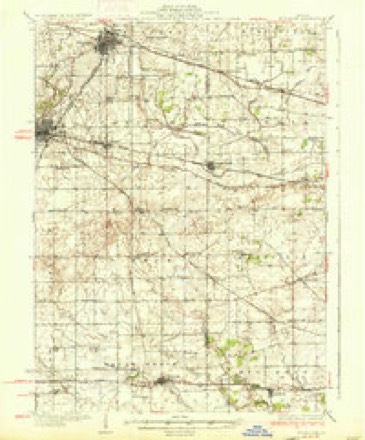
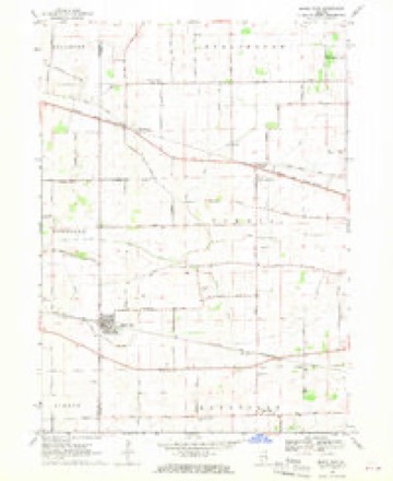
5 surveys from 9 printed sheetsMatched by testing this settlement's coordinate against the published boundary of every sheet in the United States Geological Survey's historical collection. Each opens the scanned sheet at the Survey.
- 1937 USGS Sycamore quadrangle1:62500, 2 printings
- 1958 USGS Aurora quadrangle1:250000, 3 printings
- 1961 USGS Aurora quadrangle1:250000
- 1968 USGS Maple Park quadrangle1:24000, 2 printings
- 1985 USGS Aurora quadrangle1:100000



In the county-history sources
615 words on this townshipHistory of Kane County, Ill., published 1908 names this settlement in its chapter on Virgil Township. These are the passages that mention it, exactly as the scans read.
The building of the Chicago & Galena railroad through the township in 1853 was the beginning of the now thriving and prosperous village of Maple Park, which was platted in March, 1854, by Loren Heath and Zachariah Hathorn. It was at first known as Lodi, which name was changed to Alaple Park in 1879 or 1880. Heath and Hathorn built a store, which was the first building in the place. James Haines built a house, which became a tavern, and Mr. Watson a store. O. S. and F. T. I\Iiner put up a blacksmith shop in 1854, and B. \\'. Lyon a store in 1855. Within eighteen months after the village was laid out it had a population of over four hundred, and it has since then continued to grow until now a beautiful village of over one thousand people as industrious and intelligent as may be found anywhere fill the once sweeping prairie with modern stores, hotels and factories. Mr. Milton J. Beverly, the present probate clerk, is from this enterprising little city.
Passage source: History of Kane County, Ill., published 1908.
Machine-read from a century-old scan, so expect the errors a machine makes: misspelled names, dropped words, stray characters.
Mines and quarries near this place
3 within 5 milesRegional context, not property-specific evidence. The federal mineral resources record lists 3 workings within 5 miles of Maple Park: 1 plant, 1 past producer, 1 producer. 2 still produce. What was taken out: Stone, Crushed/Broken, Sand and Gravel, Construction, Iron. Distance is straight-line from the map coordinates, so a quarry counted here may appear on a neighbouring settlement's page as well.
| Where | Site | Commodity | Status | Recorded |
|---|---|---|---|---|
| Sears Limestone Quarry & Plant | Stone, Crushed/Broken | Plant | ||
| Smith Chemical Plant | Iron | Producer | ||
| West Lake Pit | Sand and Gravel, Construction | Past Producer |
Storms near this place
26 since 1998Regional context, not property-specific evidence. The National Weather Service names Maple Park in 26 storm reports between 1998 and 2025: 17 thunderstorm wind, 5 hail, 3 tornado, 1 funnel cloud. No death or injury is recorded in these reports. Each account below is quoted exactly as the forecast office filed it, from the NOAA Storm Events Database, and each date opens the federal record of that event.
| When | Event | Place named | Harm | What the report says |
|---|---|---|---|---|
| June 2008 | Thunderstorm Wind | Maple Park | $10,000 | A semi truck was blown over near mile marker 101 on Interstate 88. |
| March 2025 | Thunderstorm Wind | Maple Park | - | A tree was downed onto a high tension power line. |
| March 2025 | Thunderstorm Wind | Maple Park | - | Tree damage was reported on the northeast side of Maple Park. |
| March 2025 | Thunderstorm Wind | Maple Park | - | A tree fell onto power lines and was lying across the road near Maple Park. |
| March 2025 | Thunderstorm Wind | Maple Park | - | A tree was downed onto a high tension power line near IL-38 and County Line Road in Maple Park. |
| February 2024 | Tornado (EF0) | Maple Park | - | This tornado touched down along Keslinger Road just west of Watson Road between Maple Park and Elburn. The tornado then may have lifted intermittently as it approached, crossed, and then eventually paralleled Route 38 before sustaining itself on the ground as it tracked northeast into the southwest side of Campton Hills. The path of the tornado was characterized by damage to trees, a grain elevator, a windmill, and roofing. The tornadic damage was consistent with an EF-0 rating with 80 mph winds. |
| July 2024 | Thunderstorm Wind | Maple Park | - | A roof was blown off of a house, a greenhouse was damaged and several trees were blown down. Other tree limbs and power lines were blown down nearby. |
| July 2024 | Thunderstorm Wind | Maple Park | - | Over 20 trees that were 25 feet tall were snapped in the middle. A staked playground set was launched over 100 feet. Wheat in an adjacent field was flattened. |
| July 2024 | Tornado (EFU) | Maple Park | - | High resolution satellite imagery showed a tornado which began in De Kalb County and crossed into Kane County just south of the intersection of County Line Road and Pleasant Street, produced only crop damage. The tornado ended in a field east of County Line Road and south of Union Ditch 3. Since the only known damage from this tornado was to crops, it was assigned the EF-U (unknown) rating. |
| March 2023 | Thunderstorm Wind | Maple Park | - | Wooden utility poles were found leaning along IL Rt. 38 between Schrader Rd and Howard Rd southeast of Maple Park. Wind magnitude and time were estimated based on radar. |
| March 2023 | Thunderstorm Wind | Maple Park | - | Roofing material was blown off of the northwest corner of a barn on IL Rt. 38 at Howard Rd southeast of Maple Park. Wind magnitude and time were estimated based on radar. |
| July 2021 | Thunderstorm Wind | Maple Park | - | Power lines were blown down and a tree was on fire at Route 38 and Schrader Road. |
| August 2020 | Thunderstorm Wind | Maple Park | - | Multiple trees were blown down, some 20 inches in diameter. Power lines and fences were also blown down. |
| August 2020 | Thunderstorm Wind | Maple Park | - | Damage to traffic signals and a 4 inch tree limb blown down was reported at the intersection of Meredith Road and Route 38. |
| August 2020 | Tornado (EF1) | Maple Park | - | A tornado with peak winds of 90 mph touched down just west of Thatcher Road, northeast of Maple Park and ended near Meredith Road. Drone footage revealed a narrow swath of corn flattened in a convergent pattern. Damage to a barn occurred with a near complete removal of the gabled roof. The path of this tornado was determined, in part, using high resolution satellite imagery. |
| May 2014 | Hail | Maple Park | - | A few reports of hail between quarter size and golf ball size came in from near Maple Park. |
| June 2012 | Thunderstorm Wind | Maple Park | - | Wind gusts to 62 mph were measured near Interstate 88 and Keslinger Road. |
| November 2010 | Hail | Maple Park | - | Quarter size hail was reported at Route 38 and County Line Road. |
| April 2010 | Thunderstorm Wind | Maple Park | - | A wind gust to 70 mph was measured in Maple Park. |
| June 2010 | Thunderstorm Wind | Maple Park | - | A wind gust was measured to 65 mph. |
| June 2007 | Thunderstorm Wind | Maple Park | - | A large tree, strongly rooted at a nursery, was blown over. Wind gust estimated to 60 mph on the Kane DeKalb County line. |
| August 2007 | Funnel Cloud | Maple Park | - | Funnel cloud reported one quarter way to the ground. |
| May 1998 | Hail | Maple Park | - | Gusty winds, large hail and dozens of lightning strikes were responsible for downed tree limbs and power lines, with the worst of it in the Dundee Township area. A lightning strike started a fire in a Carpentersville home. The lightning hit the front of the home near the gas meter, starting a fire in the wall. Damage was moderate. A wind gust of 73 mph was reported in Carpentersville. |
| August 2015 | Hail | Maple Park | - | no account filed |
| May 2003 | Hail | Maple Park | - | no account filed |
| July 1998 | Thunderstorm Wind | Maple Park | - | no account filed |
Nearest settlements
The eight closest, with where each one stands in the county. Distances are straight-line, computed from the Geographic Names Information System coordinates.
| Map | Place | Distance | Sheets |
|---|---|---|---|
| Pine View | 3.1 miles | 9 | |
| Kaneland Estates | 3.2 miles | 9 | |
| Meredith | 3.2 miles | 9 | |
| Richardson | 4.1 miles | 9 | |
| Virgil | 4.7 miles | 9 | |
| The Meadows of Virgil | 5.0 miles | 9 | |
| Troxel | 5.1 miles | 9 | |
| Kaneville | 6.4 miles | 9 |
Elsewhere
Matched on this settlement's Geographic Names Information System number rather than its name, so it cannot be a different place of the same name in another state.
| Wikipedia article on Maple Park | An encyclopaedic summary. Its text is share-alike, so it is linked here rather than copied. |
| Wikidata item Q1920931 | The structured record the population and elevation above come from. Public domain (CC0). |
Provenance
This settlement is recorded in the Geographic Names Information System as feature 412961. The sheet list is computed by point-in-boundary test against the United States Geological Survey's historical topographic inventory. Both are works of the United States government and carry no copyright under 17 U.S.C. 105.
Mines and quarries. USGS Mineral Resources Data System (MRDS) https://mrdata.usgs.gov/mrds/ A work of the United States government, no copyright under 17 U.S.C. 105.
Storms. NOAA National Centers for Environmental Information, Storm Events Database https://www.ncei.noaa.gov/stormevents/ A work of the United States government, no copyright under 17 U.S.C. 105. Narratives are quoted verbatim from the National Weather Service report and are not edited or summarised.