 Block
Wesley, Illinois
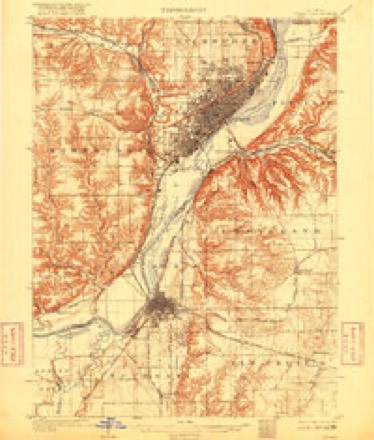
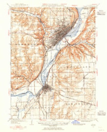
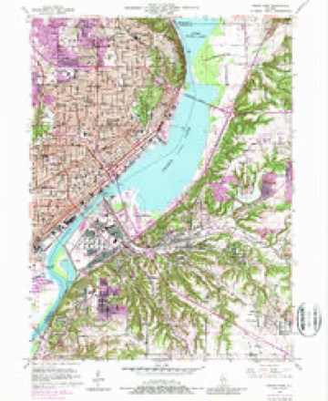
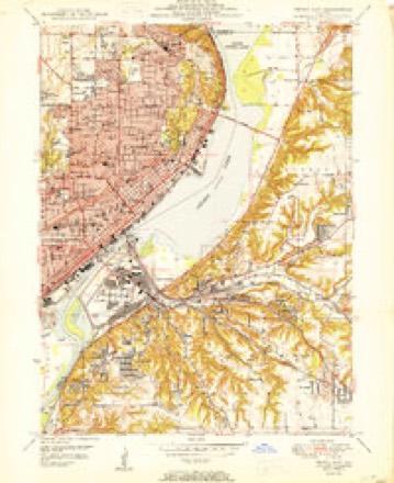
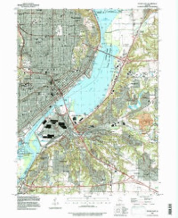
21 topographic sheets cover this place, the earliest surveyed in 1905 and the latest in 1996. It stands in Groveland Township. It lies in ZIP code area 61610. The Survey maps it on the Peoria East quadrangle.
Topographic sheets covering this place
11 surveys from 21 printed sheetsMatched by testing this settlement's coordinate against the published boundary of every sheet in the United States Geological Survey's historical collection. Each opens the scanned sheet at the Survey.
- 1905 USGS Peoria quadrangle1:62500, 4 printings
- 1927 USGS Peoria quadrangle1:62500
- 1949 USGS Peoria East quadrangle1:24000, 5 printings
- 1950 USGS Peoria East quadrangle1:24000
- 1958 USGS Peoria quadrangle1:250000, 4 printings
- 1961 USGS Peoria quadrangle1:250000
- 1963 USGS Peoria quadrangle1:250000
- 1985 USGS Peoria quadrangle1:100000
- 1989 USGS Peoria quadrangle1:100000
- 1990 USGS Peoria quadrangle1:250000
- 1996 USGS Peoria East quadrangle1:24000






In the county-history sources
5,216 words on this townshipHistory of Tazewell County, Illinois ; Together with Sketches of Its Cities, Villages and Townships, Educational, Religious, Civil, Military, and Political History; Portraits of Prominent Persons and Biographies of Representative Citizens. History of Illinois ... Digest of State Laws, published 1879 names this settlement in its chapter on Groveland Township. These are the passages that mention it, exactly as the scans read.
The first settlers here experienced many hardships. During the winter of the big snow, 1830-31, they suffered greatly. The slight snow and sleet that fell before the heavy snow came froze the mast to the ground, which, when the big snow came, the wild animals were unable to get to subsist upon, and, consequently, many died. Those, however, that could get to the cornfields lived well. Wild hogs were quite abundant these times. These were the progeny of the hogs the old French traders formerly raised about Wesley City. They would often mix with the hogs of the settlers running in the timber. Sometimes they would become furious and attack other stock. One old hog, with ancient and mammoth tusks, became quite fierce and troublesome. Many eifijrts were made to kill him, but in vain. His thick callous hide resisted many a shot and rifle ball. However, Franklin, son of B. J. Montgomery, found his weak spot one day, and sent the fatal lead to the monster's forehead, and relieved the neighborhood of their dreaded terror.
Passage source: History of Tazewell County, Illinois ; Together with Sketches of Its Cities, Villages and Townships, Educational, Religious, Civil, Military, and Political History; Portraits of Prominent Persons and Biographies of Representative Citizens. History of Illinois ... Digest of State Laws, published 1879.
The streams of the township are the South, Middle and North forks of Lick creek, named from the Deer licks of salt springs. At the lick on the Middle Fork, Mr. B. J. Montgomery found the skeleton of two large bucks, that had locked their horns together, and unable to separate themselves died. He kept these horns for many years. This same gentleman also describes the Indian burying places of this section. A pen was made about the size of a coffin, of split timber about four inches square, nicely locked together at the corner, joints all very close. These were covered with bark. A hole was cut through either side of this pen, one for the good spirit to go in, and the other for the evil one to go out. These when first seen were somewhat decayed. The bones, beads and an old hat were all that was visible in the enclosure, where, evidently, an Indian woman, with a child abont four years old, were laid to rest. As many as half-dozen of these pens were seen on ths east bluff, near Wesley City, section 6.
Passage source: History of Tazewell County, Illinois ; Together with Sketches of Its Cities, Villages and Townships, Educational, Religious, Civil, Military, and Political History; Portraits of Prominent Persons and Biographies of Representative Citizens. History of Illinois ... Digest of State Laws, published 1879.
The oldest house in Groveland is owned by Thomas Hancock, section 27. Some twenty years ago it was moved from the bottoms near Wesley City, and is said to be over fifty years old. It is made of logs and looks quite pioneer-like, as also the present owner, who believes in old-time ways and customs, and has never been on a railway car. Although he does not believe in sewing machines and many other modern improvements, yet we see he has a modern mowing machine. Still he is of that liberal turn of mind which leaves every one, without let or hindrance, to enjoy his own chosen ways.
Passage source: History of Tazewell County, Illinois ; Together with Sketches of Its Cities, Villages and Townships, Educational, Religious, Civil, Military, and Political History; Portraits of Prominent Persons and Biographies of Representative Citizens. History of Illinois ... Digest of State Laws, published 1879.
Machine-read from a century-old scan, so expect the errors a machine makes: misspelled names, dropped words, stray characters.
Fires near this place
3 since 2009Regional context, not property-specific evidence. The federal wildfire occurrence database lists 3 fires within 5 miles of Wesley in 2009, burning about 3 acres in total. None started naturally. None was recorded as arson. Distance is straight-line from the map coordinates, so a fire counted here may appear on a neighbouring settlement's page as well.
| Reported cause | Fires |
|---|---|
| Debris and open burning | 3 |
The most recent of them, most recent first, with the day each was reported and the service that recorded it.
| Date | Cause | Size | Reported by | Name on the report |
|---|---|---|---|---|
| 3 March 2009 | Debris and open burning | 1.0 acres | Illinois Division of Forestry Resources | MURR |
| 23 March 2009 | Debris and open burning | under an acre | Illinois Division of Forestry Resources | 9273 |
| 20 March 2009 | Debris and open burning | 2.0 acres | Illinois Division of Forestry Resources | DUNDEE |
Settlements close enough to share some of these fires:
Mines and quarries near this place
10 within 5 milesRegional context, not property-specific evidence. The federal mineral resources record lists 10 workings within 5 miles of Wesley: 4 producers, 4 past producers, 1 occurrence, 1 plant. 5 still produce. What was taken out: Sand and Gravel, Construction, Stone, Crushed/Broken, Fire Clay (Refractory), Clay. Distance is straight-line from the map coordinates, so a quarry counted here may appear on a neighbouring settlement's page as well.
| Where | Site | Commodity | Status | Recorded |
|---|---|---|---|---|
| Clay Pit No 3 Peoria Brick & Tile | Clay | Producer | ||
| Peoria Blacktop S & G | Fire Clay (Refractory) | Plant | ||
| Limestone Prospect | Stone, Crushed/Broken | Occurrence | ||
| Peoria City Pit | Stone, Crushed/Broken | Past Producer | ||
| Farmdale Sand & Gravel Pit | Sand and Gravel, Construction | Producer | ||
| Jubilee Materials Inc. | Sand and Gravel, Construction | Past Producer | ||
| Moushon Construction Co. Pit #2 | Sand and Gravel, Construction | Producer | ||
| Pekin Sand | Sand and Gravel, Construction | Producer | ||
| Peoria Pit | Sand and Gravel, Construction | Past Producer | ||
| Stevers Pit | Sand and Gravel, Construction | Past Producer |
Nearest settlements
The eight closest, with where each one stands in the county. Distances are straight-line, computed from the Geographic Names Information System coordinates.
| Map | Place | Distance | Sheets |
|---|---|---|---|
| Creve Coeur | 0.8 miles | 21 | |
| East Peoria | 1.6 miles | 21 | |
| Fond du Lac | 1.6 miles | 21 | |
| Marquette Heights | 2.5 miles | 18 | |
| Grove | 2.6 miles | 18 | |
| North Pekin | 2.8 miles | 18 | |
| Highway Village | 3.2 miles | 21 | |
| Fondulac Plaza Shopping Center | 3.8 miles | 21 |
Provenance
This settlement is recorded in the Geographic Names Information System as feature 420760. The sheet list is computed by point-in-boundary test against the United States Geological Survey's historical topographic inventory. Both are works of the United States government and carry no copyright under 17 U.S.C. 105.
Wildfire. Short, Karen C. 2022. Spatial wildfire occurrence data for the United States, 1992-2020 [FPA_FOD_20221014]. 6th Edition. Fort Collins, CO: Forest Service Research Data Archive. https://doi.org/10.2737/RDS-2013-0009.6 Collected with United States Government funding and usable without additional permissions or fees.
Mines and quarries. USGS Mineral Resources Data System (MRDS) https://mrdata.usgs.gov/mrds/ A work of the United States government, no copyright under 17 U.S.C. 105.