| November 2013 | Tornado (EF4) | Marquette Hgts | 3 killed, 121 hurt, $910,000,000 | A tornado touched down 2.4 miles SE of East Peoria at 10:59 AM CST, then tracked northeastward through parts of East Peoria and Washington before crossing the border into Woodford County at 11:12 AM CST. One man in Washington was killed by the tornado, one woman from Washington died 11 days later from multiple serious injuries sustained by the tornado, one man died six weeks later from injuries sustained by the tornado, and 121 people were injured.| |In East Peoria: 20 homes were destroyed, while 75 homes, 7 businesses, and 5 apartment buildings suffered major damage. Minor damage occurred to 137 homes and 3 businesses. In addition, nearly 400 vehicles were damaged, thousands of trees and numerous power poles were destroyed. The estimated damage in East Peoria stands at $110 million.||In Washington: The tornado increased to EF4 intensity and widened to between 1/4 and 1/2 mile wide. 633 homes, 7 businesses, 7 apartment buildings, and 2,500 vehicles were destroyed. Major damage occurred to 280 homes, 2 businesses, the roof of a school, and several outbuildings. Minor damage occurred to another 190 homes. Thousands of trees and power poles were snapped. Nearly 5,000 people were in the path of this tornado: however, injury and fatality totals were relatively low due to early warning and the fact that many people were either in church or out of town at the time. The tornado moved out of the Washington city limits and across another 2 miles of rural Tazewell County before crossing the border into Woodford County. Total damage in Washington is estimated at $800 million. |
| May 2003 | Tornado (F3) | South Pekin | 32 hurt, $10,000,000 | This long track tornado first touched down 3 miles southwest of South Pekin and traveled to the northeast. It destroyed several homes before reaching the eastern sections of South Pekin where it intensified to F3 strength. The tornado destroyed 50 homes, caused minor to major damage on an additional 80 homes before exiting the town. As the tornado approached Morton, it weakened briefly but quickly intensified again as it crossed the intersection of I-74 and I-155. When it crossed the highways, 8 vehicles were damaged and one injury was sustained when a car was overturned by the tornado as it crossed I-74. It destroyed several three story apartment buildings and severely damaged several others in the complex. A couple of businesses in the area were destroyed as well. It then moved through several subdivisions, damaging over 100 homes, some severely. The tornado eventually weakened and lifted 2.5 miles north of Morton. In all, 32 people were injured by the tornado, three seriously, but they have since recovered. |
| May 1995 | Tornado (F3) | Tremont | 25 hurt, $4,000,000 | A tornado touched down along the Illinois River (3 NE of Goofy Ridge) and traveled to the northeast for 25 miles before lifting and dissipating in Tremont (Tazwell County). The tornado damaged or destroyed over 36 homes and mobile homes in Mason County and injured 23 people. Numerous trees were blown down, especially in the Sand Ridge State Forest, as well as, numerous power poles. In Tazwell County, 25 homes were either damaged or destroyed (seven homes were destroyed in a subdivision 1 S of South Pekin were two people suffered minor injuries). Numerous silos and machine sheds were destroyed. Damage was estimated around $4 million. |
| November 2013 | Tornado (EF2) | Pekin | 10 hurt, $45,000,000 | This tornado crossed the Illinois River from Peoria County at 10:53 AM CST. It tracked through the northwest side of Pekin before lifting 2 miles northeast of Pekin at 10:54 AM CST. Approximately 179 houses and 6 businesses suffered major damage, while 182 houses experienced minor roof damage. In addition, 3 apartment buildings lost their roofs, a power substation had minor damage, and hundreds of cars were damaged. Ten people were injured. |
| February 1999 | Thunderstorm Wind | Delavan | 6 hurt, $40,000 | Widespread damage occurred in Tazewell County. As the severe thunderstorm moved northeast across the county, it took the roof off of a corn crib and flipped over an irrigation rig 3 miles southwest of Delavan then blew the roof off of a house in Delavan. In South Pekin, around a dozen power poles were blown down and six miles south of Tremont the tops of numerous trees were torn off and a swing set was blown over. Two miles northeast of Morton, 6 semis were blown over on I-74 causing 6 minor injuries. Also, in Tremont a semi was blown over on Route 9 near the interchange with I-155. No injuries occurred with this incident. Countywide numerous trees were blown over and several sheds, barns, and outbuildings were either damaged or destroyed. Damage to two of the semis that were blown over is estimated around $40,000. |
| June 1995 | Thunderstorm Wind | Morton | 6 hurt | Thunderstorm winds blew down the roof of a motel that was being constructed. Six workers were injured, none seriously. Also, at another nearby construction site, the top two floors of a three story townhouse complex were flattened. No one was injured in that incident. No damage estimate was available. |
| November 1990 | Tornado (F2) | not stated | 2 hurt, $2,500,000 | no account filed |
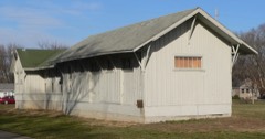
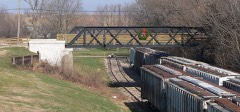
| May 1995 | Tornado (F1) | South Pekin | 2 hurt, $1,000,000 | A tornado touched down 3 SW of South Pekin and moved to the northeast. Several barns were destroyed just south of South Pekin and one house had minor damage. The tornado sent a 2" x 4" through the grill of a pickup truck. As it moved through the northern part of South Pekin, it destroyed a railroad workers' barracks, slightly injuring one worker, and blew over four empty railroad cars. Numerous large trees were blown over. Several cars were smashed by fallen trees (three people were trapped in one car-none were injured). Also, four or five garages were destroyed and part of the roof was missing from a Lutheran church. Damage was estimated around $1 million. |
| July 2015 | Tornado (EF2) | Delavan | 1 hurt, $1,200,000 | A tornado touched down 0.6 miles south of Delavan at 11:39 PM CDT. The tornado then moved east-northeast across the south side of Delavan, damaging 51 homes. 15 of the homes sustained severe damage, including either the roofs being completely torn off or the majority of the roof deck being lifted off. Numerous garages, outbuildings, and trees were damaged. The tornado also crossed through the Prairie Rest Cemetery, damaging grave markers and several trees before dissipating in a cornfield 2.2 miles east-northeast of Delavan at 11:46 PM CDT. |
| May 1955 | Tornado (F2) | not stated | 1 hurt, $250,000 | no account filed |
| April 1997 | Tornado (F0) | Pekin | 1 hurt, $115,000 | A tornado briefly touched down 7 miles southwest of Pekin in the Country View Estates Subdivision severely damaging a home under construction causing around $90,000 in damage. Also, the tornado damaged a garage across the street and four other homes in the area sustained minor roof damage with shingles missing. A 20 inch diameter tree was blown down blocking Bass Road. There was one minor injury reported when a man had a piece of sheetrock hit him in the head as he headed for cover, sustaining a minor injury, though he did not seek medical assistance. The total dollar amount of damage is estimated around $115,000. |
| April 2013 | Flash Flood | Parkland | $31,400,000 | Very heavy rainfall of 3.00 to 5.00 inches resulted in damage to thousands of houses and businesses in the county, which included the cities of East Peoria, Pekin, Washington and Morton. Every creek and stream in the western and northern part of the county was flooded. Nearly every road in the flooded area was impassable, including parts of Interstate 74 which had to be closed. Numerous water rescues were made. Mudslides were also reported on the bluffs along the Illinois River which did damage to a gas station and covered U.S. Highway 150 with several inches of mud. |
| May 2013 | Flood | East Peoria | $21,700,000 | High impact flooding on the Illinois River continued from April.||Several homes, businesses and roads along the Illinois River in Tazewell County suffered flood damage due to record river levels. A total of 374 structures were damaged by the flooding in Tazewell County. High impact flooding subsided when the river level at Peoria fell below a stage of 22 feet on May 8th. |
| June 1990 | Tornado (F1) | not stated | $2,500,000 | no account filed |
| September 1986 | Tornado (F2) | not stated | $2,500,000 | no account filed |
| June 1998 | Thunderstorm Wind | Countywide | $2,000,000 | As the storms moved through Tazewell County, more intense damage was observed in two main areas, Morton and South Pekin. In Morton, as a tornado moved through southwestern portions of the city, strong microburst winds (100 to 110 mph) caused considerable tree and power line damage, as well as, structural damage in and close to the tornado path which masked or "wiped out" any evidence of a possible tornado touchdown. The tornado occurrence was not discounted however, as there were numerous valid spotter observations plus a mesocyclone signature on doppler radar. In the South Pekin area, 7 railroad cars were blown over and two high-tension towers were blown down. Fortunately, no injuries were reported and damage in Tazewell County was estimated around $3 million. |
| June 1998 | Tornado (F1) | Marquette Hgts | $1,000,000 | A tornado formed over the Marquette Heights area blowing down numerous trees and power lines as it travelled to the east southeast. When the tornado reached the Groveland area, numerous homes sustained minor to moderate damage and part of the canopy over the gas pumps at a convenience store was blown down. As the tornado reached the southwestern side of Morton it intensified. It caused considerable damage to a 30 store shopping center, tearing half the roof off and breaking windows. In this same area it also caused moderate damage to a cinema, several restaurants, and other businesses. Then the tornado moved into a residential area causing light to moderate damage to around 24 homes, mainly roof damage, before lifting and dissipating. So far damage has been estimated around $1 million and no injuries or deaths were reported. |
| April 1996 | Tornado (F2) | Armington | $1,000,000 | no account filed |
| April 2000 | Thunderstorm Wind | Countywide | $600,000 | Widespread damage was reported countywide. In Green Valley, a large empty grain bin was blown over, several sheds destroyed, and an irrigation system was wrapped around a couple of power poles. In Groveland, a radio tower was blown down, causing $500,000 in damage. New townhouses under construction in Pekin were destroyed. In Morton, part of a roof from a business was blown off. Debris from the roof damaged 3 cars in the parking lot. In Washington the storm intensified. A building housing a restaurant and a bakery was destroyed and a hanger at a private airport was destroyed. Three planes in the hanger were damaged. In Minier, several homes sustained roof damage and a couple of sheds were destroyed. Also, numerous trees, tree limbs, power poles, and power lines were blown down countywide. |
| June 2010 | Tornado (EF2) | Pekin Jct | $560,000 | A tornado touched down 2.9 miles north of Washington in northern Tazewell County, then continued eastward to the Tazewell-Woodford County line. Numerous trees and power poles were snapped along the path of the tornado. Three large outbuildings and two hog sheds were destroyed. In addition, the roof of a farm house was lifted off, the roof of another house was severely damaged, a garage was destroyed, and a grain bin was blown one quarter of a mile into a field. The tornado then continued eastward into Woodford County. |
| March 1998 | Thunderstorm Wind | Green Vly | $500,000 | A line of severe thunderstorms moved through Tazewell county. A 60 mph wind gust was recorded in Delavan and numerous trees & tree limbs were reported blown down in Green Valley, South Pekin, and Tremont. In Morton, the thunderstorm winds caused $500,000 in damage to a car dealership as shingles, rocks, and other debris were blown onto over 300 cars, knocking out windows on some and causing large dents in others. No injuries were reported. |
| May 2000 | Tornado (F1) | Parkland | $275,000 | A tornado briefly touched down 1.5 miles west of Parkland on a farm. It destroyed 4 large grain bins and blew a machine shed 100 yards from where it had been. A garage nearby sustained minor damage with siding and a door blown off. No injuries were reported. |
| October 1991 | Tornado (F1) | not stated | $250,000 | no account filed |
| September 1977 | Tornado (F1) | not stated | $250,000 | no account filed |
| March 1976 | Tornado (F1) | not stated | $250,000 | no account filed |
| October 1969 | Tornado (F2) | not stated | $250,000 | no account filed |
| August 2016 | Flash Flood | Winkel | $240,000 | Persistent thunderstorms produced heavy rainfall during the late afternoon and early evening hours when 4.00 to 8.00 inches was reported in 3. to 4 hours. Numerous roads in southern and eastern Tazewell County were flooded, including parts of I-155 two to four miles north of the Tazewell-Logan County line. Cars which hydroplaned on the water covered roads slid into ditches along the interstate. Parts of Illinois Route 122 were also impassable from Delavan through Hopedale to Minier. Most of the flash flooding subsided by late evening. |
| August 2011 | Thunderstorm Wind | East Peoria | $185,000 | Several trees were blown down on cars and houses in the 1100 block of Springfield Road in East Peoria. Wind damage occurred over a 2 block radius. |
| March 2017 | Tornado (EF1) | Winkel | $175,000 | A tornado touched down along Wagonseller Road about 5 miles southwest of Green Valley at 12:00 AM CST March 7th. The tornado quickly tracked northeastward and widened to around 150 yards and increased in intensity to EF-1 as it destroyed an outbuilding and an historic single room schoolhouse about 4 miles southwest of Green Valley. It then continued moving northeastward through mainly open fields, but did produce damage to 2 grain bins, a barn, and several trees along Towerline Rd. The tornado dissipated about 3 miles east-northeast of Green Valley at 12:06 AM CST. |
| June 2010 | Thunderstorm Wind | Armington | $125,000 | Grain bins and machine sheds were damaged. A large tree limb was blown down onto the roof of a house. |
| March 2017 | Tornado (EF2) | Delavan | $120,000 | A tornado touched down in an open field 1.4 miles north-northeast of Delavan at 12:09 CST. The tornado quickly tracked northeastward and widened to 200 yards, causing EF-2 damage to one outbuilding and EF-1 damage to several other outbuildings and trees. It continued northeastward before dissipating 4.1 miles northeast of Delavan at 12:13 AM CST. |
| May 2017 | Thunderstorm Wind | Morton | $100,000 | Numerous trees and power lines were blown down on the north side of Morton north of I-74 from Lakeland Road eastward to Tennessee Avenue. |
| June 2015 | Thunderstorm Wind | East Peoria | $100,000 | Numerous trees and power lines were blown down. |
| June 2010 | Thunderstorm Wind | Mackinaw | $90,000 | The roof of a house and several outbuildings were damaged. Numerous trees and power lines were blown down. |
| December 2018 | Tornado (EF0) | Parkland | $80,000 | A tornado briefly touched down 4.8 miles southwest of South Pekin at 5:34 PM CST. The tornado blew over a couple of outbuildings, damaged a pool deck structure near a home, and tipped over an irrigation system before dissipating 4.7 miles southwest of South Pekin at 5:35 PM CST. |
| June 2015 | Thunderstorm Wind | Pekin | $80,000 | Numerous trees and tree branches were blown down. |
| June 2015 | Thunderstorm Wind | Creve Coeur | $75,000 | Numerous trees and power lines were blown down. A few trees fell onto houses. |
| June 2008 | Thunderstorm Wind | Creve Coeur | $75,000 | Numerous trees, large tree limbs and power lines were blown down. In addition, an A frame house was destroyed when 2 large trees fell on it. |
| August 2009 | Thunderstorm Wind | Stoehrs Station | $65,000 | A machine shed was destroyed and a barn was pushed off its foundation at a farm in far northwestern Tazewell County. In addition, windows were broken out and several trees were broken off or uprooted. |
| June 2019 | Tornado (EF1) | Pekin Muni Arpt | $60,000 | A tornado touched down 2.1 miles southwest of South Pekin at 10:19 PM CDT. The tornado tracked east-southeast...destroying a shed, blowing over several 18 to 24-inch diameter trees, and knocking over power poles north of Christmas Tree Road near Highway 29 before dissipating about 2.4 miles southeast of South Pekin at 10:22 PM CDT. |
| May 2011 | Thunderstorm Wind | Delavan | $60,000 | Part of the roof was blown off the high school. Power was knocked out to the south side of Delavan. |
| June 2021 | Thunderstorm Wind | Pekin | $55,000 | Numerous trees and tree branches were blown down, including a large tree that fell onto a car. |
| June 2015 | Thunderstorm Wind | Washington | $50,000 | Several trees and power lines were blown down. |
| June 2009 | Thunderstorm Wind | Morton | $50,000 | Several trees and power lines were blown down. |
| June 2008 | Lightning | Harvard Hills | $50,000 | Lightning struck a tree next to a house, setting the house ablaze. Two rooms were burned, and damage was done to the house roof and siding. Damage was also done to a vehicle parked nearby. There were no injuries. |
| June 1994 | Thunderstorm Wind | not stated | $50,000 | A television crew taped a brief tornado touchdown at Spring Street in East Peoria. Near Washington, a two mile wide path of crop damage was caused by thunderstorm winds and several houses had siding damaged. At Creve Coeur, three inch diameter limbs were blown down and a vent stack was blown off the roof of Wesleyan Church. At Pekin, large tree limbs were blown down and trees were blown down along Highway 98. Marble- to golf ball-size hail covered the ground at Tremont. Crops were damaged by high winds. Large trees were blown down at Townline and Schrader Roads. Winds also damaged siding on several houses. |
| July 2012 | Thunderstorm Wind | Armington | $42,000 | Numerous trees and tree branches were blown down. Power lines were knocked downed as well, creating a power outage in Armington. In addition, the roof of an old school was damaged. |
| August 2011 | Thunderstorm Wind | Creve Coeur | $42,000 | A one foot diameter tree fell onto a house in Creve Coeur. |
| October 2010 | Thunderstorm Wind | Morton | $40,000 | Power poles were blown down in Morton. |
| October 2010 | Thunderstorm Wind | Washington | $40,000 | Power poles were blown down in Washington. |
| May 2011 | Thunderstorm Wind | Delavan | $35,000 | Windows were broken at a house and a metal shed was blown onto a road about 1 mile east of Delavan. |
| October 2010 | Thunderstorm Wind | Hopedale | $35,000 | Several power poles were blown down. In addition, the roof of a shed was damaged and 4 pear trees were toppled. |
| June 2009 | Thunderstorm Wind | Washington | $35,000 | Power lines were blown down in Washington. Numerous large tree branches were downed as well. |
| June 2021 | Thunderstorm Wind | South Pekin | $30,000 | Numerous trees were blown down. |
| July 2020 | Thunderstorm Wind | Morton | $30,000 | Fencing and numerous trees were blown down in Morton. |
| July 2017 | Thunderstorm Wind | Pekin | $30,000 | Several trees were blown over. |
| July 2016 | Thunderstorm Wind | Mackinaw | $30,000 | A 50-foot tall poplar tree approximately 12 to 15 feet in diameter was blown over onto Heritage Drive at Heritage Lake. Numerous trees were snapped around Mackinaw. |
| June 2015 | Thunderstorm Wind | Pekin | $30,000 | A large tree was blown onto a garage and the roof of a house in Pekin. |
| June 2015 | Thunderstorm Wind | Pekin | $30,000 | Several trees were snapped and uprooted in Pekin. |
| August 2015 | Tornado (EF0) | Mackinaw | $30,000 | A tornado touched down 1.7 miles east-southeast of Mackinaw at 6:09 PM CDT. The tornado tracked northeastward for 2 miles, damaging several pine trees, downing tree limbs onto 3 houses, and damaging crops in a path 50 to 75 yards wide. The tornado dissipated in a wooded area 2.7 miles east-northeast of Mackinaw at 6:11 PM CDT. |
 Block