 Block
Westfield Corners, Illinois
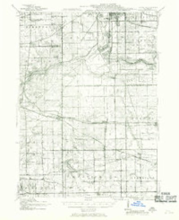
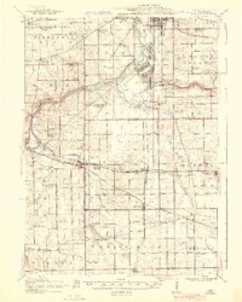
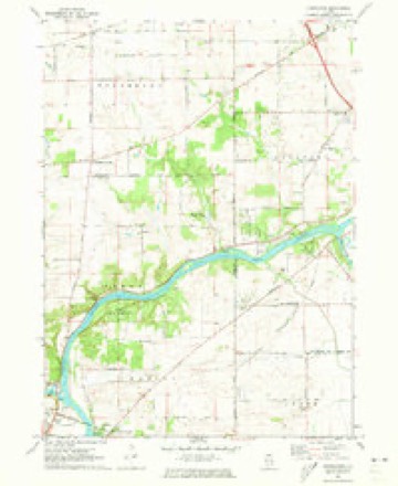
14 topographic sheets cover this place, the earliest surveyed in 1917 and the latest in 1981. It stands in Winnebago Township. It lies in ZIP code area 61088. The Survey maps it on the Kishwaukee quadrangle.
Topographic sheets covering this place
8 surveys from 14 printed sheetsMatched by testing this settlement's coordinate against the published boundary of every sheet in the United States Geological Survey's historical collection. Each opens the scanned sheet at the Survey.
- 1917 USGS Kings quadrangle1:62500
- 1918 USGS Kings quadrangle1:62500, 3 printings
- 1954 USGS Rockford quadrangle1:250000
- 1955 USGS Rockford quadrangle1:250000
- 1958 USGS Rockford quadrangle1:250000, 4 printings
- 1963 USGS Rockford quadrangle1:250000
- 1971 USGS Kishwaukee quadrangle1:24000
- 1981 USGS Rockford quadrangle1:100000, 2 printings





In the county-history sources
43,384 words on this townshipThe History of Winnebago County, Illinois : Its Past and Present, Containing ... a Biographical Directory of Its Citizens, War Record of Its Volunteers in the Late Rebellion, General and Local Statistics ... History of the Northwest, History of Illinois ... Etc, published 1877; The History of Winnebago County, Ill., published 1877 names this settlement in its chapter on Winnebago Township. These are the passages that mention it, exactly as the scans read.
The first newspaper established in the county was the Hock River Express. Its publication was commenced in the village of Rockford, May 4, 1840, by B. J. Gray. It was Whig in politics. After being published one year, the press and materials were sold and removed from the place.
Passage source: The History of Winnebago County, Illinois : Its Past and Present, Containing ... a Biographical Directory of Its Citizens, War Record of Its Volunteers in the Late Rebellion, General and Local Statistics ... History of the Northwest, History of Illinois ... Etc, published 1877.
Rockford Register, established February, 1855, as a Republican paper, by EHas C. Daugherty, who continued its publication until June 12, 1865, when the entire- establishment, and also the Rock River Democrat ofiice, were purchased by a joint stock company, known as the Rockford Register Company, by whom it has been published to the present time.
Passage source: The History of Winnebago County, Illinois : Its Past and Present, Containing ... a Biographical Directory of Its Citizens, War Record of Its Volunteers in the Late Rebellion, General and Local Statistics ... History of the Northwest, History of Illinois ... Etc, published 1877.
The Forty-fifth took a conspicuous and honorable part in the two days' battle of Shiloh, losing 26 killed and 199 wounded and missing - nearly one. half of the regi'.nent. April 12th, Col. John E. Smith, of the Forty-fifth, took command of the Brigade. During the seige of Corinth, the regiment was in the P irst Brigade, I'hird Division, Reserve Army of the Tennessee, and bore its full share of the labors and dangers of the campaign. June 4th, the regiment was assigned to Third Brigade, and moved toward Purdy, fifteen miles. On the 5th, marched to Bethel; 7th, to Montezuma, and on the 8th to Jackson, Tenn., the enemy flying on its approach.
Passage source: The History of Winnebago County, Ill., published 1877.
Machine-read from a century-old scan, so expect the errors a machine makes: misspelled names, dropped words, stray characters.
Read the whole chapter on Winnebago Township - it names this place 2 more 2 times.
Fires near this place
5 since 2015Regional context, not property-specific evidence. The federal wildfire occurrence database lists 5 fires within 5 miles of Westfield Corners between 2015 and 2020, burning about 21 acres in total. None started naturally. None was recorded as arson. Distance is straight-line from the map coordinates, so a fire counted here may appear on a neighbouring settlement's page as well.
| Reported cause | Fires |
|---|---|
| Debris and open burning | 3 |
| Missing data/not specified/undetermined | 2 |
The most recent of them, most recent first, with the day each was reported and the service that recorded it.
| Date | Cause | Size | Reported by | Name on the report |
|---|---|---|---|---|
| 7 April 2015 | Debris and open burning | under an acre | Illinois Division of Forestry Resources | 15-0000163 |
| 6 April 2015 | Missing data/not specified/undetermined | under an acre | Illinois Division of Forestry Resources | 15-0000159 |
| 3 April 2019 | Debris and open burning | under an acre | Illinois Division of Forestry Resources | 19-0000214 |
| 8 December 2020 | Debris and open burning | 20 acres | Illinois Division of Forestry Resources | 20-0000590 |
| 8 December 2020 | Missing data/not specified/undetermined | under an acre | Illinois Division of Forestry Resources | 20-0000594 |
Settlements close enough to share some of these fires:
Mines and quarries near this place
8 within 5 milesRegional context, not property-specific evidence. The federal mineral resources record lists 8 workings within 5 miles of Westfield Corners: 7 past producers, 1 producer. 1 still produces. What was taken out: Stone, Crushed/Broken, Sand and Gravel, Construction. Distance is straight-line from the map coordinates, so a quarry counted here may appear on a neighbouring settlement's page as well.
| Where | Site | Commodity | Status | Recorded |
|---|---|---|---|---|
| Byron Materials Pit | Sand and Gravel, Construction | Past Producer | ||
| Asche Quarry | Stone, Crushed/Broken | Past Producer | ||
| Aschelford Quarry | Stone, Crushed/Broken | Producer | ||
| R. Mcgee Quarry | Stone, Crushed/Broken | Past Producer | ||
| Rockford Township Quarry | Stone, Crushed/Broken | Past Producer | ||
| Unnamed Limestone Quarry | Stone, Crushed/Broken | Past Producer | ||
| Wickwire Quarry | Stone, Crushed/Broken | Past Producer | ||
| Young Quarry | Stone, Crushed/Broken | Past Producer |
Storms near this place
3 since 2024Regional context, not property-specific evidence. The National Weather Service names Westfield Corners in 3 storm reports in 2024: 2 thunderstorm wind, 1 tornado. No death or injury is recorded in these reports. Each account below is quoted exactly as the forecast office filed it, from the NOAA Storm Events Database, and each date opens the federal record of that event.
| When | Event | Place named | Harm | What the report says |
|---|---|---|---|---|
| July 2024 | Tornado (EF0) | Westfield Corners | - | A tornado with estimated peak winds of 75 mph touched down just north of the entrance to a forest preserve off Montague Road. The tornado initially moved southeast and then turned northeast moving along Montague Road. Damage to trees, power lines and crops occurred along the path of this tornado. A car was reported to have been pushed off Montague Road just south of Highlands Drive. The tornado ended just southeast of Highlands Drive. |
| July 2024 | Thunderstorm Wind | Westfield Corners | - | A few large tree limbs were blown down and corn was bent over. |
| July 2024 | Thunderstorm Wind | Westfield Corners | - | Trees were blown down on Meridian Road between Edwardsville Road and Kelley Road. Tree limbs and power lines were also blown down nearby. |
Nearest settlements
The eight closest, with where each one stands in the county. Distances are straight-line, computed from the Geographic Names Information System coordinates.
| Map | Place | Distance | Sheets |
|---|---|---|---|
| Alworth | 2.6 miles | 14 | |
| Hickory Creek | 3.9 miles | 14 | |
| Winnebago | 4.0 miles | 18 | |
| Woodcrest | 5.0 miles | 14 | |
| Grant View Heights | 5.1 miles | 14 | |
| Motor Heights | 5.1 miles | 14 | |
| Kishwaukee | 5.2 miles | 14 | |
| Brewster Heights | 5.6 miles | 14 |
Elsewhere
Matched on this settlement's Geographic Names Information System number rather than its name, so it cannot be a different place of the same name in another state.
| Wikipedia article on Westfield Corners | An encyclopaedic summary. Its text is share-alike, so it is linked here rather than copied. |
| Wikidata item Q60750102 | The structured record the population and elevation above come from. Public domain (CC0). |
Provenance
This settlement is recorded in the Geographic Names Information System as feature 420961. The sheet list is computed by point-in-boundary test against the United States Geological Survey's historical topographic inventory. Both are works of the United States government and carry no copyright under 17 U.S.C. 105.
Wildfire. Short, Karen C. 2022. Spatial wildfire occurrence data for the United States, 1992-2020 [FPA_FOD_20221014]. 6th Edition. Fort Collins, CO: Forest Service Research Data Archive. https://doi.org/10.2737/RDS-2013-0009.6 Collected with United States Government funding and usable without additional permissions or fees.
Mines and quarries. USGS Mineral Resources Data System (MRDS) https://mrdata.usgs.gov/mrds/ A work of the United States government, no copyright under 17 U.S.C. 105.
Storms. NOAA National Centers for Environmental Information, Storm Events Database https://www.ncei.noaa.gov/stormevents/ A work of the United States government, no copyright under 17 U.S.C. 105. Narratives are quoted verbatim from the National Weather Service report and are not edited or summarised.