 Block
Winnebago, Illinois
18 topographic sheets cover this place, the earliest surveyed in 1918 and the latest in 1981. It stands in Winnebago Township. It lies in ZIP code area 61088. The Survey maps it on the Winnebago quadrangle. 2,940 people lived here at the 2020 count. It stands 869 feet above sea level.
Population over time
2 figuresWinnebago fell from 3,101 to 2,940 between 2010 and 2020. These are the recorded population figures Wikidata holds for this place, reached through the Geographic Names Information System number this page is keyed on rather than by name, so they belong to this place and not to another of the same name. Most are census counts, but not all are: an early figure may be a founding or settlement estimate, and an estimate published within five years of a census is left out. The change column is computed, and is left blank where more than 20 years separate a figure from the one before it, because a gap that long is not a change between two counts.
| Year | People | Change |
|---|---|---|
| 2010 | 3,101 | |
| 2020 | 2,940 | -161 (-5%) |
Topographic sheets covering this place
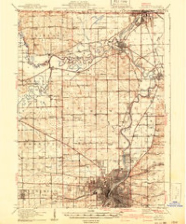
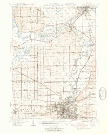
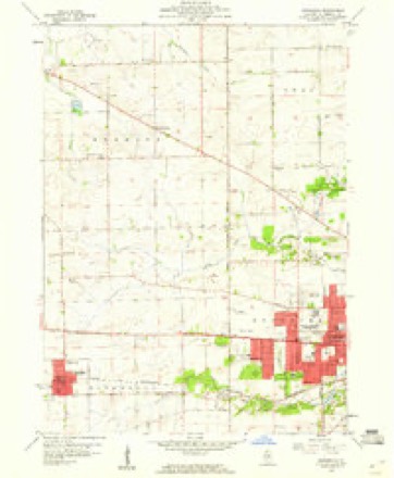
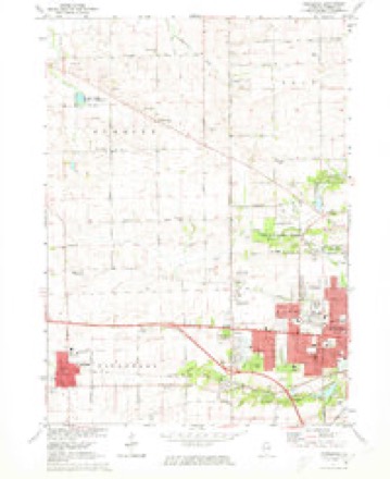
9 surveys from 18 printed sheetsMatched by testing this settlement's coordinate against the published boundary of every sheet in the United States Geological Survey's historical collection. Each opens the scanned sheet at the Survey.
- 1918 USGS Rockford quadrangle1:62500, 3 printings
- 1938 USGS Rockford quadrangle1:62500, 3 printings
- 1954 USGS Rockford quadrangle1:250000
- 1955 USGS Rockford quadrangle1:250000
- 1958 USGS Rockford quadrangle1:250000, 4 printings
- 1959 USGS Winnebago quadrangle1:24000
- 1963 USGS Rockford quadrangle1:250000
- 1971 USGS Winnebago quadrangle1:24000, 2 printings
- 1981 USGS Rockford quadrangle1:100000, 2 printings





In the county-history sources
43,384 words on this townshipThe History of Winnebago County, Illinois : Its Past and Present, Containing ... a Biographical Directory of Its Citizens, War Record of Its Volunteers in the Late Rebellion, General and Local Statistics ... History of the Northwest, History of Illinois ... Etc, published 1877 names this settlement in its chapter on Winnebago Township. These are the passages that mention it, exactly as the scans read.
The earliest permanent white settler in the territory now included in Winnebago county, of whom there is any knowledge, was Stephen Mack. His cabin was built in a grove about half a mile above the mouth of the Pecatonica Kiver at a place that was subse(|ucntly called Bird's Grove. The time of his coming and casting his lot with the VVinnebagoes is not definitely known. Neither is there much known of his early life, or of the^ motives that caused him to isolate himself from kindred, friends and his own race. All that was ever known of this strange recluse is presented in the following sketch:
Passage source: The History of Winnebago County, Illinois : Its Past and Present, Containing ... a Biographical Directory of Its Citizens, War Record of Its Volunteers in the Late Rebellion, General and Local Statistics ... History of the Northwest, History of Illinois ... Etc, published 1877.
Those who knew the subject of the above sketch say that Stephen Mack was di2:nified and manly in his bearing, affable and pleasant in his intercourse with his white neighbors, and particularly pleasant with those with whom he had an intimate acquaintance. It is said that he hardly ever used a profane word. Sometimes he would manifest religious inclinations, and at one time hired a man named McDowell to come to liis house, read the Scriptures, and pray with his fiimily. But this kind of devotion did not last long. Mack was tall, and as erect as any of the Indians among whom he dwelt, and possessing a good common education, and withal a close reader - always keeping a good stock of books in his cabin - he might have been a man among men, but he chose otherwise.
Passage source: The History of Winnebago County, Illinois : Its Past and Present, Containing ... a Biographical Directory of Its Citizens, War Record of Its Volunteers in the Late Rebellion, General and Local Statistics ... History of the Northwest, History of Illinois ... Etc, published 1877.
In 1833, Mr. Kent with his family and his colored boy, Lewis Lemon, came up to Galena, where his brother, Rev. Aratus Kent, a Presbyterian clero-yman, was located. Soon after his arrival there, Mr. Kent learned from some of the soldiers that had been with Scott's army, of the exceeding beauty of the Rock River country, and he determined to visit it at the earliest opportunity.
Passage source: The History of Winnebago County, Illinois : Its Past and Present, Containing ... a Biographical Directory of Its Citizens, War Record of Its Volunteers in the Late Rebellion, General and Local Statistics ... History of the Northwest, History of Illinois ... Etc, published 1877.
Machine-read from a century-old scan, so expect the errors a machine makes: misspelled names, dropped words, stray characters.
Read the whole chapter on Winnebago Township - it names this place 82 more 82 times.
Fires near this place
9 since 2015Regional context, not property-specific evidence. The federal wildfire occurrence database lists 9 fires within 5 miles of Winnebago between 2015 and 2020, burning about 28 acres in total. None started naturally. None was recorded as arson. Distance is straight-line from the map coordinates, so a fire counted here may appear on a neighbouring settlement's page as well.
| Reported cause | Fires |
|---|---|
| Debris and open burning | 6 |
| Missing data/not specified/undetermined | 3 |
The most recent of them, most recent first, with the day each was reported and the service that recorded it.
| Date | Cause | Size | Reported by | Name on the report |
|---|---|---|---|---|
| 4 May 2020 | Missing data/not specified/undetermined | under an acre | Illinois Division of Forestry Resources | 20-0000206 |
| 7 April 2015 | Debris and open burning | under an acre | Illinois Division of Forestry Resources | 15-0000163 |
| 6 April 2015 | Debris and open burning | under an acre | Illinois Division of Forestry Resources | 15-0000158 |
| 3 April 2019 | Debris and open burning | under an acre | Illinois Division of Forestry Resources | 19-0000214 |
| 1 April 2015 | Debris and open burning | under an acre | Illinois Division of Forestry Resources | 15-0000142 |
| 31 March 2015 | Debris and open burning | 5.0 acres | Illinois Division of Forestry Resources | 15-0000139 |
| 8 December 2020 | Debris and open burning | 20 acres | Illinois Division of Forestry Resources | 20-0000590 |
| 8 December 2020 | Missing data/not specified/undetermined | under an acre | Illinois Division of Forestry Resources | 20-0000594 |
Settlements close enough to share some of these fires:
Mines and quarries near this place
6 within 5 milesRegional context, not property-specific evidence. The federal mineral resources record lists 6 workings within 5 miles of Winnebago: 5 past producers, 1 producer. 1 still produces. What was taken out: Stone, Crushed/Broken, Sand and Gravel, Construction. Distance is straight-line from the map coordinates, so a quarry counted here may appear on a neighbouring settlement's page as well.
| Where | Site | Commodity | Status | Recorded |
|---|---|---|---|---|
| William Howard Pit | Sand and Gravel, Construction | Past Producer | ||
| Cunningham Quarry & Mill | Stone, Crushed/Broken | Producer | ||
| Netherly Quarry | Stone, Crushed/Broken | Past Producer | ||
| Unnamed Limestone Quarry | Stone, Crushed/Broken | Past Producer | ||
| Unnamed Limestone Quarry | Stone, Crushed/Broken | Past Producer | ||
| Winnebago Co. Highway Dept. Quarry | Stone, Crushed/Broken | Past Producer |
Storms near this place
33 since 2006Regional context, not property-specific evidence. The National Weather Service names Winnebago in 33 storm reports between 2006 and 2026: 19 thunderstorm wind, 8 hail, 2 lightning, 2 flood. The reports record 1 injury. Each account below is quoted exactly as the forecast office filed it, from the NOAA Storm Events Database, and each date opens the federal record of that event.
| When | Event | Place named | Harm | What the report says |
|---|---|---|---|---|
| July 2023 | Lightning | Winnebago | 1 hurt | A man was injured when he was struck by lightning while visiting a Rockford cemetery. His condition was reported as unknown, but the man was responsive when paramedics arrived on scene. |
| August 2007 | Flood | Winnebago | $2,000,000 | Flooding continued from heavy rains and flash flooding earlier on August 7th. In Rockford, multiple roads closed due to flooding inlcuding Valencia, Avalon, and Churchill Grove from 9th to 20th. City officials in Rockford feared that water flowing over the spillway at the Alpine dam in Rockford would result in structural failure of the 65 year old dam. Residents in a 1200 home area immediately downstream of the dam along Keith Creek were evacuated as a precaution. Flood waters up to the first level of some houses and as many as 12 basement collapses were reported as a result of the flooding. Water came within 2 feet of flowing over the Alpine dam spillway at around 1130 AM. Severe flooding occurred within the Churchill Park area. Significant flooding also occurred along Madigan Creek in the Cherry Valley area. More than 40 residents along the creek were evacuated. About 30 homes along the creek sustained flood damage. Rainfall totals include 6.84 inches 3 miles southeast of Rockford, 6.79 inches northwest of Rockford and 4.70 inches 3 miles northeast of Rockford. The city of Rockford and Winnebago County were declared a state disaster area as a result of the flash flooding and flooding. |
| September 2006 | Lightning | Winnebago | $50,000 | The roof of a house was struck by lightning. The lightning blew out a television and started a fire which caused significant damage to the house. |
| March 2025 | Thunderstorm Wind | Winnebago | - | Numerous large tree limbs and branches were down around WREX-TV on the north side of Winnebago. |
| June 2024 | Thunderstorm Wind | Winnebago | - | The canopy of the Mobil gas station at US-20 and N Meridian Road collapsed. |
| June 2024 | Thunderstorm Wind | Winnebago | - | Numerous trees and power lines were reported down across the Parker Woods subdivision. |
| June 2024 | Thunderstorm Wind | Winnebago | - | A large tree was reported down on the side of a house. |
| July 2024 | Thunderstorm Wind | Winnebago | - | Numerous trees were blown down. |
| July 2024 | Flood | Winnebago | - | Multiple reports of roadway flooding were received. |
| June 2023 | Thunderstorm Wind | Winnebago | - | Wind gusts were estimated between 60 and 65 mph. |
| July 2022 | Thunderstorm Wind | Winnebago | - | Part of a barn roof was blown off and several twigs were blown around. |
| August 2022 | Thunderstorm Wind | Winnebago | - | A photo shared on social media showed a 2 to 3 foot diameter tree that was snapped at the intersection of Meridian Road and West State Street. |
| August 2022 | Flash Flood | Winnebago | - | Some backyards were under nearly one foot of water and widespread basement flooding was reported. |
| April 2020 | Hail | Winnebago | - | Hail as large as 3 inches in diameter was reported in Winnebago, which damaged cars and siding. |
| May 2020 | Thunderstorm Wind | Winnebago | - | Wind gusts were estimated to 60 mph. |
| November 2020 | Thunderstorm Wind | Winnebago | - | Two box trucks were flipped over into a ditch along Route 20 just west of Winnebago. Some silo damage also occurred. |
| November 2020 | Thunderstorm Wind | Winnebago | - | Wind gusts were measured to 73 mph. Extensive damage was reported with multiple trees blown down, many onto cars with car windows broken. |
| November 2020 | Hail | Winnebago | - | Brief penny to quarter size hail was reported. |
| May 2018 | Hail | Winnebago | - | Penny to quarter size hail was reported on the southwest side of Winnebago. |
| June 2017 | Thunderstorm Wind | Winnebago | - | Wind gusts were estimated to be at least 60 mph. |
| July 2016 | Funnel Cloud | Winnebago | - | Multiple reports of funnel clouds from the Seward and Winnebago area. |
| August 2016 | Thunderstorm Wind | Winnebago | - | Estimated winds of 60-65 mph. |
| May 2011 | Thunderstorm Wind | Winnebago | - | Numerous one foot diameter trees were reported down in and around Winnebago. |
| July 2011 | Thunderstorm Wind | Winnebago | - | Several trees 10 to 14 inches in diameter were blown down. |
| July 2008 | Thunderstorm Wind | Winnebago | - | Wind gusts were estimated to 60 mph. |
| July 2008 | Thunderstorm Wind | Winnebago | - | Wind gusts were estimated to 60 mph one mile north of Winnebago. |
| July 2006 | Thunderstorm Wind | Winnebago | - | Trees were blown down. |
| April 2026 | Hail | Winnebago | - | no account filed |
| March 2025 | Thunderstorm Wind | Winnebago | - | no account filed |
| April 2020 | Hail | Winnebago | - | no account filed |
| May 2020 | Hail | Winnebago | - | no account filed |
| May 2020 | Hail | Winnebago | - | no account filed |
| July 2017 | Hail | Winnebago | - | no account filed |
Nearest settlements
The eight closest, with where each one stands in the county. Distances are straight-line, computed from the Geographic Names Information System coordinates.
| Map | Place | Distance | Sheets |
|---|---|---|---|
| Alworth | 1.6 miles | 14 | |
| Westlake Village | 3.7 miles | 15 | |
| Westfield Corners | 4.0 miles | 14 | |
| Westmoreland | 4.2 miles | 18 | |
| Hickory Creek | 5.4 miles | 14 | |
| Wempletown | 5.7 miles | 18 | |
| Seward | 6.5 miles | 14 | |
| Coreys Bluff | 6.7 miles | 17 |
Elsewhere
Matched on this settlement's Geographic Names Information System number rather than its name, so it cannot be a different place of the same name in another state.
| Wikipedia article on Winnebago | An encyclopaedic summary. Its text is share-alike, so it is linked here rather than copied. |
| Wikidata item Q2671996 | The structured record the population and elevation above come from. Public domain (CC0). |
Provenance
This settlement is recorded in the Geographic Names Information System as feature 421336. The sheet list is computed by point-in-boundary test against the United States Geological Survey's historical topographic inventory. Both are works of the United States government and carry no copyright under 17 U.S.C. 105.
Wildfire. Short, Karen C. 2022. Spatial wildfire occurrence data for the United States, 1992-2020 [FPA_FOD_20221014]. 6th Edition. Fort Collins, CO: Forest Service Research Data Archive. https://doi.org/10.2737/RDS-2013-0009.6 Collected with United States Government funding and usable without additional permissions or fees.
Mines and quarries. USGS Mineral Resources Data System (MRDS) https://mrdata.usgs.gov/mrds/ A work of the United States government, no copyright under 17 U.S.C. 105.
Storms. NOAA National Centers for Environmental Information, Storm Events Database https://www.ncei.noaa.gov/stormevents/ A work of the United States government, no copyright under 17 U.S.C. 105. Narratives are quoted verbatim from the National Weather Service report and are not edited or summarised.