 Block
Williamsville, Illinois
17 topographic sheets cover this place, the earliest surveyed in 1907 and the latest in 1985. It stands in Williams Township. It lies in ZIP code area 62693. The Survey maps it on the Williamsville quadrangle. 1,425 people lived here at the 2020 count. It stands 597 feet above sea level.
On record in Williamsville
Buildings and businesses the archive holds for this place. Each opens its own page, with the source record it came from.
On the National Register 1 record
 Price-Prather Houselisted 1991
Population over time
2 figuresWilliamsville fell from 1,476 to 1,425 between 2010 and 2020. These are the recorded population figures Wikidata holds for this place, reached through the Geographic Names Information System number this page is keyed on rather than by name, so they belong to this place and not to another of the same name. Most are census counts, but not all are: an early figure may be a founding or settlement estimate, and an estimate published within five years of a census is left out. The change column is computed, and is left blank where more than 20 years separate a figure from the one before it, because a gap that long is not a change between two counts.
| Year | People | Change |
|---|---|---|
| 2010 | 1,476 | |
| 2020 | 1,425 | -51 (-3%) |
Topographic sheets covering this place
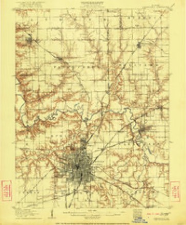
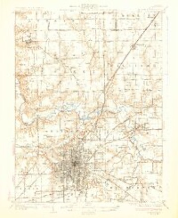
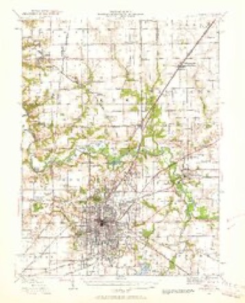
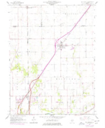
7 surveys from 17 printed sheetsMatched by testing this settlement's coordinate against the published boundary of every sheet in the United States Geological Survey's historical collection. Each opens the scanned sheet at the Survey.
- 1907 USGS Springfield quadrangle1:62500, 2 printings
- 1930 USGS Springfield quadrangle1:62500, 3 printings
- 1940 USGS Springfield quadrangle1:62500, 2 printings
- 1958 USGS Decatur quadrangle1:250000, 3 printings
- 1961 USGS Decatur quadrangle1:250000, 2 printings
- 1966 USGS Williamsville quadrangle1:24000, 3 printings
- 1985 USGS Springfield quadrangle1:100000, 2 printings



In the county-history sources
10,853 words on this townshipHistory of Sangamon County, Illinois; Together with Sketches of Its Cities, Villages and Townships ... Portraits of Prominent Persons, and Biographies of Representative Citizens. History of Illinois, published 1881 names this settlement in its chapter on Williams Township. These are the passages that mention it, exactly as the scans read.
Mrs. Rebecca Miller has a silver half-dollar given to her when a child by her mother, bearing date 1822, the year in which Mrs. Miller was born. In 1846, her husband desired to purchase a piece of land, and lacked one-half dollar of having the necessary amount to pay for it. The coveted half-dollar was given to him, and paid out on this purchase. In 1876, the identical half-dollar was given to him in change by a merchant in Williamsville, and by him returned to Mrs. Miller. Thus, after a lapse of thirty years, she received back the precious coin, paid out in Jackson City, Missouri.
Passage source: History of Sangamon County, Illinois; Together with Sketches of Its Cities, Villages and Townships ... Portraits of Prominent Persons, and Biographies of Representative Citizens. History of Illinois, published 1881.
A petition of the citizens was circulated, praying the post office department at Washington, to establish here a post office. Their petition was granted, and an office established in the spring of 1854, named Williamsville Post Office, with John George as postmastei*. Mr. George was subsequently succeeded by his son, Wesley George, who served until 1858, when Jacob Mc- Clure was appointed. From 1858 to the present time, the[.following named have had charge of the office: George Brown, Jacob McClure, Charles Elder, R. M. Lawrence, William Stewart, Sarah Stewart, and Jacob McClure, the second time, the incumbent.
Passage source: History of Sangamon County, Illinois; Together with Sketches of Its Cities, Villages and Townships ... Portraits of Prominent Persons, and Biographies of Representative Citizens. History of Illinois, published 1881.
No community can exist without the aid of the doctor, at least this is the general opinion. In 1850, Dr. Connery, of Ohio, moved to the township, and commenced here the practice of medicine. In 1855, he moved into the new village of Benton, now Williamsville, and continued to practice, being the first physician in the place. He was a clever man, a good physician and enjoyed the respect of the community in which he lived. He secured an excellent practice, but died in 1857. Since Dr. Connery's time there have been a number of physicians who have practiced their profession in the place, among whom were Drs. Henry VanMeter, J. M. West, Thomas M. Helm and J. Y. Winn. The present resident physicians of the place are: M. Mathus, J. Y. Winn, A. D. Tavlor and K. E. McClelland.
Passage source: History of Sangamon County, Illinois; Together with Sketches of Its Cities, Villages and Townships ... Portraits of Prominent Persons, and Biographies of Representative Citizens. History of Illinois, published 1881.
Machine-read from a century-old scan, so expect the errors a machine makes: misspelled names, dropped words, stray characters.
Read the whole chapter on Williams Township - it names this place 22 more 22 times.
Fires near this place
15 since 2002Regional context, not property-specific evidence. The federal wildfire occurrence database lists 15 fires within 5 miles of Williamsville between 2002 and 2014, burning about 94 acres in total. None started naturally. None was recorded as arson. Distance is straight-line from the map coordinates, so a fire counted here may appear on a neighbouring settlement's page as well.
| Reported cause | Fires |
|---|---|
| Missing data/not specified/undetermined | 10 |
| Debris and open burning | 4 |
| Recreation and ceremony | 1 |
The most recent of them, most recent first, with the day each was reported and the service that recorded it.
| Date | Cause | Size | Reported by | Name on the report |
|---|---|---|---|---|
| 26 September 2013 | Debris and open burning | 2.0 acres | Illinois Division of Forestry Resources | 13-0000327 |
| 17 September 2010 | Missing data/not specified/undetermined | 1.0 acres | Illinois Division of Forestry Resources | 10308 |
| 8 August 2010 | Missing data/not specified/undetermined | under an acre | Illinois Division of Forestry Resources | 10259 |
| 8 July 2010 | Missing data/not specified/undetermined | 1.0 acres | Illinois Division of Forestry Resources | 10209 |
| 19 July 2010 | Missing data/not specified/undetermined | under an acre | Illinois Division of Forestry Resources | 10228 |
| 6 April 2014 | Debris and open burning | 1.0 acres | Illinois Division of Forestry Resources | 14-0000112 |
| 14 April 2010 | Missing data/not specified/undetermined | under an acre | Illinois Division of Forestry Resources | 10107 |
| 1 April 2010 | Missing data/not specified/undetermined | 75 acres | Illinois Division of Forestry Resources | 1098 |
Settlements close enough to share some of these fires:
Storms near this place
24 since 1996Regional context, not property-specific evidence. The National Weather Service names Williamsville in 24 storm reports between 1996 and 2022: 13 hail, 8 thunderstorm wind, 2 tornado, 1 flash flood. The reports record 17 injuries. Each account below is quoted exactly as the forecast office filed it, from the NOAA Storm Events Database, and each date opens the federal record of that event.
| When | Event | Place named | Harm | What the report says |
|---|---|---|---|---|
| August 2009 | Tornado (EF3) | Williamsville | 17 hurt, $11,000,000 | The tornado touched down on the west side of Williamsville, just west of I-55, at 319 PM CST. It destroyed an antique mall, damaged the Casey's gas station building and collapsed the canopy over the gas pumps. One person was injured at the mall, while 2 motorcyclists were injured when they were thrown from their bikes. The tornado moved northeast through Williamsville and hit a church, throwing a 2-horse trailer onto the roof and collapsing the roof over half of the building. One person inside the church was injured. The tornado continued through the northern portion of town, causing damage to numerous trees and several homes. Two homes lost their roof and several others lost a portion of their roof. The tornado also caved in the southern end of a metal building, part of an agricultural business on the edge of town. A total of 12 additional people were injured by tornado debris in the town of Williamsville. The width of the tornado through town ranged from 100 to 150 yards. The maximum wind speed of 135 mph (EF2) in Williamsville was determined from the damage to the church. A total of 10 houses were destroyed and 35 houses damaged in Williamsville. A total of six businesses and non-residential properties were destroyed.||The tornado continued east-northeast and flattened cornfields, damaged farm outbuildings and machine sheds, and damaged homes, garages, and vehicles on Lester Rd. Two houses were completely destroyed, and four others had extensive damage, as the tornado widened to 600 yards at this point. A 19-month-old baby was injured as the family home was hit by the tornado. ||The maximum wind speed at this point was estimated at 140 mph (EF3). The tornado continued through fields, causing extensive crop damage, until crossing into Logan County around 326 PM CST. Path length through Sangamon County was 4.5 miles. |
| June 2009 | Thunderstorm Wind | Williamsville | $100,000 | The roof of a pole barn was lifted off by strong winds. The building had no doors and was open to the south. Based on radar data, a microburst with winds of between 50 and 60 mph likely caused the damage. |
| October 2012 | Thunderstorm Wind | Williamsville | $40,000 | Several trees were blown down or snapped off about 10 feet above the ground. Five homes sustained minor damage to their roof shingles and siding. A fence was blown down as well. |
| May 2009 | Thunderstorm Wind | Williamsville | $15,000 | Power poles were blown down on the east side of Williamsville. |
| June 2016 | Thunderstorm Wind | Williamsville | $12,000 | Nine trees were blown down just west of Williamsville. |
| May 2012 | Thunderstorm Wind | Williamsville | $12,000 | A tree fell onto a vacant house in Williamsville. |
| May 2019 | Thunderstorm Wind | Williamsville | - | Five power poles were snapped. |
| May 2019 | Thunderstorm Wind | Williamsville | - | Power lines were blown down onto IL-123. |
| June 2015 | Flash Flood | Williamsville | - | Rainfall amounts of 2.00 to 3.00, on top of waterlogged ground, were reported during the evening of June 28th. This resulted in the flooding of streets and viaducts in parts fo Springfield. Part of Illinois Route 124 from Williamsville to the Menard County line was also impassable. |
| September 2007 | Tornado (EF0) | Williamsville | - | A tornado briefly touched down in a field. No damage or injuries were reported. |
| June 1998 | Thunderstorm Wind | Williamsville | - | Several trees were blown down eight miles west of Williamsville. One of the fallen trees landed on chimney and caused minor damage. No injuries were reported and no damage estimate was available. |
| August 2022 | Hail | Williamsville | - | no account filed |
| March 2017 | Hail | Williamsville | - | no account filed |
| June 2015 | Hail | Williamsville | - | no account filed |
| June 2013 | Hail | Williamsville | - | no account filed |
| June 2013 | Hail | Williamsville | - | no account filed |
| May 2011 | Hail | Williamsville | - | no account filed |
| April 2011 | Hail | Williamsville | - | no account filed |
| May 2009 | Hail | Williamsville | - | no account filed |
| May 2009 | Hail | Williamsville | - | no account filed |
| May 2009 | Hail | Williamsville | - | no account filed |
| May 2009 | Hail | Williamsville | - | no account filed |
| July 2006 | Hail | Williamsville | - | no account filed |
| August 1996 | Hail | Williamsville | - | no account filed |
Nearest settlements
The eight closest, with where each one stands in the county. Distances are straight-line, computed from the Geographic Names Information System coordinates.
Elsewhere
Matched on this settlement's Geographic Names Information System number rather than its name, so it cannot be a different place of the same name in another state.
| Wikipedia article on Williamsville | An encyclopaedic summary. Its text is share-alike, so it is linked here rather than copied. |
| Wikidata item Q548896 | The structured record the population and elevation above come from. Public domain (CC0). |
Provenance
This settlement is recorded in the Geographic Names Information System as feature 421218. The sheet list is computed by point-in-boundary test against the United States Geological Survey's historical topographic inventory. Both are works of the United States government and carry no copyright under 17 U.S.C. 105.
Wildfire. Short, Karen C. 2022. Spatial wildfire occurrence data for the United States, 1992-2020 [FPA_FOD_20221014]. 6th Edition. Fort Collins, CO: Forest Service Research Data Archive. https://doi.org/10.2737/RDS-2013-0009.6 Collected with United States Government funding and usable without additional permissions or fees.
Storms. NOAA National Centers for Environmental Information, Storm Events Database https://www.ncei.noaa.gov/stormevents/ A work of the United States government, no copyright under 17 U.S.C. 105. Narratives are quoted verbatim from the National Weather Service report and are not edited or summarised.