 Block
Wilmington, Illinois
23 topographic sheets cover this place, the earliest surveyed in 1892 and the latest in 1999. It stands in Wilmington Township. It lies in ZIP code area 60481. It stands on Forked Creek. The Survey maps it on the Wilmington quadrangle. 5,664 people lived here at the 2020 count. It stands 528 feet above sea level.
On record in Wilmington
Buildings and businesses the archive holds for this place. Each opens its own page, with the source record it came from.
On the National Register 2 records
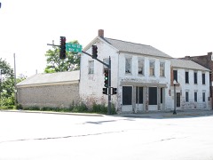 Eagle Hotellisted 1994
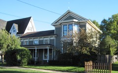 Small-Towle Houselisted 2004
Population over time
3 figuresWilmington grew from 5,600 to 5,664 between 2000 and 2020. These are the recorded population figures Wikidata holds for this place, reached through the Geographic Names Information System number this page is keyed on rather than by name, so they belong to this place and not to another of the same name. Most are census counts, but not all are: an early figure may be a founding or settlement estimate, and an estimate published within five years of a census is left out. The change column is computed, and is left blank where more than 20 years separate a figure from the one before it, because a gap that long is not a change between two counts.
| Year | People | Change |
|---|---|---|
| 2000 | 5,600 | |
| 2010 | 5,724 | +124 (+2%) |
| 2020 | 5,664 | -60 (-1%) |
Topographic sheets covering this place
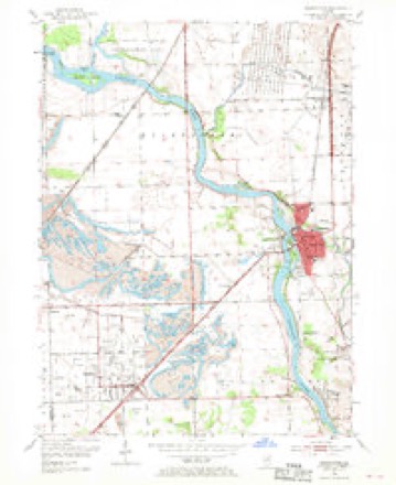
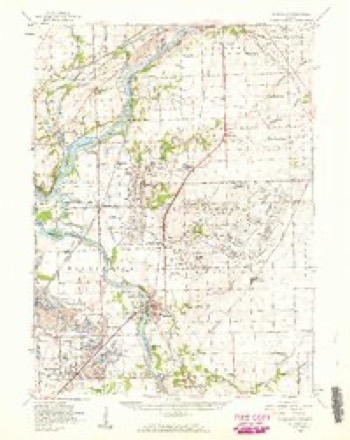
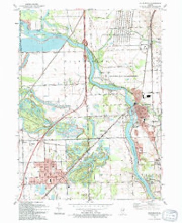
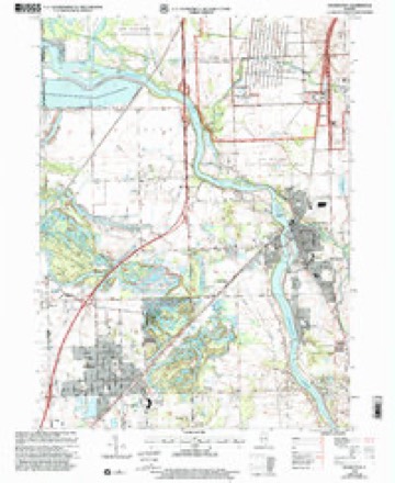
10 surveys from 23 printed sheetsMatched by testing this settlement's coordinate against the published boundary of every sheet in the United States Geological Survey's historical collection. Each opens the scanned sheet at the Survey.
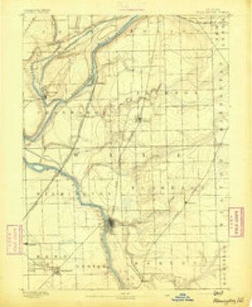
- 1892 USGS Wilmington quadrangle1:62500, 3 printings
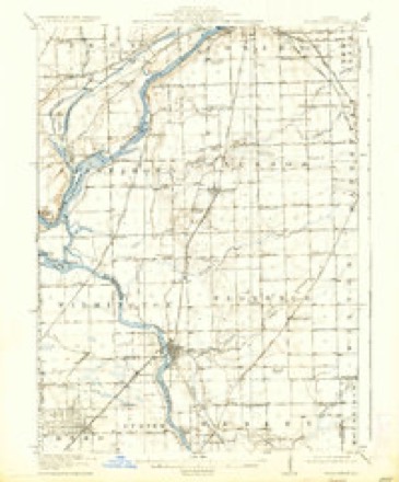
- 1918 USGS Wilmington quadrangle1:62500, 5 printings
- 1954 USGS Wilmington quadrangle1:24000, 4 printings
- 1954 USGS Wilmington quadrangle1:62500, 3 printings
- 1958 USGS Aurora quadrangle1:250000, 3 printings
- 1961 USGS Aurora quadrangle1:250000
- 1985 USGS Ottawa quadrangle1:100000
- 1991 USGS Ottawa quadrangle1:100000
- 1993 USGS Wilmington quadrangle1:24000
- 1999 USGS Wilmington quadrangle1:24000


In the county-history sources
4,757 words on this townshipHistory of Will County Illinois, published 1878 names this settlement in its chapter on Wilmington Township. These are the passages that mention it, exactly as the scans read.
The village of Wilmington was laid out in 1836, and as this and its immediate vicinity was the objective point toward which the early settlers naturally cast their eyes, the early history is necessarily embraced in that of the township. However, in 1854, having attained a population required by law, it was deemed best by most of the leading citizens to organize the village as a separate corporation. It was argued that this would give the village authority to build sidewalks, abate nuisances, control the liquor traffic, and, perhaps, obtain some revenue from the trade in the way of license, and numerous other advantages not enjoyed while merely constituting a portion of the township. Therefore, a notice, signed by '"' Many Citizens,' requesting the residents and freeholders to meet at the schoolhouse on Saturday, the 24th day of June, to take into consideration the incorporation of the town, was posted in various public places by S. W. Munn ten days before the date specified in the notice. At the meeting, Peter Stewart was called to the chair, and James F. Alden was selected as Clerk. The advantages of incorporation were then argued pro and con. (mostly pro), after which a vote was taken, resulting in favor of organization 12 to 1. A day was then appointed for the election of a town board, and on the 3d day of July the election took place. Of the election, Peter Stewart and James F. Allen occupied the position designated at the primary meeting. Sixty-three votes were cast, and D. W. Smead, J. D. Henderson, Samuel C. Thompson, J. A. Seebor and James F. Alden were elected Trustees ; James LL. Young was chosen Clerk; Anthony Riker, Street Commissioner, and Fred. Walrath, Constable. Thus was the incorporation of the village fully accomplished, and under this organization it continued eleven years. D. W. Smead was chosen first President. His successors were as follows: 1855, H. Warner; 1857, Anson Packard; 1858, Israel Massey ; 1859, S. W. Munn; 1860, William Harbottle; 1861, John D. White; 1862, John S. Jessup; 1864 E. H. Jessup.
Passage source: History of Will County Illinois, published 1878.
About the date last named, the question of changing the charter of the town, so as to give the incorporation some additional powers and a more genteel title, began to be agitated, and resulted in obtaining from the Legislature a charter, February 15, 1865, "constituting the inhabitants of said town a body corporate, by the name and style of city of Wilmington." Under this charter, the first election was held on the third Tuesday of March of the year named.
Passage source: History of Will County Illinois, published 1878.
The early settlers of Wilmington, unlike the pioneers of most other localities, were religious people, and they had but constructed a habitation, which barely sheltered them from the inclemencies of the weather, bofore they began to take measures for the establishing of a house for the Lord. Like the ancient Israelites, they experienced no trouble in worshiping God, even in the wilderness, and Peter Stewart's barn answered the purpose of a tabernacle. In this barn, services were held, and, in 1838, two years after the first settler made his appearance in the vicinity, in it was organized the Presbyterian Church. The organization was effected by J. G. Porter, now a venerable servant of the Master, and resident of Naperville. Among the original members were the two Stewart brothers and Daniel McIntosh with, their wives. Rev. Mr. Porter continued to preach for the little society once a month for a year or two, holding the services sometimes in the barn and afterward in the little frame schoolhouse erected about this time. Afterward he was called to the Church, regularly installed, and served the Church as Pastor for twelve years. A part of the present building was erected in 1840, at a cost of $1,400. Since then some additions have been made which make it quite a commodious and comfortable house. The present minister is Rev. R. K. Wharton. In connection with the Church is a prosperous Sunday school, of which H. L. Cady is Superintendent. The membership of the Church is 121, and of the Sunday school about 150.
Passage source: History of Will County Illinois, published 1878.
Machine-read from a century-old scan, so expect the errors a machine makes: misspelled names, dropped words, stray characters.
Read the whole chapter on Wilmington Township - it names this place 15 more 15 times.
Fires near this place
17 since 2002Regional context, not property-specific evidence. The federal wildfire occurrence database lists 17 fires within 5 miles of Wilmington between 2002 and 2018, burning about 349 acres in total. 1 started naturally. 1 was recorded as arson. Distance is straight-line from the map coordinates, so a fire counted here may appear on a neighbouring settlement's page as well.
| Reported cause | Fires |
|---|---|
| Equipment and vehicle use | 7 |
| Smoking | 4 |
| Debris and open burning | 2 |
| Arson/incendiarism | 1 |
| Missing data/not specified/undetermined | 1 |
| Natural | 1 |
| Railroad operations and maintenance | 1 |
The most recent of them, most recent first, with the day each was reported and the service that recorded it.
| Date | Cause | Size | Reported by | Name on the report |
|---|---|---|---|---|
| 26 September 2006 | Equipment and vehicle use | under an acre | Midewin National Tall Grass Prairie | ROUTE 53 FIRE |
| 9 July 2005 | Equipment and vehicle use | 1.5 acres | Midewin National Tall Grass Prairie | WELDER FIRE |
| 28 July 2008 | Equipment and vehicle use | under an acre | Midewin National Tall Grass Prairie | IRON BRIDGE TRAILHEA |
| 15 June 2007 | Equipment and vehicle use | under an acre | Midewin National Tall Grass Prairie | GORMAN FIRE |
| 8 May 2007 | Equipment and vehicle use | under an acre | Midewin National Tall Grass Prairie | IRON BRIDGE FIRE |
| 6 April 2008 | Debris and open burning | 5.0 acres | Midewin National Tall Grass Prairie | OLD CHICAGO FARM FIR |
| 6 April 2005 | Smoking | under an acre | Midewin National Tall Grass Prairie | SOUTH ARSENAL FIRE |
| 25 April 2018 | Railroad operations and maintenance | 9.2 acres | Midewin National Tall Grass Prairie | CENTER POINT |
Settlements close enough to share some of these fires:
Mines and quarries near this place
3 within 5 milesRegional context, not property-specific evidence. The federal mineral resources record lists 3 workings within 5 miles of Wilmington: 2 past producers, 1 occurrence. None of them still produces. What was taken out: Stone, Crushed/Broken, Sand and Gravel, Construction. Distance is straight-line from the map coordinates, so a quarry counted here may appear on a neighbouring settlement's page as well.
| Where | Site | Commodity | Status | Recorded |
|---|---|---|---|---|
| Charles & Son Sand Pit | Sand and Gravel, Construction | Past Producer | ||
| Limestone Prospect | Stone, Crushed/Broken | Occurrence | ||
| Unnamed Limestone Quarry | Stone, Crushed/Broken | Past Producer |
Storms near this place
35 since 1994Regional context, not property-specific evidence. The National Weather Service names Wilmington in 35 storm reports between 1994 and 2025: 15 hail, 13 thunderstorm wind, 4 flash flood, 1 wildfire. No death or injury is recorded in these reports. Each account below is quoted exactly as the forecast office filed it, from the NOAA Storm Events Database, and each date opens the federal record of that event.
| When | Event | Place named | Harm | What the report says |
|---|---|---|---|---|
| August 2007 | Flash Flood | Wilmington | $15,000 | A car drove into flood waters on Ballou Road near Forked Creek and was submerged to the roof of the car. One of the three occupants swam to dry ground to get help. The other two occupants were rescued several hours later. |
| May 2025 | Thunderstorm Wind | Wilmington | - | Numerous reports of tree damage were received in and near Wilmington. Fascia damage occurred to a house. A photo shared on social media showed a large section of roofing material that was blown into the street in the business district. |
| August 2022 | Thunderstorm Wind | Wilmington | - | A photo shared on social media showed a semi trailer tipped over at an industrial parking lot. |
| August 2022 | Thunderstorm Wind | Wilmington | - | A photo shared on social media showed a 6 inch diameter tree limb blown down near Bremer Street. |
| February 2022 | Flash Flood | Wilmington | - | An ice jam formed on the Kankakee River near the Interstate 55 bridge. This ice jam caused localized flash flooding near the river, downstream of Wilmington. |
| February 2022 | Flash Flood | Wilmington | - | An ice jam formed on the Kankakee River near the Interstate 55 bridge. This ice jam caused localized flash flooding affecting yards and roads in the Phelan Acres subdivision. |
| June 2019 | Thunderstorm Wind | Wilmington | - | Widespread tree damage was reported in Wilmington. Route 102 was blocked by large trees. |
| July 2017 | Thunderstorm Wind | Wilmington | - | Tree limbs were blown down and at least one tree was uprooted. |
| June 2015 | Flash Flood | Wilmington | - | Several roads were flooded and closed including Route 53 at Kankakee Street and Main Street, as well as Main Street and River Street. An observer in nearby Manhattan measured 3.25 inches of rain. |
| April 2011 | Hail | Wilmington | - | Penny size hail was reported in Wilmington. |
| October 2007 | Hail | Wilmington | - | Penny size hail was reported at Interstate 55 and the Kankakee River. |
| October 2007 | Hail | Wilmington | - | Penny size hail was reported at Interstate 55 and Lorenzo Road. |
| August 2007 | Thunderstorm Wind | Wilmington | - | Trees were blown down at Route 102 and 113. |
| June 2006 | Thunderstorm Wind | Wilmington | - | Several trees were blown down along West Thornton Road. |
| March 2005 | Hail | Wilmington | - | Penny sized hail was reported near the intersection of Lorenzo Rd. and I-55. |
| May 2005 | Thunderstorm Wind | Wilmington | - | A gust to 60 mph was reported near Route 53 and Wilmington-Petone Road. |
| May 2004 | Thunderstorm Wind | Wilmington | - | Two large trees were blown down. |
| May 2004 | Lightning | Wilmington | - | The Embassy Care Center was struck by lightning and a fire started on the west side of the building. |
| May 2003 | Tornado (F0) | Wilmington | - | A weak tornado touched down in a field about 2 miles east of Wilmington near Old Chicago Road. No damage was reported. |
| May 2010 | Hail | Wilmington | - | no account filed |
| July 2010 | Thunderstorm Wind | Wilmington | - | no account filed |
| October 2007 | Thunderstorm Wind | Wilmington | - | no account filed |
| October 2007 | Hail | Wilmington | - | no account filed |
| March 2006 | Hail | Wilmington | - | no account filed |
| May 2006 | Hail | Wilmington | - | no account filed |
| April 2003 | Wildfire | Wilmington | - | no account filed |
| July 2003 | Hail | Wilmington | - | no account filed |
| July 2001 | Thunderstorm Wind | Wilmington | - | no account filed |
| April 1999 | Hail | Wilmington | - | no account filed |
| May 1999 | Thunderstorm Wind | Wilmington | - | no account filed |
| May 1997 | Hail | Wilmington | - | no account filed |
| April 1996 | Hail | Wilmington | - | no account filed |
| April 1994 | Hail | Wilmington | - | no account filed |
| April 1994 | Hail | Wilmington | - | no account filed |
| April 1994 | Hail | Wilmington | - | no account filed |
Nearest settlements
The eight closest, with where each one stands in the county. Distances are straight-line, computed from the Geographic Names Information System coordinates.
| Map | Place | Distance | Sheets |
|---|---|---|---|
| Winchester Estates | 0.5 miles | 23 | |
| Riverwood Estates | 0.6 miles | 23 | |
| Lakewood Shores | 1.8 miles | 23 | |
| Ballou | 3.2 miles | 21 | |
| Resthaven | 3.2 miles | 23 | |
| Ritchie Station | 3.8 miles | 21 | |
| Ritchie | 4.3 miles | 21 | |
| Custer Park | 4.4 miles | 13 |
Elsewhere
Matched on this settlement's Geographic Names Information System number rather than its name, so it cannot be a different place of the same name in another state.
| Wikipedia article on Wilmington | An encyclopaedic summary. Its text is share-alike, so it is linked here rather than copied. |
| Wikidata item Q576212 | The structured record the population and elevation above come from. Public domain (CC0). |
Provenance
This settlement is recorded in the Geographic Names Information System as feature 421278. The sheet list is computed by point-in-boundary test against the United States Geological Survey's historical topographic inventory. Both are works of the United States government and carry no copyright under 17 U.S.C. 105.
Wildfire. Short, Karen C. 2022. Spatial wildfire occurrence data for the United States, 1992-2020 [FPA_FOD_20221014]. 6th Edition. Fort Collins, CO: Forest Service Research Data Archive. https://doi.org/10.2737/RDS-2013-0009.6 Collected with United States Government funding and usable without additional permissions or fees.
Mines and quarries. USGS Mineral Resources Data System (MRDS) https://mrdata.usgs.gov/mrds/ A work of the United States government, no copyright under 17 U.S.C. 105.
Storms. NOAA National Centers for Environmental Information, Storm Events Database https://www.ncei.noaa.gov/stormevents/ A work of the United States government, no copyright under 17 U.S.C. 105. Narratives are quoted verbatim from the National Weather Service report and are not edited or summarised.