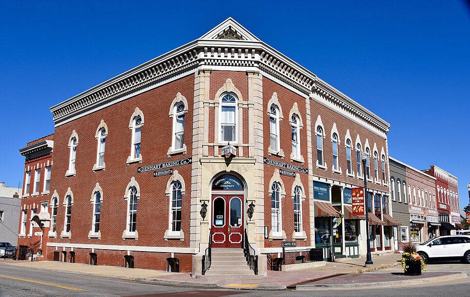
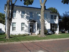
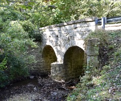
Listed on the National Register of Historic Places in 2005.
From the record
“The Denhart Bank Building is a historic bank building located at 101 Washington Square in Washington, Illinois. Charles Anthony and Henry Denhart built the building for their bank, which began business in 1866, around 1872.”
Wikipedia article Denhart Bank Building, CC BY-SA 4.0.
One of 16 National Register listings published here for Tazewell County · listed in 2005 · category: Building.
National Register reference number.05000874- the number the National Park Service assigned this property when it was listed, and the key its nomination file is catalogued under at the National Archives.
The first settler in Washington township was William Holland, Sen., a native of North Carolina, and who emigrated from that State, and settled in Edwardsville, Madison county. 111., in 1815. He remained there for three years, when he removed to Sangamon Co., and after two years residence there moved to Peoria, then Fort Clark, in the spring of 1820. He crossed the river to the flats, now Fond du Lac township, and occupied an old shanty. Here he raised a crop during the summer of the same year. He cut logs, which he hauled across the river and erected a double log cabin. This was the second dwelling built in Peoria. Prior to his settling in Peoria, and during his residence in Sangamon, he was employed by a man named Cramer, who had contracts with the Government to do blacksmithing for the Indians. But completing the erection of his abode, he, himself, formed negotiations with the Government, and commenced at his trade, blacksmithing. In the spring of 1825, he came to this township, and built a log house on section 23, and on the present site of A. G. Danforth's residence. Here the family were surrounded by a dense wilderness, and were the only white occupants of this township until 1826. Holland commenced improving a farm on sec. 24, town 26, range 3, just east of the town of Washington, and embracing a part of the Holland, Dorsey, Walthan and Robinson addition to the town. His nearest neighbors were located on Farm creek, three miles east of Peoria, where the first settlement was made in this section. Amono' them were Wm. Blanchard, Elza Bethard, Jack Phillips, and his son William, Austin and Horace Crocker, and Thomas Camlin, whose cabin was located nearest Holland's Gove. There are others, the exact data of whose coming seems quite impossible to determine. In 1824 Jacob Wilson, Sr., Joshua Walker, Thomas Banks, and Elisha Green, all settled on Farm creek. Cyrus J. Gibson followed in 1830, and Thomas Trimble, whose sons are now prominent among the residents of Washington City, settled there in 1834. William Thompson, a native of Indiana, came in 1826, and settled on the farm now occupied by John Johnson and made some improvements. The same year William Weeks came from Indiana, and settled on the present estate of Peter Portman, where he erected a rude habitation, which has since given place to the fine residence of its owner. In the fall of the same year, John Redman, also from Indiana, settled near the farm of 'Squire Baker.
With the coming of the spring and summer months of 1833, there came a general rush of immigrants, and ere the first snows of winter fell, the whole of the timbered sections of the township were nterspersed with cal)ins and settlers. A large ])ortion of the lands bearing timber, and the smaller groves, were claimed, if not occupied, while the prairie, for most part, was left untouched and unsought. The })rairie land was regarded as Avorthless for purposes of agriculture, and considered a useless waste. There were hundreds of men w^ho believed it would never be occupied. If any of the settlers at that time had located on the prairie he would have been regarded as extremely visionary, if not absolutely crazy. Of those whose names appear among the early pilgrims, many removed from the township ere many years had flown ; others followed from year to year, in other localities; others have passed to the Shining Shore of the Beautiful River, while many others still remain in the enjoyment of the homes of their industry, endurance, and enterprise ; fashioned and founded in the beautiful lands of Washington. The surroundings of piom^er life arc well calculated to test the true inwardness of the human heart, and the trials, sufferings, and endurance, incident to the founding and building of homes, unite them in the strongest and deepest feelings of friendship, that grows and strengthens with their years. Raven locks may bk'ach and whiten ; full round cheeks wither and waste away ; the fires of intelligence vanish from the organs of vision ; the brow become wrinkled with care and age, and the erect form bowed with accumulating years, but the true friends of long ago will be remembered as long as life and reason endure.
Regional context, not property-specific
evidence. The
federal wildfire occurrence database
lists 4 fires within 5 miles of Denhart Bank Building
between 2010 and 2013, burning about 10 acres in total. None started naturally. None was recorded as arson.
Distance is straight-line from the map coordinates, so a fire counted
here may appear on a neighbouring settlement's page as well.
Reported cause
Fires
Missing data/not specified/undetermined
2
Debris and open burning
2
The most recent of
them, most recent first, with the day each was reported and the service
that recorded it.
Regional context, not property-specific
evidence. The National Weather Service names
Washington, the town this property stands in, in 56 storm reports between 1993 and 2025: 26 thunderstorm wind, 25 hail, 3 tornado, 2 flash flood.
No death or injury is recorded in these reports. Each account below is quoted exactly as the forecast office
filed it, from the NOAA Storm Events Database, and each date
opens the federal record of that event.
Large hail fell from northwest of Washington through Washington, then southeast to Mackinaw. Hundreds of cars sustained damage, as well as, hundreds of homes with siding damage. No injuries were reported.
As the tornado crossed from Woodford into Tazewell County, 3 miles north northwest of Washington, it continued to blow down numerous trees and power lines. It destroyed a shed before lifting and dissipating 2 miles north of Washington. No injuries were reported.
A tornado first touched down in Tazewell County 3 miles southeast of Washington. It damaged a couple of homes and businesses, as well as blowing down numerous trees, power poles and power lines. The tornado then moved into Woodford County where it increased in intensity. No injuries were reported.
No historic map-sheet match is published
for this property yet. That does not mean no map exists. This record needs
a coordinate-quality review before it can be joined to a sheet boundary.
Browse the county's mapped places while that work is
pending.
Listed places nearby
3 within 8 miles
Other National Register properties close
enough to walk or drive between, ordered by distance from this one. Both
positions come from the same geocoding pass that matched these properties
to their map sheets.
Listing record. National Park Service National Register of Historic Places, listed-properties dataset, current to 2026-05-22.
Map join. Address geocoded through the United States Census geocoder, then tested against the published boundary of every sheet in the USGS Historical Topographic Map Collection.
How this page is made. Listing fields come from federal records; map-sheet coverage is a labelled coordinate-to-boundary calculation, not a source-field claim.
Wildfire. Short, Karen C. 2022. Spatial wildfire occurrence data for the United States, 1992-2020 [FPA_FOD_20221014]. 6th Edition. Fort Collins, CO: Forest Service Research Data Archive. https://doi.org/10.2737/RDS-2013-0009.6 Collected with United States Government funding and usable without additional permissions or fees.
Storms. NOAA National Centers for Environmental Information, Storm Events Database https://www.ncei.noaa.gov/stormevents/ A work of the United States government, no copyright under 17 U.S.C. 105. Narratives are quoted verbatim from the National Weather Service report and are not edited or summarised.
 Block