Listed on the National Register of Historic Places in 2015.
From the record
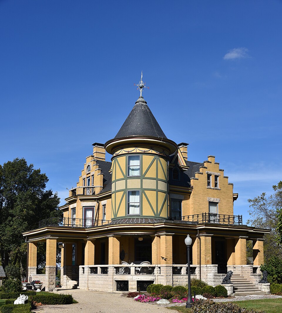
“The David Hyatt Van Dolah House is a historic house located at 10 North Spencer Street in Lexington, Illinois. The house was built in 1898 for David Hyatt Van Dolah, a prominent local landowner best known as an importer and broker of French horses.”
Wikipedia article David Hyatt Van Dolah House, CC BY-SA 4.0.
One of 35 National Register listings published here for McLean County · listed in 2015 · category: Building.
During the winter of the deep snow Mr. Spawr pounded corn of course. For nearly sixty days the sun did not shine warm enough to make a wet spot in front of his south door. During that winter a man named Rook came down from Rook's Creek (Little Vermilion) with a handsled, walking with snow-shoes, and obtained corn for his family of Conrad Flesher, who lived where Lexington now stands.
The town of Lexington was laid off in 1835; and in 1836 Mr. Spawr moved there from Money Creek timber. It was during December of that year that the great sudden change of the weather occurred. Mr. Spawr then saw the water blown into waves and frozen in that way. He speaks of another sudden change almost as severe. In November, 1842, he started for Chicago with a party to drive stock. The weather had been mild, but it snowed and melted and by the seventh of November it froze up. On the return of the party from Chicago they crossed the Kankakee on the ice at the rapids, where the water runs as swiftly as a mill race. A thaw came in January, but the cold weather again returned and winter continued until March.
Regional context, not property-specific
evidence. The
federal wildfire occurrence database
lists 14 fires within 5 miles of David Hyatt Van Dolah House
between 2009 and 2014, burning about 101 acres in total. None started naturally. None was recorded as arson.
Distance is straight-line from the map coordinates, so a fire counted
here may appear on a neighbouring settlement's page as well.
Reported cause
Fires
Missing data/not specified/undetermined
10
Debris and open burning
4
The most recent of
them, most recent first, with the day each was reported and the service
that recorded it.
Regional context, not property-specific
evidence. The federal mineral resources record lists
2 workings within 5 miles of David Hyatt Van Dolah House: 2 past producers.
None of them still produces. What was taken out: Sand and Gravel, Construction. Distance is straight-line from the
map coordinates, so a quarry counted here may appear on a neighbouring
settlement's page as well.
Regional context, not property-specific
evidence. The National Weather Service names
Lexington, the town this property stands in, in 26 storm reports between 1998 and 2024: 13 thunderstorm wind, 11 hail, 1 tornado, 1 lightning.
No death or injury is recorded in these reports. Each account below is quoted exactly as the forecast office
filed it, from the NOAA Storm Events Database, and each date
opens the federal record of that event.
Lightning struck a tree and gas line in Lexington in McLean County at 2:40 AM CST. The tree caught fire, with the fire then spreading to a nearby home. The house suffered considerable damage to its roof and upper floor.
No historic map-sheet match is published
for this property yet. That does not mean no map exists. This record needs
a coordinate-quality review before it can be joined to a sheet boundary.
Browse the county's mapped places while that work is
pending.
Listed places nearby
3 within 8 miles
Other National Register properties close
enough to walk or drive between, ordered by distance from this one. Both
positions come from the same geocoding pass that matched these properties
to their map sheets.
Listing record. National Park Service National Register of Historic Places, listed-properties dataset, current to 2026-05-22.
Map join. Address geocoded through the United States Census geocoder, then tested against the published boundary of every sheet in the USGS Historical Topographic Map Collection.
How this page is made. Listing fields come from federal records; map-sheet coverage is a labelled coordinate-to-boundary calculation, not a source-field claim.
Wildfire. Short, Karen C. 2022. Spatial wildfire occurrence data for the United States, 1992-2020 [FPA_FOD_20221014]. 6th Edition. Fort Collins, CO: Forest Service Research Data Archive. https://doi.org/10.2737/RDS-2013-0009.6 Collected with United States Government funding and usable without additional permissions or fees.
Mines and quarries. USGS Mineral Resources Data System (MRDS) https://mrdata.usgs.gov/mrds/ A work of the United States government, no copyright under 17 U.S.C. 105.
Storms. NOAA National Centers for Environmental Information, Storm Events Database https://www.ncei.noaa.gov/stormevents/ A work of the United States government, no copyright under 17 U.S.C. 105. Narratives are quoted verbatim from the National Weather Service report and are not edited or summarised.
 Block