| August 2011 | Lightning | Ottawa | 1 hurt | A man working near a window in his basement felt a big jolt, as lightning struck near his house. He later found a natural gas line damaged by the lightning and while on the way to buy replacement parts, his right arm became numb. He stopped at fire station, who then transported him to a local hospital. He was not expected to have any long lasting injuries. |
| July 2003 | Hail | Ottawa | 1 hurt | no account filed |
| August 2007 | Flash Flood | Ottawa | $250,000 | Several inches of flowing water over Route 23 in and north of Ottawa. Flash flooding occurred in Utica as Clark Run Creek overflowed its banks sending floodwaters down the main part of town. According to reports, about 45 residents responded to a request for evacuation. Widespread basement flooding was reported in the Peru-La Salle areas. Many streets and county roads flooded within La Salle County. Flash flooding was also reported in Triumph, Naplate, and Grand Ridge in La Salle County. Dee Bennet Road near Buffalo Rock State park was closed due to flooding. Portions of Route 178 were also closed. |
| October 2000 | Thunderstorm Wind | Ottawa | $100,000 | no account filed |
| August 2011 | Lightning | Ottawa | $50,000 | A house in Ottawa was struck by lightning. |
| July 2010 | Thunderstorm Wind | Ottawa | $30,000 | Numerous trees, tree limbs and power lines were blown down across Ottawa. Two homes were damaged by falling tree limbs. Route 23 was closed due power lines that fell across the road. |
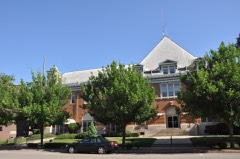
| July 2011 | Lightning | Ottawa | $20,000 | Lightning damaged the chimney of the historic Reddick Building, which was built in the 1850s. Falling bricks damaged an air conditioner and broke a window. |
| July 2010 | Thunderstorm Wind | Ottawa | $5,000 | Trees, tree limbs and power lines were blown down. A large tree limb fell on a pickup truck. |
| August 2007 | Thunderstorm Wind | Ottawa | $5,000 | Tree limbs and power lines were blown down on Hillside Avenue in northern Ottawa. |
| May 2006 | Thunderstorm Wind | Ottawa | $5,000 | Several trees, utility poles and power lines were blown down across parts of Southern Ottawa. |
| August 2008 | Thunderstorm Wind | Ottawa | $3,000 | Trees, tree limbs and power lines were blown down in Ottawa. |
| December 2007 | Thunderstorm Wind | Ottawa | $2,000 | A utility pole was snapped off. Part of the pole went through the roof of a building. |
| September 2006 | Thunderstorm Wind | Ottawa | $2,000 | A tree limb was blown down on York Street which took down power lines. |
| March 2017 | Thunderstorm Wind | Ottawa | $1,000 | Law enforcement relayed reports of power poles and power lines down just south of Ottawa. A large tree was also blown down onto Illinois Route 71. |
| April 2026 | Thunderstorm Wind | Ottawa | - | A photo was shared of a tree down across Columbus St just north of E Jackson St in Ottawa. |
| March 2025 | Thunderstorm Wind | Ottawa | - | Power poles were leaning in Ottawa. |
| January 2024 | Flood | Ottawa | - | An ice jam occurred along the Fox River at the Route 6 bridge which caused some water and ice chunks to spill out of the river banks near a medical center. |
| July 2024 | Thunderstorm Wind | Ottawa | - | A large tree was uprooted in the 700 block of Guthrie Street, which also brought down power lines and snapped a utility pole. |
| August 2024 | Thunderstorm Wind | Ottawa | - | Power outages, downed trees, and a flipped picnic table were reported on the north side of Ottawa. A semi truck was also rolled on I-80 near Ottawa. |
| August 2022 | Thunderstorm Wind | Ottawa | - | Tree limbs were blown down in Ottawa. One tree was snapped and a utility pole was bent. |
| August 2021 | Thunderstorm Wind | Ottawa | - | Tree limbs 6 to 8 inches in diameter were blown down. |
| May 2020 | Thunderstorm Wind | Ottawa | - | Trees were blown down on the east side of Ottawa. |
| August 2020 | Thunderstorm Wind | Ottawa | - | Trees, tree limbs and power lines were blown down in Ottawa. A shed was destroyed. Multiple signs in downtown Ottawa were blown down. |
| August 2020 | Tornado (EF1) | Ottawa | - | A tornado with peak winds of 100 mph touched down south of Marquette Street west of La Salle Street. The tornado impacted several businesses ripping off well anchored roofing material and snapping a utility pole at its base. The roof of a flooring business was blown off and hit a nearby building. It was here the tornado reached peak intensity. The tornado continued east ripping shingles off of roofs of buildings and houses and shredding trees. One tree was shredded badly near Canal Street and a large tree limb fell onto a new pickup truck causing significant damage. Fallen trees and tree limbs covered most areas along the path to the Fox River. The tornado is believed to have lifted in an inaccessible forested area east of the Fox River. Eye witnesses indicated the tornado may have had multiple vortices with clear rising and rotating motion of debris. |
| February 2017 | Thunderstorm Wind | Ottawa | - | Wind gusts were estimated to 70 mph. |
| July 2017 | Flood | Ottawa | - | Up to five inches of standing water was reported covering Route 6 west of the Fox River. |
| February 2017 | Hail | Ottawa | - | Hail was estimated to be the size of baseballs in Ottawa. |
| July 2016 | Thunderstorm Wind | Ottawa | - | Measured by U.S. Army Corp of Engineers sensor. |
| July 2016 | Thunderstorm Wind | Ottawa | - | Several large trees down along Oaklane Drive. Relayed via Facebook. |
| July 2016 | Hail | Ottawa | - | Intersection of Boyce Memorial Drive and Ottawa Avenue. |
| July 2015 | Hail | Ottawa | - | Golf ball size hail fell just north of Route 6. |
| June 2014 | Thunderstorm Wind | Ottawa | - | Tree branches to around 12 inches in diameter were blown down. |
| June 2013 | Thunderstorm Wind | Ottawa | - | Winds were measured to 62 mph at a mesonet site approximately a mile south-southwest of Ottawa. Large trees were uprooted on the south side of Ottawa. |
| September 2013 | Thunderstorm Wind | Ottawa | - | A large tree was blown down onto power lines near the intersection of Route 6 and Route 23. |
| August 2010 | Thunderstorm Wind | Ottawa | - | A large tree was blown down near Marcy and Guthrie Streets. |
| June 2009 | Thunderstorm Wind | Ottawa | - | Tree limbs were blown down. |
| July 2008 | Thunderstorm Wind | Ottawa | - | Wind gusts were estimated to 65 mph. |
| June 2007 | Flood | Ottawa | - | One to two feet of standing water in Madison Street, 2.07 inches of rain measured in on hour from 130 pm CST to 230 pm CST. |
| May 2007 | Thunderstorm Wind | Ottawa | - | On Interstate 80, near mile marker 85, a car was picked up and turned around. |
| March 2007 | Hail | Ottawa | - | Penny size hail was reported on Route 23, just south of Interstate 80. |
| August 2007 | Flood | Ottawa | - | Covel Creek affecting homes near Route 23 south of Ottawa. Water on roadways throughout the county, 4.51 inches of rain since 10 am on August 23rd. |
| August 2007 | Thunderstorm Wind | Ottawa | - | Several large trees blown down on the north side of Ottawa. |
| August 2007 | Thunderstorm Wind | Ottawa | - | Measured gust to 70 mph. |
| August 2007 | Thunderstorm Wind | Ottawa | - | Measured gust to 63 mph. |
| August 2007 | Flood | Ottawa | - | Four inches of water over Route 23. |
| August 2006 | Thunderstorm Wind | Ottawa | - | Trees blown down along Jack Dougherty Road. |
| August 2006 | Flood | Ottawa | - | Three to four inches of water was reported covering streets in Ottawa, where 1.49 inches of rain was measured. |
| August 2006 | Thunderstorm Wind | Ottawa | - | Wind gusts were estimated to 60 mph. |
| March 2005 | Hail | Ottawa | - | Nickel sized hail was reported south of Rt. 80 on E. 16th rd. in the Autumnwood subdivision, 1830-1840 CST.The ground was reported to be covered with 2 to 3 inches of quarter sized hail, 1842-1847 CST. |
| June 2005 | Thunderstorm Wind | Ottawa | - | Several large trees were blown down on the west side of Ottawa. |
| July 2005 | Thunderstorm Wind | Ottawa | - | A gust to 60 mph was reported in Ottawa with some tree damage. |
| May 2004 | Thunderstorm Wind | Ottawa | - | Trees were blown down at the water tower. |
| May 2004 | Thunderstorm Wind | Ottawa | - | Many tree limbs were blown down on the south side of town. |
| June 2000 | Thunderstorm Wind | Ottawa | - | Trees were down on Highway 71 near Ottawa. A spotter reported 60 to 65 mph winds near Streator. |
| June 1997 | Tornado (F0) | Ottawa | - | State police reported a tornado over an open field. There were no damages. |
| April 2026 | Thunderstorm Wind | Ottawa | - | no account filed |
| May 2020 | Hail | Ottawa | - | no account filed |
| May 2020 | Funnel Cloud | Ottawa | - | no account filed |
| September 2010 | Hail | Ottawa | - | no account filed |
| September 2010 | Hail | Ottawa | - | no account filed |
 Block