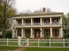
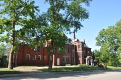
Listed on the National Register of Historic Places in 1987.
From the record
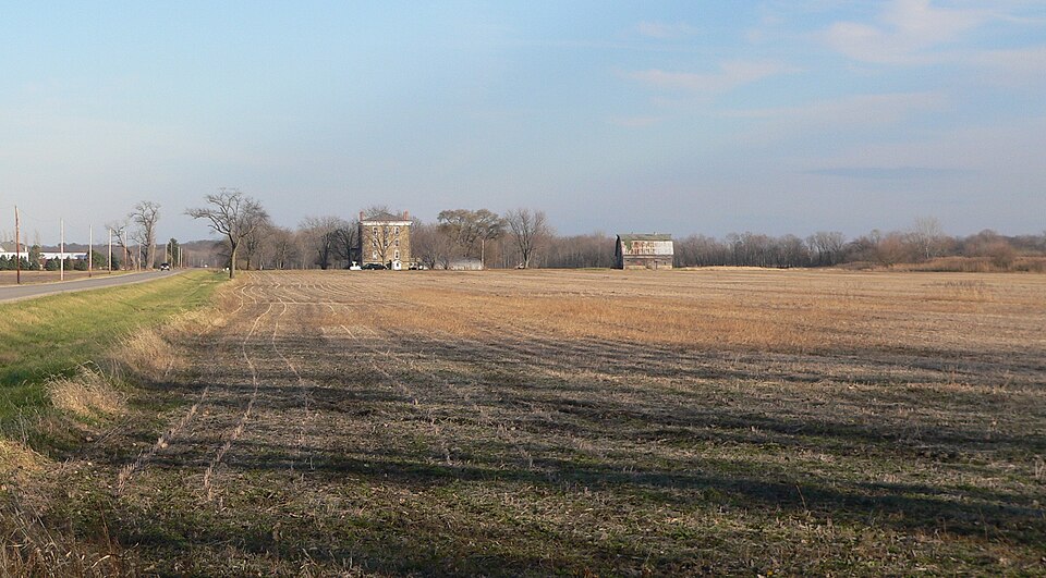
“The Spring Valley House-Sulfur Springs Hotel is a historic former hotel located along Dee Bennett Road in rural Utica Township, LaSalle County, Illinois. Built circa 1849, the hotel is unusually large for a rural hotel of the area.”
Wikipedia article Spring Valley House-Sulfur Springs Hotel, CC BY-SA 4.0.
One of 29 National Register listings published here for LaSalle County · listed in 1987 · category: District.
National Register reference number.87002055- the number the National Park Service assigned this property when it was listed, and the key its nomination file is catalogued under at the National Archives.
Utica embraces that part of T. 93, R. 2, which lies north of the Illinois river, being about half a township; the river, which is the southern boundary, running about due west, near the centre line of the town. There isa wide strip of bottom Iand between the bluff and the river, most of it very valuable for agriculture, but more so for the rich mineral wealth it contains. The beds of hydraulic lime which here lie near the surface, and are easily accessible, are the only ones found in the State, and the source of a large and valuable business.
This bottom land was the favorite resort of the Tilinois Indians, who occupied it in great numbers, and both savage and civilized men have ever regarded it as a point of attraction, for its beautiful scenery, its rich soil, and mineral wealth. Old Utica was a town on the river first occupied by Simon Crosiar, and when the business was all done by river boats, was 2 commercial point of some importance, the boats arriving and departing with ¢onsiderable regularity. It was regarded as the head of navigation, except at very high water when the boats ascended to Ottawa. 'But the building of the canal and the Rock Island Railroad, both along the foot of the bluff, on the opposite side of the valley, a mile distant, and the river boats all discharging at the basin at La Salle, dried up its sources of business, and it now stands like Goldsmith's deserted village. Instead of the panting of the river boat, its shrill note of arrival and departure, and the busy hum of the cheerful denizens of the embryo town on shore, Mong Its glades a solitary guest, 'The hollow sounding bittern guards its nest ; Sunk are its bowers in shapeless ruin all, And the rank woods o'ertop the crumbling wall."
Regional context, not property-specific
evidence. The
federal wildfire occurrence database
lists 32 fires within 5 miles of Spring Valley House-Sulfur Springs Hotel
between 2008 and 2017, burning about 306 acres in total. 3 started naturally. 3 were recorded as arson.
Distance is straight-line from the map coordinates, so a fire counted
here may appear on a neighbouring settlement's page as well.
Reported cause
Fires
Missing data/not specified/undetermined
13
Debris and open burning
10
Natural
3
Arson/incendiarism
3
Smoking
2
Power generation/transmission/distribution
1
The most recent of
them, most recent first, with the day each was reported and the service
that recorded it.
Regional context, not property-specific
evidence. The federal mineral resources record lists
12 workings within 5 miles of Spring Valley House-Sulfur Springs Hotel: 6 producers, 5 past producers, 1 plant.
7 still produce. What was taken out: Sand and Gravel, Construction, Clay, Stone, Crushed/Broken, Silica. Distance is straight-line from the
map coordinates, so a quarry counted here may appear on a neighbouring
settlement's page as well.
Regional context, not property-specific
evidence. The National Weather Service names
Utica, the town this property stands in, in 19 storm reports between 1997 and 2026: 10 thunderstorm wind, 6 hail, 1 tornado, 1 flood.
No death or injury is recorded in these reports. Each account below is quoted exactly as the forecast office
filed it, from the NOAA Storm Events Database, and each date
opens the federal record of that event.
Major flooding occurred along portions of the Illinois River. The river crested at 32.14 feet near La Salle on May 3rd, which was the third highest stage recorded. Flood stage near La Salle is 20 feet and major stage is 31 feet.
The tornado formed on the ridge northeast of Utica and moved across County Road 2803, west of 10th Street. A garage was destroyed and trees were damaged. The tornado became a wide multiple vortex tornado at this point. It caused damage to 2 homes, trees and outbuildings on Route 6, west of 11th Street. Part of the roof of a house was torn off. A storage building was damaged and a garage roof removed on 11th Street. A garage and grain bin were destroyed on County Road 2950. The tornado crossed I-80 at 12th Street damaging a building and flipping a semi-tractor trailer. The driver was not injured. North of I-80 a small satellite tornado formed behind the large parent tornado. It had a damage path 2 miles long and 5 to 20 yards wide. Its track was about 1/4 to 3/4 mile south of the main track. It caused no damage. The main tornado destroyed a machine shed on 13th Street and knocked down power poles. On 31st Street west of 14th big pine trees were snapped and a house suffered roof damage. A barn was destroyed on 14th north of 31st. On 32nd Street west of 15th, a two story house was hit. The top floor was mostly destroyed. A machine shed was destroyed on 16th between 32nd and 33rd. The tornado ended at 33rd and Route 23 where there was minor tree damage.
A swath of hail cut across La Salle county from North Utica to 5 miles WSW of Kangley.The following reports were received:1.75 inch hail at North Utica0.75 inch hail at South Utica1.25 inch hail 2 miles east of Leonore0.75 inch hail at Leonore1.00 inch hail 3 miles SW of Grand Ridge2.00 inch hail 5 miles W of Streator at County Road 18.1.75 inch hail at Streator2.75 inch hail 5 miles WSW of Kangley
No historic map-sheet match is published
for this property yet. That does not mean no map exists. This record needs
a coordinate-quality review before it can be joined to a sheet boundary.
Browse the county's mapped places while that work is
pending.
Listed places nearby
6 within 8 miles
Other National Register properties close
enough to walk or drive between, ordered by distance from this one. Both
positions come from the same geocoding pass that matched these properties
to their map sheets.
Listing record. National Park Service National Register of Historic Places, listed-properties dataset, current to 2026-05-22.
Map join. Address geocoded through the United States Census geocoder, then tested against the published boundary of every sheet in the USGS Historical Topographic Map Collection.
How this page is made. Listing fields come from federal records; map-sheet coverage is a labelled coordinate-to-boundary calculation, not a source-field claim.
Wildfire. Short, Karen C. 2022. Spatial wildfire occurrence data for the United States, 1992-2020 [FPA_FOD_20221014]. 6th Edition. Fort Collins, CO: Forest Service Research Data Archive. https://doi.org/10.2737/RDS-2013-0009.6 Collected with United States Government funding and usable without additional permissions or fees.
Mines and quarries. USGS Mineral Resources Data System (MRDS) https://mrdata.usgs.gov/mrds/ A work of the United States government, no copyright under 17 U.S.C. 105.
Storms. NOAA National Centers for Environmental Information, Storm Events Database https://www.ncei.noaa.gov/stormevents/ A work of the United States government, no copyright under 17 U.S.C. 105. Narratives are quoted verbatim from the National Weather Service report and are not edited or summarised.
 Block