
BlockBefore
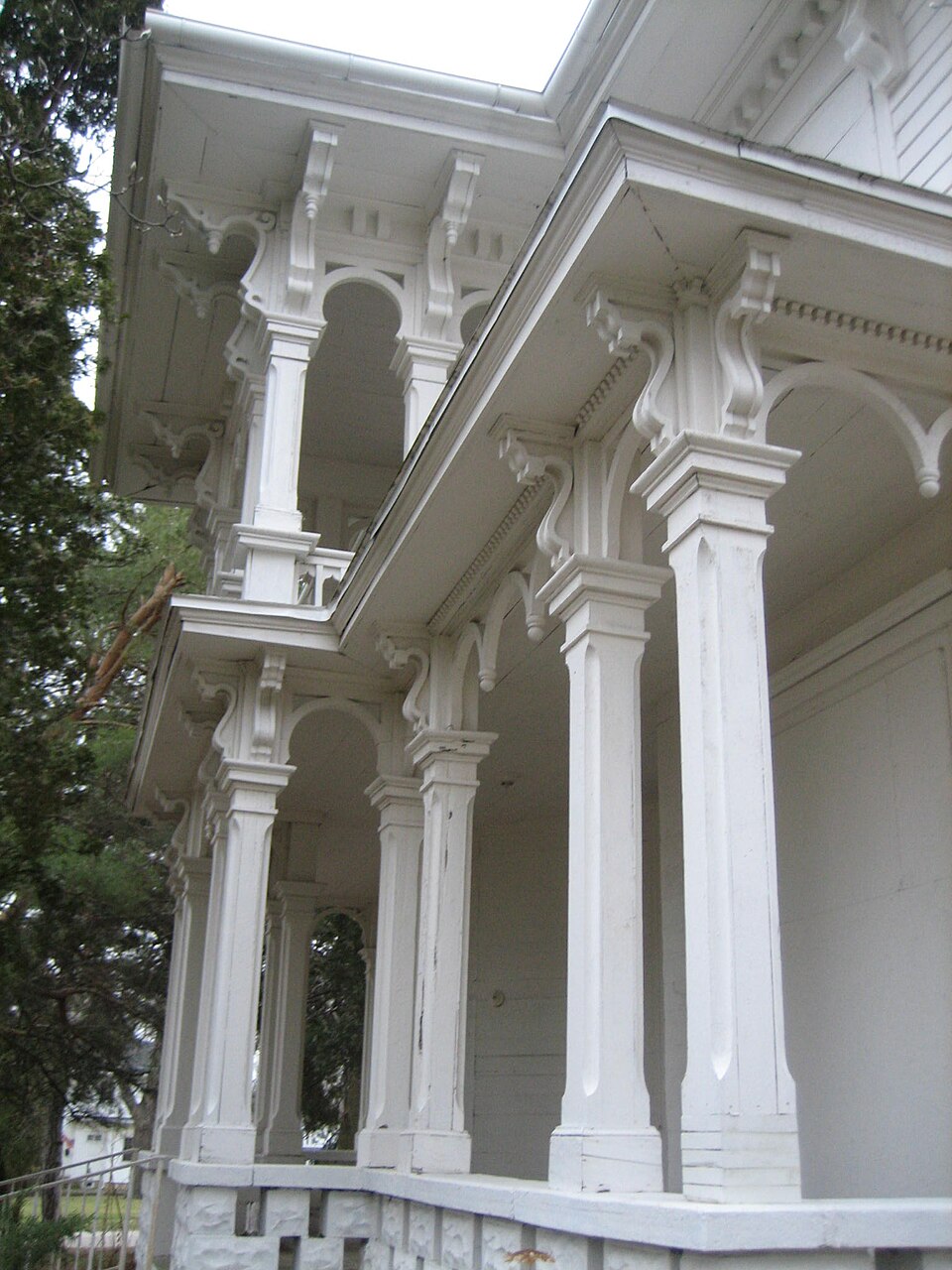
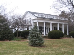
Photograph of Charles H. Hibbard House
Photograph by Andy McMurray, CC BY 2.5. Via Wikimedia Commons.

Charles H. Hibbard House

Listed on the National Register of Historic Places in 1979.

From the record

“Hibbard House, in the McHenry County city of Marengo, Illinois, has been listed on the National Register of Historic Places since 1979. The home, also known as the Cupola House, stood unoccupied on Grant Highway as of January 2007.”

Wikipedia article Charles H. Hibbard House, CC BY-SA 4.0.

One of 13 National Register listings published here for McHenry County · listed in 1979 · category: Building.

Sources: the Wikipedia article · the case file at the National Archives · the National Register database, National Park Service
The listing

  • What is counted as historic. The nomination lists 1 building as contributing to the listing.
  • Listed as. Hibbard, Charles H., House - the National Register files a house under its owner's surname.
  • Address. 413 W. Grant Hwy., Marengo, 60152
  • When was it listed? February 1979
  • Category. building
  • Township. Marengo township
  • Architectural style. Italianate architecture
  • National Register reference number. 79003113 - the number the National Park Service assigned this property when it was listed, and the key its nomination file is catalogued under at the National Archives.

The ground it stands on

37,385 words

The chapter on Marengo Township in History of McHenry County, Illinois : Together with Sketches of Its Cities, Villages and Towns : Educational, Religious, Civil, Military, and Political History : Portraits of Prominent Persons, and Biographies of Representative Citizens, Also a Condensed History of Illinois .., published 1885 names Marengo. This is what it says, exactly as the scans read.

This township is surpassed by none for its rich lands and splendid improvements. Go where you will and nothing but beautiful farms under the highest state of agriculture greets the eye, together with the finest of residences and farm buildings. Nowhere in all the country do we see such marked evidence that enterprise has kept perfect pace with time and all its wondrous changes and improvements, and rapid strides in the interests of civilization. The township consists chiefly of prairie land which is so well drained by Nature's own provision that every foot is tillable and productive. For grain and stock raising the township is equally well adapted. The dairying business has grown to be quite an industry here, while thousands of bushels of grain are yearly raised. The township is scarce of timber, except along the branches of streams where some small timber is found, it being more plenty in early times than at present. Kishwaukee Creek crosses sections 25, 26, 27, 28, 29 and 30, and is joined on the east by Rush Creek. This is the only township in the county that can boast of a stone quarry. It is situated on section 31, and has proved to be a marked benefit. From it was taken the stone to build the school-houses at Marengo and Union. Near the southern line the railroad traverses the township from east to west, and the location of the depot at the village of Marengo makes an advantageous point for ship ping the products of adjoining townships.

Passage source: History of McHenry County, Illinois : Together with Sketches of Its Cities, Villages and Towns : Educational, Religious, Civil, Military, and Political History : Portraits of Prominent Persons, and Biographies of Representative Citizens, Also a Condensed History of Illinois .., published 1885.

Calvin Spencer was the first man to take np a claim in Marengo Township. He came from Seneca County, Ohio, in the spring of 1835, accompanied by his sister, who was the first white woman whoever kept house in the township. At the time of Mr. Spencer's settlement his nearest neighbor was Joseph Boyington, whose residence was ten miles distant. Soon after coming to Marengo, Mr. Spencer married Miss Mary Ann Hance. They had a family of eight children. Her death occurred in the year 1875. In the fall of 1835 Moses Spencer, father of Calvin Spencer, located in Marengo Township. In November of the same year he buried his wife. This is said to be the first death that occurred in the township. The next settler was Ward Burley, who came to Marengo during the winter of 1835 and '36. He purchased a piece of land east of the present village bite, which he afterward traded to Frank Safford for a stock of dry-goods, and carried on the dry-goods business for a time in connection with his practice of medicine. He was the first physician to locate in the place, and here he remained in practice till his death, which occurred July, 1847. John Sponable came here in 1836 and made his claim in Garden Prairie, Boone County, where he remained but a short time, when he came to Marengo, where he remained till his death, which occurred in 1846. Among the very earliest settlers of Marengo Township was Bichard B. Simpkins, who came in September, 1835, and made his claim where William Sponable afterward resided. He afterward located in Coral Township. He came from Bradford County, Pa. In 1838 he married Eveline Ames, of Boone County, who made his home a happy one till her death, which occurred in 1860. He died in 1884, leaving a family of seven children.

Passage source: History of McHenry County, Illinois : Together with Sketches of Its Cities, Villages and Towns : Educational, Religious, Civil, Military, and Political History : Portraits of Prominent Persons, and Biographies of Representative Citizens, Also a Condensed History of Illinois .., published 1885.

Machine-read from a century-old scan, so expect the errors a machine makes: misspelled names, dropped words, stray characters.

Read the whole chapter on Marengo Township - 37,385 words on its settlement, mills, schools and churches.

Fires near this property

1 since 2010

Regional context, not property-specific evidence. The federal wildfire occurrence database lists 1 fire within 5 miles of Charles H. Hibbard House in 2010, burning under an acre in total. None started naturally. None was recorded as arson. Distance is straight-line from the map coordinates, so a fire counted here may appear on a neighbouring settlement's page as well.

Reported cause Fires
Debris and open burning1

The most recent of them, most recent first, with the day each was reported and the service that recorded it.

DateCause SizeReported by Name on the report
28 September 2010Debris and open burningunder an acreIllinois Division of Forestry ResourcesGOODMARK

Every fire recorded in McHenry County

Mines and quarries near this property

3 within 5 miles

Regional context, not property-specific evidence. The federal mineral resources record lists 3 workings within 5 miles of Charles H. Hibbard House: 2 producers, 1 past producer. 2 still produce. What was taken out: Sand and Gravel, Construction. Distance is straight-line from the map coordinates, so a quarry counted here may appear on a neighbouring settlement's page as well.

Where SiteCommodity StatusRecorded
Griebel Trucking Co. PitSand and Gravel, ConstructionProducer
Metcalf Sand & Gravel PitSand and Gravel, ConstructionPast Producer
North PitSand and Gravel, ConstructionProducer

Every working recorded in McHenry County

Storms near this property

60 of 61 shown

Regional context, not property-specific evidence. The National Weather Service names Marengo, the town this property stands in, in 61 storm reports between 2000 and 2025: 28 thunderstorm wind, 27 hail, 3 lightning, 1 funnel cloud. The reports record 1 injury. Each account below is quoted exactly as the forecast office filed it, from the NOAA Storm Events Database, and each date opens the federal record of that event.

WhenEvent Place namedHarm What the report says
June 2024LightningMarengo1 hurtAn employee of Nichols Farm and Orchard in Marengo was injured when he was struck by lightning. It's believed that lightning struck a tree and then traveled through the man who was nearby. He was transported to the hospital with minor to moderate injuries.
April 2014Thunderstorm WindMarengo$100,000Large grain augers were ripped from the top of grain bins, shingles were peeled off roofs, irrigation systems were blown over, and barns were blown down. A tree branch was reportedly lodged into the side of a house.
July 2007LightningMarengo$100,000Lightning struck a two-story house starting a fire which caused signficant damage.
October 2006HailMarengo$75,000Walnut size hail dented houses and cars in Marengo.
April 2010Thunderstorm WindMarengo$25,000A barn was blown down.
September 2001LightningMarengo$10,000no account filed
April 2006HailMarengo$5,000Quarter size hail dented siding on a house and a vehicle.
June 2008Thunderstorm WindMarengo$2,000Trees and power lines were blown down near Route 23 and Route 176. Some roads were impassible because of debris.
March 2025Thunderstorm WindMarengo-A photo was shared of a tree uprooted in Marengo.
May 2025Thunderstorm WindMarengo-A DOT weather station measured a wind gust to 65 mph.
July 2025Thunderstorm WindMarengo-Multiple trees and power lines were blown down in and near Marengo.
July 2024Heavy RainMarengo-A private weather station measured 4.21 inches of rainfall in two hours.
July 2024Thunderstorm WindMarengo-Roads were blocked due to trees and power lines that were blown down.
August 2023Thunderstorm WindMarengo-A large sign at an auction house was blown down. Roof and awning damage occurred to at least two buildings.
July 2023Thunderstorm WindMarengo-A report came in of a large tree approximately 6 to 8 inches in diameter that had fallen onto power lines.
March 2022Thunderstorm WindMarengo-A wind gust to 66 mph was measured.
November 2022Thunderstorm WindMarengo-Several trees and power lines were blown down across McHenry County.
August 2021Thunderstorm WindMarengo-A tree limb was blown down.
July 2021Thunderstorm WindMarengo-A photo was shared on social media of a large tree limb that was blown down onto the canopy of a Gazebo.
June 2020FloodMarengo-Widespread field and yard flooding with some road flooding was reported around Marengo.
July 2019Thunderstorm WindMarengo-Trees were blown down.
June 2017Funnel CloudMarengo-Marengo police reported a funnel cloud.
July 2016Thunderstorm WindMarengo-Large tree blown down. Time estimated by radar.
April 2014HailMarengo-Quarter size hail covered the ground.
March 2012HailMarengo-Hail ranging from pea to nickel size fell for several minutes over Marengo.
April 2010Thunderstorm WindMarengo-Numerous trees and tree limbs were blown down. Structural damage was reported to one building.
June 2009HailMarengo-Hail to the size of golf balls was reported in Marengo. Other reports in Marengo included nickel size and half dollar size hail.
June 2008Thunderstorm WindMarengo-Four inch diameter tree limbs were blown down.
June 2008Thunderstorm WindMarengo-A tree was blown down.
September 2007Thunderstorm WindMarengo-A tree was blown down.
March 2007Thunderstorm WindMarengo-Tree limbs were blown down.
July 2006HailMarengo-Nickel size hail was reported on the south side of Marengo.
July 2006Thunderstorm WindMarengo-A healthy 30 foot tall pine tree was snapped near the ground at Sacred Heart Cemetery.
July 2006Thunderstorm WindMarengo-Trees and large tree limbs were blown down.
September 2005Thunderstorm WindMarengo-A strong thunderstorm moved across south central McHenry county during the morning hours. Large trees, tree limbs and power lines were blown down in Marengo, Lakewood and Crystal Lake. Trees 16-18 inches in diameter were blown down on the west side of Crystal Lake. Boats and picnic tables were moved. Some cars were damaged by falling tree limbs and one house was left uninhabitable.
August 2024HailMarengo-no account filed
June 2023HailMarengo-no account filed
April 2020HailMarengo-no account filed
July 2015HailMarengo-no account filed
April 2015HailMarengo-no account filed
June 2015HailMarengo-no account filed
August 2014Thunderstorm WindMarengo-no account filed
May 2014HailMarengo-no account filed
August 2013HailMarengo-no account filed
May 2012HailMarengo-no account filed
May 2012Thunderstorm WindMarengo-no account filed
July 2008HailMarengo-no account filed
June 2006HailMarengo-no account filed
July 2006HailMarengo-no account filed
March 2004HailMarengo-no account filed
March 2003HailMarengo-no account filed
July 2003Thunderstorm WindMarengo-no account filed
September 2001HailMarengo-no account filed
May 2000HailMarengo-no account filed

Every storm recorded in McHenry County

Map coverage status

No historic map-sheet match is published for this property yet. That does not mean no map exists. This record needs a coordinate-quality review before it can be joined to a sheet boundary. Browse the county's mapped places while that work is pending.

Listed places nearby

1 within 8 miles

Other National Register properties close enough to walk or drive between, ordered by distance from this one. Both positions come from the same geocoding pass that matched these properties to their map sheets.

Photograph PropertyDistance Listed
Orson Rogers House1.8 miles1979

Sources for this property

National Archives recordThe nomination case file for reference 79003113 in Record Group 79.
Wikipedia articleCommunity-written account of this property, licensed CC BY-SA.
McHenry CountyAll 13 listed properties in this county.

Provenance

  • Listing record. National Park Service National Register of Historic Places, listed-properties dataset, current to 2026-05-22.
  • Map join. Address geocoded through the United States Census geocoder, then tested against the published boundary of every sheet in the USGS Historical Topographic Map Collection.
  • How this page is made. Listing fields come from federal records; map-sheet coverage is a labelled coordinate-to-boundary calculation, not a source-field claim.
  • Wildfire. Short, Karen C. 2022. Spatial wildfire occurrence data for the United States, 1992-2020 [FPA_FOD_20221014]. 6th Edition. Fort Collins, CO: Forest Service Research Data Archive. https://doi.org/10.2737/RDS-2013-0009.6 Collected with United States Government funding and usable without additional permissions or fees.
  • Mines and quarries. USGS Mineral Resources Data System (MRDS) https://mrdata.usgs.gov/mrds/ A work of the United States government, no copyright under 17 U.S.C. 105.
  • Storms. NOAA National Centers for Environmental Information, Storm Events Database https://www.ncei.noaa.gov/stormevents/ A work of the United States government, no copyright under 17 U.S.C. 105. Narratives are quoted verbatim from the National Weather Service report and are not edited or summarised.