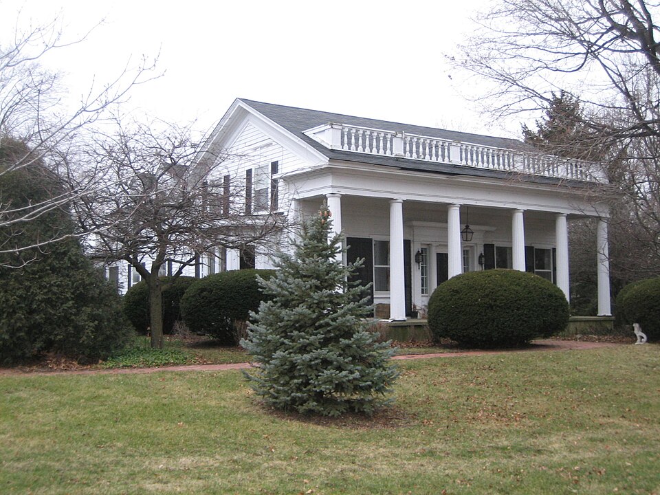
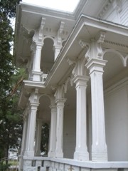
Listed on the National Register of Historic Places in 1979.
From the record
“The Orson Rogers House is listed on the National Register of Historic Places and located in the McHenry County, Illinois city of Marengo. The property consists of several outbuildings, currently and in the past, as well, those buildings are and were mostly agriculture related.”
Wikipedia article Orson Rogers House, CC BY-SA 4.0.
One of 13 National Register listings published here for McHenry County · listed in 1979 · category: Building.
National Register reference number.79003114- the number the National Park Service assigned this property when it was listed, and the key its nomination file is catalogued under at the National Archives.
What happened here
An account from the chapter on Coral township. The inset identifies its exact
source book and publication year.
Illinois (Second Board of Trade Regiment) Infantry, and was commissioned Lieutenant of Company I. At the battle of Kenesaw Mountain he was shot through the body, and left by the Surgeons on the field for dead, but through the care of his comrade, William Johnson, recovered. He was married Jan. 1, 1866, to Mary A.
This is one of the first settled towns in the county. The first settler was William ^Hamilton, who came from Ohio in November, 1835, and located near where the village of Coral now stands. "While assisting Calvin Spencer, of Marengo, to raise a log building, Mr. Hamilton received an injury from a falling timber, which caused his death the following spring. Benjamin Van Vleet and his father were the next to come into this township. They built their house near the old Indian camp-ground. Here they remained till the fall of 1836, when they sold to Wm. Jackson and moved to Pecatonica where they both died many years ago. O. P. Rogers came in 1836, arriving here on the 16th day of March. His was the first that was honored with the presence of a white woman. Mr. Kogers came from Middletown, Vt. At the time of his settlement there was not a single house between his residence and Dundee, and a house three miles west of Elgin marked the only spot of habitation between him and that city. Mr. Rogers resided in the township many years, when he moved to Marengo, where he still resides. Claims were made in 1835 for Frank Diggins and Enos A. Pease, who came in the spring of 1836. Mr. Diggins soon afterward moved to the township of Dunham, where he still resides. Mr. Pease remained in the township, and raised a large family. His son Marion was killed at the battle of Vicksburg. Some of the family are still residents of the county. L. Thompson came from Ohio in 1836 and resided in the township only a few years, when he moved to Abingdon, 111.
Universalist Church was organized June, 1864, in connection with the church at Marengo. The entire membership originally numbered forty, but has diminished to almost nothing at present. First church officers elected were: A. D. Keeler, Treasurer; A. J. King, Timothy Bigelow and Daniel Graves, Trustees; J. G. Botsford, Collector; S. Gf. Jones, Clerk. This society seldom have services,, though in former days they employed regular pastors. In 1867 they, in company with the Masonic lodge, erected a stone building, the lower story of which they used as a place of worship. Kev. Homer Slade was the first stated pastor of this church; he came in 1871 and remained quite a length of time when Kev. Root was called to take his place. Under the preaching of this man the church revived spiritually and grew in numbers.
Regional context, not property-specific
evidence. The
federal wildfire occurrence database
lists 2 fires within 5 miles of Orson Rogers House
between 2003 and 2010, burning under an acre in total. None started naturally. None was recorded as arson.
Distance is straight-line from the map coordinates, so a fire counted
here may appear on a neighbouring settlement's page as well.
Reported cause
Fires
Smoking
1
Debris and open burning
1
The most recent of
them, most recent first, with the day each was reported and the service
that recorded it.
Regional context, not property-specific
evidence. The federal mineral resources record lists
4 workings within 5 miles of Orson Rogers House: 2 producers, 2 past producers.
2 still produce. What was taken out: Sand and Gravel, Construction. Distance is straight-line from the
map coordinates, so a quarry counted here may appear on a neighbouring
settlement's page as well.
Regional context, not property-specific
evidence. The National Weather Service names
Marengo, the town this property stands in, in 61 storm reports between 2000 and 2025: 28 thunderstorm wind, 27 hail, 3 lightning, 1 funnel cloud.
The reports record 1 injury. Each account below is quoted exactly as the forecast office
filed it, from the NOAA Storm Events Database, and each date
opens the federal record of that event.
An employee of Nichols Farm and Orchard in Marengo was injured when he was struck by lightning. It's believed that lightning struck a tree and then traveled through the man who was nearby. He was transported to the hospital with minor to moderate injuries.
Large grain augers were ripped from the top of grain bins, shingles were peeled off roofs, irrigation systems were blown over, and barns were blown down. A tree branch was reportedly lodged into the side of a house.
A strong thunderstorm moved across south central McHenry county during the morning hours. Large trees, tree limbs and power lines were blown down in Marengo, Lakewood and Crystal Lake. Trees 16-18 inches in diameter were blown down on the west side of Crystal Lake. Boats and picnic tables were moved. Some cars were damaged by falling tree limbs and one house was left uninhabitable.
No historic map-sheet match is published
for this property yet. That does not mean no map exists. This record needs
a coordinate-quality review before it can be joined to a sheet boundary.
Browse the county's mapped places while that work is
pending.
Listed places nearby
1 within 8 miles
Other National Register properties close
enough to walk or drive between, ordered by distance from this one. Both
positions come from the same geocoding pass that matched these properties
to their map sheets.
Listing record. National Park Service National Register of Historic Places, listed-properties dataset, current to 2026-05-22.
Map join. Address geocoded through the United States Census geocoder, then tested against the published boundary of every sheet in the USGS Historical Topographic Map Collection.
How this page is made. Listing fields come from federal records; map-sheet coverage is a labelled coordinate-to-boundary calculation, not a source-field claim.
Wildfire. Short, Karen C. 2022. Spatial wildfire occurrence data for the United States, 1992-2020 [FPA_FOD_20221014]. 6th Edition. Fort Collins, CO: Forest Service Research Data Archive. https://doi.org/10.2737/RDS-2013-0009.6 Collected with United States Government funding and usable without additional permissions or fees.
Mines and quarries. USGS Mineral Resources Data System (MRDS) https://mrdata.usgs.gov/mrds/ A work of the United States government, no copyright under 17 U.S.C. 105.
Storms. NOAA National Centers for Environmental Information, Storm Events Database https://www.ncei.noaa.gov/stormevents/ A work of the United States government, no copyright under 17 U.S.C. 105. Narratives are quoted verbatim from the National Weather Service report and are not edited or summarised.
 Block