BlockBefore
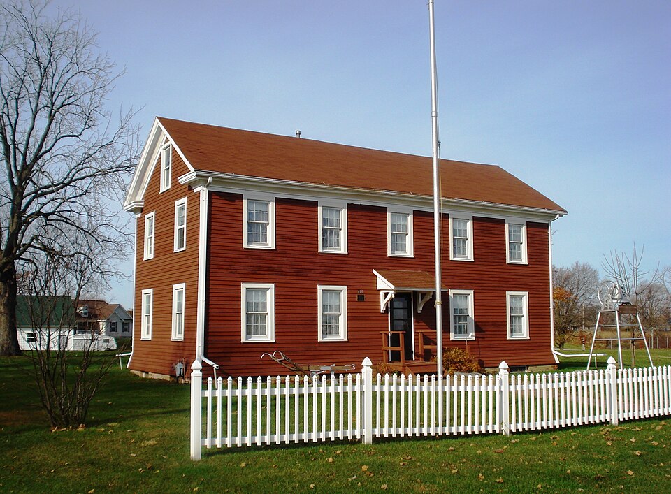
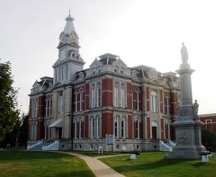
Photograph of Andover Chapter House
Photograph by Kepper66, CC BY-SA 3.0. Via Wikimedia Commons.

Andover Chapter House

Listed on the National Register of Historic Places in 1980.

From the record

“The Andover Chapter House is a historic building located on Locust Street northwest of 5th Avenue in Andover, Illinois. The building was constructed between 1909 and 1910 as a meetinghouse for Andover's chapter of the American Woman's League.”

Wikipedia article Andover Chapter House, CC BY-SA 4.0.

One of 16 National Register listings published here for Henry County · listed in 1980 · category: Building.

Sources: the Wikipedia article · the case file at the National Archives · the National Register database, National Park Service
The listing

  • What is counted as historic. The nomination lists 1 building as contributing to the listing.
  • Address. Locust St., NW, Andover, 61233
  • When was it listed? November 1980
  • Category. building
  • Also known as. American Woman's League Chapter Houses TR
  • Township. Andover township
  • Architectural style. Prairie School architecture
  • Architect. Helfensteller, Hirsch & Watson
  • National Register reference number. 80001367 - the number the National Park Service assigned this property when it was listed, and the key its nomination file is catalogued under at the National Archives.

The ground it stands on

5,251 words

The chapter on Andover Township in History of Henry County, Illinois : It's Taxpayers and Voters; Containing Also, a Biographical Directory, a Condensed History of the State; Map of the County; a Business Directory...etc, published 1877 names Andover. This is what it says, exactly as the scans read.

OARLSSON KIJL. Clergyman, Sec. 8; P.O. Andover; born Sweden, 1822; came to county 1875; Rep; Luth; was ordained to the holy ministry in Wexio, Sweden, 1849; served as minister of the gospel in the Established Church of Sweden until June 1853, when he accepted a call of the Swedish Evang. Luth. Immanuel's Church in Chicago; after twentytwo years labor as pastor in Chicago, he moved in 1875 to Andover, and is at present pastor of the Swedish Evang. Luth. Church of said place; in 1855, he was married to Eva C. Anderson, of Temmelhed, Sweden; has two sons and two (laughters living.

Passage source: History of Henry County, Illinois : It's Taxpayers and Voters; Containing Also, a Biographical Directory, a Condensed History of the State; Map of the County; a Business Directory...etc, published 1877.

FRAGD JOHN M. Farmer, Sec. 18. P.O. Andover; born Jonkoping, Ian, Sweden. 1813; came to Co. 1857; Rep; Luth; owns 50 acres, val. $3,250; was married in June, 1835, to Miss Anna Helena Peterson; has had eight children, six now living; served as soldier in the royal Swedish army for 14 years.

Passage source: History of Henry County, Illinois : It's Taxpayers and Voters; Containing Also, a Biographical Directory, a Condensed History of the State; Map of the County; a Business Directory...etc, published 1877.

Machine-read from a century-old scan, so expect the errors a machine makes: misspelled names, dropped words, stray characters.

Read the whole chapter on Andover Township - 5,251 words on its settlement, mills, schools and churches.

Mines and quarries near this property

1 within 5 miles

Regional context, not property-specific evidence. The federal mineral resources record lists 1 working within 5 miles of Andover Chapter House: 1 producer. All of them still produce. What was taken out: Sand and Gravel, Construction. Distance is straight-line from the map coordinates, so a quarry counted here may appear on a neighbouring settlement's page as well.

Where SiteCommodity StatusRecorded
Orlo Woodcock PitSand and Gravel, ConstructionProducer

Every working recorded in Henry County

Storms near this property

5 since 1996

Regional context, not property-specific evidence. The National Weather Service names Andover, the town this property stands in, in 5 storm reports between 1996 and 2022: 2 thunderstorm wind, 1 lightning, 1 flash flood, 1 hail. No death or injury is recorded in these reports. Each account below is quoted exactly as the forecast office filed it, from the NOAA Storm Events Database, and each date opens the federal record of that event.

WhenEvent Place namedHarm What the report says
September 1996LightningAndover$20,000no account filed
May 2004Thunderstorm WindAndover$10,000Semi truck blown over just after it crossed the Edwards River Bridge.
May 2022Thunderstorm WindAndover-Trees down over the road near Andover.
February 2008HailAndover-A trained spotter reported hail the size of pennies.
September 2006Flash FloodAndover-A spotter reported 6 inches of water flowing over a paved township road south of town.

Every storm recorded in Henry County

Map coverage status

No historic map-sheet match is published for this property yet. That does not mean no map exists. This record needs a coordinate-quality review before it can be joined to a sheet boundary. Browse the county's mapped places while that work is pending.

Listed places nearby

5 within 8 miles

Other National Register properties close enough to walk or drive between, ordered by distance from this one. Both positions come from the same geocoding pass that matched these properties to their map sheets.

Photograph PropertyDistance Listed
August and Margaretha Rehnstrom Houseunder 500 feet2008
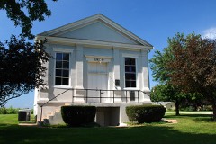
Jenny Lind Chapel0.4 miles1975
Henry County Courthouse5.0 miles2004
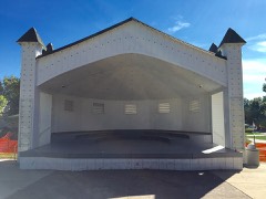
Music Pavilion6.2 miles2002
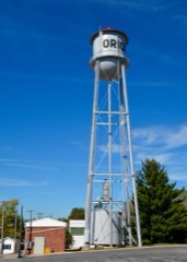
West Water Tower and Ground Storage Tank6.2 miles2003

Sources for this property

National Archives recordThe nomination case file for reference 80001367 in Record Group 79.
Wikipedia articleCommunity-written account of this property, licensed CC BY-SA.
Henry CountyAll 16 listed properties in this county.

Provenance

  • Listing record. National Park Service National Register of Historic Places, listed-properties dataset, current to 2026-05-22.
  • Map join. Address geocoded through the United States Census geocoder, then tested against the published boundary of every sheet in the USGS Historical Topographic Map Collection.
  • How this page is made. Listing fields come from federal records; map-sheet coverage is a labelled coordinate-to-boundary calculation, not a source-field claim.
  • Mines and quarries. USGS Mineral Resources Data System (MRDS) https://mrdata.usgs.gov/mrds/ A work of the United States government, no copyright under 17 U.S.C. 105.
  • Storms. NOAA National Centers for Environmental Information, Storm Events Database https://www.ncei.noaa.gov/stormevents/ A work of the United States government, no copyright under 17 U.S.C. 105. Narratives are quoted verbatim from the National Weather Service report and are not edited or summarised.